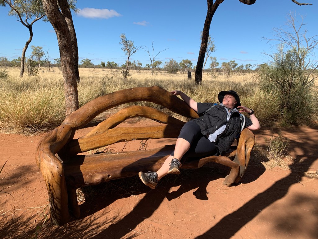
Leaving our little camp by the salt lake mid morning we set off towards the south again. We passed a few more salt lakes and just before Glendambo was a lake very close to the road on the left and this one was full of water. Glendambo is a dot on the map and consists of a couple of roadhouses and a pub. It has a huge windmill out the front. it looks like a popular spot for the big road trains to stop for a break.
Just south of Glendambo the Stuart Highway crosses over The Ghan railway line. There is a huge man made hill enabling the road to go over the top of the tracks. I’d love to see the train as it went underneath!
55kms from Pimba we came across a car, with a Jayco Camper on the back, pulled off the side of the road. It looked like they’d blown a tyre. We pulled up and Katie pulled up behind us and we walked back to check if they needed any help. We found Des & Jen and their three kids stranded as they’d blown a tyre and the remains of the shredded tyre had wrapped around the axle and they had no means of getting it off. Des was on his phone on hold with RACV to see if they could arrange something.
We got their phone numbers and said we’d call in at Spuds Roadhouse at Pimba and see if anyone there could help. They were very appreciative as we were the only ones who’d stopped to check on them.
We drove to Pimba and as soon as we got service I called Des to see how they got on with RACV. He said they were not particularly helpful and quoted $1,200 to come get them and tow them to Port Augusta and it would take some 6 hours to get to them. 6 hours sitting on the side of the very busy Stuart Highway….not ideal.
Fortunately a very kind diesel mechanic named Mitch had pulled up to see if they were OK and he had the tools and skills to remove the hub and remove the shredded tyre rubber, put the hub and spare tyre back on. They were able to get back on the road with Mitch following them to make sure the tyre doesn’t overheat. What a kind bloke and what a good outcome for Des, Jen and the kids. Sort of restores your faith in humanity when you hear off kind acts like that. Makes you grateful.
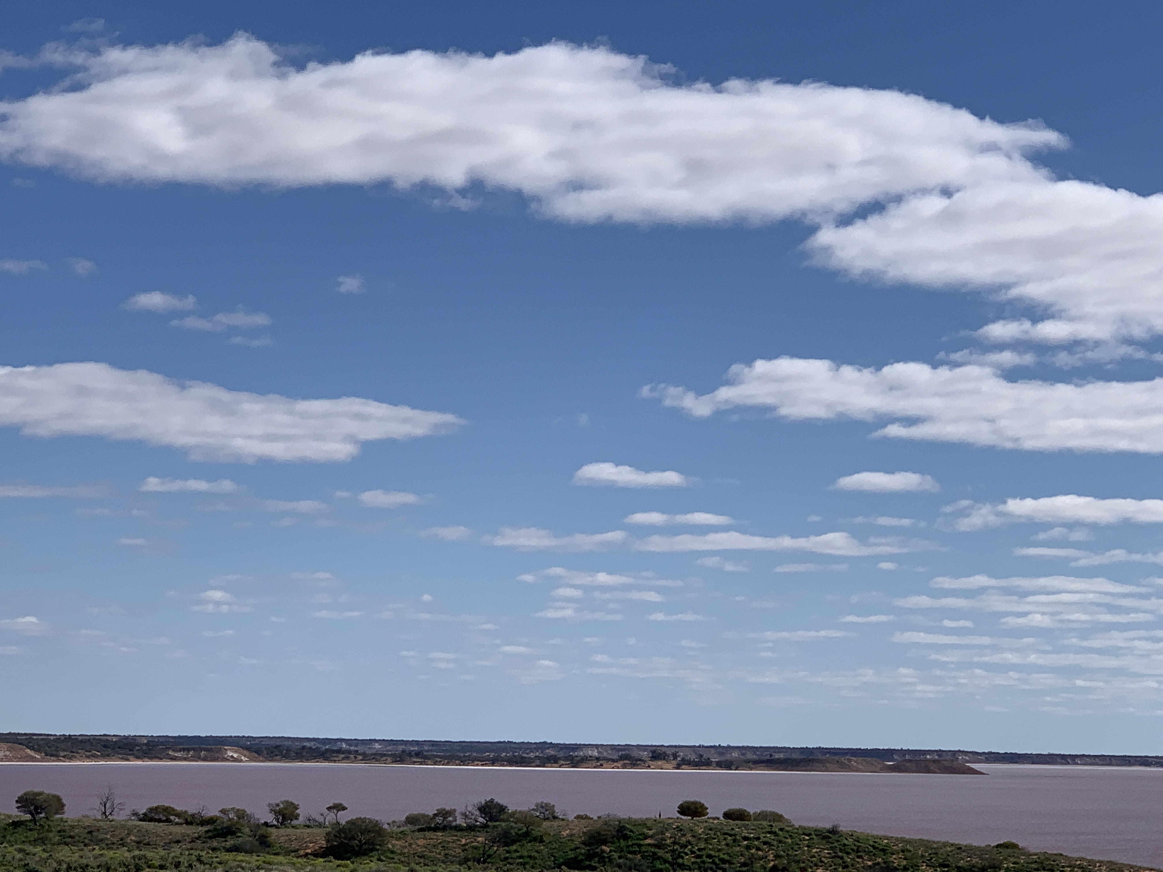
On the way to Pimba we passed Lake Hart and I insisted we pull in to have a look as we’d driven straight past on the way north. Lake Hart is a huge salt lake and it was full of water. The sun was shining and the water shimmered in the sunlight. It is hard to describe and my photos don’t do it justice. It’s a beautiful sight.
Lake Hart
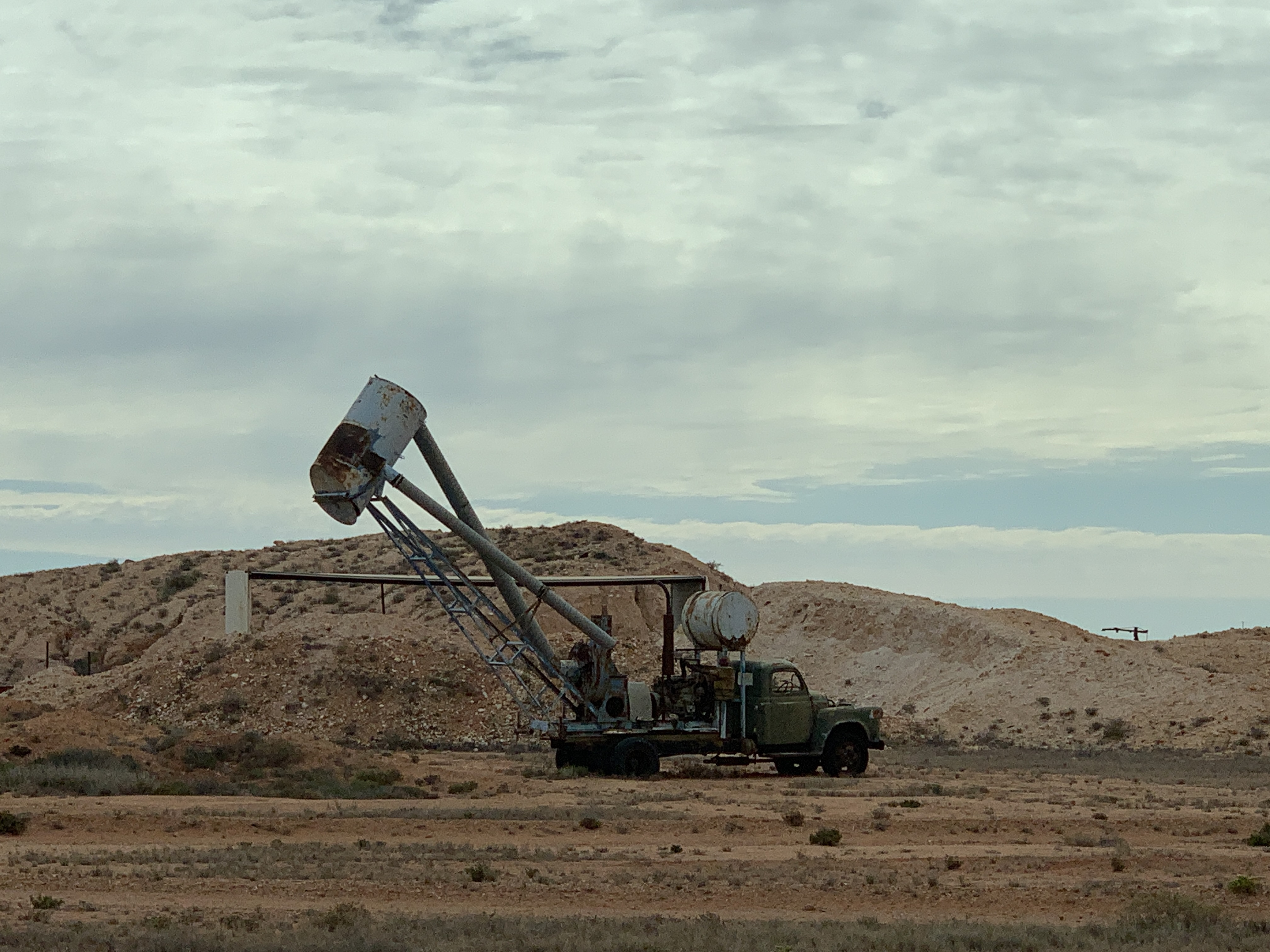
The area around Pimba is gentle hills with low grasses and no trees or shrubs at all. Not a tree could be seen anywhere. There are huge salt lakes, some with water and others dried up.
The first sign of trees occurs some 30km south of Pimba where you come across the Woomera Pipeline. This is a water pipeline that supplies vital water to the town of Woomera.
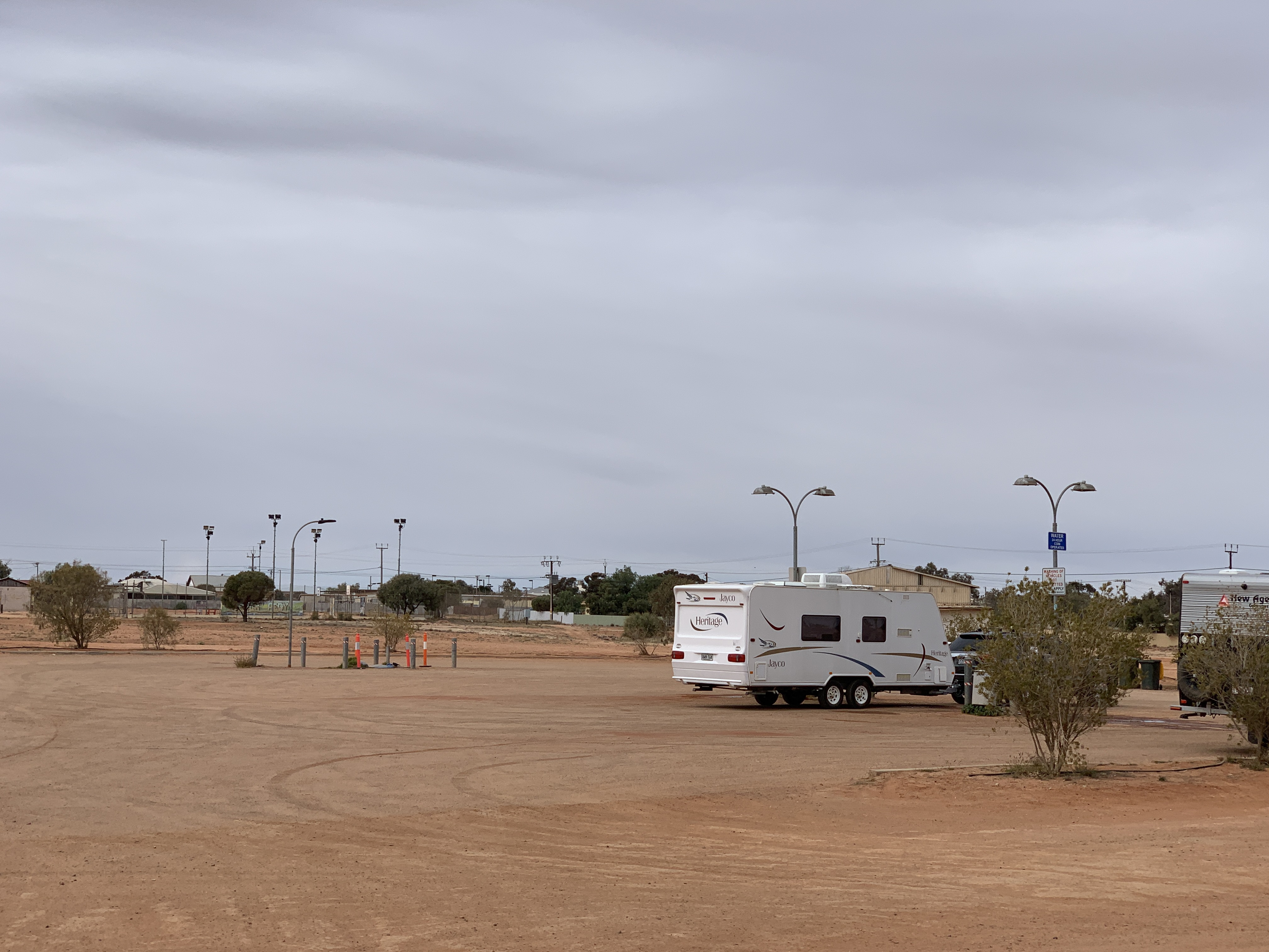
We arrived in Port Augusta late in the afternoon and our first stop was at the car wash to wash the red dirt off our RV’s. It felt so good to wash it all off. Our rigs were sparkling clean again. We’d traveled 316km to reach Port Augusta from our overnight camp. We checked in to the Discovery Parks – Port Augusta where we’d stayed on our way north. It’s a lovely park with lots of the usual amenities including a powered site with water. We could clean and wash clothes after a couple of nights free camping.
We were pleased to see a car and camper pull in to the park. It was Des and Jen and their kids. They’d made it to Port Augusta and had already been to the tyre place and have two tyres to go on tomorrow. They should get home safely then. We were glad they’d arrived safely. You never know, that might be us one day!
Continuing our journey southwards we set off before 9am from our lovely overnight free camp at Mount John Rest Area. Back on the Stuart Highway and there was still quite a few RV’s on the road. It is still school holidays in SA so maybe that’s why.
We stopped briefly at the Quarantine Bin in Marla to drop off our left over fruit and veggies that are banned from South Australia. We didn’t have much to dispose off though. Just a bit of fruit and some baby tomatoes.
The country side along the way to Coober Pedy is all red desert with scrubby bush and mostly flat for as far as the eye can see. Funny! This was how I imagined the Red Centre to be and it wasn’t like that at all. The Red Centre is a land of hills, jump ups and rocky sandstone ridges with sand dunes and desert in between. We chatted about that on the UHF as we drove along and we all agreed that we were surprised by the Red Centre landscape. In particular we all loved Alice Springs and how the town is built in between the rocky hills of the MacDonnell Ranges.
Stopped in Coober Pedy to top up with water, use the dump point, top up with fuel and get some groceries at the IGA. The IGA in Coober Pedy is a very well stocked supermarket and newsagency. Prices are a little higher than we are used to but it is a long way from anywhere so freight would be a high cost. Still we were glad to stock up on fruit & veggies and basic supplies.
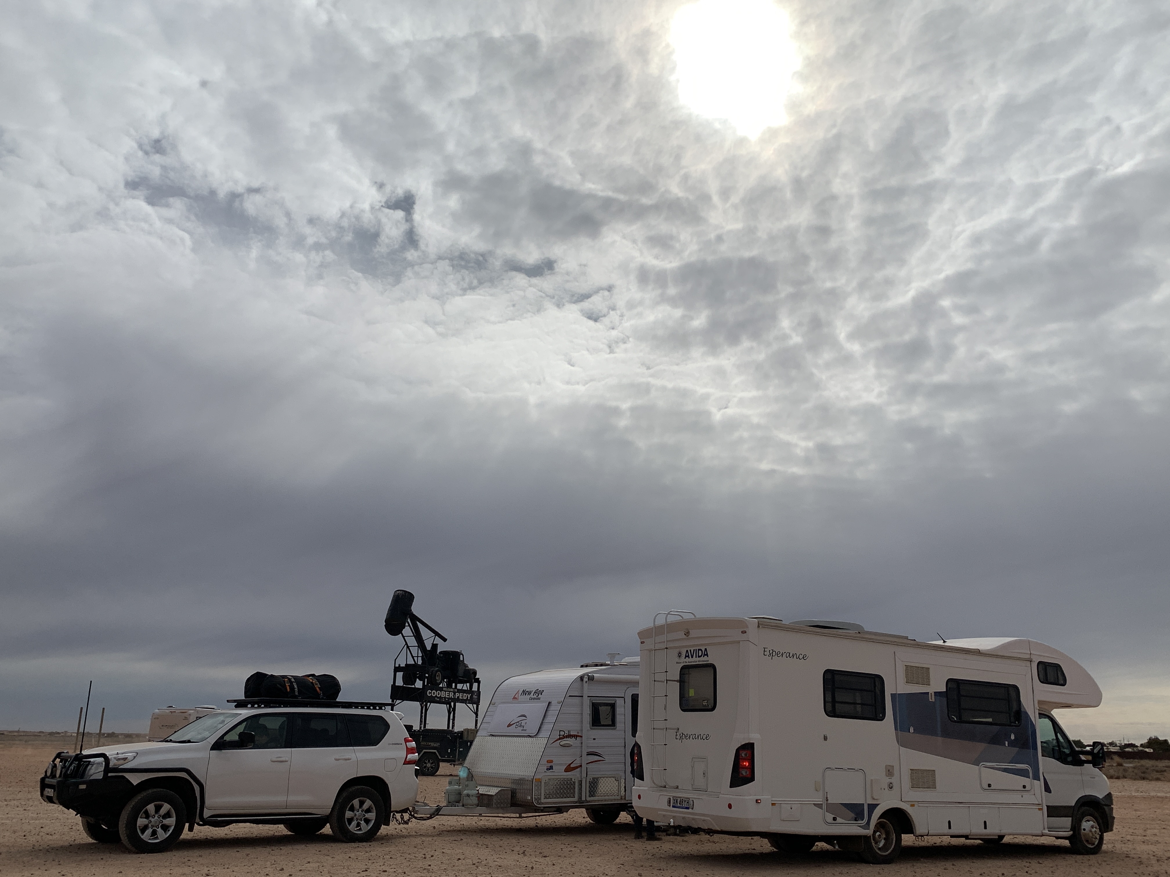
We had a lunch break parked in the carpark near the iconic Coober Pedy sign. Just about every RV that goes by stops in there to have their photo taken under the ‘Big Blower’.
The quirky and strange Coober Pedy
South of Coober Pedy we passed the turnoff to Prominent Hill Mine. Wonder what they mine there. Will have to look it up when we get some service.
Edit @ 02/08/2022: I looked up Prominent Hill Mine and it is a major copper, silver and gold mine. It began production in 2006 and is expected to run until 2030. It has an open pit and two underground mines accessible from the open pit. It cost $1.15 billion to develop and is projected to produce 100,000 tonnes of copper and 115,000 ounces of gold per year..
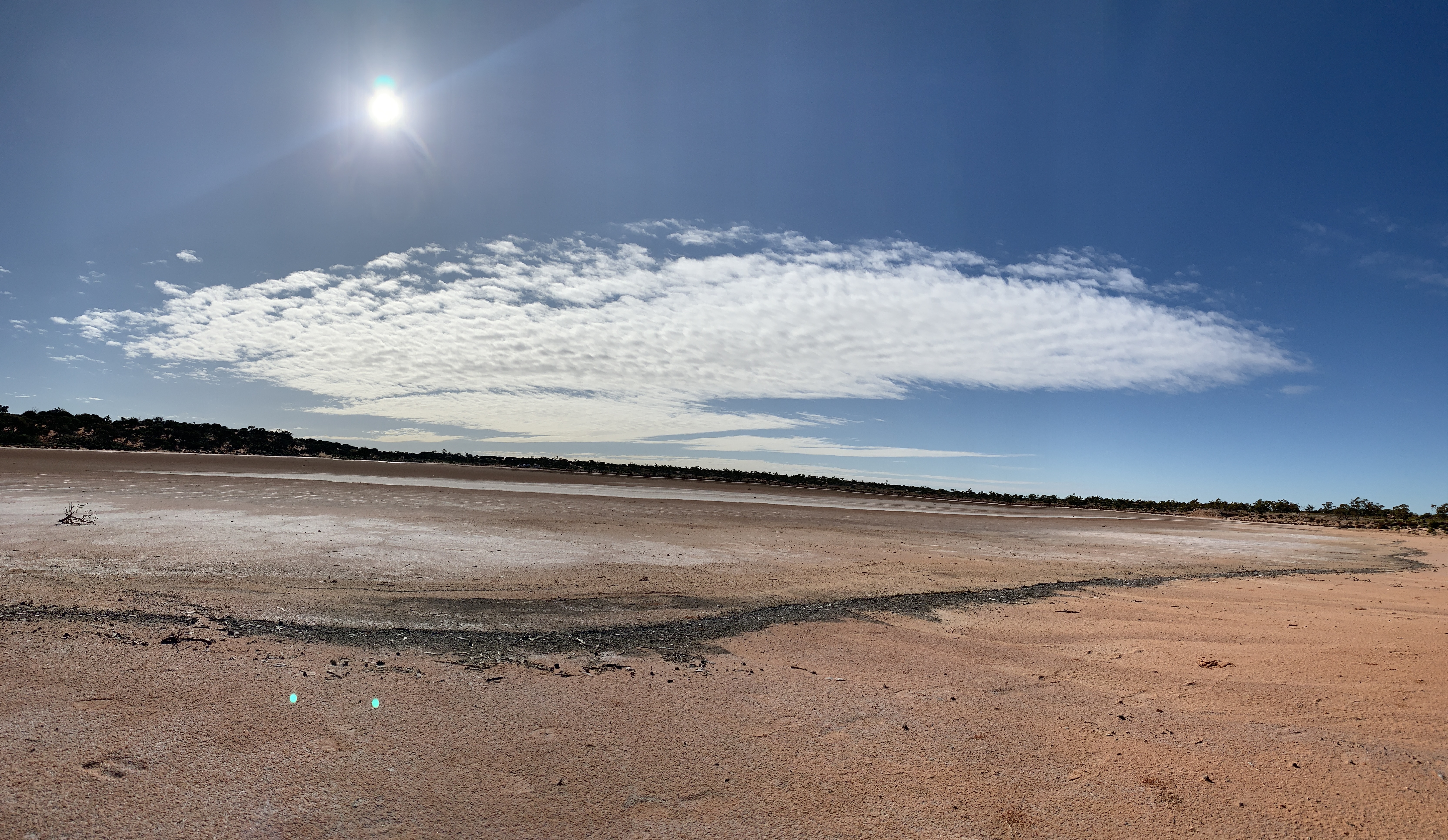
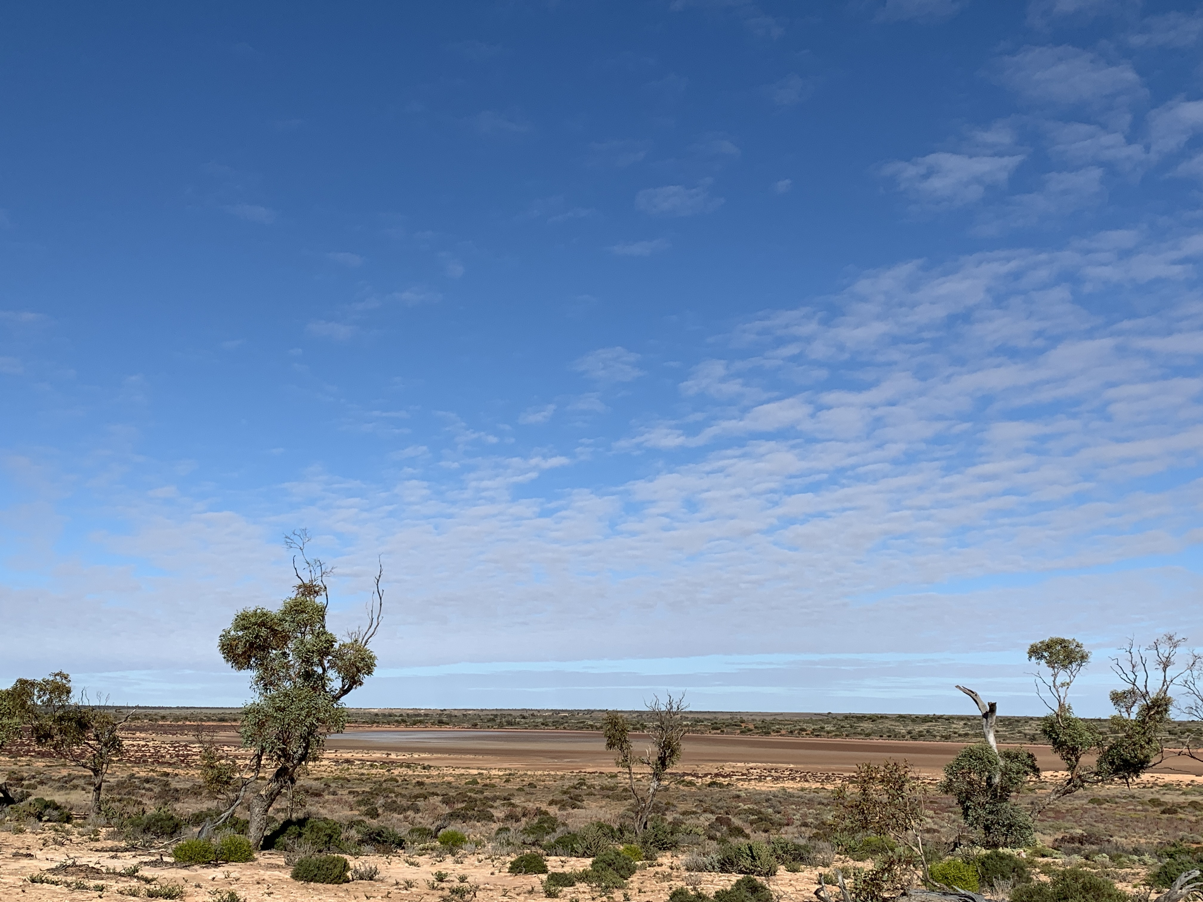
We stopped for the night at a fabulous spot we found on WikiCamps. It is simply called Salt Lake Rest Area and to find it you have to very carefully watch for the track leading of the road. It is very easy to miss. The narrow sandy track leads over a sand dune and there before you is the salt lake. The lake is not visible from the road. The track continues down the other side of the dune and onto the edge of the lake bed. It is a good solid sandy track but could be slippery if wet.
There are lots of spots to camp along the track and it looks like the track might go all the way around the roughly circular lake. We found a good spot, set up camp and got the fire going to cook our dinner.
How’ this for a camp>Sandy track in
We’d had a big driving day and achieved 480km. I think everyone was very glad to get out of the vehicles and wander around the lake. The kids took off exploring and I wondered how long it would be before one of them got stuck in the mud. The surface of the lake can be deceiving. It looks dry but when you step on it, it is mushy mud underneath. Sure enough Riley got stuck in the mud. We could hear squealing as the other two rescued him from the sucking mud. We thought it quite funny when he came back looking sad that his boots were all muddy. We explained that he shouldn’t worry about it. They would dry near the fire and the mud will be able to be brushed off in the morning. No problem.
Pa and Riley were our chief BBQ cooks and capably cooked our sausages and rissoles on the Biji-BBQ. Katie cooked a yummy potato a bake and mixed veggies to go with it and we enjoyed our dinner under the stars.
The stars were very bright in the night sky. Our friend Kathy, who has just returned from a fabulous trip on The Ghan, had recommended we download an app called Sky View Lite so we gave it a try and it is amazing. You hold your phone up to the sky and if you point it at an object it tells you what it is. Brilliant. Thanks Kathy.
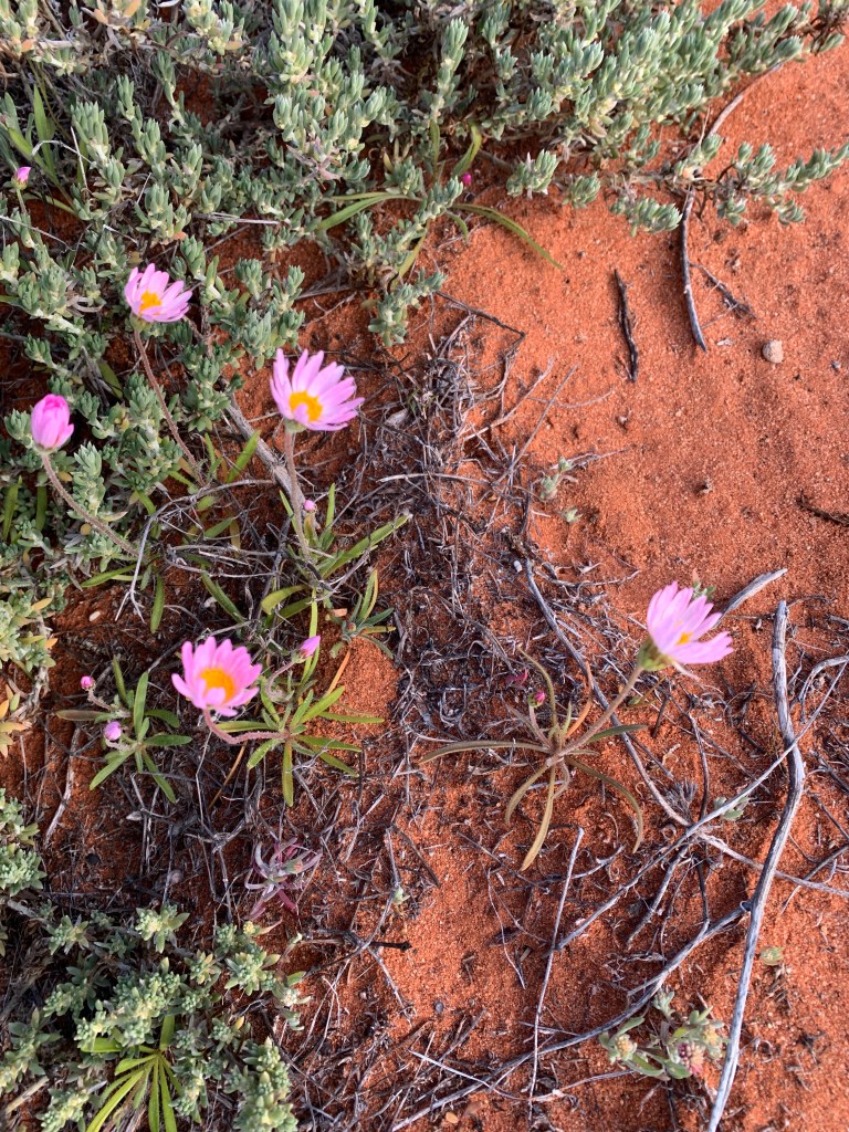
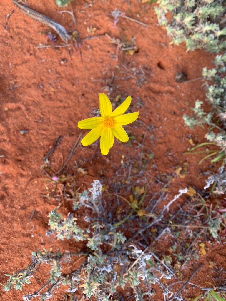
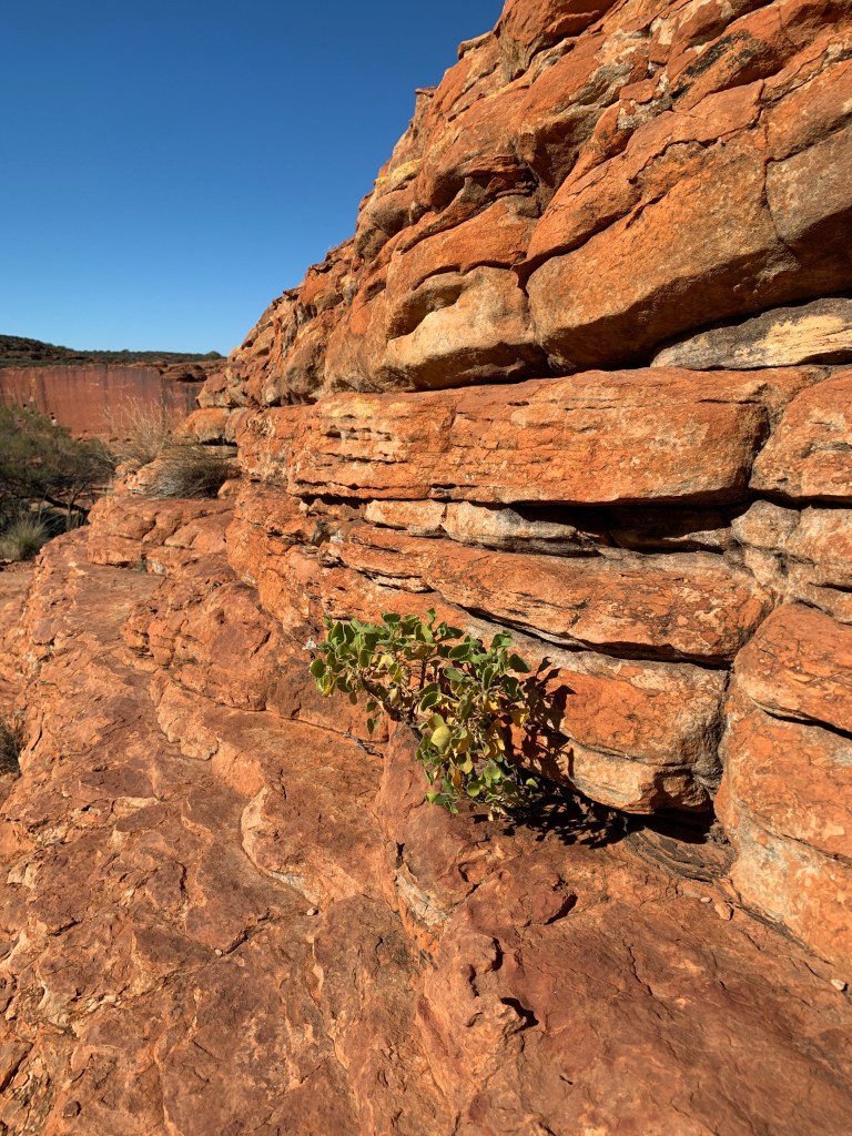
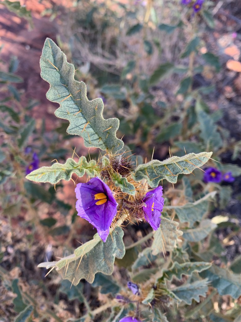
After a great nights sleep and a delicious breakfast of scrambled eggs & bacon, the kids and I set off to walk around the salt lake. We discovered on the other side of the lake there was another salt lake on the other side of the dunes. We also discovered the track doesn’t go all the way around and we had to bush bash a couple of times. It took us about 45 minutes to complete the circumnavigation of the lake. It was a lovely walk in the bush. There are so many lovely plants in the desert country. Check them out.
Beautiful desert plantsOn our walk around the salt lake
Goodbye Kings Canyon Resort. We’d had a great visit but it was time to head towards home. We were all up bright and early and on the road before 8am. Katie needed milk from the General Store so we pulled up next to the pub to wait. The kids were very excited and called us on the UHF when they spied four wild dingos across the road. Riley and Ben got out to take photos with Maddie giving us a running commentary over the radio.
50km from Kings Canyon Resort we noticed piles of horse droppings on the road. We spotted 4 bay brumbies off to the side off the road. Not long after the kids spotted another mob of brumbies on the other side of the road.
As we drove past Kings Creek Station we saw camels in the paddock and a lovely bright blue helicopter parked out the front waiting to take passengers for joy flights.
The Giles Range runs along the northern side of the road and provides a stunning vista of craggy sandstone hills. The road from Kings Canyon Resort to the Lassiter Highway is a very good quality tar road. It is two lanes wide.
We both love this wild desert country in the Red Centre. It has a beauty all its own. Not sure I’d like it so much in the middle of summer when it gets so very hot.
Just after a short stop for a wee break we passed the turn off for the Ernest Giles Road. This 100km dirt road is the short cut to Alice Springs 234km away.
Not long after the turnoff we came to a Desert Oak forest. Acres and acres of these amazing trees. The young trees have hairy branches all the way to the ground. When Ben first saw them he thought they looked like the Lorax from Dr Suexx so we’ve been calling them Lorax Trees ever since. The more mature trees spread their top branches out and lose the ones on their trunk. The very mature trees have huge spreading top branches. I wonder how old they have to be before they start spreading their top branches.
Desert Oak forest
We pulled up at the intersection of the Luritja Road and the Lassiter Highway. At the corner is one of the iconic Red Centre Way signs and we just had to get one of those. Some friendly bikers pulled up just after us and kindly offered to take our photos. They’d just come from Yulara and we’re heading to King Canyon. They wanted to know what the road was like and we were able to let them know its a good tar road all the way.
Mt EbenezerMt EbenezerErldunda Roadhouse
Stopped for fuel at Kulgera Roadhouse. Had a brief lunch break here also. We’d done 330km so far for the day but decided to push on. It’s flat desert country with lots of bushy scrub around there.
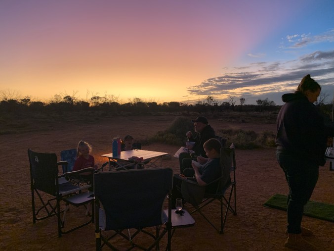
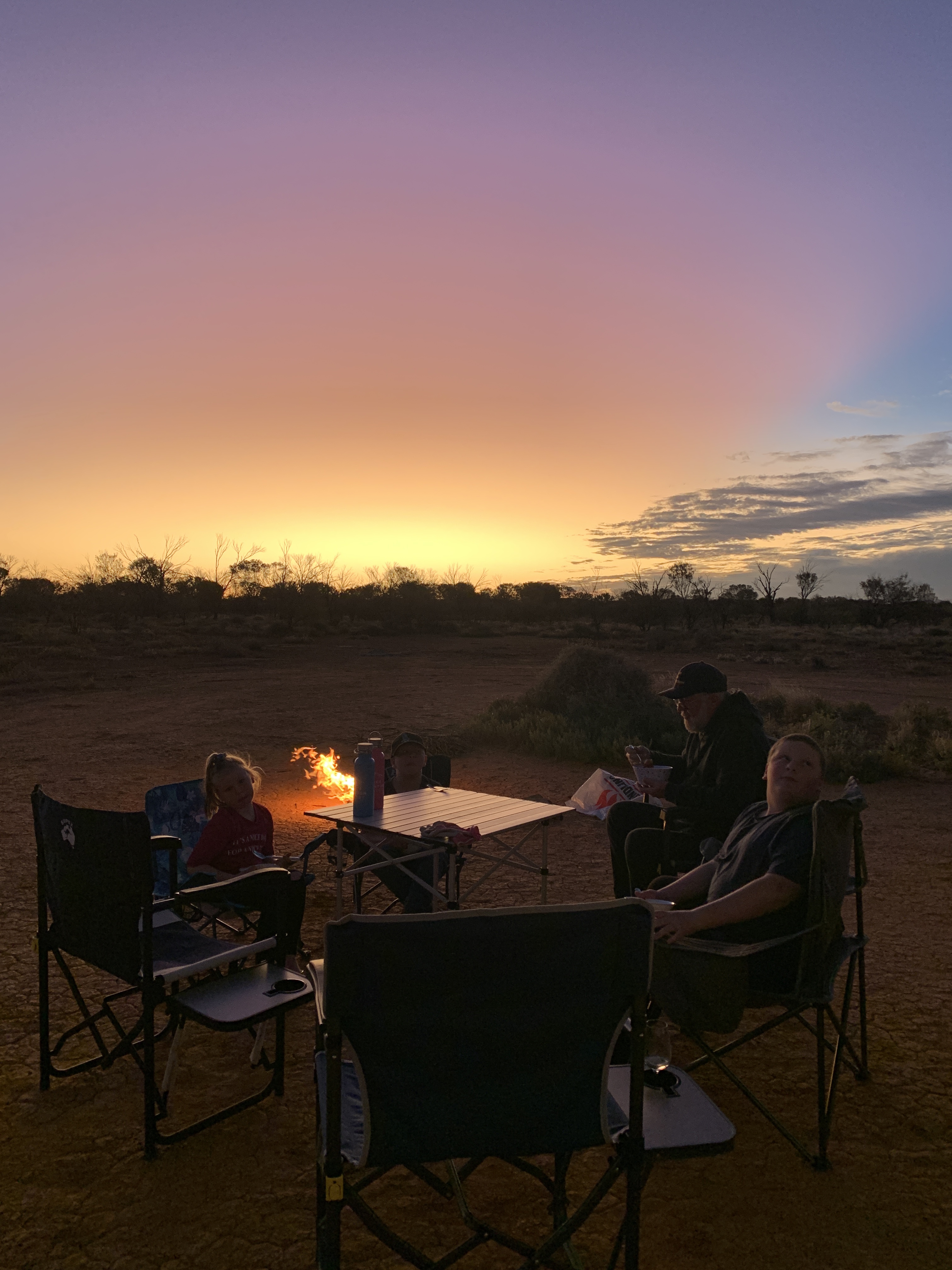
We eventually stopped at Mount John Rest Area. This great spot is on WikiCamps and is not an official Rest Area. There is a small track leading off the highway towards the west and you can drive for quite a way into the desert to get away from the highway. If you go too far though you come to the railway line. This is the line The Ghan uses but we’d missed it. The Ghan would have gone through that morning on its way to Alice Springs.
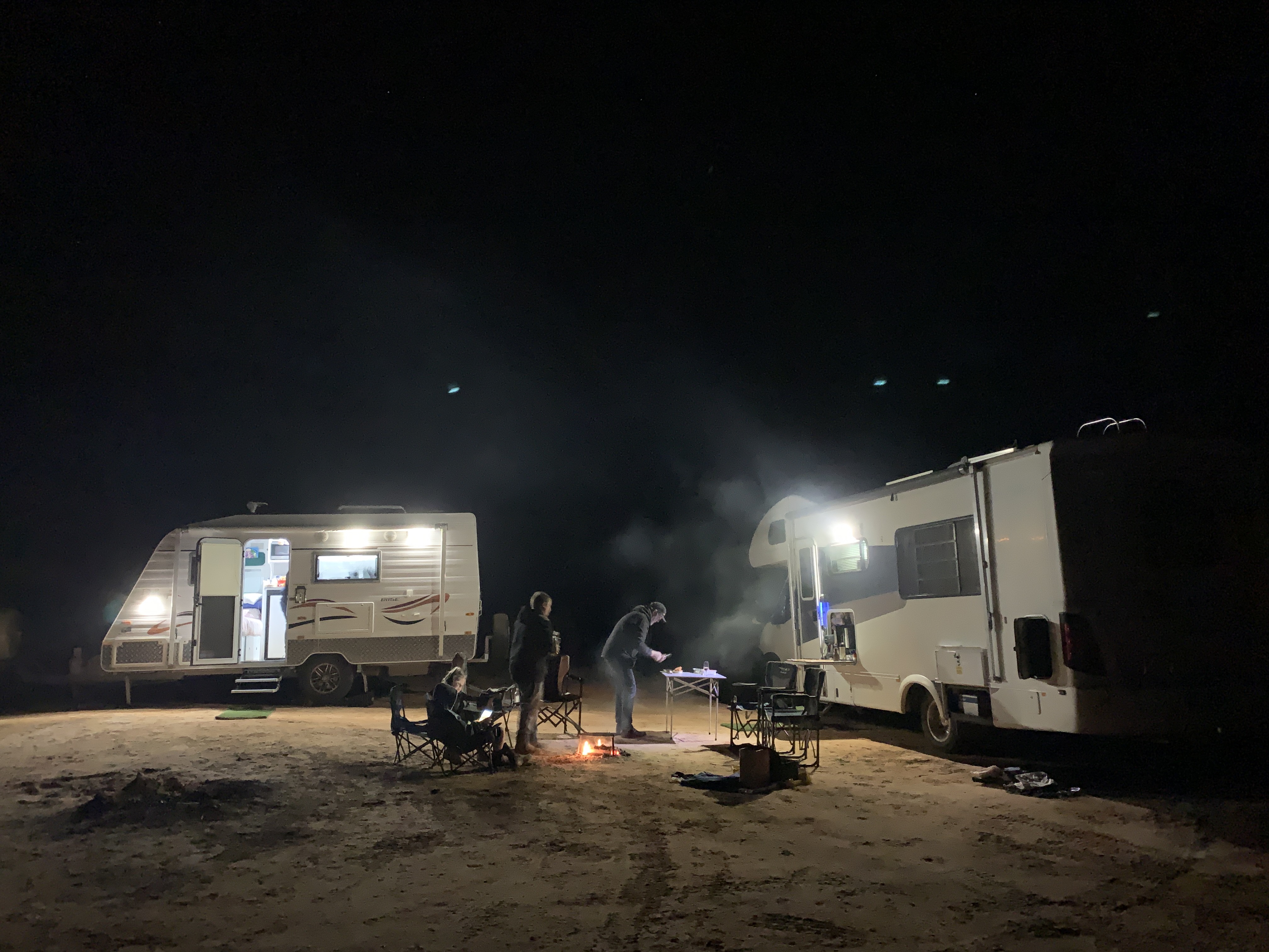
We found a good flat spot and ‘circled the wagons’ so they blocked the prevailing wind. Our camp was quickly set up. Everyone knows what to do to get camp set up now we’ve been on the road for over 30 days. We had a lovely campfire and ate our chicken & mushroom risotto sitting around the fire. I’d cooked the risotto in my little crockpot.
We’d traveled 511km for the day. That was a big day’s travel for us. It was a beautiful sunset in the desert and the stars in the sky were so bright. The kids get excited when they spot a satellite going overhead. I think they spotted 5 or 6 that night. They can all easily identify the Southern Cross constellation now.
Maddie, aged 6, taught me how to play a card game called Spit. It is a fast game and you need your wits about you. It’s a lot of fun.
Those free camps in the bush are always my favourites. There’s no other distractions, just the family, awesome sunsets and a great little campfire.
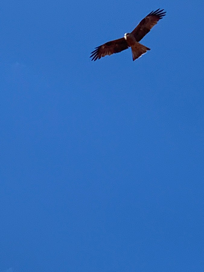
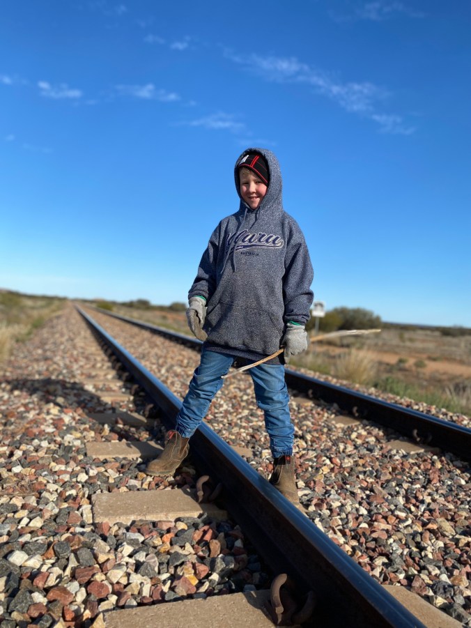
My attempt at capturing a flying hawkStanding on The Ghan trackCamped at Mount John Rest Area
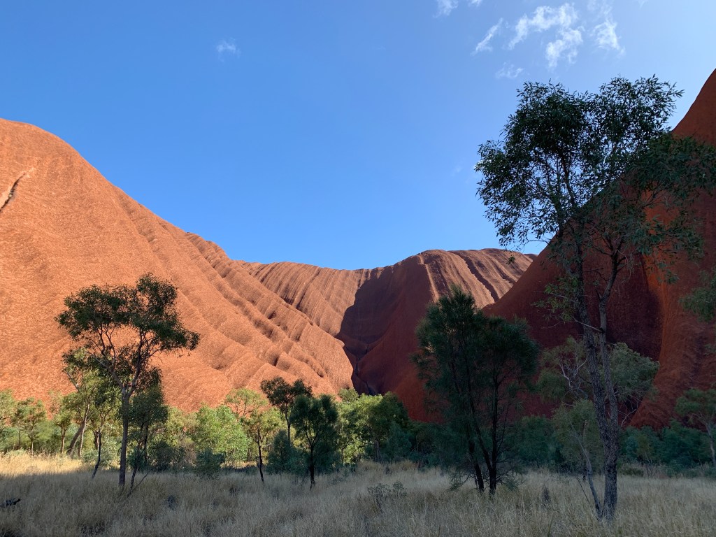
We set off from Ayers Rock Campground before 8am. We were all a little sad to be leaving Yulara. We had enjoyed our stay there vey much. Seeing Uluru and Kata Tjuta had been the highlight of our trip. It was the reason we came this way in the first place.
We pulled up for a break at the Lookout to Mt Connor and I’d read that there was a salt lake on the other side of the road. I couldn’t recall any salt lake when we came that way so I was curious to find it. Mt Connor was shimmering pinkish in the morning sun when we pulled in at the lookout. Across the road I could see a huge red sand dune and there was a pathway leading over it that looked like many feet had passed that way. Worth a look.
Across the road we went, up and over the red sand dune and there it was. Wow! The salt lake is huge. To get it all in one photo I had to use the panorama setting. It even has an island in the middle!
Curtin SpringsMount ConnorSalt lake
We took the turn off northwards to Kings Canyon on the Luritja Road and found it to be a good tar road. Two lanes although not a particularly wide road.
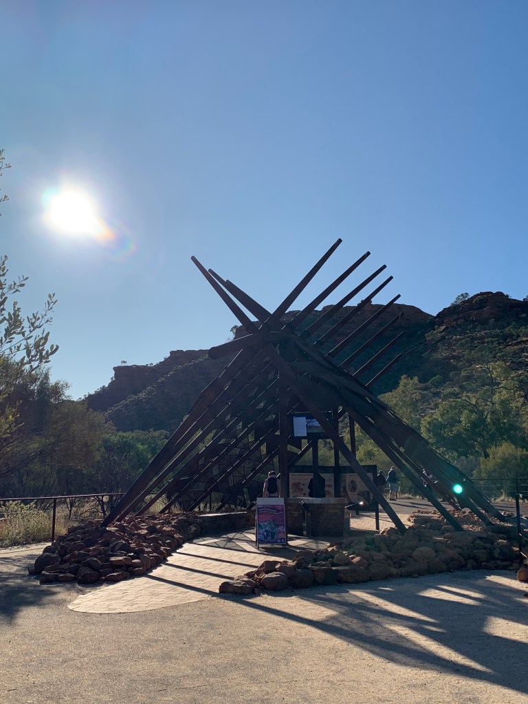
We pulled up for a look at the information boards and to take a photo in front of the Watarrka National Park sign. We’d made it to Kings Canyon. Another tick off that bucket list.
We had an uneventful trip to arrive at Kings Canyon Resort around midday.
Kings Canyon Resort has been taken over by Discovery Parks and it looked like a fair bit of money had been spent recently. The reception building was either new or newly renovated. All the signage around the park was new. We checked in and were a bit disappointed that they couldn’t put us on sites next to each other. We’d booked them so many months ago. Oh well!
We were even more disappointed days later when the sites either side of us had people only staying for one night. It would not have been difficult to move them so we could be next to each other. I feel that the reception staff need better training on how to use their own booking system. We have not had any problems with the other Discovery Parks we’ve stayed in.
The resort has a Service Station and General Store that sells a good variety of basic food supplies. There is also a pub that looks like it would be a good spot for a cold beer or some pub grub. There is a swimming pool surrounded by lots of green grass (amazing out in the the desert).
There are multiple amenities blocks, camp kitchens and BBQ’s scattered through the park. It is a very large park and offers all types of camping as well as lodge accomodation.
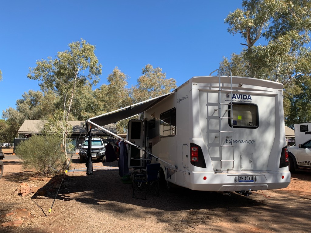
We set up our tables under the motorhome awning and enjoyed a family dinner while we discussed our plans to visit the canyon and which walk we were going to do.
After dinner, while a few of us were inside the motorhome doing the washing up, two wild dingos wandered through the campground. The kids were very excited to see a wild dingo for the first time.
Dingos are commonly seen around the park and there are many signs up saying NOT to feed them and to report any aggressive behaviour to rangers.
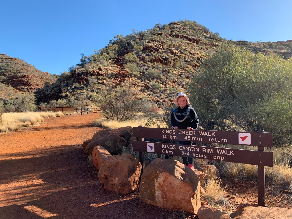
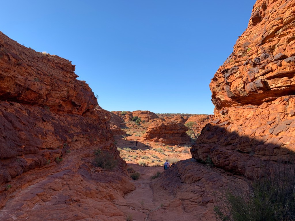
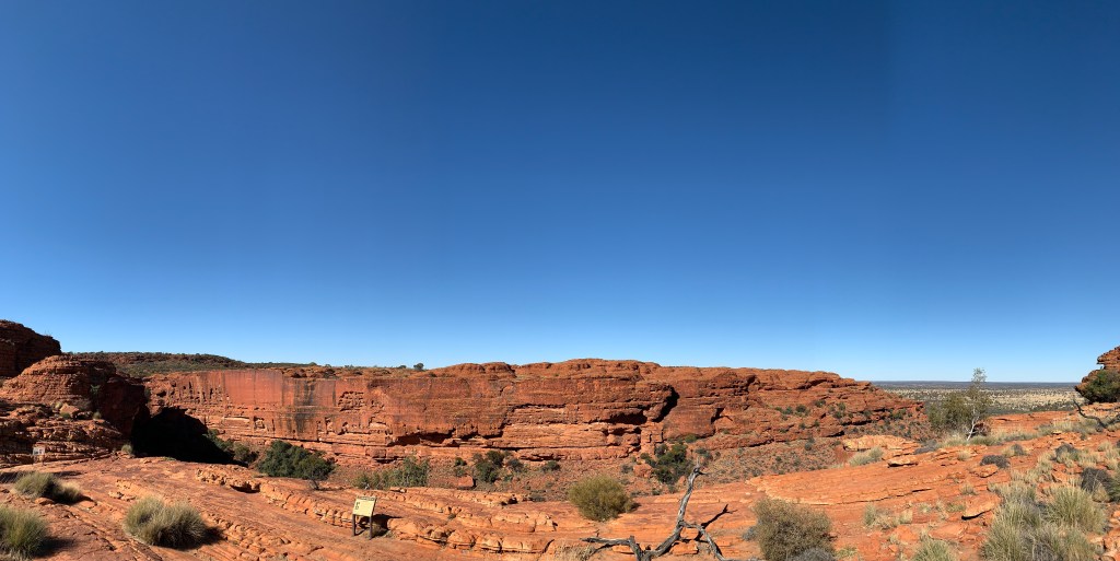
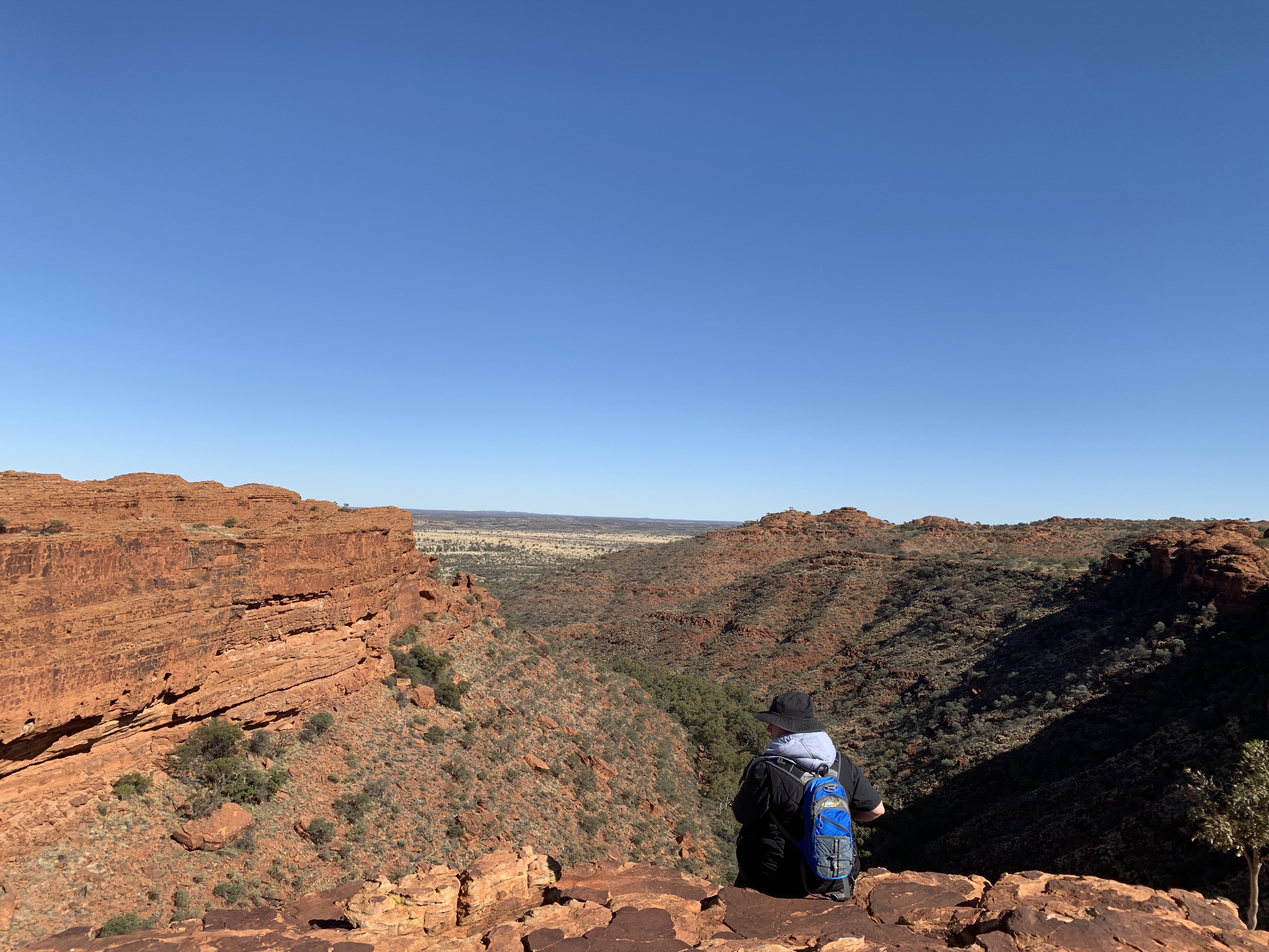
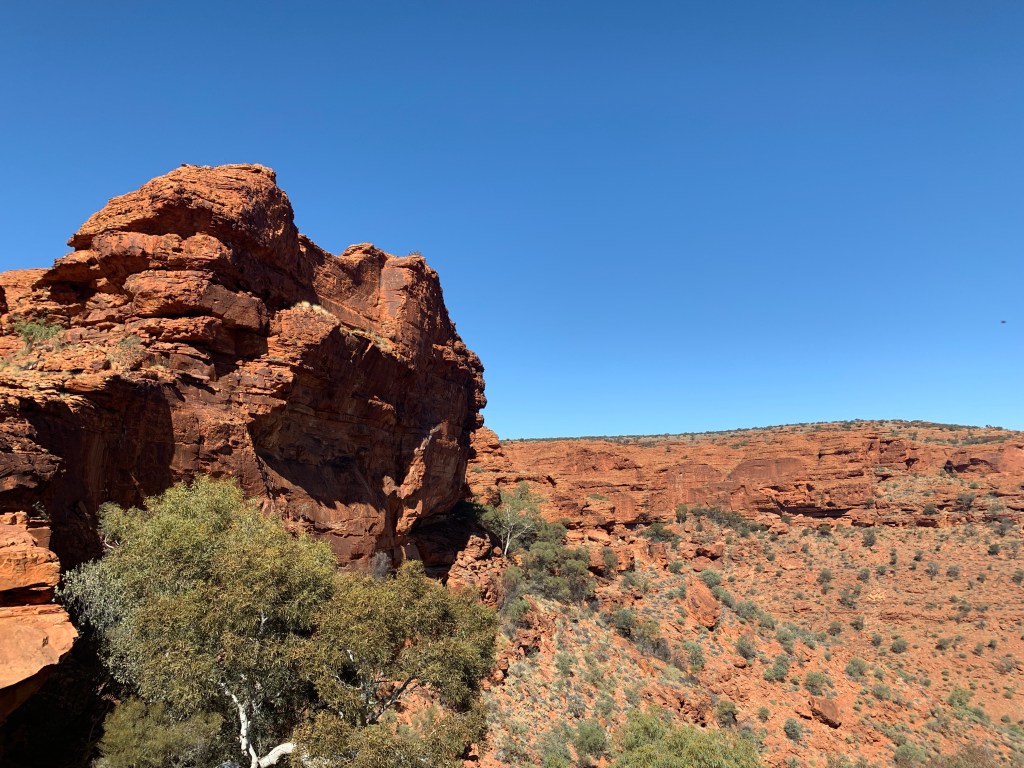
Day 2 at Kings Canyon Resort saw us all up bright and early ready to tackle the canyon walk. We’d decided we’d do the Rim Walk. The Rim Walk is a 6km loop that is classed as a Grade 4 – Moderate to Difficult walk.
Everyone enjoyed the walk however it was a more difficult walk than any of us anticipated. The first part of the walk was on a flat tarred track that leads into the canyon. This lovely walking track is wheelchair friendly and follows the bottom of the canyon for 1km. The Rim Walk branches off and this is where the hard part starts. It is about 500 rocky steps to reach the top and some of the stones are set quite a height apart. Definitely a challenge for those with short legs!
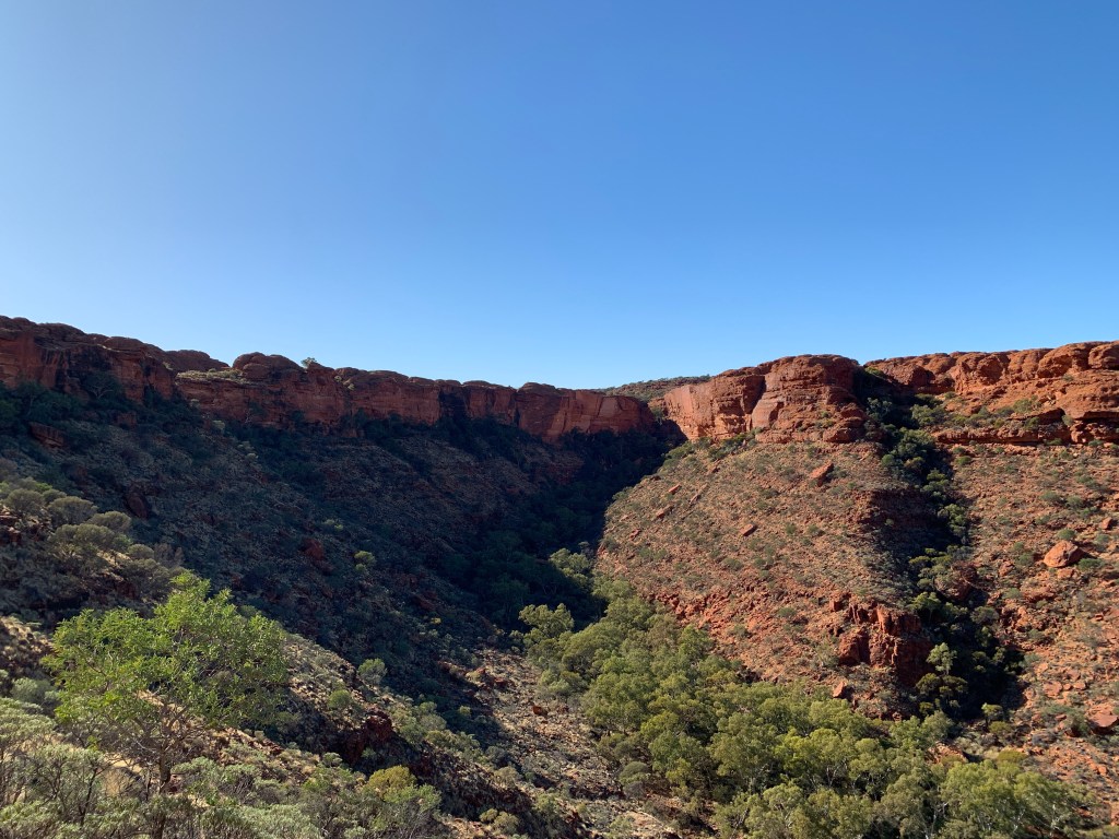
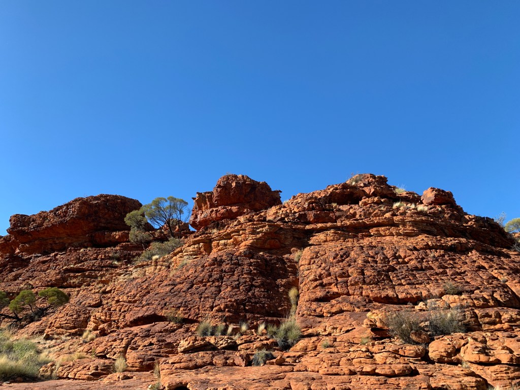
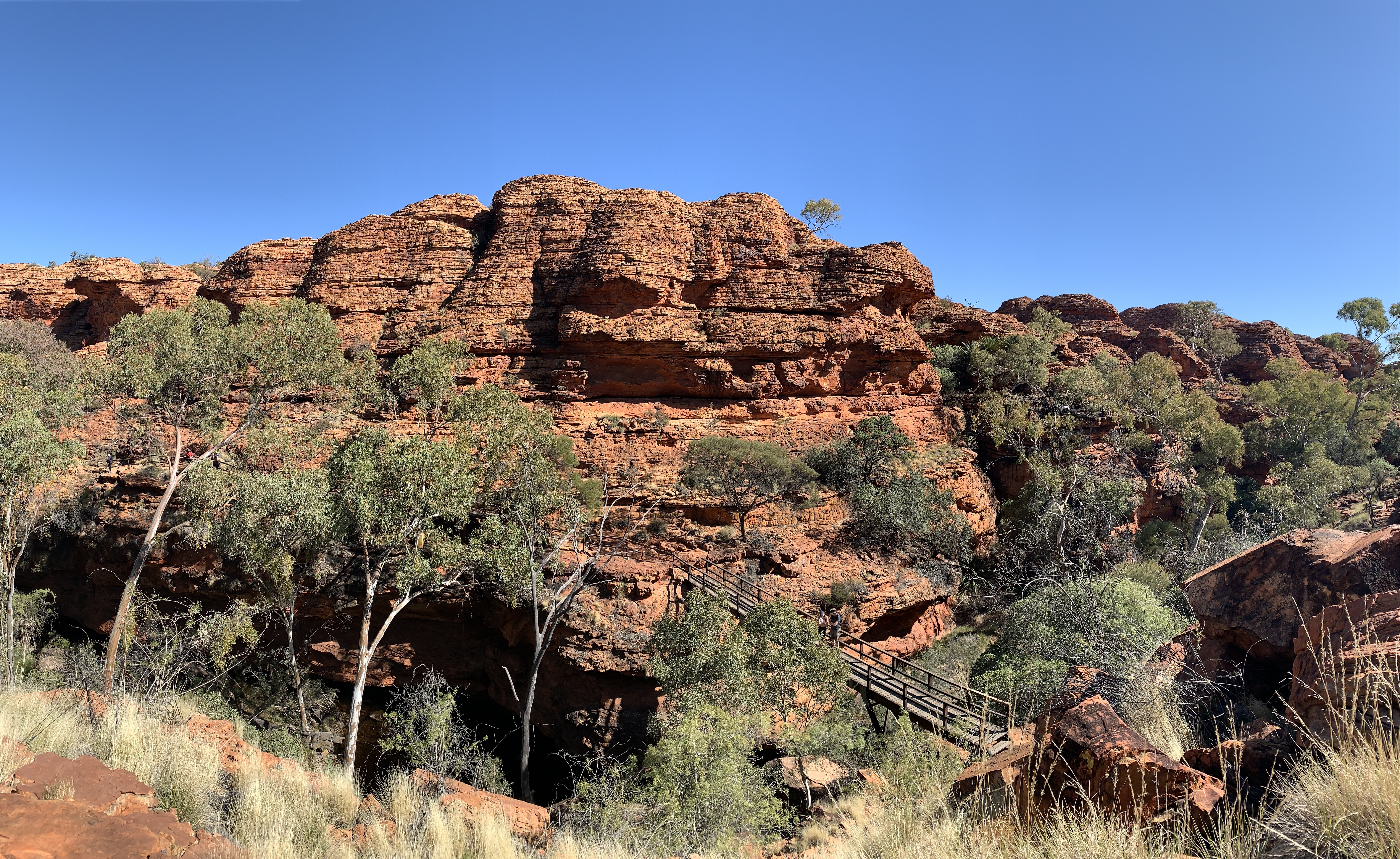
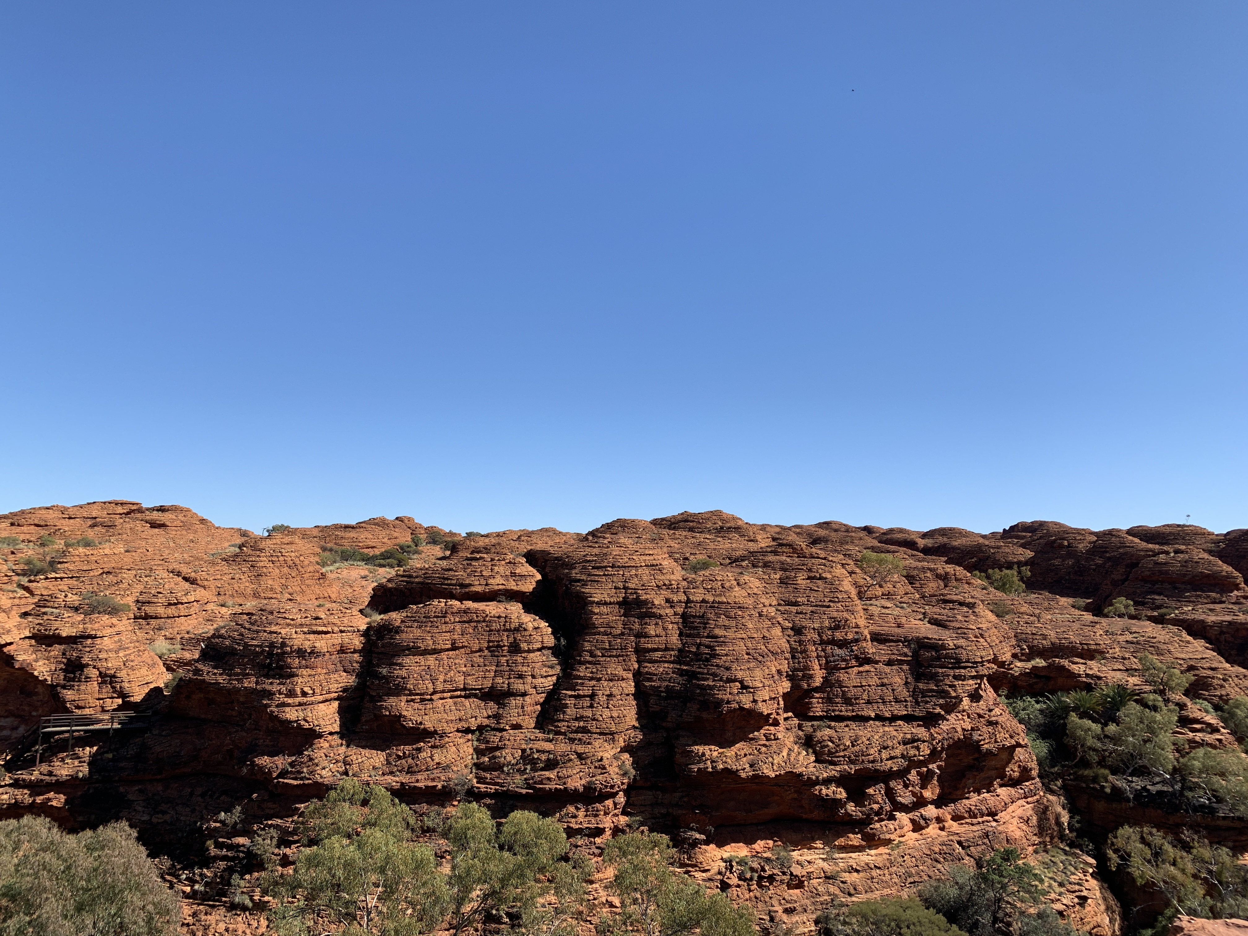
After the exhausting climb up the 500 rocky steps you finally reach the top and the path flattens out. By this time you’ve climbed over 100m. The top of the hills have eroded over time into strange looking domes. They are truly stunning.
400 million years ago Watarrka was a windswept plain covered with sand dunes. That sand has become the Mereenie Sandstone of the cliff tops. It’s hard and brittle. The softer Carmichael Sandstone of the slopes is more crumbly.
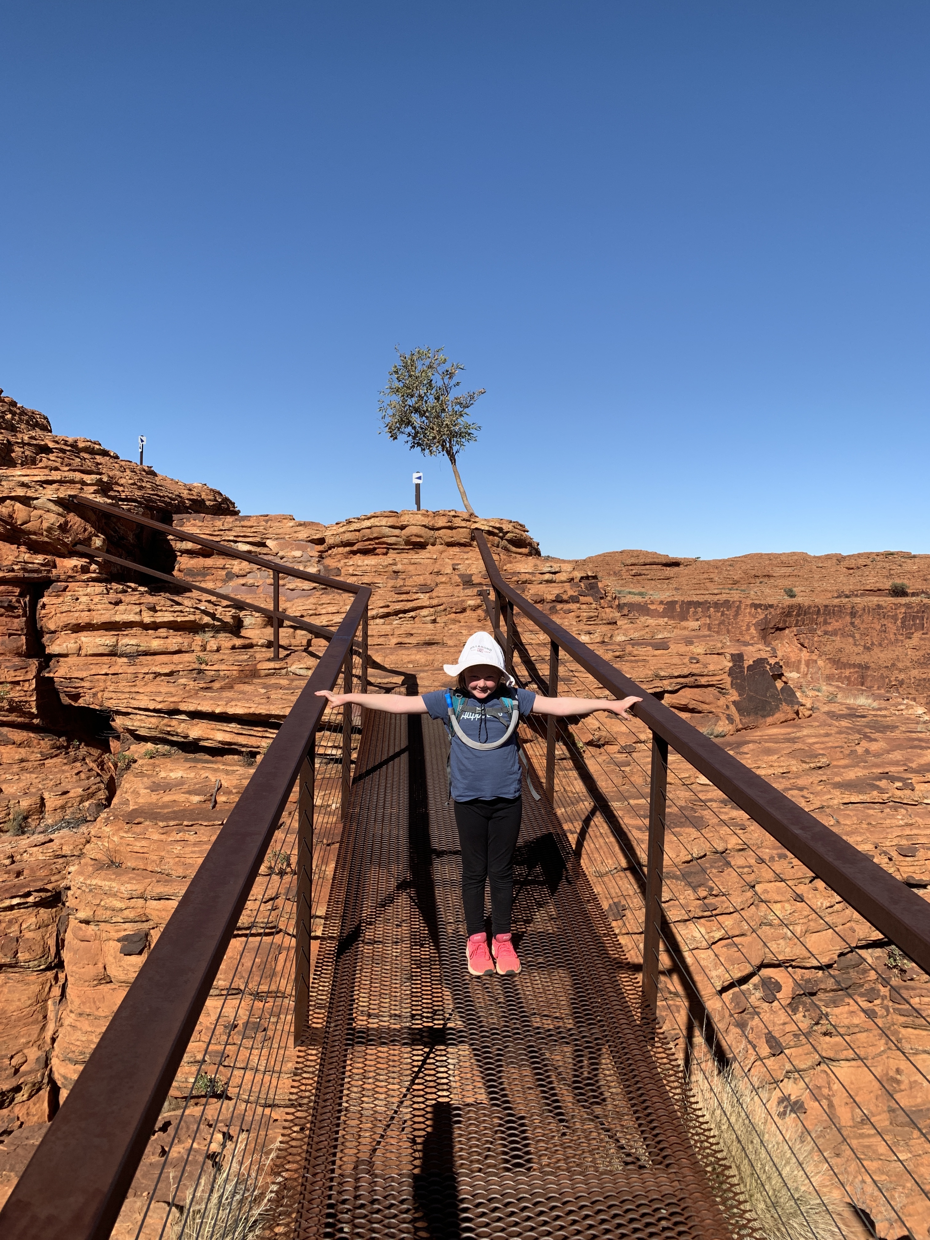
The track does a detour out to Cotterill’s Lookout. We had to check that out! It was challenging climbing over rocks following the track until we came to a metal bridge, Once across that the track leads straight up to the top of one of the domes. Maddie scampered up the side of the dome however I found this bit quite scary. It was a very long way down and I’m not great with heights. We turned around at that point and made our way back to the main track.
Ripple marks
Some of the stone has ripple marks. Evidence that there were once shallow lakes and rivers at Watarrka.
Eventually the track leads to a set of very steep series of stairs that go down into the canyon. Near the bottom is a bridge across the waterhole below. Another series of steep stairs goes up the other side. About half way up is the detour to the Garden of Eden. This 600m detour leads to the well known waterhole. Ben and I decided to go this way whilst the others went straight to the top and had a lunch break while they waited for us to come back.
About half way there I nearly said to Ben ‘forget it’. It was lots and lots of stairs going up and down. I’m really glad I stuck it out though. The Garden of Eden is a magic spot. It is sacred to local Aboriginal men and swimming in the waterhole is forbidden in their culture. They ask visitors to respect that and not to swim in that special place. It is certainly a great spot to just sit and take in the serenity. Even though there were quite a few walkers there everyone spoke in hushed voices and were careful not to spoil the ambiance for others. Ben and I just sat there for a bit, not talking, just taking it all in. Check out the photo below.
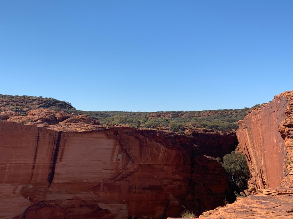
After reaching the top of the stairs on the other side of the canyon the track continues and comes to a bridge with a gate. Once through the gate you cannot come back through. This marks the end of the Southern Rim Walk. Some of the views from that side are spectacular. We were all very careful to stay away from the cliff edge as they are sheer cliffs and a fall would probably be fatal.
The Southern Rim Walk is a very rocky track with lots of up and down. Riley was great at helping his short Granny down some of the steep bits. I have to say how impressed I was with our three kids. What little troopers. They stayed in formation leaving about 2m between them and the person in front, they carried their own backpacks, and they all seemed to enjoy the walk.
It was 6 tired people that arrived back at the car park. What an epic walk.
At the end of our walk my Apple Watch said we’d walked 8.6km and had taken us four hours and three minutes, although we’d had a few rest stops and a lunch break along the way.
Southern Rim Walk
We decided to have a night off from cooking after our strenuous day’s walk and go to the Pub for dinner. The Thirsty Dog Pub looks like it’s had a Reno recently too. It’s quite a large space with a restaurant at one end, bar area in the middle and another large bar area behind a wall of glass doors. There’s a pool table there too. Outside the pub is surround by red gravel and gardens with long benches set up under the stars. There’s a boardwalk to a lookout where there is a little caravan set up as a bar. The lookout bar opens from 5pm – 7pm each night and live music is on offer. It’s a great spot to watch the sunset with a nice cold beer.
We found ourselves a table for six, ordered dinner and the three adults enjoyed a lovely cold beer. Rich and I were a little disappointed in our meals, they were overcooked, however the rest declared theirs to be good pub grub.
Our third day at Kings Canyon Resort was a down day. A day to just chill and relax. Katie and I got our cleaners hats on and cleaned our RV’s from top to bottom inside. Clean sheets on the beds, floors washed, multiple loads of washing done and hung out in the lovely sunshine. The outside would have to wait until we get back down south and can find a car wash we can fit in.
The rest of the day was spent reading, napping, relaxing. The kids played cards, read books and scootered around the park meeting up with other kids and swimming in the cold pool. Rich spent the day reading a book and starting a new one. He did do a run to the dump point though.
As we sat around our tables next to Katie’s van we discussed what has been the best thing so far. We were now 4 weeks into our 6 week trip. We all had so many highlights, Uluru, Kata Tjuta, Kings Canyon, the West MacDonnells, Alice Springs, the Desert Park in Alice, Territory Day Fireworks in Alice, the Day Dream Mine Tour in Silverton, the bus tour in Coober Pedy. So many amazing experiences. All of us have enjoyed seeing the desert and have found the landscape so incredibly beautiful.
I was really pleased to hear that all the children have enjoyed the walks we’ve done. They all declared the Kings Canyon Rim Walk to be the best and Redbank Gorge in the West MacDonnells the worst. The Rim Walk was long but they loved it. Redbank Gorge was just plain hard work climbing over rocks.
We retired early so we could be up and on the road early the next morning. We have three long driving days ahead. It’s 1,100km back to Port Augusta.
When we arrived at Ayers Rock Campground we had a powered site with water so we plugged in our power cord, attached our water hose to the tap and the other end to the motorhome and attached our grey water hose to the outlet. The other end I placed near a big bush.
The first few days everything was fine.
We came back from our night at the Field of Light Dinner and Katie informed us that there was water leaking from under the motorhome. I’d put on a load of washing before we’d left and the grey water tank had filled to overflowing. It was too dark to do anything about it so I’d look at it the following morning.
The next morning, before we had our showers, I went out to investigate why the grey water tank wasn’t draining. I checked the end of the hose near the bush and there didn’t look like any water had come out, the sand was dry.
Next I unattached the fitting from our outlet. Ewwww what was that sticking out of the outlet? I got a tent peg and used that to lever it out and discovered the body of a drowned mouse. Gross! The mouse must have crawled up the length of the grey water hose until it arrived at the valve and couldn’t go any further. It must have drowned there and blocked the hose so no water could get through.
Once the mouse body was cleared the grey water tank outlet was working again so I reattached the hose, opened the valve and, hey presto, grey water came out the end and watered the big bush again.
I poured a big bucket of water with disinfectant down the shower to kill any germs the mouse had left behind then disposed of the body of the mouse on the sand dune behind us. Maybe a bird would eat it, or the ants!
It was our last day at Yulara before we head off to Kings Canyon and we’d saved Kata Tjuta until last.
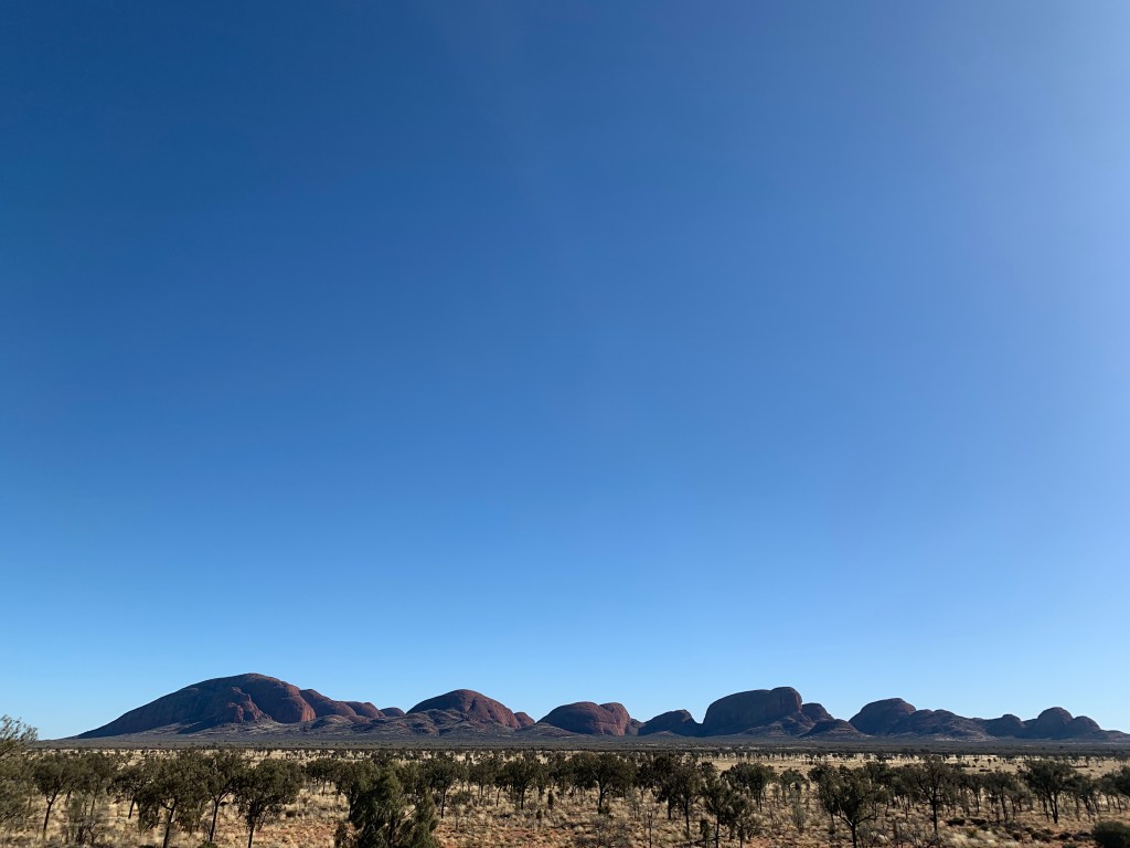
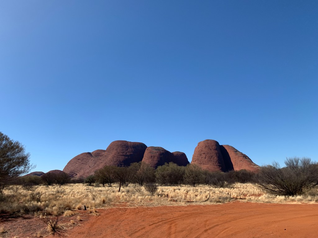
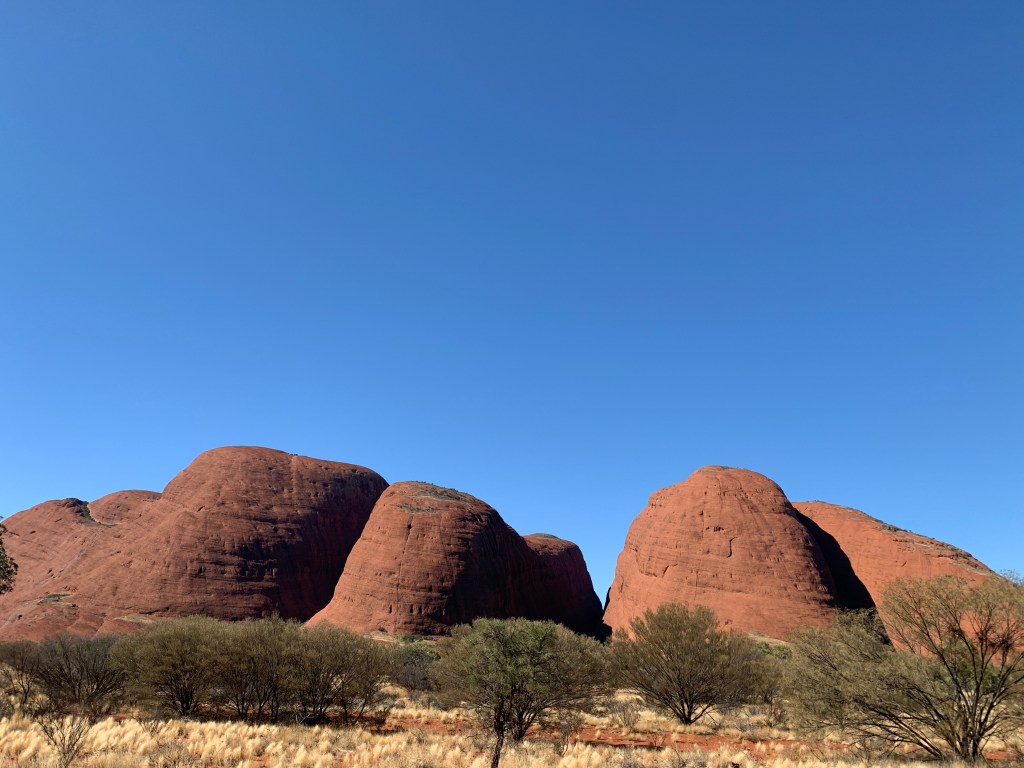
We set off into the National Park once again and this time took a right turn towards Kata Tjuta. Many of you will recall they used to be called The Olgas. Mt Olga is the tallest of the domes at Kata Tjuta and at 1,069m is 206m taller than Uluru.
Our first stop was at the Sand Dune Viewing Point. Here there is a car park and a short walk up the sand dune on a metal boardwalk. The boardwalk is to protect the fragile sand dune environment. From the top of the dune you get a fabulous view across to the red domes of Kata Tjuta. There is a large boardwalk platform on the top of the dune with storyboards full of information about the flora and fauna of the sand dunes.
View from the Sand Dune
We continued on and passed the turnoff to Kaltukatjara (Docker River) which is the continuation of the Outback Way (The Longest Shortcut) and takes you all the way to WA.
Our second stop was to the Sunset Viewing Car Park. We were way too early for sunset but this is the only place in Kata Tjuta that has toilets.
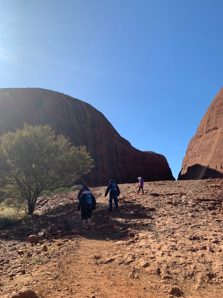
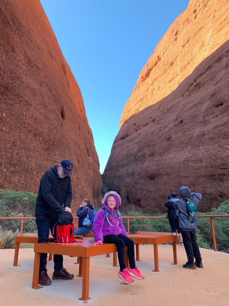
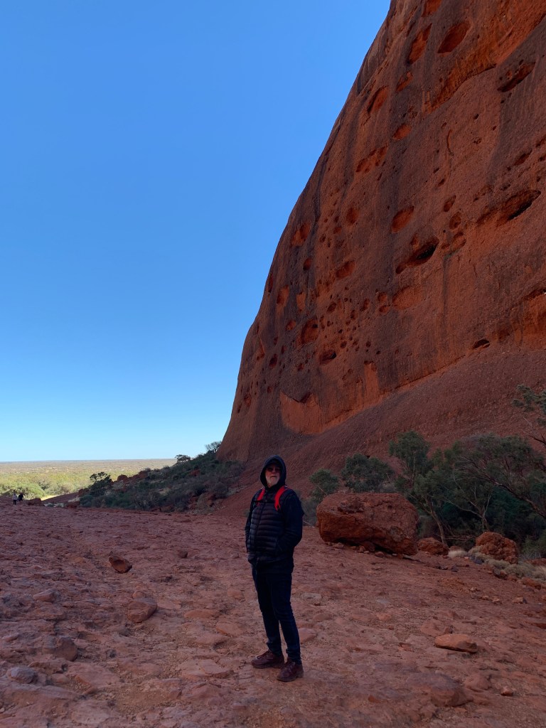
Our third stop was at the car park for the Waḻpa Gorge walk. This walk is a Grade 3 – Moderate walk of 2.6km. It is a very rocky walk and not an easy one. You really do have to watch your step on this track. The wind was howling down through the gorge and it made for very chilly walking. I was wishing I’d worn my beanie as my hat blew off a couple of times and the children had to run after it before it blew too far away. Waḻpa means ‘windy’ in the local language.
There is a sign at the beginning of the track that says that Kata Tjuta is an Aṉangu mens site and is sacred under Tjukuṟpa (traditional law). Visitors are asked to stay on the track and to be respectful of the area. particularly those people who wish to make silly rock cairns. There are signs asking people to please not do that to this sacred place.
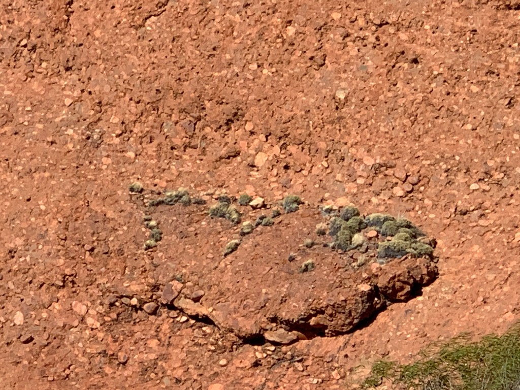
Once at the end of the walk there is a large platform with seats where you can catch your breath and just sit and listen to the sounds of the gorge. It is a beautiful place. Hundreds of tiny birds, we think they were finches, darted all about. There are rare plants that grow in Waḻpa Gorge that grow nowhere else in the world.
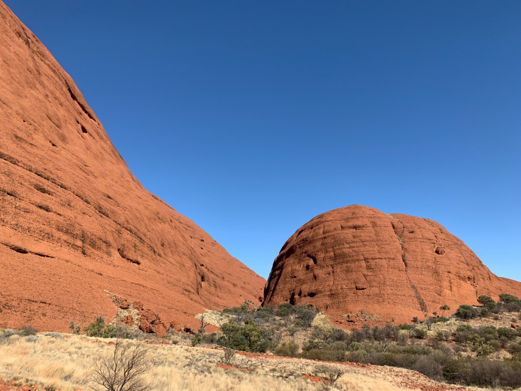
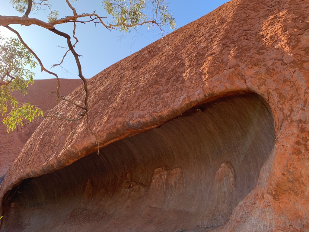
Kata Tjuta differs from Uluru in its composition. Uluru is one great big sandstone rock. The domes of Kata Tjuta are made up of conglomerate rock. Millions of rocks fused together over millenia. They are truly stunning.
Hanging onto my hatWaḻpa Gorge Walk
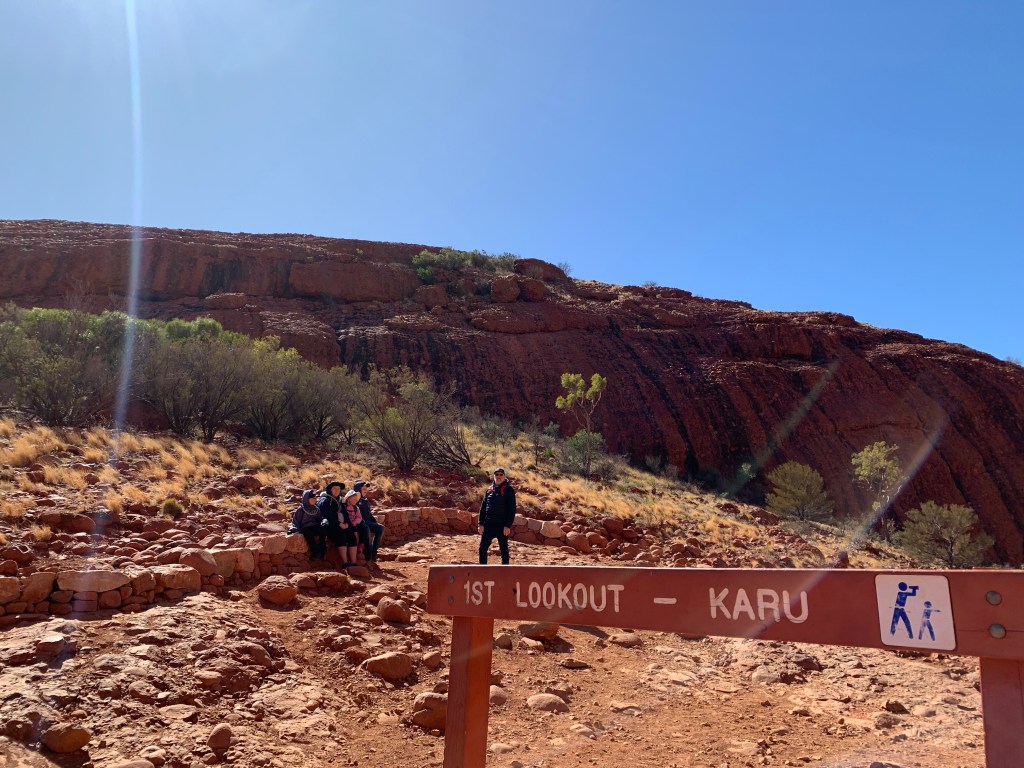
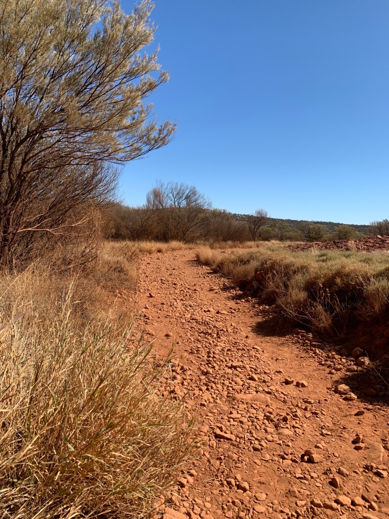
We walked back out of Waḻpa Gorge to the car and drove to our next stop, the car park for the Valley of the Winds walk. The Valley of the Winds walk is in three sections. The first part is to Karu Lookout and this section is a Grade 3 – moderate walk of 1.1km. The next section is to Karingana Lookout and is a Grade 4 – Difficult walk of 2.7km. The Full circuit walk is a Grade 4 – difficult walk of 7.4km and takes about 4 hours.
We chose to only do the walk to Karu Lookout and even though this is a moderate walk it was still challenging due to the rocky path. There are lots of loose rocks so you have to mind your step. The view at the end is worth it though. Wow. What an amazing place. It was also very windy
Karu Lookout Walk
It was a tired group of 5 that headed back to the car and I think we were all relieved to get out of the cold wind. It was lovely to get back in the nice warm car.
Kata Tjuta (The Olgas)
Back at camp Katie and I menu planned for the next week and headed off to the IGA to stock up on groceries. We will have 3 days at Kings Canyon then a few nights free camping before we get anywhere near another supermarket.
We were heading back to the car with our trolleys when I looked up and who do I see but someone from our home town of Griffith. Fancy that! They are also staying at the Campground for a few days and were probably in the West MacDonnells when we were. It’s a small world.
Richard and Riley did a dump point run to empty both cassettes before we set off in the morning. I think I’ve already mentioned that the only dump point at Yulara is 5km away from the Campground out near the Water Treatment Plant on the other side of town.
After dinner everyone chipped in to pack up what we could so there is less to do in the morning. We have 305km to travel to get to Kings Canyon Resort where we have powered sites booked for 3 nights.
I think everyone is ready to move on and continue our travels after 6 days spent at Yulara. We have enjoyed it here very much. This is somewhere all Aussies need to visit at least once in their lifetimes and we feel very fortunate to have done this trip together. We are not sure how people only come for two or three days as there is so much to do.
Wow! I received a notification today that my website has reached 10,000 views. I’m a bit stunned. I know that isn’t many for a full time blog however my little blog is really only to record our travels and maybe share some of our adventures with other like-minded travellers.
I started this little blog in March 2016 and I really enjoy writing about our meanders around our fabulous country.
Thank you to all who have been part of that 10,000 views. I hope you enjoy reading my stories as much as I enjoy writing them.
I’m always happy to hear from readers what you would like to hear about. Let me know your thoughts!
Months ago, when we booked our camp sites at Ayers Rock Campground, we’d also booked for a special night out at The Field of Light Dinner. This combines the Sounds of Silence Dinner with the Field of Light Experience. We were quite excited by the thought of this night out.
Rich and I put on our glad rags and set off to the Campground Bus Stop to wait for our ride. When we arrived at the bus stop there were already a few people waiting for various tours.
Each night, every day of the year, multiple dinners are held out in the desert under the night sky. We found out there is the Field of Light Dinner site, two Sounds of Silence dinner sites and one site for the extra special, top of the range, fine-dining experience called Tali Wiru.
You can also book just to visit the Field of Light and this is what Katie and the kids were doing. They planned to go to the Outback Pioneer Pub for an early dinner before meeting their bus for the ride out to the Field of Light. We hoped we’d catch up with them there.
There were two big coaches that collected all booked for the Field of Light Dinner and we were driven out into the desert, across sand dunes to be dropped off at the base of one dune. A pathway led to the top and along the crest of the dune to a lookout where staff were waiting to serve us drinks and delicious canapés. The canapés included things like a crocodile quiche, small bite-sized pieces of kangaroo served on crusty bread, scrumptious little caramelised onion tartlets, a prawn bite and another tartlet with sweet potato cream. Bubbles, red and white wine were available and soft drink for the no-alcohol guests.
We did have a bit of a laugh when we discovered the wine being served was De Bortoli’s. We travel all this way to be served wine from home.
The staff were very attentive and passed by frequently with platters and to top up your drinks. The flat area had a great view out towards Uluru and we stayed up on top of the dune until the sun set.
We were then led down the hill to our dining site. This was amazing. Large round tables set with white tablecloths under the stars on the red desert sand. Along one side was a large buffet and delicious smells were wafting from there as we sat down for dinner.
We sat a table with a couple from Sydney that we’d met at the top of the dune, three young ladies also from Sydney and a young couple from Italy who were on their honeymoon in Australia. Everyone was great company.
Our lovely waiter introduced himself as Amos and he would be looking after our table all evening. The first course was served to the table and consisted of a native tomato soup. It was spicy and delicious.
Second course was from the buffet and we were invited up table by table. There were 4-5 salads, grilled barramundi, kangaroo in dukkah, a chicken dish and lamb cutlets as well as a couple of vegetable dishes. All dishes had a bush tucker theme using native ingredients.
The variety of food mean there was something for all tastes. I had the barramundi and kangaroo with lots of veggies and it was all very tasty.
Dessert was buffet again and tables were called up in the reverse order to help themselves to a wide selection of desserts. Tea and coffee was also available.
During dinner we had the haunting sound of a didgeroo playing. This really added to the atmosphere of the occasion.
Following dinner the resident star talker discussed the southern night sky. He used his laser to locate the Southern Cross, the signs of the zodiac, the Milky Way, as well as any planets that were visible. Unfortunately for us we had a super moon and the sky was so bight that not many stars were visible. Still, we could easily see Saturn.
I was fascinated to learn the the light from Beta Centauri takes 400 years to reach us on earth. The light you see when you look up at that star left sometime in the 1600’s. Isn’t that amazing!!!
Amos was a most attentive waiter and ensured that our wines and water were topped up regularly.
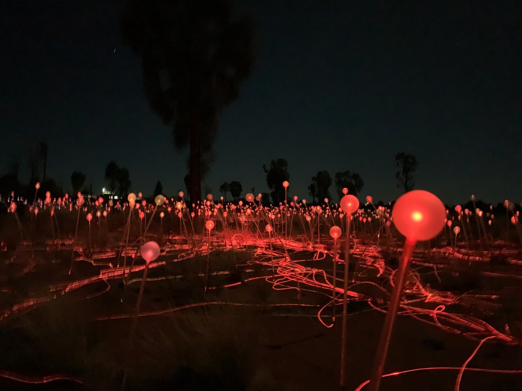
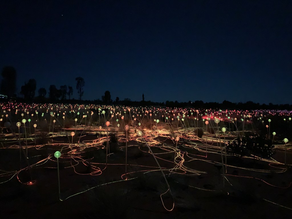
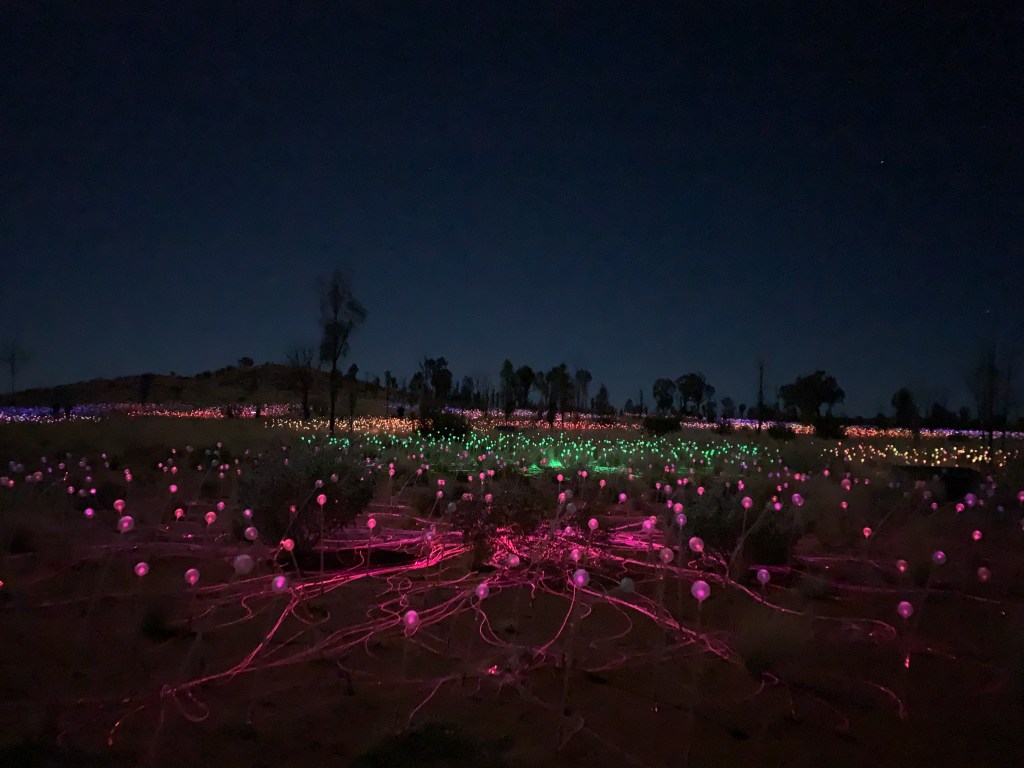
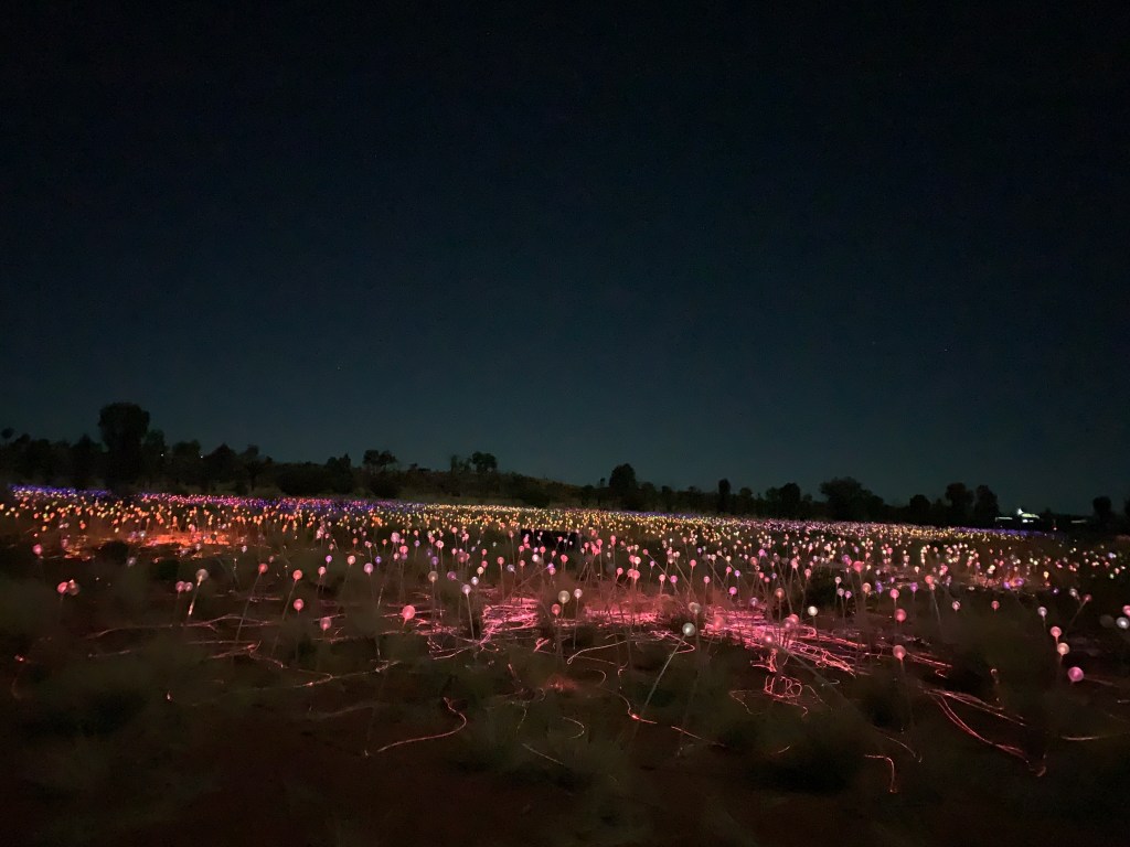
By the time dinner was over it was 9.30pm and we had 45 minutes to set off down the hill to explore the Field of Light art installation. As the sun went down we could see the lights begin to light up and gradually they became brighter and brighter.
The Field of Light is an art installation that was created by British artist Bruce Munro. It was meant to be on display for six months however, due to it’s popularity, it is still going.
There are over 50,000 lights in their frosted glass spheres that sway gently on their stems in the colours of the desert, red, ochre, deep blue and white. The area covers the size of four football fields.
Over 15 tonnes of solar powered lights were transported 19,000 miles via 32 international and domestic flights to the middle of Australia.
The Field of Light has been entrancing visitors since 2016 and will do for some time to come.
45 minutes was just enough time to walk through the magical field of coloured lights.
The evening was definitely a highlight of our visit to Yulara.
We arrived back at camp to find all the lights out next door. They must have all been asleep. We found out the next morning they’d had a lovely dinner at the pub and also enjoyed their walk through the Field of Light.
After a slow start to the day Katie, Ben, Maddie and I set off to Ulura to visit the Cultural Centre. Richard had his nose in a book and Riley planned to do the same so we left them behind.
The Cultural Centre is located in the National Park and is only a short drive from the base of Uluru. It really should be your first stop when arriving at the park. We did have a short visit there the other day when we cycled around Uluru however Katie wasn’t with us and she really wanted to have a look at the art gallery.
The Cultural Centre is housed in a free form structure built from locally made mud bricks. You enter from the car park via the Tjukuṟpa Tunnel. Tjukuṟpa (pronounced choor-orr-pa) is the foundation of the Aṉangu culture. It is the creation period, their religious heritage and provides rules for behaviour and living together. It is the law for caring for one another and the land.
Tjukuṟpa refers to the past, present and the future at the same time. The knowledge never changes, it is always the same.
This knowledge is passed on from generation to generation. Some areas of Tjukuṟpa are only passed on to those who inherited the right to the knowledge. And, as with all knowledge, comes responsibility. The Aṉangu people are happy to pass on to visitors some of this knowledge and in return they ask that visitors respect their beliefs and take responsibility for looking after this special place. Visitors are particularly asked not to take photos of sacred sites and these are clearly signposted all the way around Uluru. There are lots of other places to take great photos.
The shape of the Cultural Centre buildings represent the two ancestral snakes, Kunyiya, the woma python woman and Liru, the poisonous snake man. Aṉangu creation stories tell the battles between these two helped create Uluru. Walking through the tunnel are displays that tell the story.
Once through the tunnel you can visit the Information Centre where there are further displays of the history of the National Park and how it came to be a national park, the flora and fauna of the area and a great video presentation about bush tucker, where to find it and what to do with it.
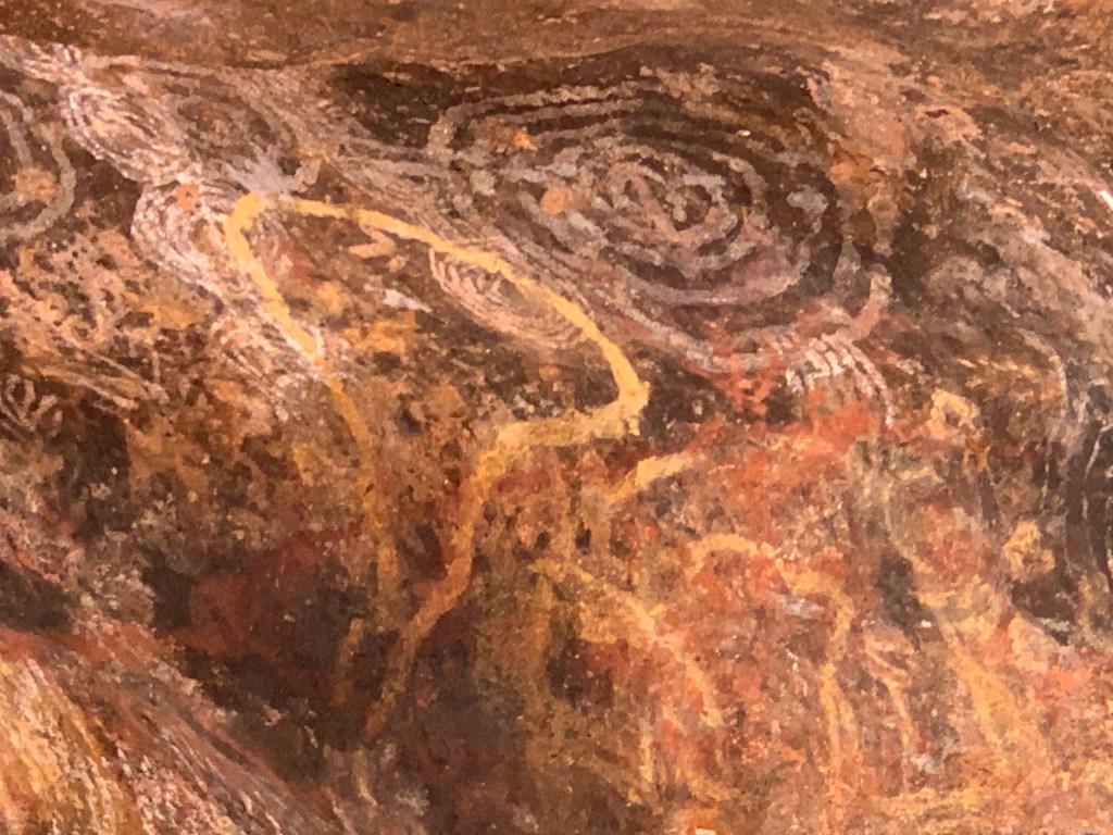
The Aṉangu owned and run Maruku Arts Store is next to that with a large area in front of it with picnic tables and chairs. Opposite is the Ininti Cafe and Souvenir Shop and next to that is the Walkatjara Art Gallery. This fascinating art gallery is also a workshop for local artists and there are often three or four artists at work at any one time. Both times we’ve visited there have been four women artists working.
I am fascinated with the style of painting using the tiny dots. It is painstakingly slow to create the paintings. Each painting tells a story and no two paintings are the same. The artists at work are more than happy to discuss their work with visitors and explain the story behind what they are working on.
There was a real difference between the quality of the art in the two stores at the Cultural Centre. The artworks in the Walkatjara Art Gallery are world class. This is, of course, reflected in the prices with paintings selling for $700-$1000 and anywhere up to $23,000.
Katie met one of the artists, Valerie Brumby, and was very taken with her work. Valerie even agreed to have her photo taken showing of her just completed works. This was quite an honour.
We bought delicious hot pies from the cafe for lunch and ate outside at one of the picnic tables. I had an emu, saltbush and sun-dried tomato pie. It was delicious.
Back in Yulara we stopped off to visit GOCA, the Gallery of Central Australia. This gallery located near the Emu Walk Apartments and Arkani Theatre showcases art from a huge area of central Australia and includes paintings, wooden objects, baskets, and pottery.
A quick visit to the IGA and the Uluru Store and we set off back to the campground. Once we drove in past reception I asked Katie to take a right turn and we drove up through the powered sites section of the park. This area is like a traditional caravan park with streets in rows. Some sites have concrete slabs and all have power and water. There are two amenities blocks and a laundry to service this area.
Between one amenities block and the laundry is a large flat are that is used by bus groups and there were two such groups set up with lots of kids eating their lunches at the many picnic tables. Behind them were rows and rows of little tents that they sleep in.
Back in the section where we are camped there are large lawn areas where people camp in a variety of tents, swags and we even saw a hammock strung up between two trees.
There are also powered sites in this area but not all of them have water. This area is more organic in shape and not in rows like the traditional area. If you drive right through this area you arrive at the overflow area which is just a big oval of red sand where you can camp with no power or water for $46 per night.
We really like our camp spot. We are tucked in with a big bush on one side so no one can camp on that side and we are backed up to the fence and, beyond that is bush, so no one is behind us either.
There are three amenities blocks in this area and each one has a washer and dryer. There is also a large camp kitchen close to where the tent sites are.
My only suggestions for improvements to the Campgound would be a couple of dump points. There is no dump point at all. The only dump point is 5km away.
The park could also do with a couple of playgrounds for the children. There are none. A bonus would be solar heating for the swimming pool. It would definitely get more use if it was heated.
What another fabulous day in The Red Centre with two big ticks off the bucket list.
The whole family piled into the car to drive out to Uluru. Katie and I were dropped off at Mala Carpark so we could do the Base Walk. Pa took the kids back to Yulara where they went to the supermarket to stock up on supplies and lazed around camp for the morning while Katie and I walked.
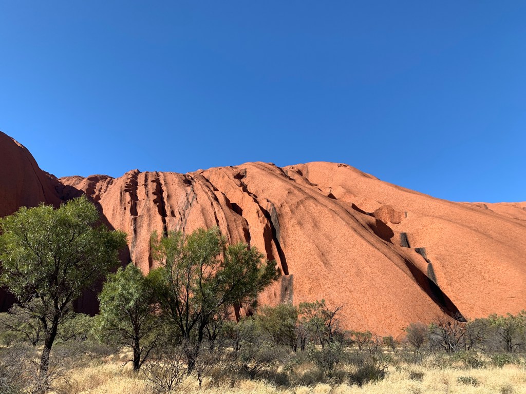
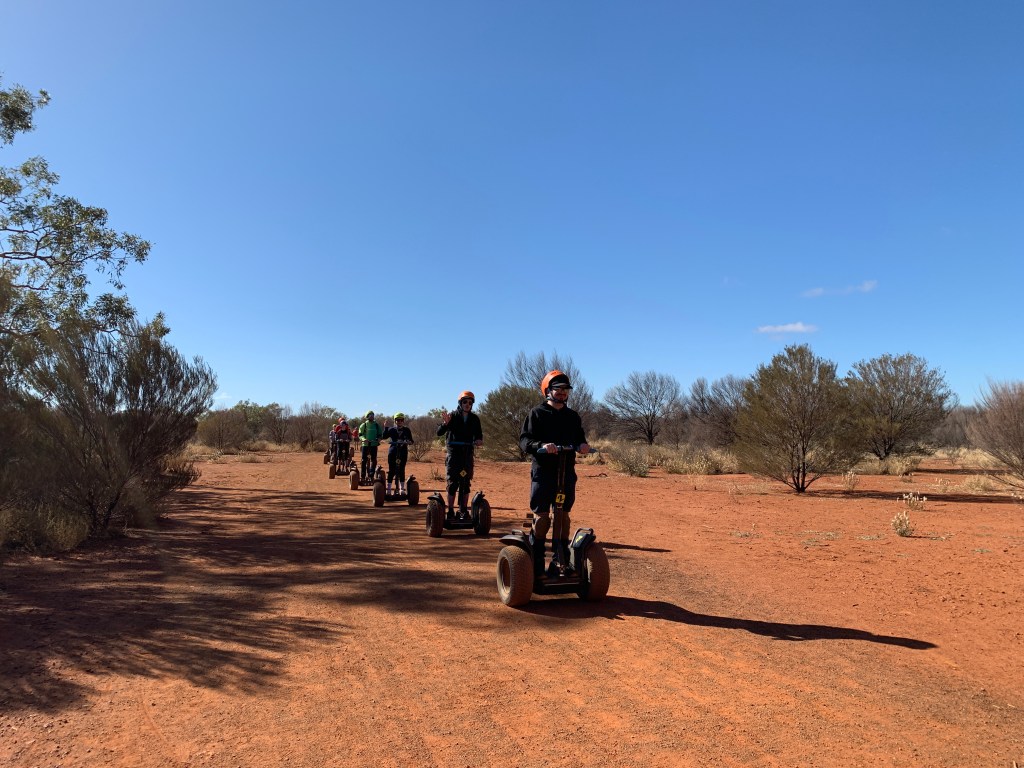
It was a beautiful morning and there were lots of walkers and cyclists. We even passed a Segway tour. We managed to walk the 10.6km all the way around in 2 1/2 hours with a stop half way around for a short rest. We made it back to the Mala Car Park and enjoyed a half hour rest waiting for the family to come and collect us. We ate our packed lunch while we waited and enjoyed just sitting taking it all in.
Walking around the rock was a bucket list item for both of us and we achieved it in good time. It was a most enjoyable walk.
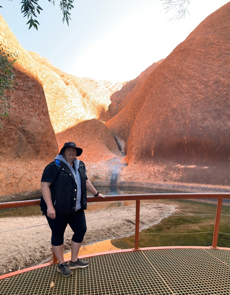
Hand on ‘the rock’Bet this guy’s not a happy chappy at the moWe did it!
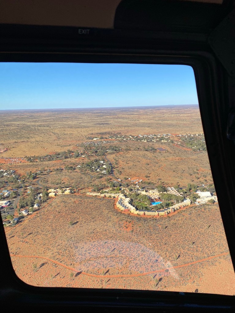
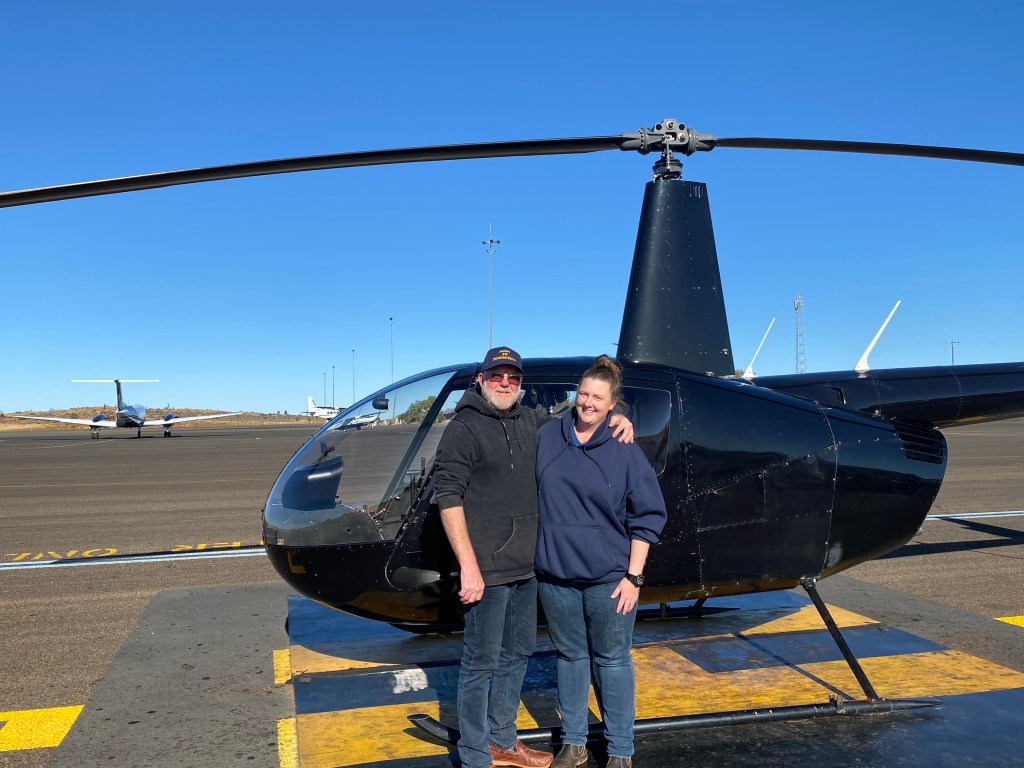
In the afternoon Richard and Katie had a helicopter tour booked and they were picked up from the Campground by pilot Jay. While they were off having an adventure I took Ben and Maddie to the pool. Even though it is not heated they wanted to go anyway. We got to the pool, they stripped off their clothes and Ben approached the edge. Brrr, it looked cold. There was a dad and his little girl on the other side of the pool however she wasnt getting in. I did think it was because it was too cold.
Ben took a flying leap and jumped in. He immediately got out yelling ‘it’s freezing’. Ben and Maddie spent the next hour getting in and out of the very cold pool. The little girl on the other side of the pool, also called Maddi, plucked up the courage to get in up to her thighs but that was it.
Personally, I thought they were all a little mad. You won’t get me in the water unless its hot!
Mad kids
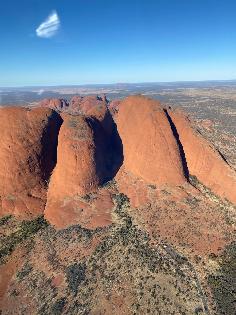
Richard and Katie came back from their helicopter flight over Uluru and Kata Tjuta with big smiles. Jay Crawford was their pilot and they declared he was an excellent pilot with a wealth of knowledge that he was happy to share while they were flying over these amazing places.
Jay was also very caring when one of them suffered from motion sickness and he took the helicopter higher up to smoother air. The whole flight was a memorable experience made even better by the pilot’s great, caring attitude. We gave him a great review on Trip Adviser and Facebook and we recommend Ayers Rock Helicopters.
One thing they learned whilst up in the air was that Kata Tjuta, Uluru and Mt Connor are all in a line, only some 2 degrees off being in a straight line. Uluru itself is 3.5km long and 2.5km wide and the body of the rock goes underground for some 15km. It is HUGE!
Kata Tjuta covers an area some 25km long and is made up of huge sandstone rocks. These are slowly being eroded over time. We will be checking out Kata Tjuta on a day trip tomorrow.
Katie hadn’t been in a helicopter before so it was a big tick off the bucket list for her. Check out the pics!
Being collectedYulara from the airUluruKata TjutaZoom this one to see Uluru and Mt Connor in a lineReady to goWow, just wow. If you look in the distance you can see Mt Connor