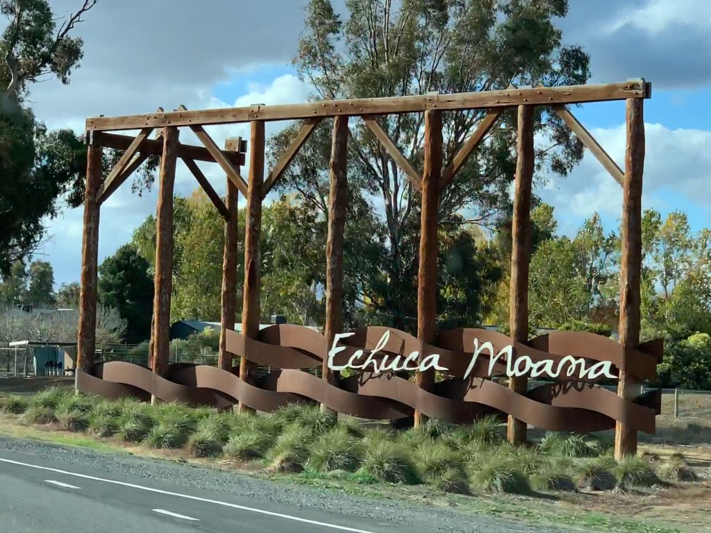
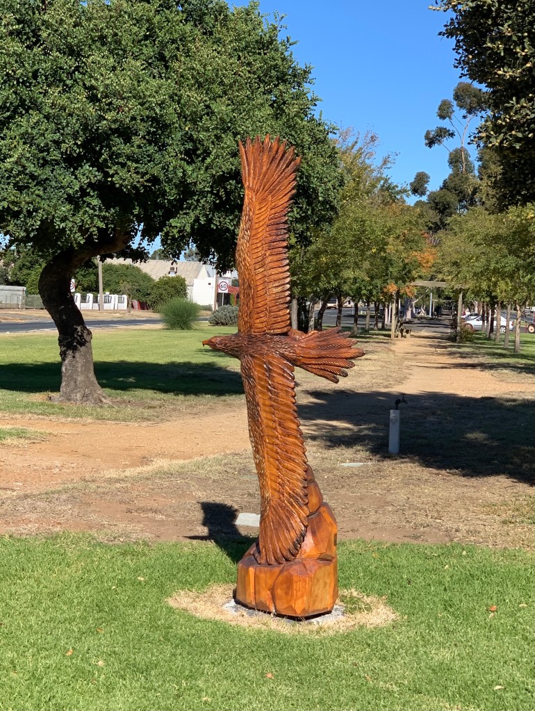
After checking out the Silo Art at Colbinabbin and Rochester we made our way back across the Murray at Echuca and headed north to Deniliquin. We checked into the McLean Beach Holiday Park and as they were not busy we could choose our site.
Our friends Jim & Chris were to join us on the Saturday and they had hired a caravan via Camplify. This van would be delivered to the park at 8.30am on the Saturday and would be all set up for them. Our other friends Kevin & Sally would arrive later on Saturday towing their caravan which they have recently purchased. Kevin and Sally didn’t know that Jim & Chris were coming as it was to be a surprise.
The friendly lady at the office said we could ‘circle the wagons’ if we liked so we could all have our awnings facing towards the middle. This was only able to be done because they were not busy and had plenty of room.
We picked a site where we could have our awning out and the hire van could be pulled in behind us with its awning facing towards us. That would leave enough room for Kevin to drive through and leave their van hooked up but still have their awning facing towards ours. This would make is easier for them as they were only staying one night.
That was the plan!
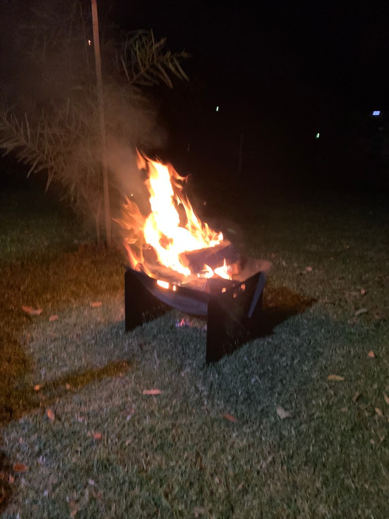
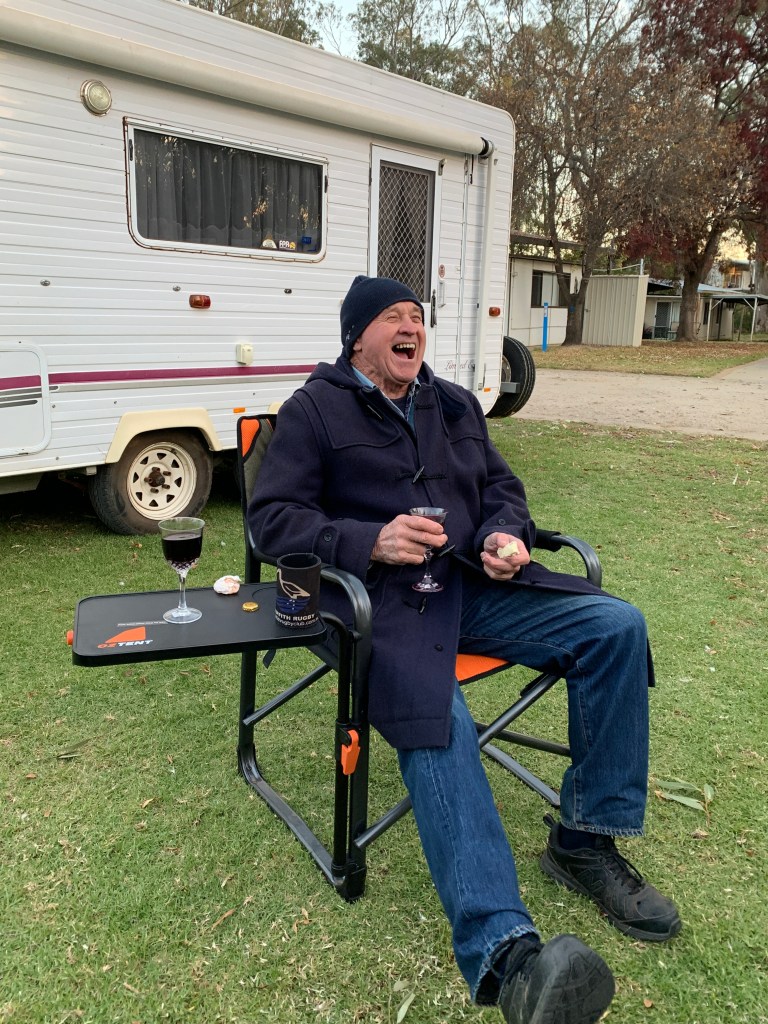
We set up our camp, put out the awning and I added solar fairy lights to it, put up the clothes line and got our chairs and fire pit out. I did a few loads of washing while we had access to water and got those hanging out in the sun while Richard used his MacBook to do some crypto currency research. Later we went for a ride on our ebikes to pick up some groceries and some wine. That evening we enjoyed a lovely little fire and a BBQ dinner cooked on our Bidgee BBQ.
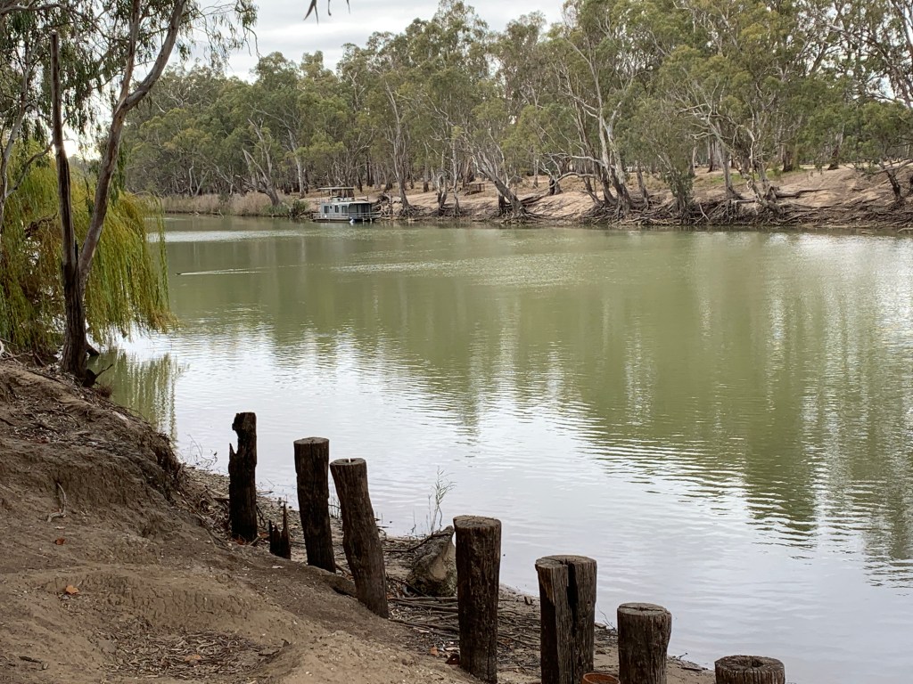
McLean Beach CP is right next to a large sandy beach on the Edward River. It has a lot of permanents but also has cabins, powered and unpowered sites, a couple of glamping tents and all the usual amenities including a small jumping pillow and playground and an excellent camp kitchen BBQ area. It is $32 per night for a powered site and we managed to get a pay for 2 stay for 3 deal. So $74 for 3 nights. The sites are all grass and quite flat. Power, water and sullage is available for each site. Pretty good for a CP.
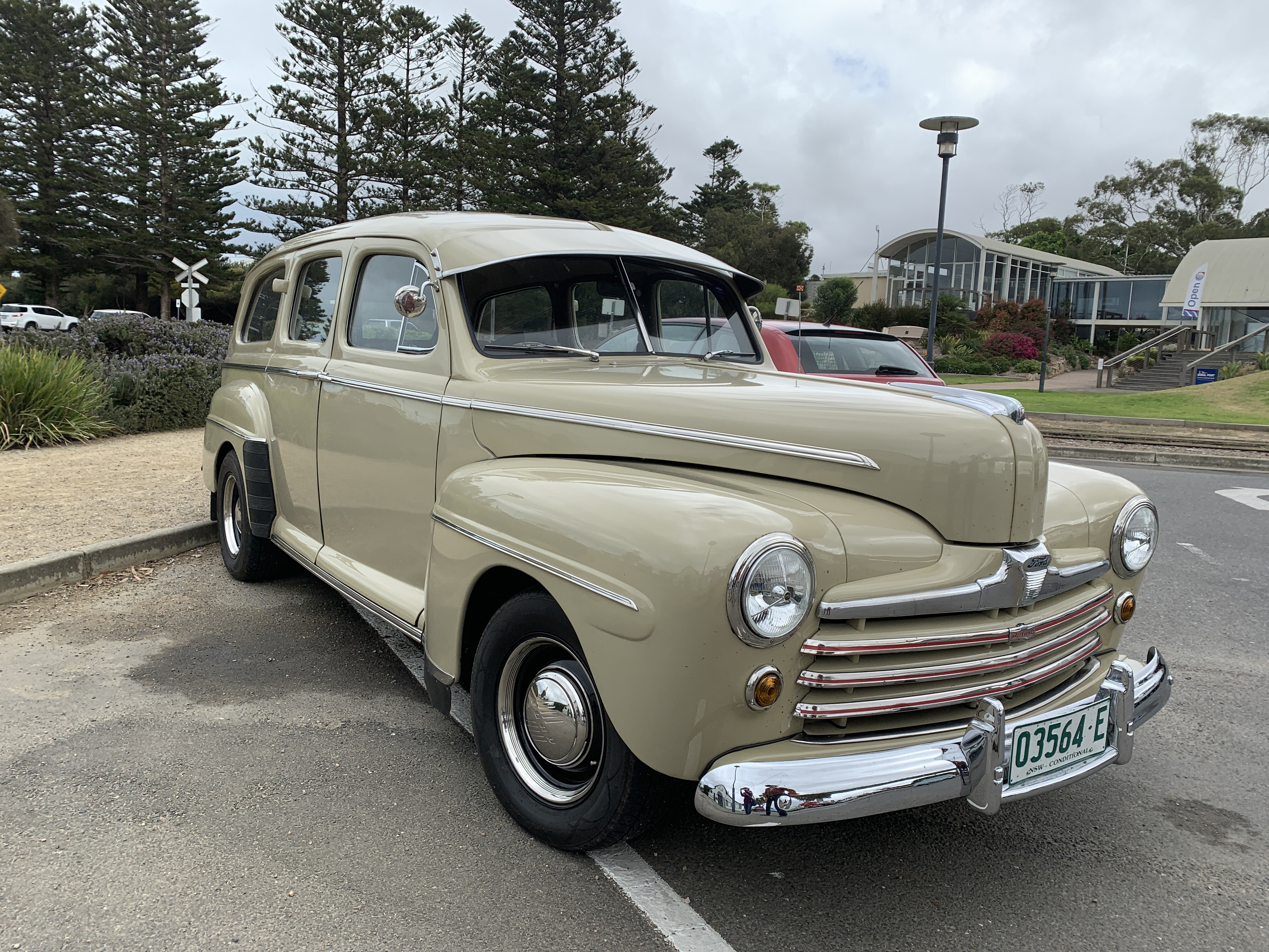
On Saturday morning the hire van arrived and it was huge. Caravans are measured on the inside and this one was a 21′ so by the time you add the A Frame drawbar at the front end and the rear bar with two spare tyres on it it was probably about 28′ long. Our motorhome is only 26′ long. Not sure what Jim & Chris were going to think when they arrived!
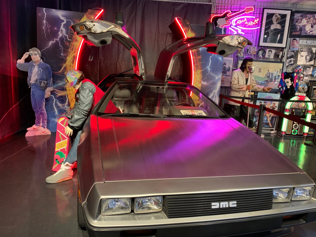
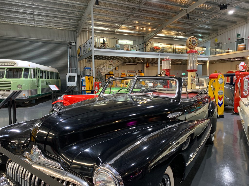
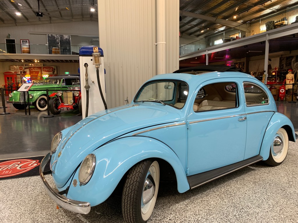
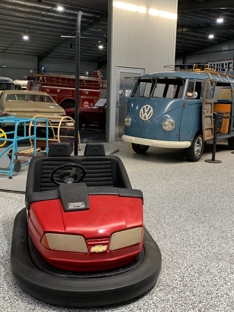
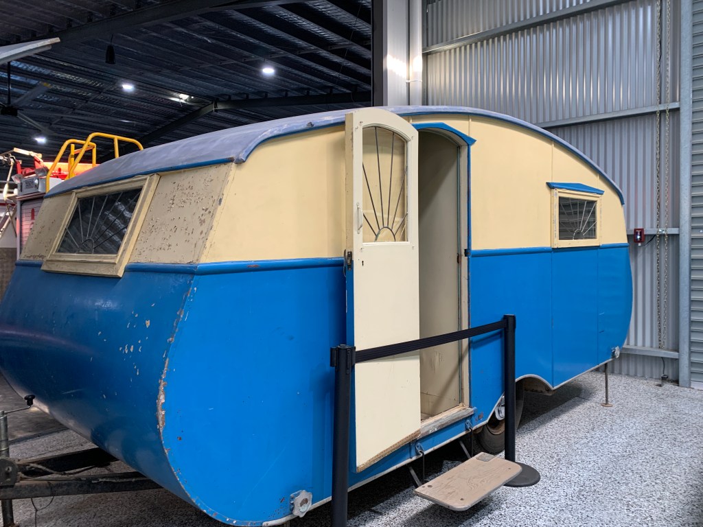
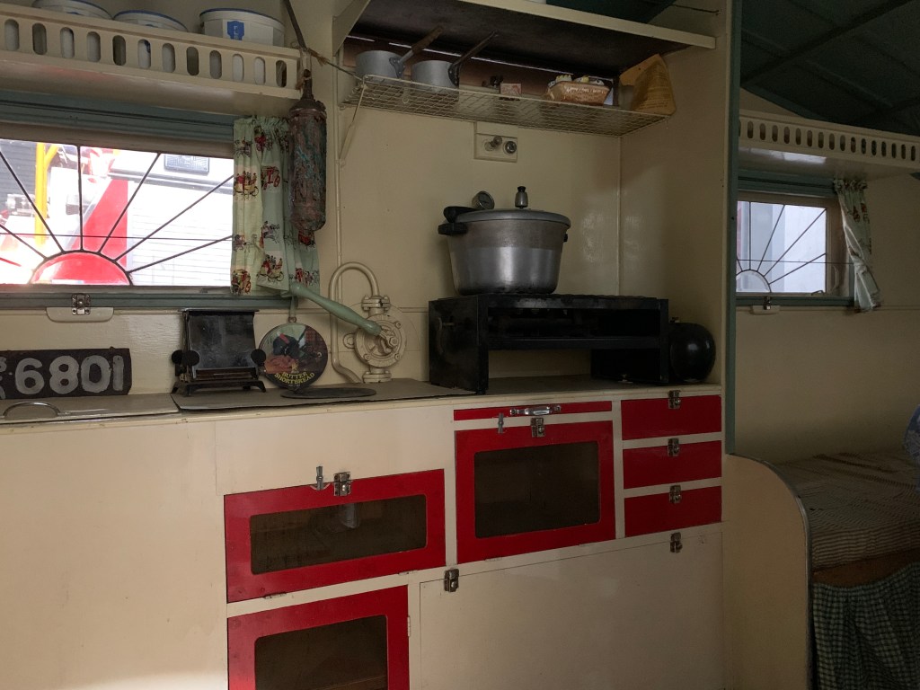
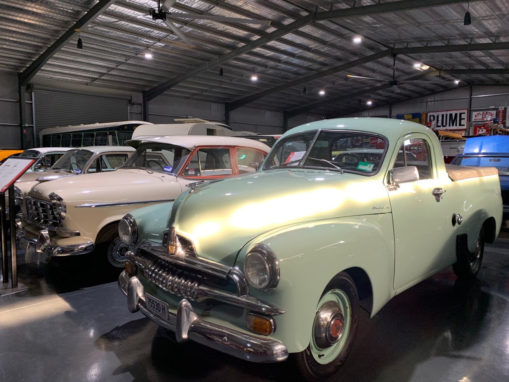
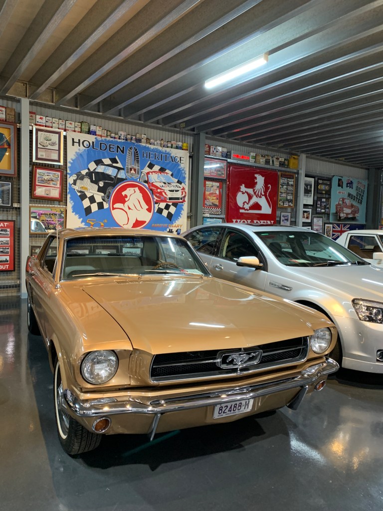
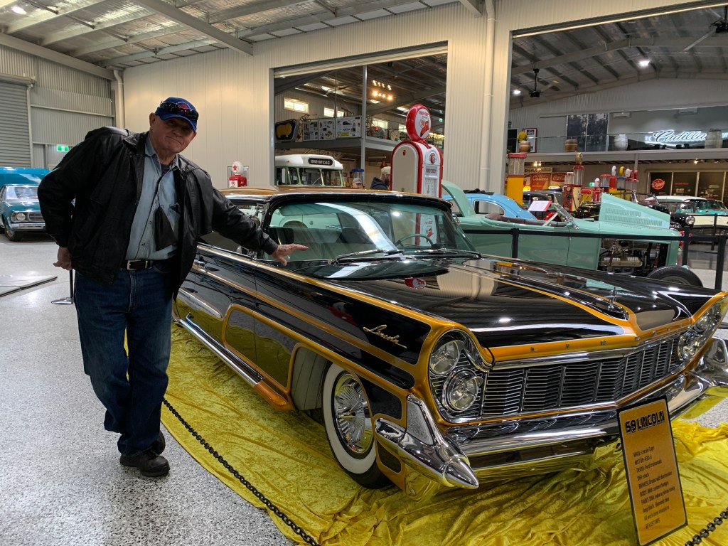
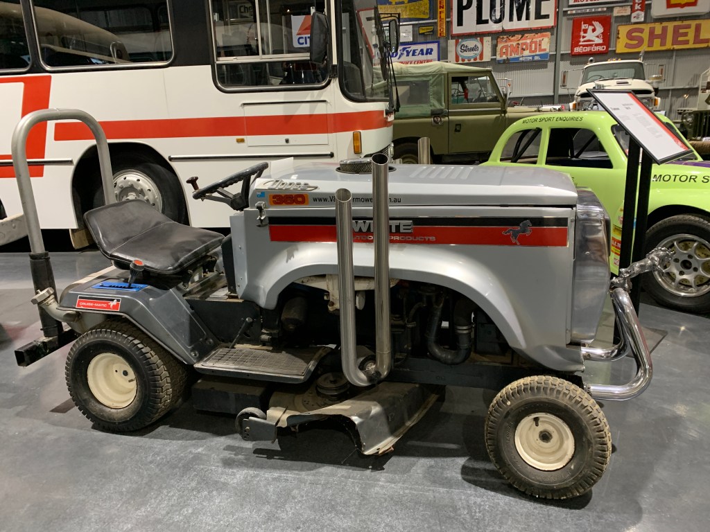
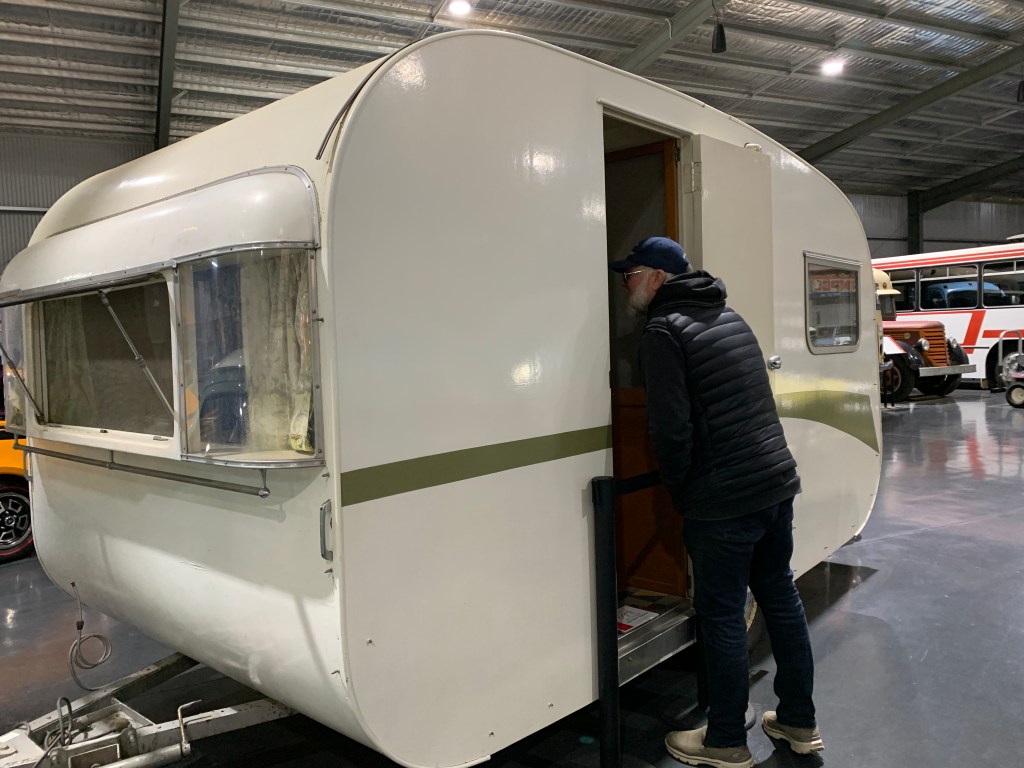
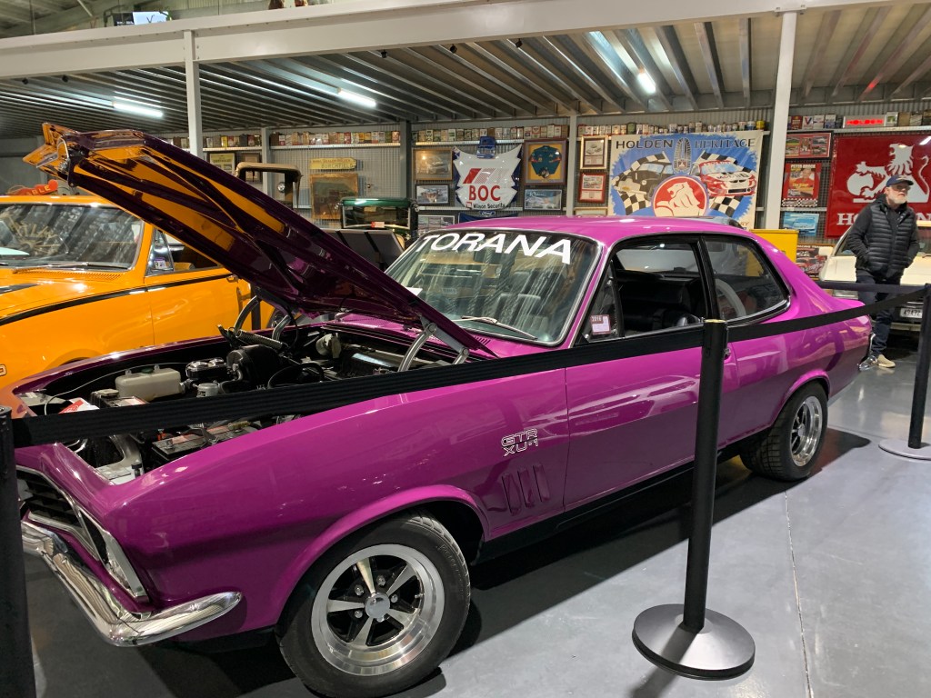
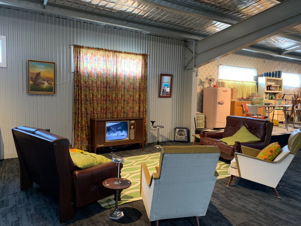
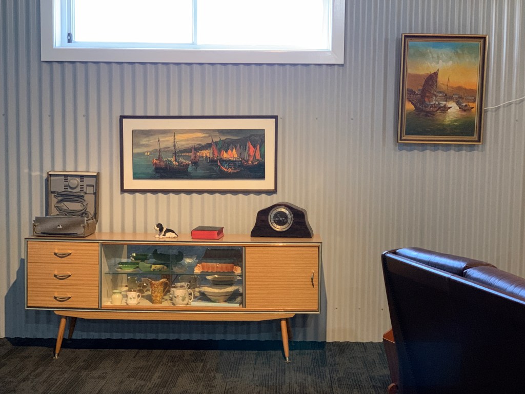
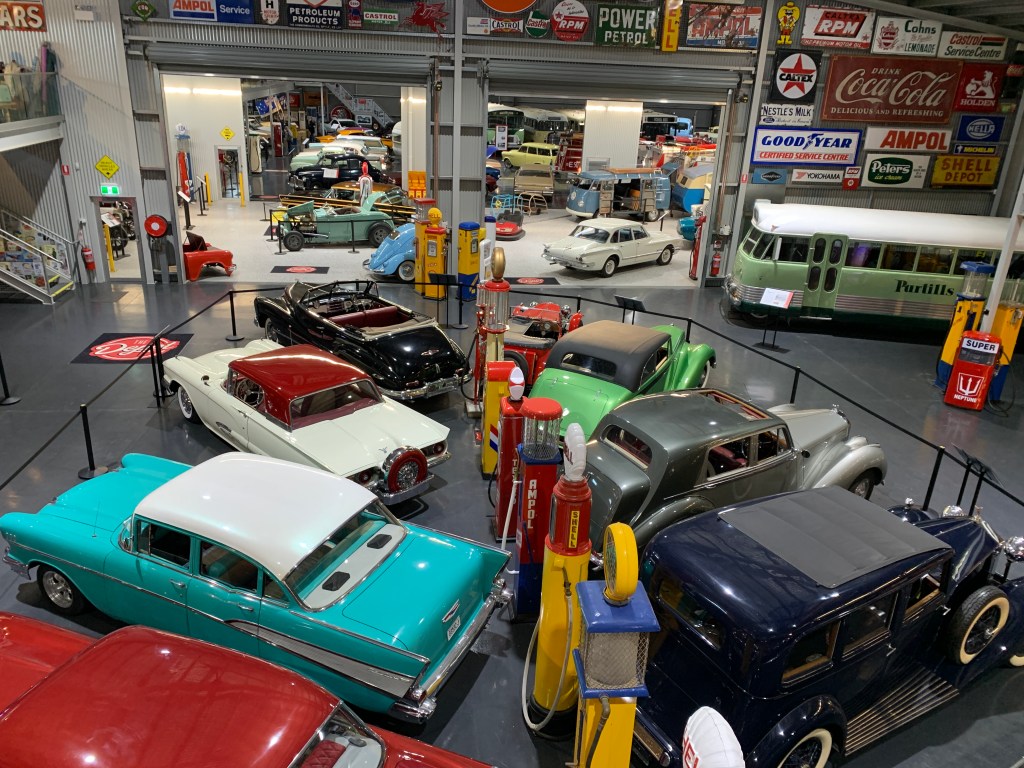
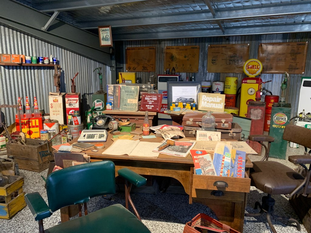
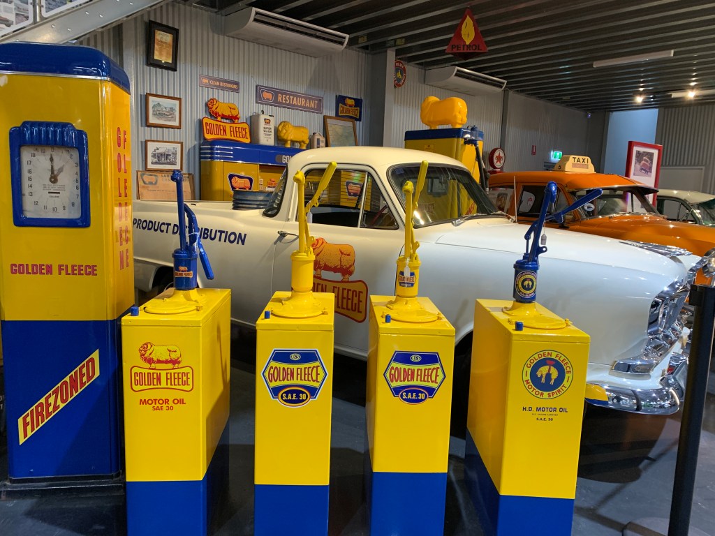
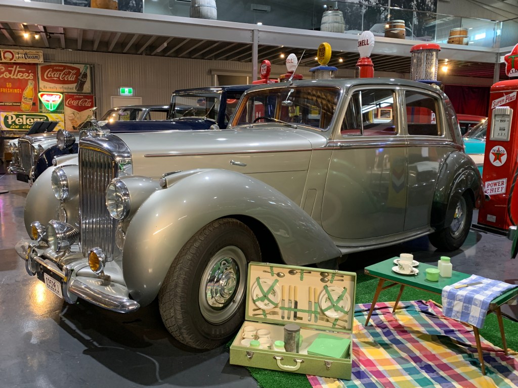
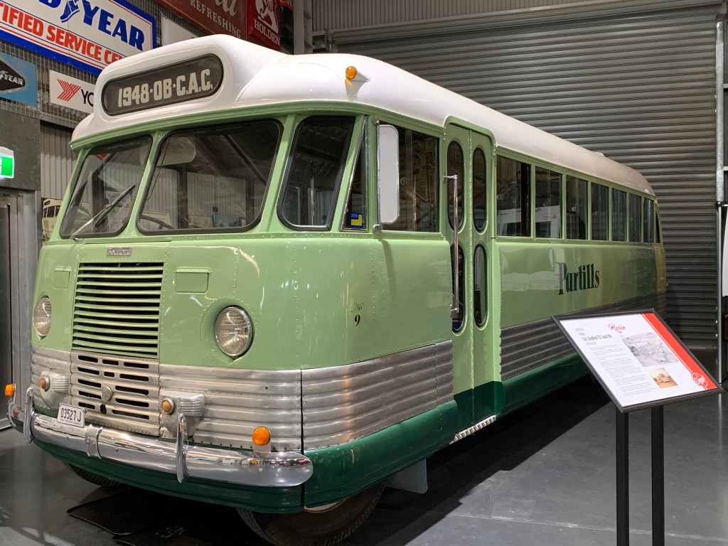
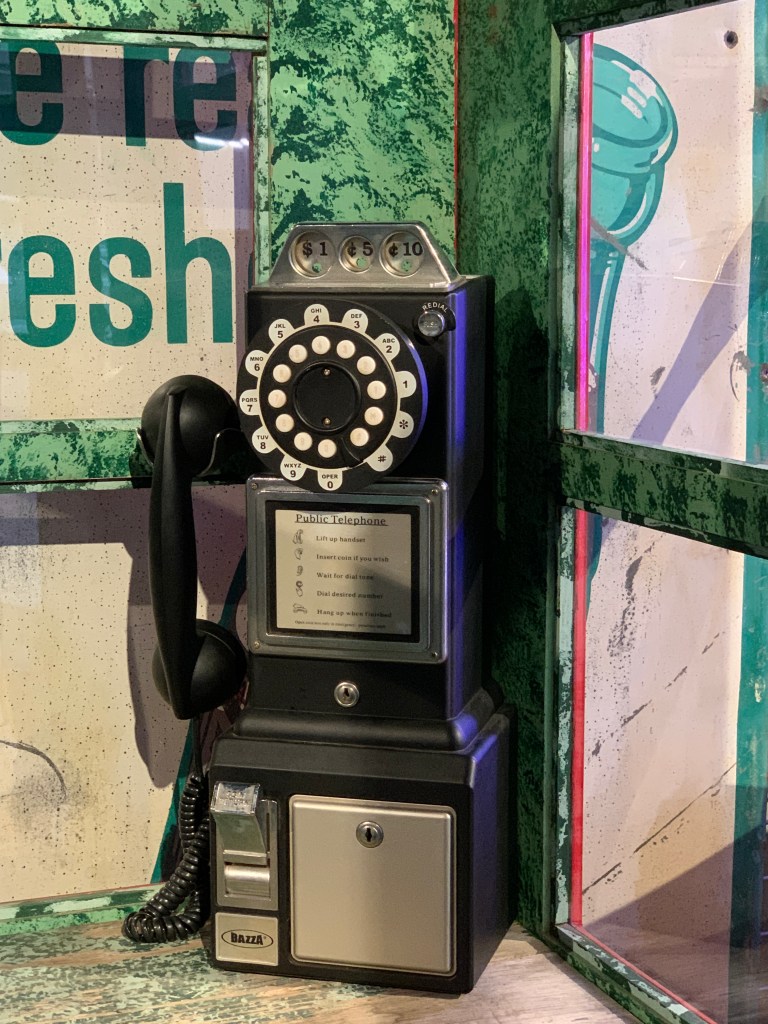
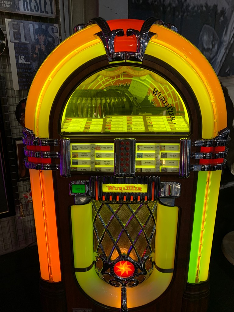
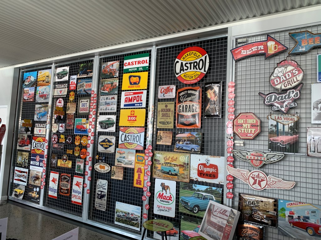
Jim & Chris arrived late morning and quickly unpacked and settled into their hire van. They also thought it was huge but quite luxurious. We were just sitting around chatting when Kevin and Sally arrived and they were surprised to see Jim & Chris. After Kevin & Sally were set up a few of us decided we would go and check out The Depot. This is a private car collection and motor museum. Richard and I rode our ebikes and met up with Jim & Kevin at The Depot. I’m not sure what I expected but I was gobsmacked after entering this incredible museum. It is HUGE and filled with glorious vehicles of every sort as well as other collections including children’s toys, 50’s household items, Elvis memorabilia and more. It is fabulous and well worth a visit. I’m not really into cars but this museum is more than just cars.
Back at camp we enjoyed a great night of socialising around the little fire pit.
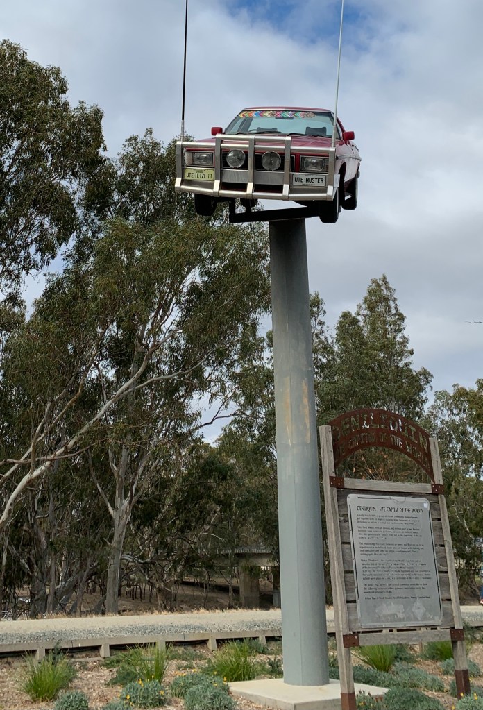
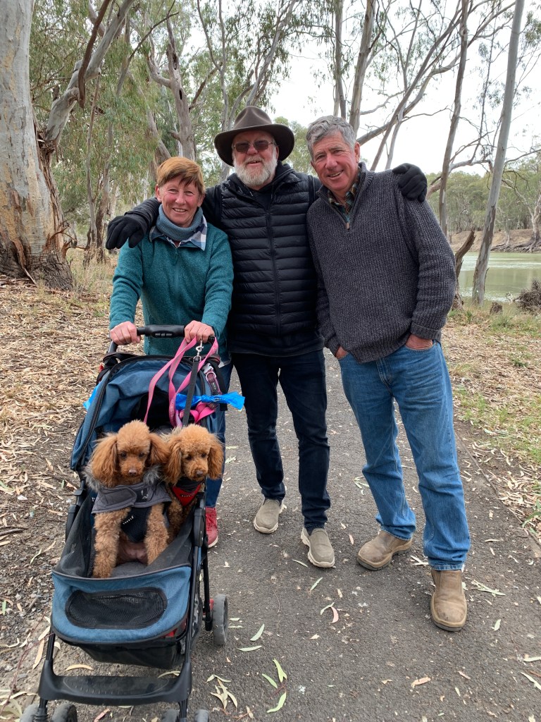
Sunday morning saw Kevin and Sally pack up and depart and head for home. Deniliquin has a lovely paved walk along the Edward River from McLean Beach to Willoughby’s Beach and the four of us (and the two toy poodles) decided to get a bit of exercise and follow the path. It was a lovely walk that took us along the riverbank, past the Ute on a Stick, under the bridge and onto the Island Sanctuary. This is a great place to spot native animals and birds. Once though the Sanctuary you pass the first town water supply tower and Memorial Park sporting grounds. You enter the Murray Valley Regional Park before finishing the walk at Willoughby’s Beach. Then we turned around and walked back along the riverside. We enjoyed another night around the fire pit.
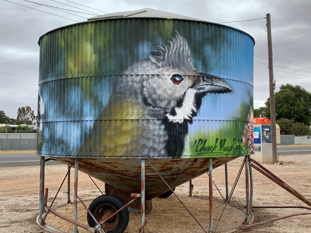
Jim & Chris had packed up and left before we got out of bed on Monday but we were up and heading out of the park about 9.00am and on our last leg towards home but not before we stopped to have a look at Deni’s painted water tower. Love this one with it’s Kookaburra.
We arrived home about lunchtime and it was good to be home after a month away. As we were unpacking the MH I commented to Richard that our house feels huge now after living in the MH for a month. Do we really need all that space?
I’ve always recorded each of our overnight stays in a log that I keep in a clipboard in the pocket above the windscreen visor. I also record when we get fuel, gas and wood. These are our final stats for this trip.
Free Camps SS&A Club Carpark, Albury 3 nights Yarrwonga Common 1 night Lock 9 Lake Cullulleraine 1 night Our friends front yard in Waikerie 2 nights Hettners Landing, Walkers Flat 1 night Point Sturt Lookout 1 night Kingston SE RV Park 2 nights (usually $10 but some nice person had left a valid ticket in the parking meter) Greenrise Lake, Penola 1 night Lake Lascelles, Hopetoun 1 night
Low Cost Camps Echuca Rotary Park 1 night $10 and $5 to use Dump point & water Lake Boga 1 night $15 Frank Potts Reserve, Langhorne Creek 1 night $5 Parnka Point Pelican Campground, Coorong NP 1 night $16.50
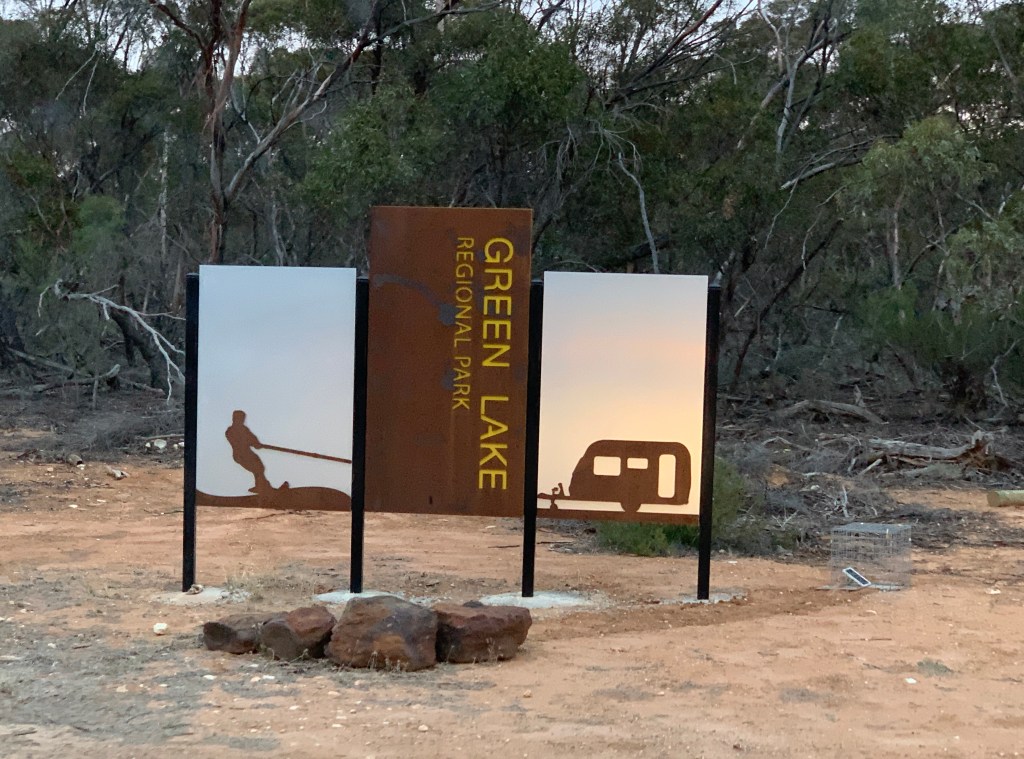
Caravan Parks Big4 Holiday Park, Mannum 4 nights $15 (while we were on The Murray Princess cruise) Big4 Holiday Park Mannum 2 nights $40 Big4 Holiday Park, Port Elliot 1 night $40 Hindmarsh Island Caravan park 1 night $25 (with Seniors discount) Lake Charlegrark Caravan Park 1 night $30 Horsham Riverside Caravan Park 1 night $38 Green Lake Reserve 1 night $20 (power only) McLean Beach Caravan Park 3 nights $36 (Pay for 2 stay for 3)
Total nights = 31 Total Free Camps = 9 (13 nights) $0 cost Total Low Cost Camps = 4 (4 nights) $51.50 cost Total Caravan Parks = 8 (14 nights) $365 cost
Total camping cost so far = $416.50/31 nights = $13.44 per night
The Wimmera is a vast plain in north western Victoria. The Wimmera extends from the Grampians National Park to Lake Albacutya, near Rainbow, and from the South Australian border in the west to Navarre in the east. It is the largest area in Victoria for growing of crops. Vast paddocks of wheat and other cereal crops are grown here. This land would have once been mallee scrub but since white settlement it has been cleared for cropping. The only stock we saw as we cross crossed The Wimmera following the Silo Art Trail were sheep.
The Wimmera River is the largest Victorian river that does not flow to the sea, but instead flows into a series of terminal lakes. The largest of these terminal lakes are Lake Hindmarsh and Lake Albacutya.
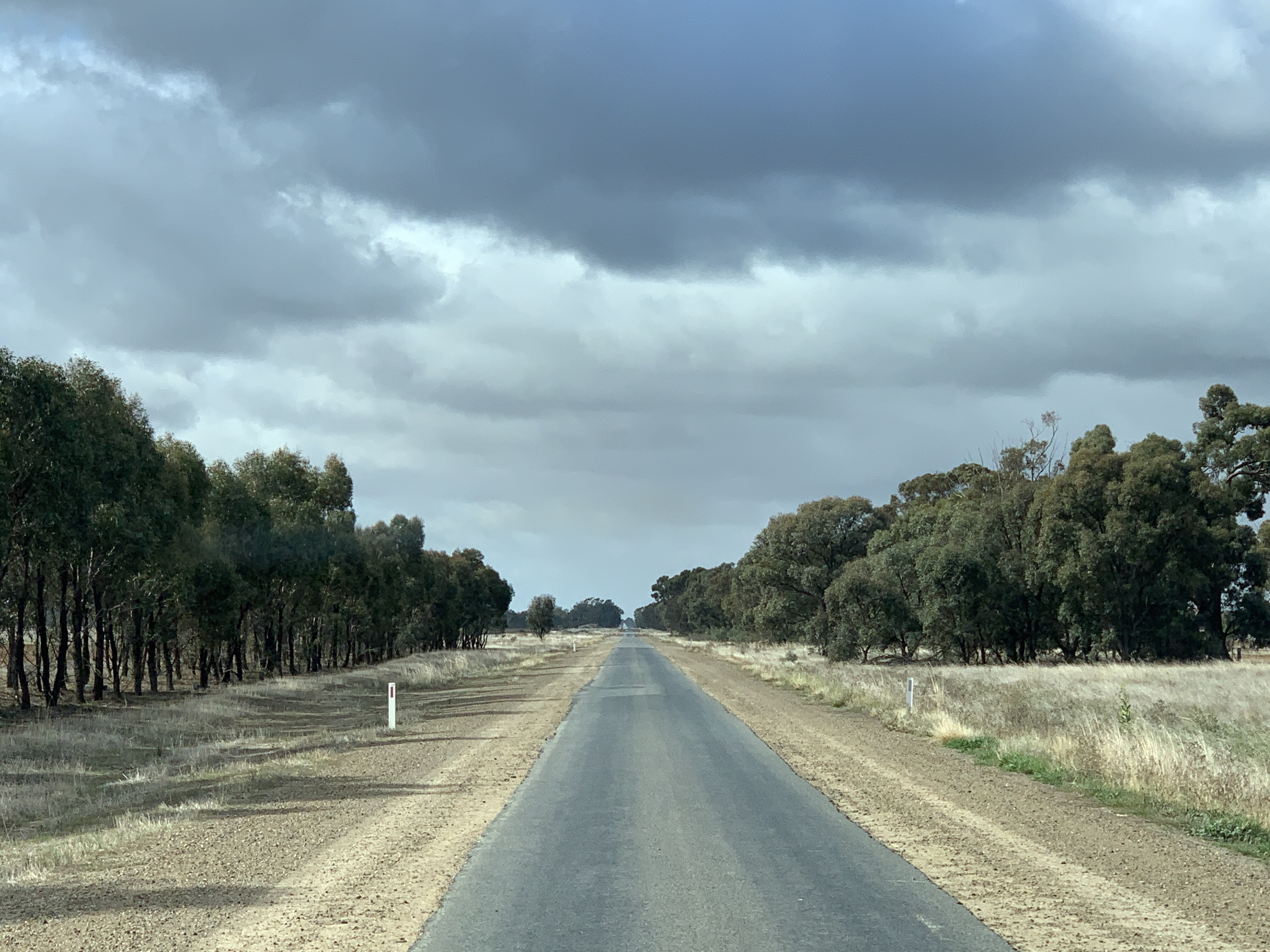
Roughly 25% of people in the Wimmera rely directly on agriculture for their income. The roads are long and straight and the farm houses are a long way apart out here. Once you get off the highways the roads are a bit of a rollercoaster. We bounced up and down along them but were still able to cruise along at 90km/h. Most of the Wimmera is very flat
This area gets some 16 inches of rain a year and this is enough to plant multiple crops a year. 25% of Victoria’s Wetlands lie in the Wimmera, mostly in the south west.
Horsham is the largest town in The Wimmera with some 16.500 people.
The Wimmera
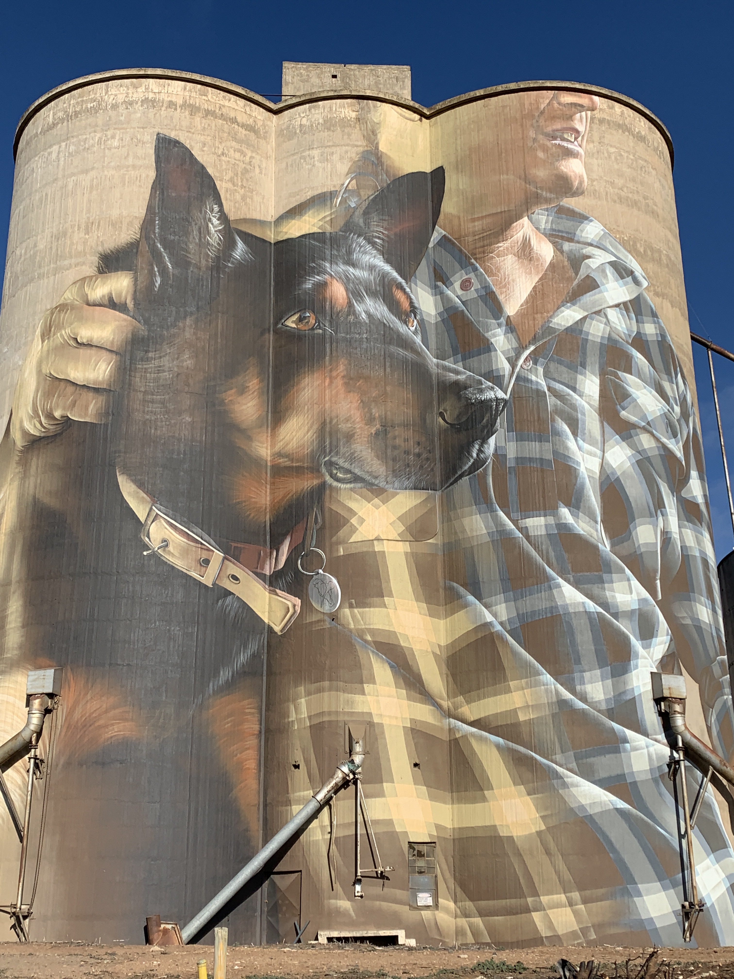
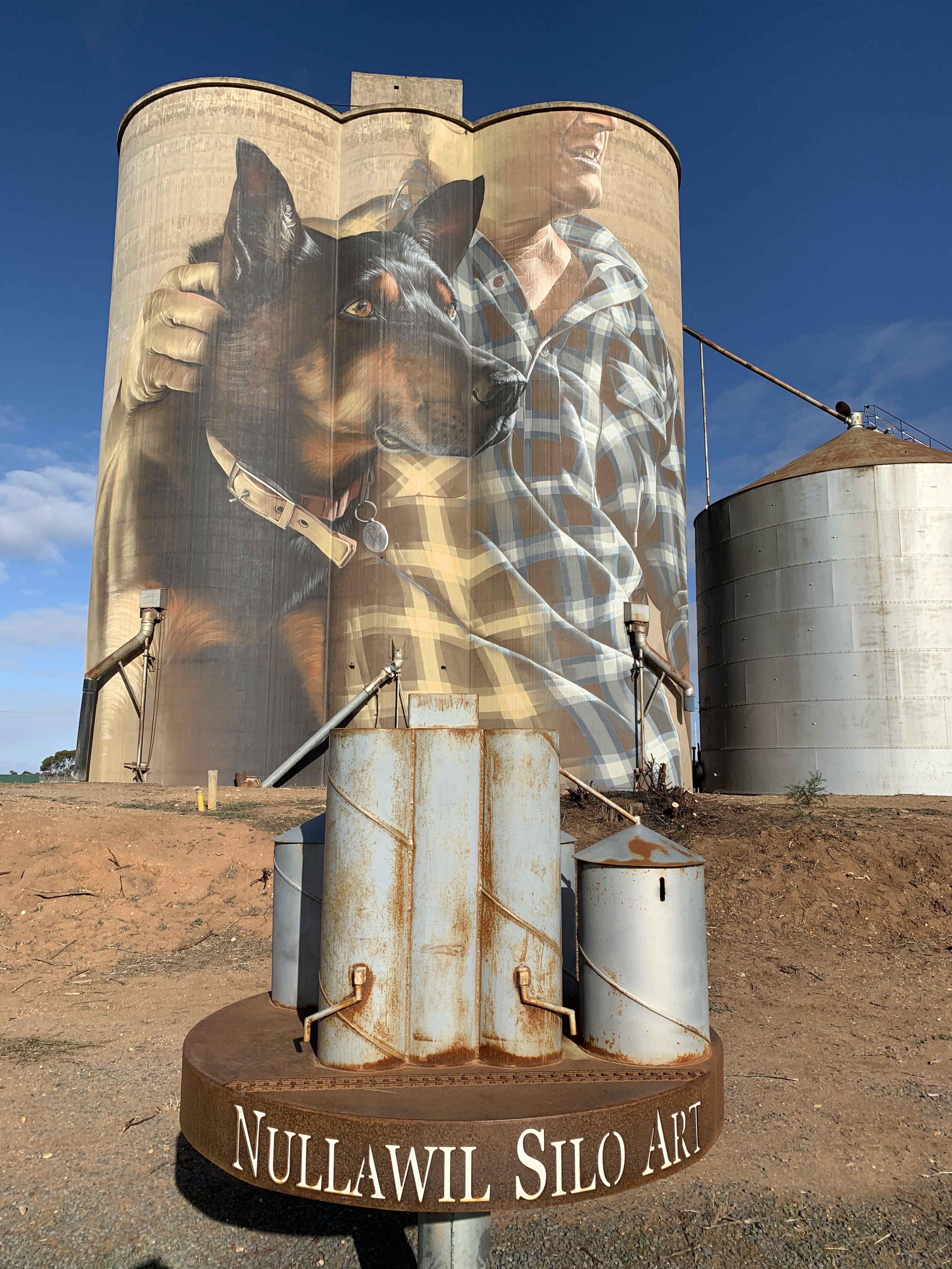
After leaving our overnight campsite at Green Lake Recreation Park we headed to the next silo art on the trail at Nullawil. Sam Bates was the artist commissioned to paint the silo at Nullawil and only took 14 days to paint the man with his dog.
Silo Art, Nullawil
As we left the Wimmera and headed east into the town of Boort. we started to see irrigation canals. Some of the crops recently sown in this area are just starting to sprout green shoots. Other farmers were busy sowing crops using their huge tractors and giant seeders. Some of the tractors have tracks instead of wheels.
I found it very interesting the the area around Boort is one of Australia’s premium tomato growing areas having been introduced in the early 1970’s by farmer Mario Brunelli.
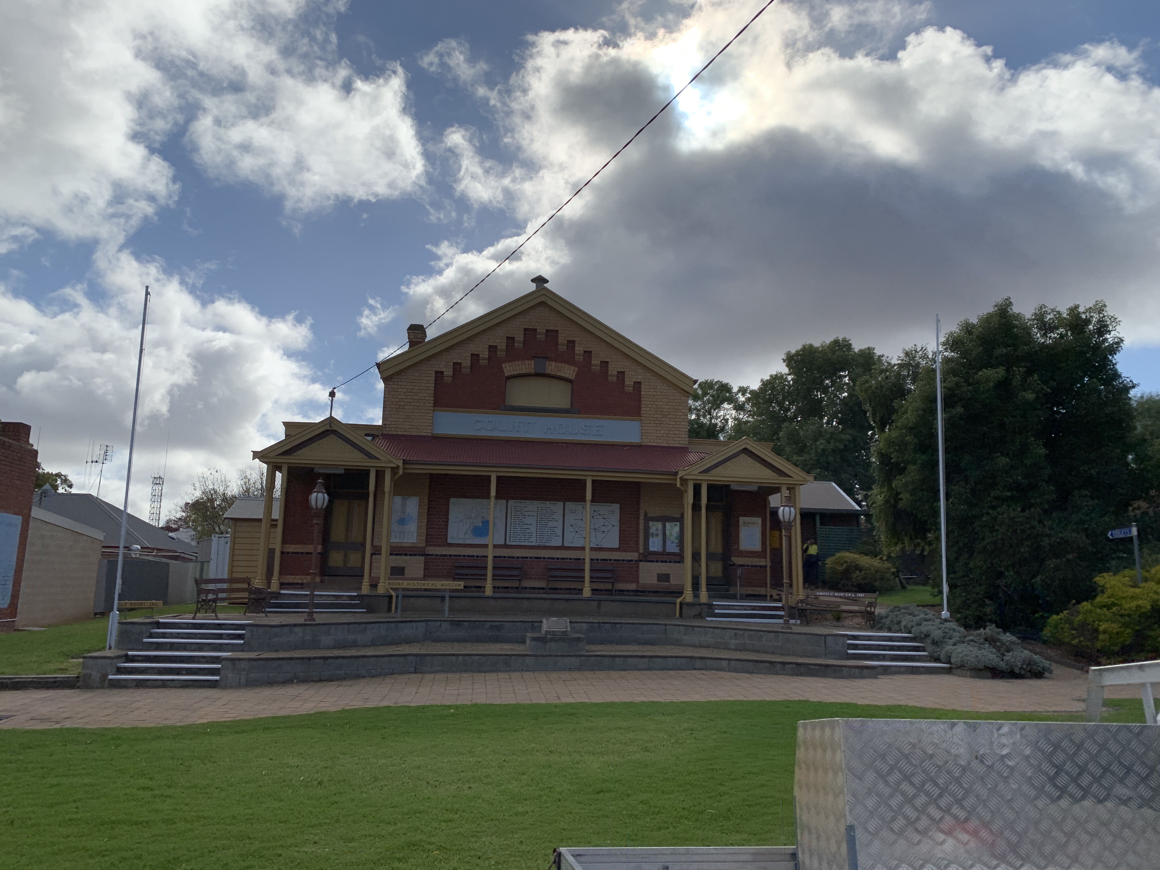
The town of Boort is situated on Little Lake Boort and this is a popular place in summer for water sports. There are walking trails around the lake and it is also a popular place for bird watching.
Boort, Victoria
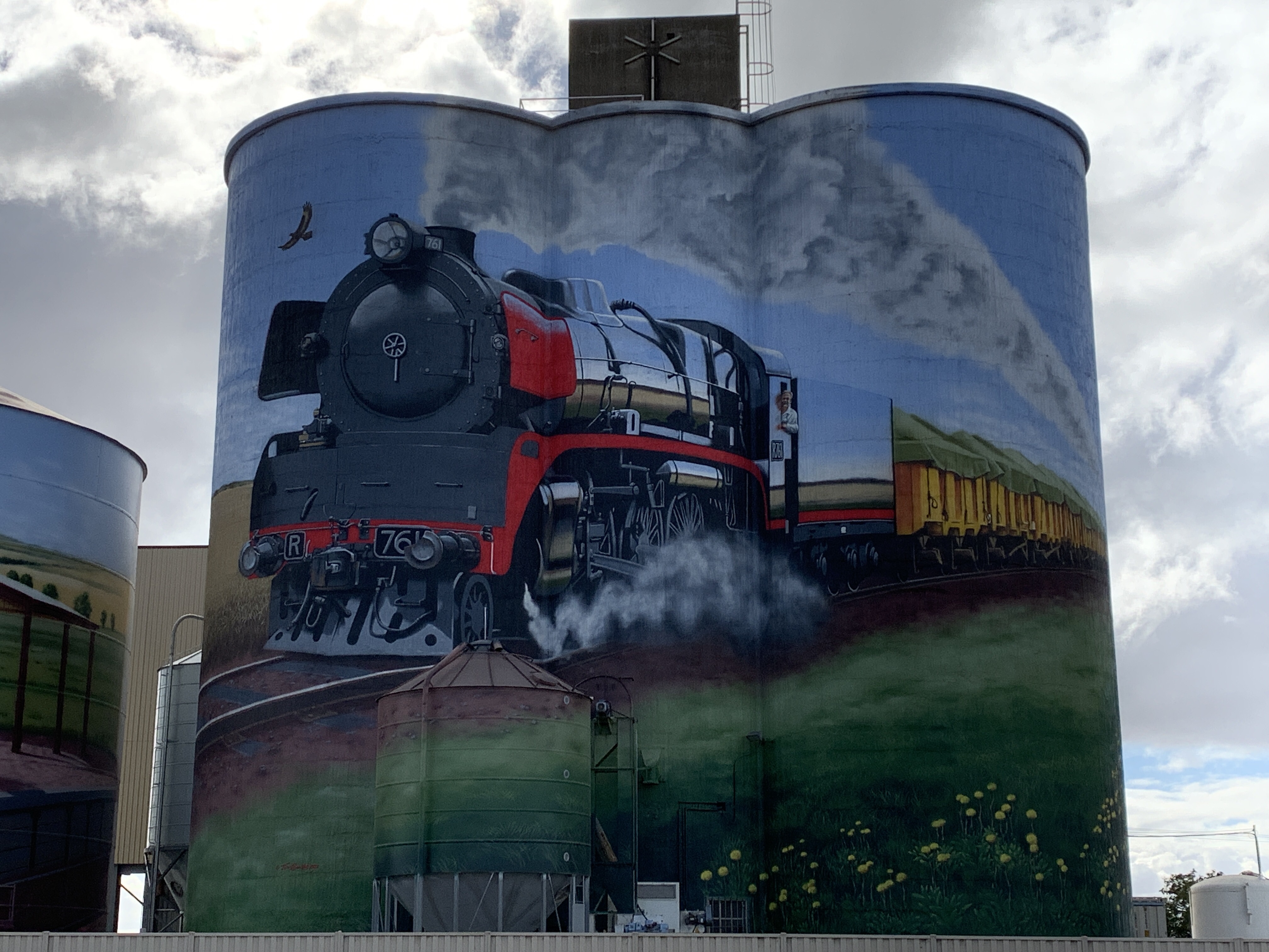
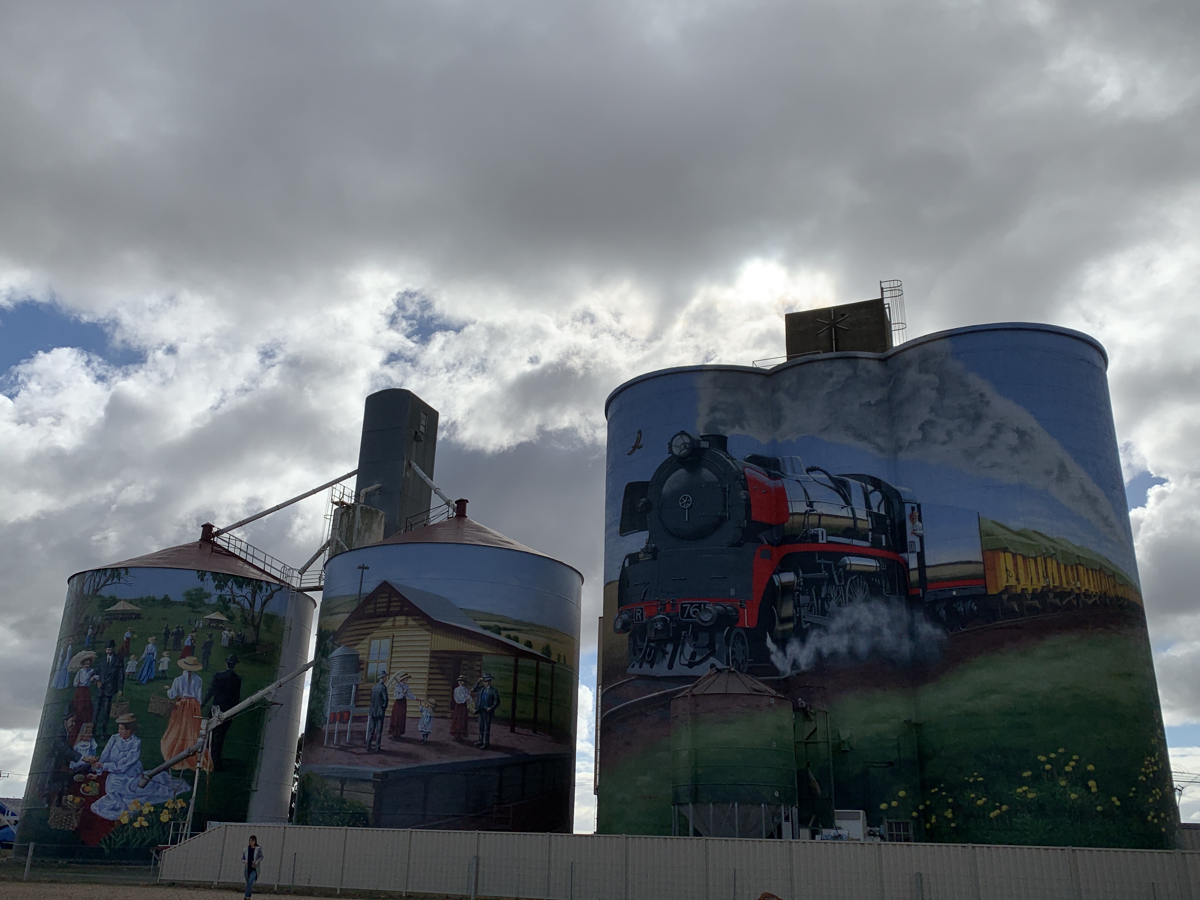
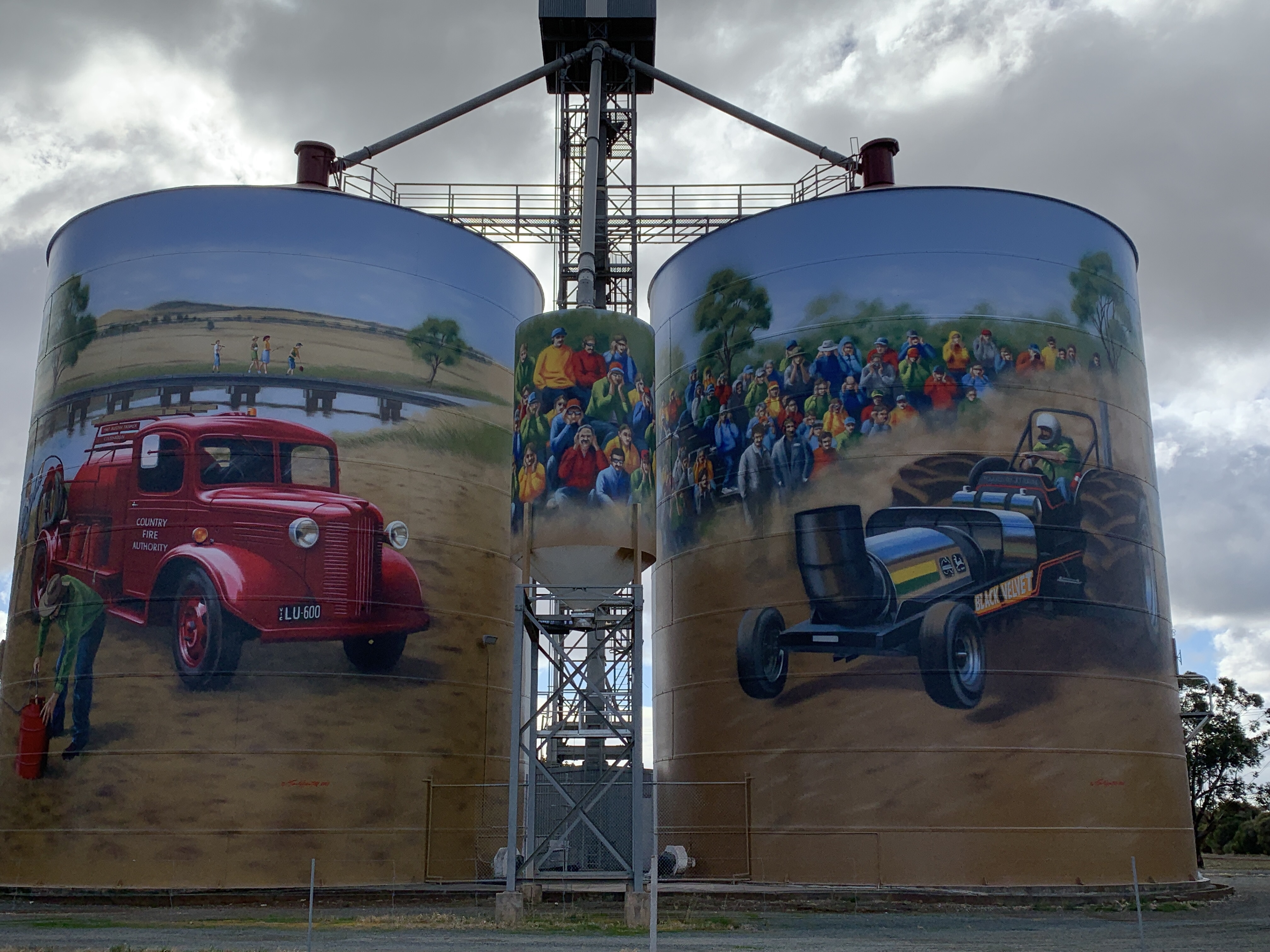
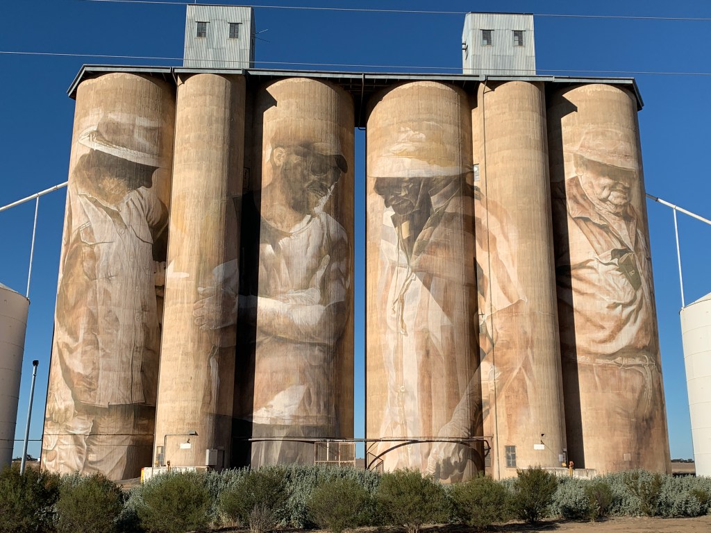
We travelled along back roads until we reached the small town of Colbinabbin. Wow their silo art is amazing. They have a large concrete conjoined silo in the middle and two metal silos on either side. Artist Tim Bowtell has painted them with scenes that reflect the area.
On the leftmost silo is a scene from the Colbinabbin Farmers Picnic, an annual event started in 1878 and ran for sixty years.
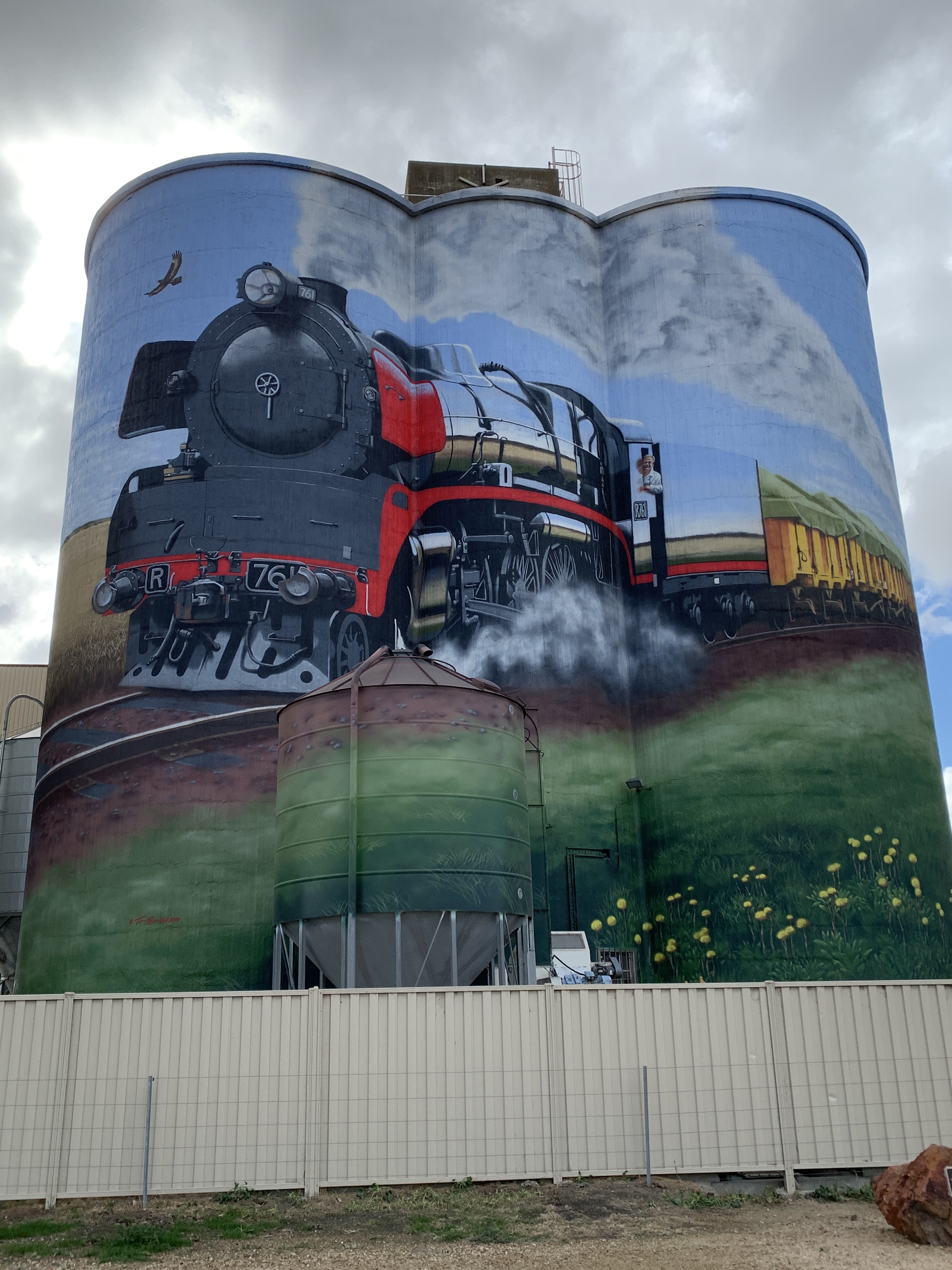
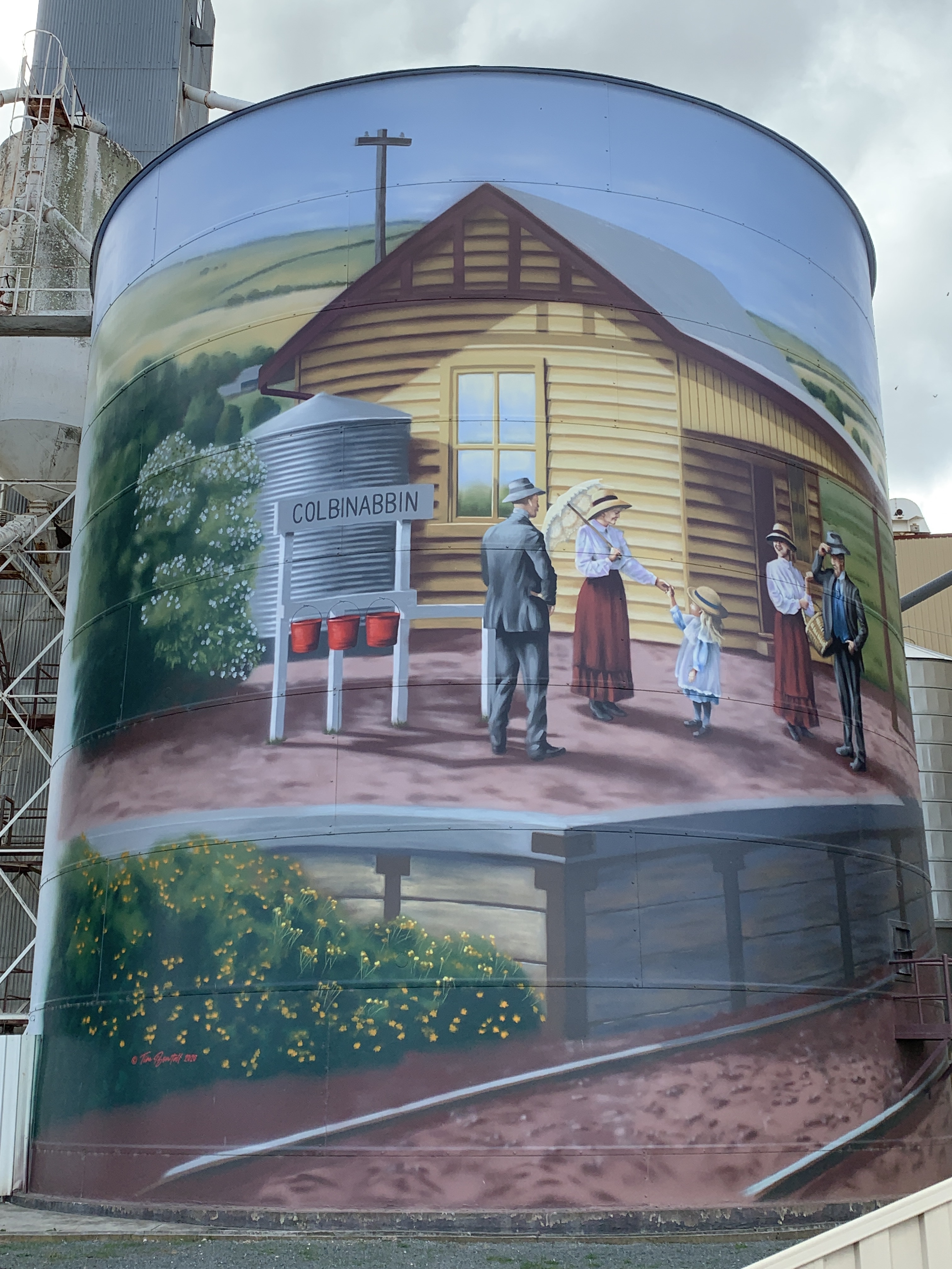
The next silo depicts the railway station. The steam train arrived in 1914 to support agriculture and to bring passengers.
The middle conjoined silos have the steam train.
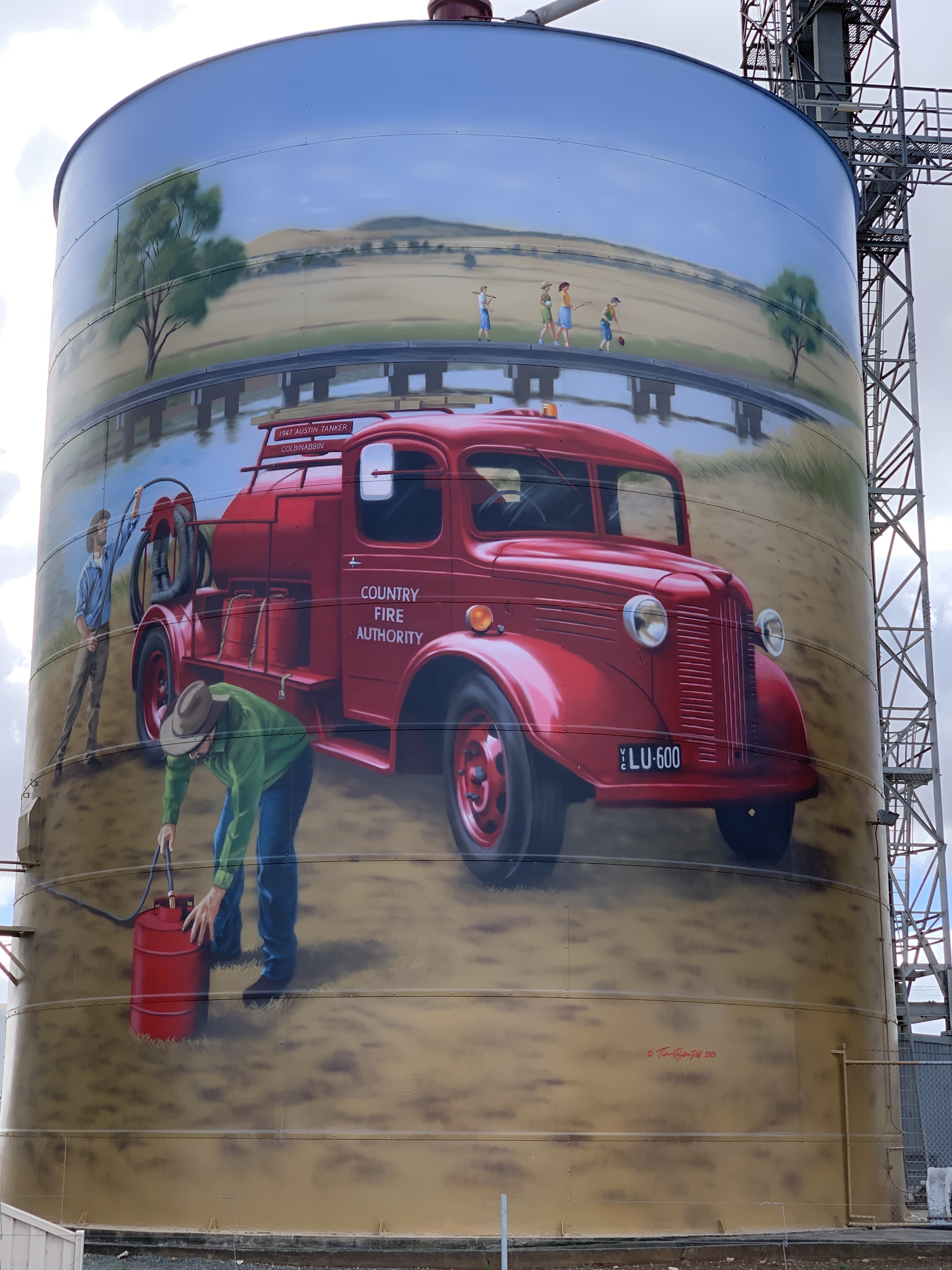
The next one across depicts the the first 1947 Austen Tanker Truck of the Country Fire Service. In the background is a couple of children crossing a bridge over the man-made Waranga Western Main Channel, the lifeline of the community.
The last silo depicts the Colbinabbin Tractor Pull. This is another annual event started in 1982 and is still held each year.
Silo Art, Colbinabbin
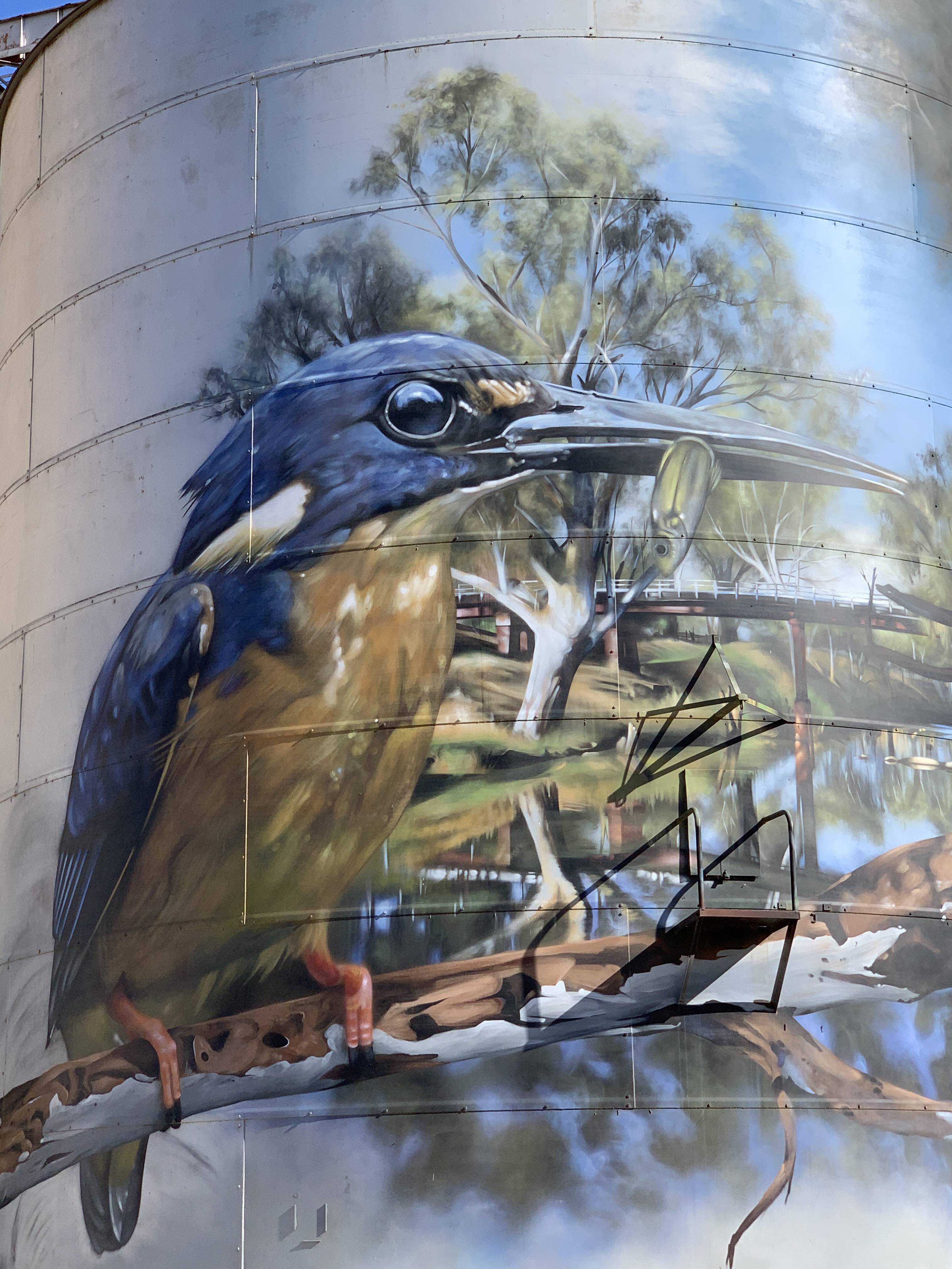
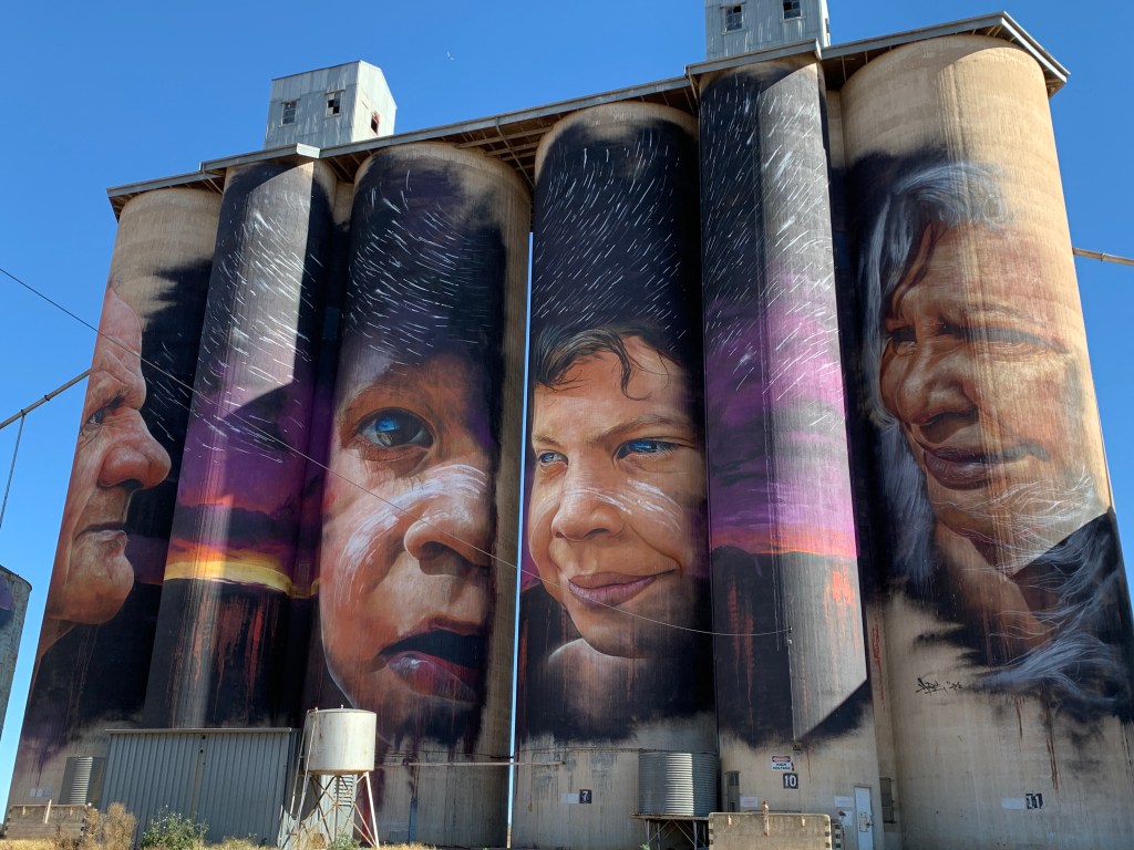
We continued on northwards to Rochester and our final silo art for this trip. The two silos at Rochester were painted by artist Dvate and depict an Azure Kingfisher and a Squirrel Glider.
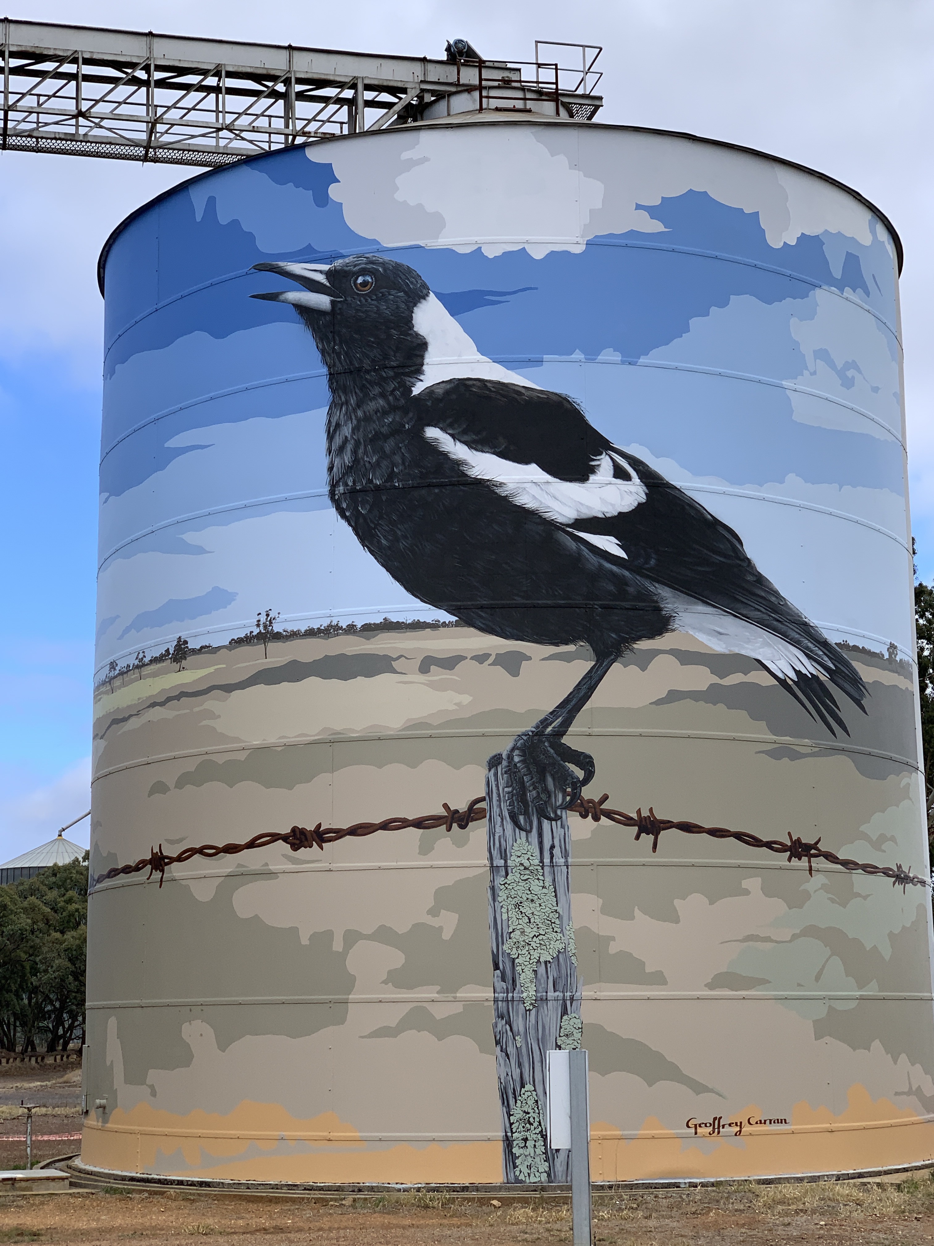
The first Silo Art we came across on the trip was the silos at the tiny community of Goroke on our way to Horsham. The artwork was painted by artist Geoffrey Carran and features a Kookaburra, a flying Galah and a Magpie sitting on a barbed wire fence. I particularly liked the barbed wire. It looked so real.
Silo Art, Goroke
In Horsham we stayed at the Riverside Caravan Park right in town alongside the Wimmera River. It was $38 per night for a large flat patch of blue gravel with power, water and sullage point. Not sure what the amenities are like as we didn’t use them.
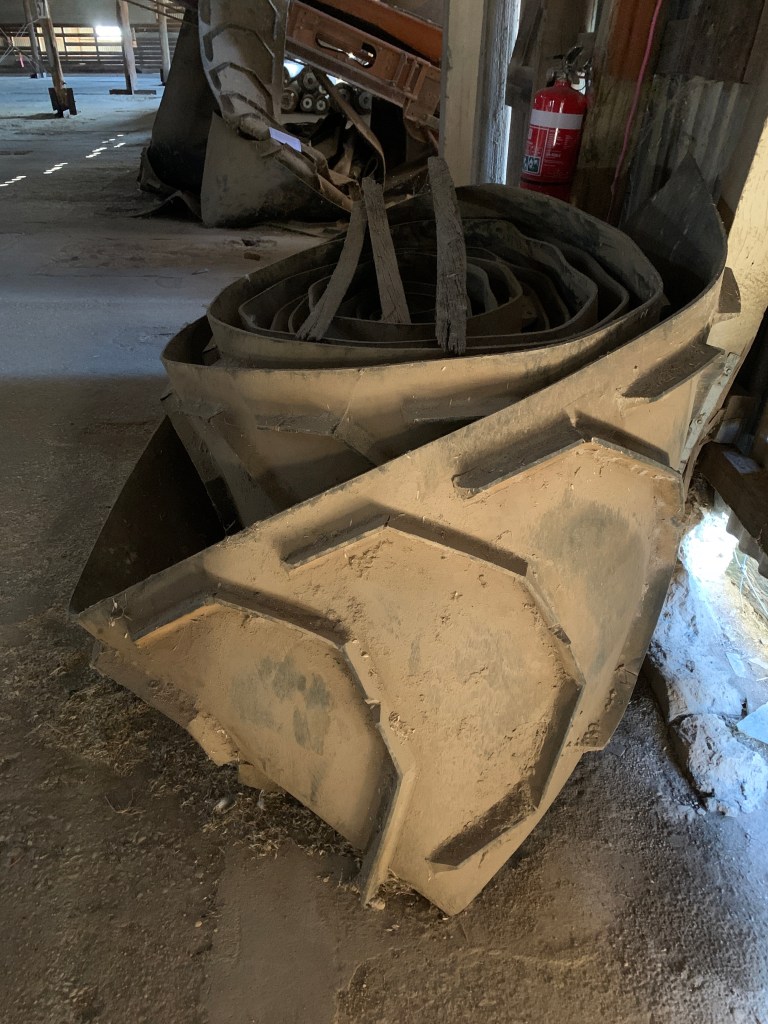
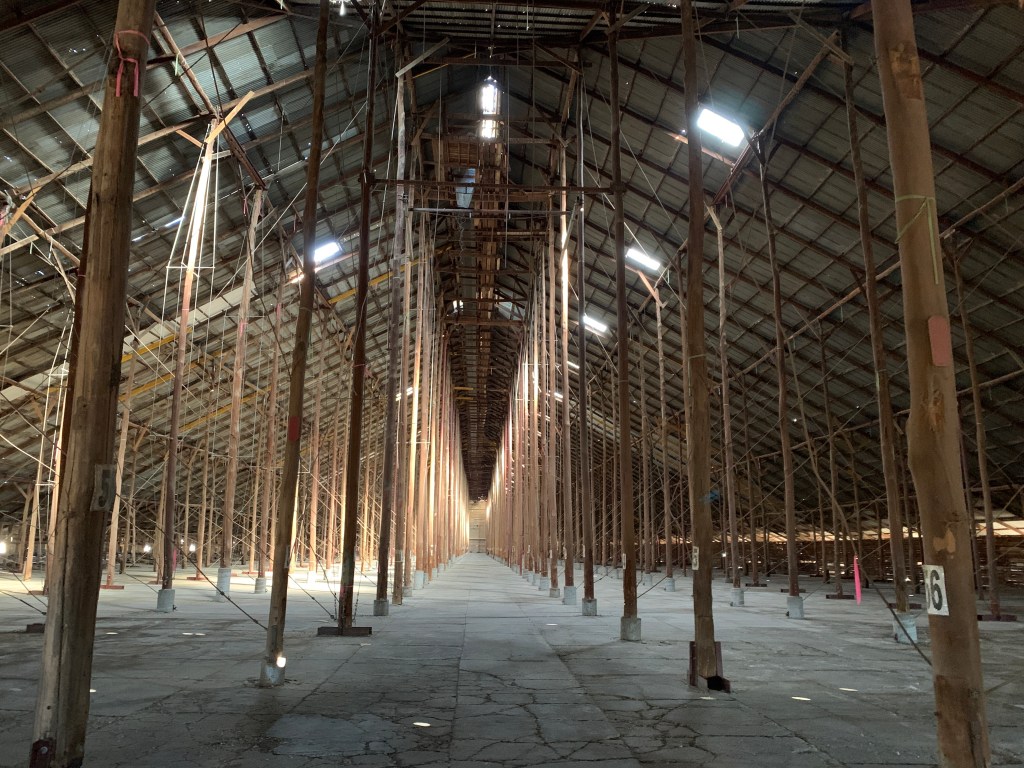
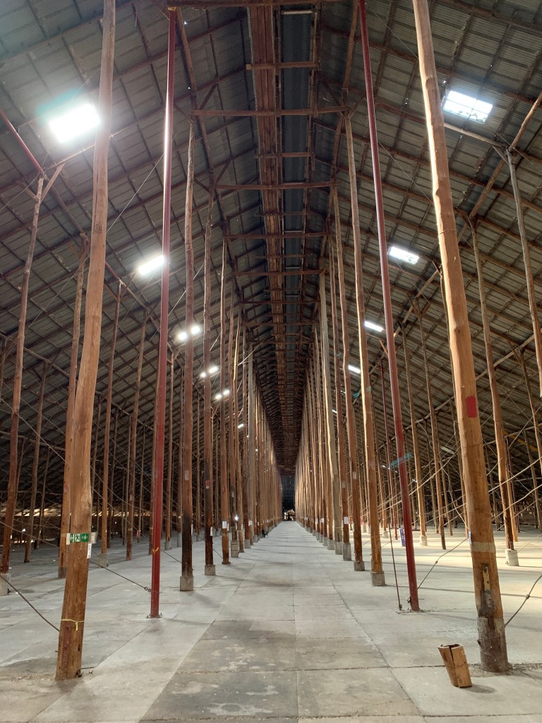
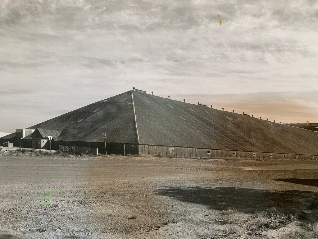
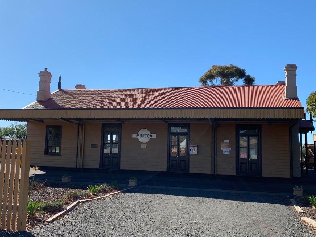
We set off the next morning following the Silo Art Trail. Our first stop on the Trail was the town of Murtoa where we called in to visit the Stick Shed. The Murtoa Stick Shed was built during World War II in 1941 when Australia couldn’t export the wheat we’d produced and needed somewhere to store it. It was built as emergency grain storage and was built in just 4 months. It is constructed from 560 unmilled poles (sticks) that support a corrugated iron roof. The shed spans the length of five Olympic swimming pools.
The shed is listed on the Victorian Heritage Register and is 270 metres long, 60 metres wide and 19 metres high at the ridge.
The shed continued to be used for grain storage until 1989 however the heritage significance of the structure was recognised and it was listed on the Victorian Heritage Register in 1990.
Walking into the Stick Shed feels a bit like walking into a huge cathedral. It was quiet in there and the soaring poles lead your eye upward like the columns in a large cathedral. It was amazing. An amazing piece of practical architecture that should be preserved and I’m glad it is being looked after.
The Stick Shed, Murtoa
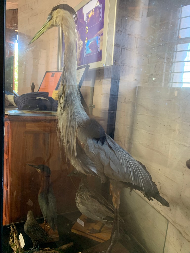
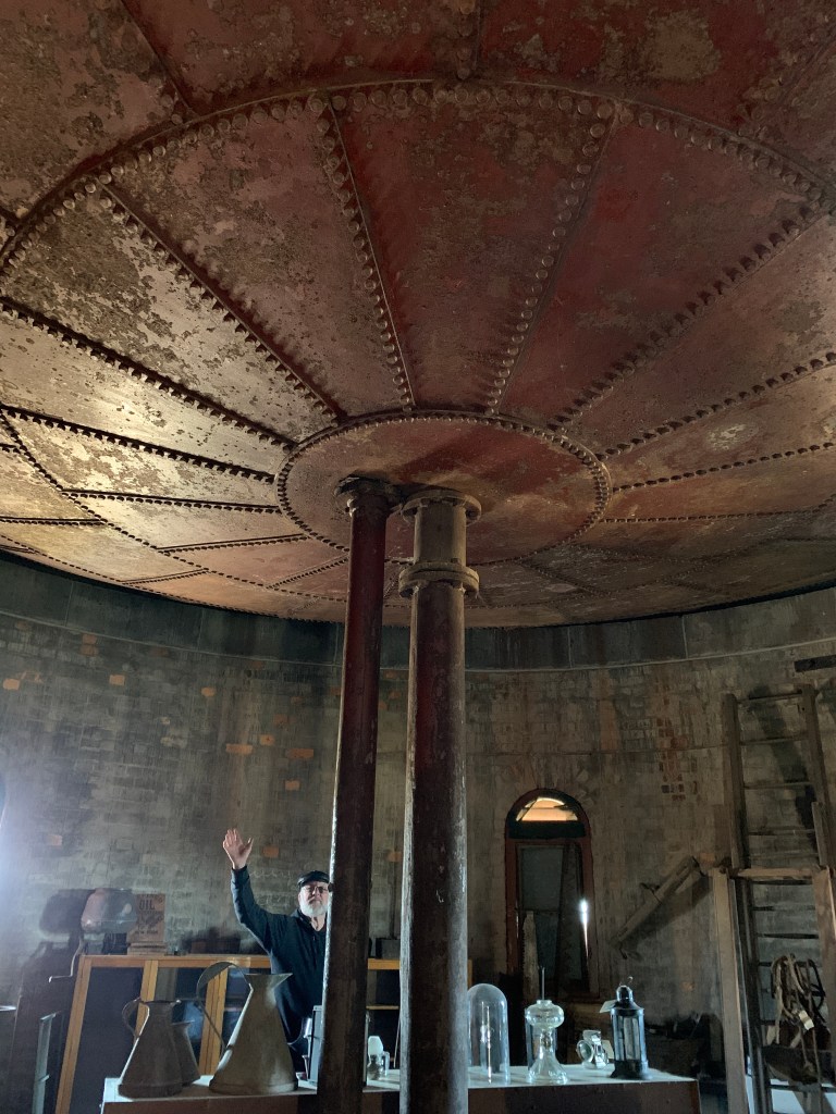
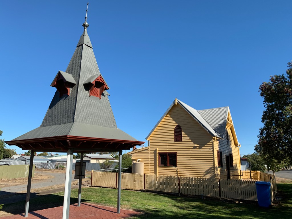
After visiting the Stick Shed we visited the Water Tower Museum and Historic Railway Station and the Historical Concordia Lutheran College. The Water Tower Museum is housed in the historic water tower and has four floors of displays. The ground floor houses an incredible display of James Hill’s Taxidermy Bird Collection. It is said to be one of the best collections in Australia. It really is incredible. Hundreds of birds are in display cabinets that James Hill collected and applied his taxidermy skills to. Unfortunately the glass cabinets make it difficult to take good photos of the collection.
The upper three floors house a collection of historical Murtoa memorabilia.
The Railway Station across the road houses a good display of the history of the railway in Murtoa and also has a lot of memorabilia.
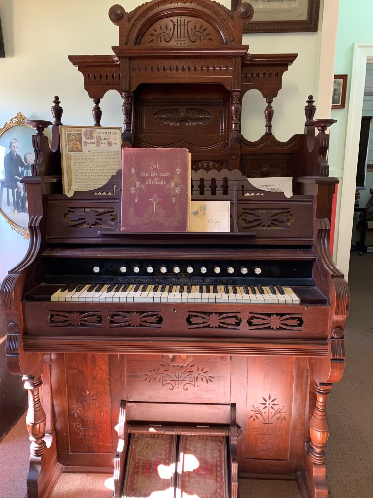
The Concordia College building next door to the water tower houses displays of the German and Lutheran heritage of the area. It is also home to the longest ongoing brass band in Australia, the Coromby Brass Band. There is so much memorabilia in the college you could be here for days however my favourite display was a gorgeous rabbit skin fur coat that a local farmer had made for his bride. It was beautiful.
Next it was on to the next town on the Silo Art Trail, Rupanyup. Rupanyup’s silo art work was painted by Russian mural artist, Julia Vochkova. Her work features two local residents, Ebony Baker in her netball uniform and Jordan Weidermann wearing his Aussie Rules uniform. The artist wanted to show the youthful spirit of strength, hope and camaraderie by honouring the role that sport plays in rural communities. This pair of conjoined silos was painted in 2017.
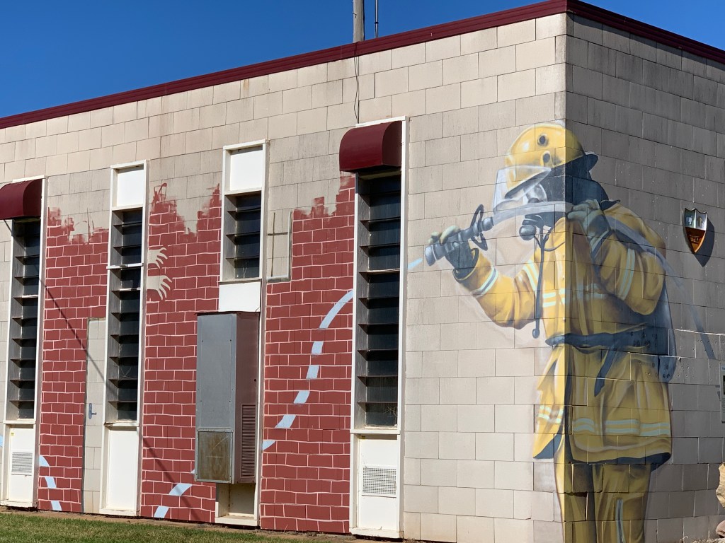
The town also has a mural of a firefighter on the old shire office building. This work was painted by Melbourne street artist Goodie.
The Main Street of Rupanyup is a divided street with a park running down the middle. At various points in the park are six wooden sculptures by Gippsland chainsaw artist John Brady.
Silo and Street Art, Rupanyup
Our next stop was Minyip where we found a street sculpture in their Main Street roundabout called The Farmer.
Artist Grant Finke from Geelong created the sculpture for the roundabout after the roundabout had received an upgrade. Minyip is famous for being the town where the very popular TV series The Flying Doctors was made.
The Farmer, Minyip
Next stop along the Silo Art Trail was the silos at Sheep Hills. This artwork is by Melbourne artist Adnate and he has used his work to tell the stories of indigenous people and their native lands. Adnate spent time in the community in 2016 and chose local Wergaia Elder, Uncle Ron Marks, and Wotjobaluk Elder, Aunty Regina Hood along with two children Savannah Marks and Curtly McDonald as the faces for this work. It is an amazing work.
Silo Art, Sheep Hills
We arrived in Warrancknabeal at lunchtime. There are three street sculptures on the roundabouts in the Main Street. The first one you come across is a sheep dog, the second on the Federation Place Roundabout has a sheepdog and a group of sheep. On one corner of this roundabout is the incredible Tudor style Post Office built in 1861 and on the opposite is the historic Palace Hotel. On the footpath around theses buildings is an amazing mosaic set in brick paving stamped with local names and businesses that supported this redevelopment of the footpaths and roundabout. The third roundabout has a sculpture of a sheep dog sitting on some bags.
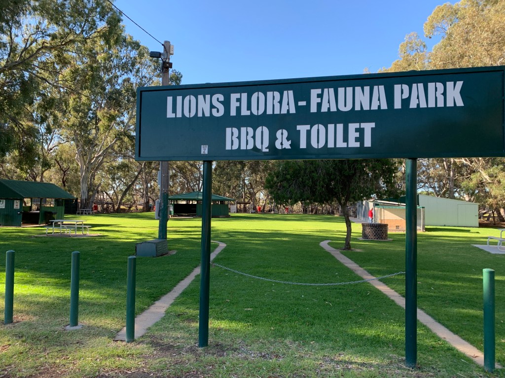
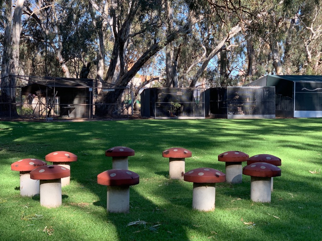
As it was lunch time we found a great spot to pull up at the Lions Flora & Fauna Park next to Yarriambiack Creek. This lovely park has a playground, free BBQ’s and picnic tables. The animal enclosures and bird aviaries house a collection of native birds and animals and there’s also a Guinea Pig enclosure.
On a walk around the park I found a Street Library. This is a a little box on a pole with a glass door. Inside you can leave a book for someone else or take a book to read. What a great idea!
There is plenty of parking and lots of room for our motorhome and we enjoyed having our lunch at this lovely park.
After lunch we continued on the Silo Art Trail and next stop was Brim. Brim takes its name from an Aboriginal word for ‘Spring’ or ‘Well of Water’. Brim’s silo art work was painted by street artist Guido van Helton. The work depicts generations of the local community.
Brim’s silo is illuminated at night by solar lighting. That would be something to see!
Brim’s silo art was the first in Victoria and was completed in 2016. The success of this work shone a spotlight on the Wimmera and inspired the establishment of the Silo Art Trail.
Silo Art, Brim
Next stop was at the 36 parallel where we found the remains of the Netting Fence which was built in 1885 from Tyntynder to the SA border to prevent Dingoes and Rabbits overrunning and devastating the pastoral and agricultural land to the south.
The Netting Fence
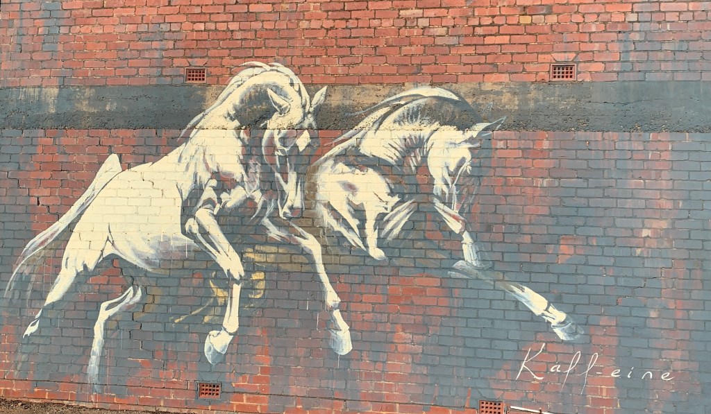
Further on in Beulah we found a street mural by artist Kaff-eine of two Arabian horses taking flight. Kaff-eine also painted the Silo Art at our next stop in Rosebery. This work was completed in 2017 and depicts a female farmer on the left and a horseman in his Akubra hat with his trusty horse on the right
By the time we arrive in Hopetoun it was time to find a camp for the night and we found a fabulous spot at Lake Lascelles. This is a small circular lake and the town provides a few powered sites as well as free camping all the way around the lovely lake. We drove around until we found a good flat spot and pulled up for the night. We had a campfire and enjoyed sitting outside watching the sunset across the lake.
Lake Lascelles
Our second day on the Silo Art Trail was an overcast and very windy day. It was 15 degrees outside but the wind made it feel much colder.
Our first stop after leaving Lake Lascelles was the tiny township of Woomelang where we found artwork on movable silos at various locations around the town. We also found a fabulous corrugated iron artwork on a wall and a scary snake mural.
Silo Art, Woomelang
Next stop was the tiny community of Lascelles. Their Silo Art, painted in 2017, depicts a local couple whose families have been farming in the area for four generations. This work is by Melbourne artist Rone and he used local farming couple Geoff and Merrilyn Herman as the subjects of this work.
Silo Art, Lascelles
Patchewollock was our next stop. Artist Fintan Magee painted this work and he used local farmer Nick ‘Noodle’ Hulland as the subject. According to Magee, the lanky Hulland was just the right height and leanness to fit on the narrow 35 metre silo. This work was completed in 2016 and depicts the reserved Hulland as the typical Aussie farmer wearing a ‘flanny’, with a solemn expression, sun-bleached hair and squinting into the distance.
Silo Art, Patchewollock
The roads out here in the Wimmera are dreadful. The motorhome bounces up and down like we are on a rollercoaster. The main highways are not too bad but once you get on the back roads we bounced up and down a lot. Some of the roads on this day were just single lane tar roads and when we approached an oncoming vehicle we had to get right off the road while they went past.
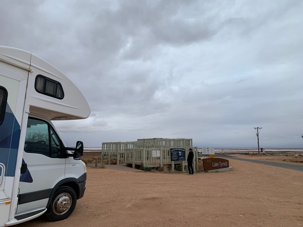
Next stop was at Lake Tyrrell near Sea Lake where we pulled in to have a quick look from the lookout. It had started to rain and was very cold so we didn’t stay long. Lake Tyrrell is a huge salt lake, the largest in Victoria at 20,860 acres. It is the terminal lake of the Avoca River/Tyrrell Creek system. Tyrrell Creek flows every 3-5 years but the water does not always reach the lake. There are signs of Aborignal occupation in this area and over 137 cultural sites have been identified. 100,000 tonnes of salt is harvested from Lake Tyrrell and you can see stacks of salt in the distance from the Lookout.
A new boardwalk and Sky Lounge, where you can lie back and view the night sky, has been constructed but it was too miserable outside to visit those. Maybe next time!
Lookout, Lake Tyrrell
The huge salt lake, Lake Tyrrell
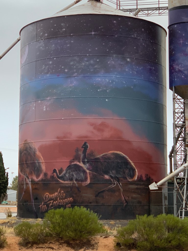
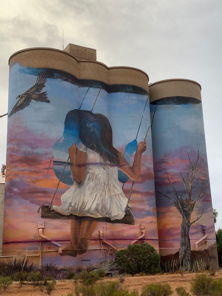
Our last silo art for the day was at Sea Lake where they have an amazing artwork by Drapl and The Zookeeper. This work depicts a young girl swinging from a Mallee Eucalyptus looking over Lake Tryell and reflects her indigenous heritage. It also depicts local flora and fauna around the lake.
Silo Art, Sea Lake
Day two of following the Silo Art Trail ended at Green Lake Reserve just south of Sea Lake where we found a lovely spot in the campground and pulled up for the night.
We turned off the Riddoch Highway to go to Naracoorte Caves. We’ve never been there before and I was looking forward to it. Naracoorte Caves are listed on the World Heritage List and along with Riversleigh Fossil Fields in Queensland make up the Australian Fossil Mammal Sites (Riversleigh/Naracoorte).
The fossils of Naracoorte Caves have accumulated over 500,000 years during a time of a series of ice ages. The fossils were well preserved in the sediment of the caves. Over 110 different species of animals have been identified with 25 of those being extinct and the others being around at the time of European settlement. Many of those have since become extinct. Excavation and exploration is ongoing at the caves and who knows what they will find next.
We arrived around noon and went to the Wonambi Fossil Centre where we booked a couple of cave tours and a visit to the Megafauna display. We had time for some pumpkin soup at the cafe before our first tour and it was delicious.
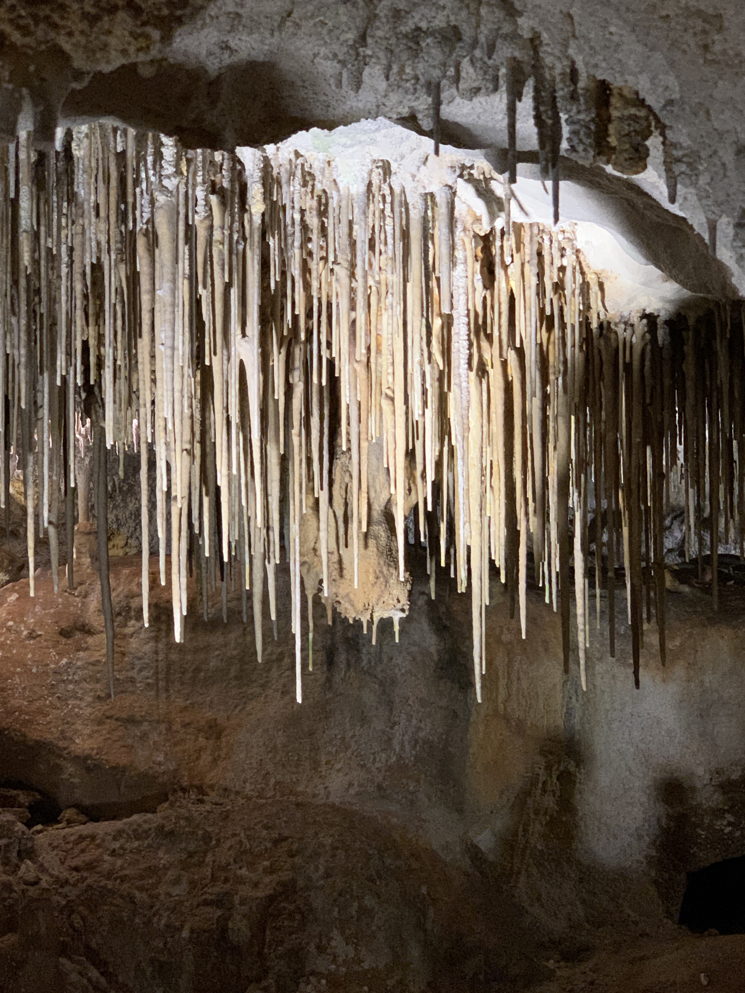
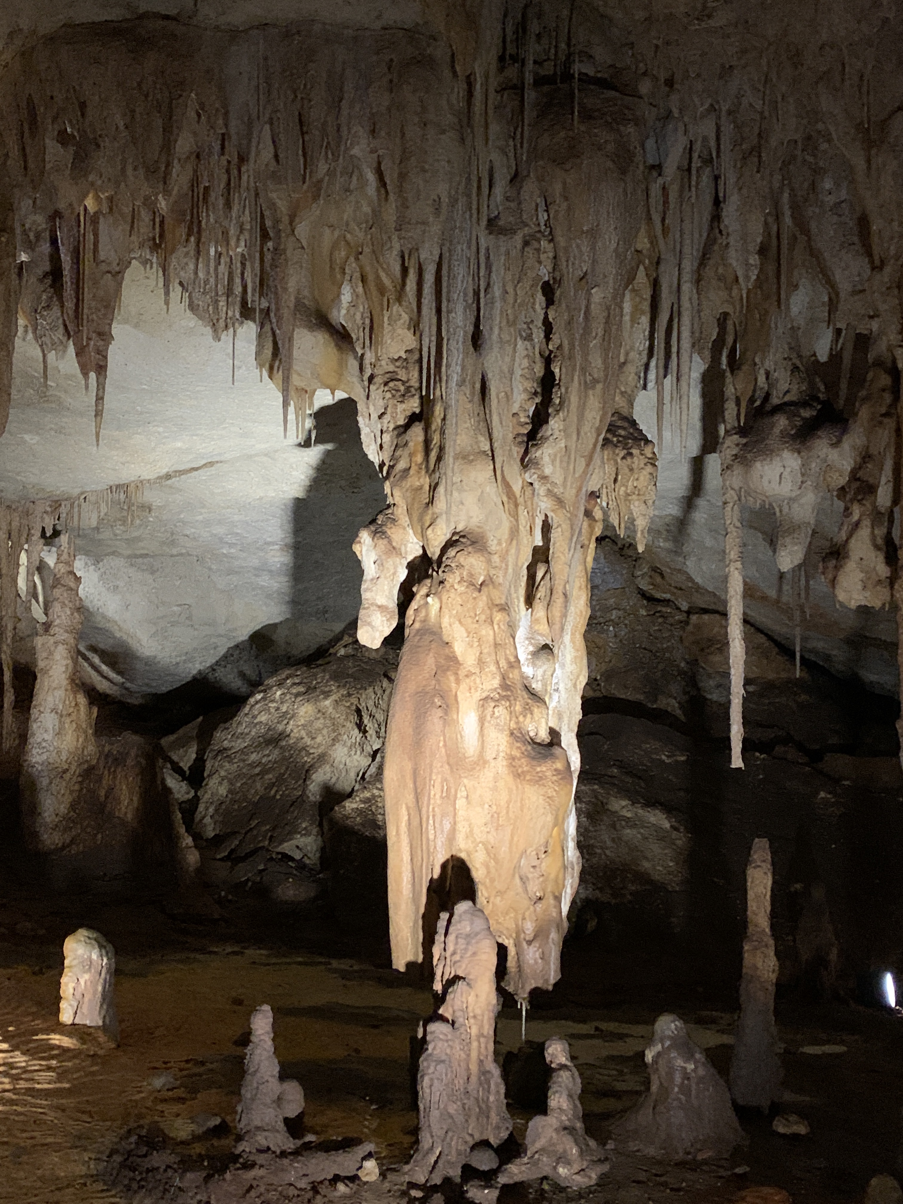
Our tour of Alexandra Cave commenced at 1.00pm from the Wonambi Centre. Our tour guide was a ranger called Gav. Alexandra Cave was discovered in 1908 and was opened for guided tours in 1909. Our 30 minute tour became 45 minutes as Gav’s enthusiasm for the cave bubbled over. This cave has some very fine examples of stalactites, stalagmites, columns, curtains and flow stone. It’s not the prettiest caved I’ve ever seen but still is amazing.
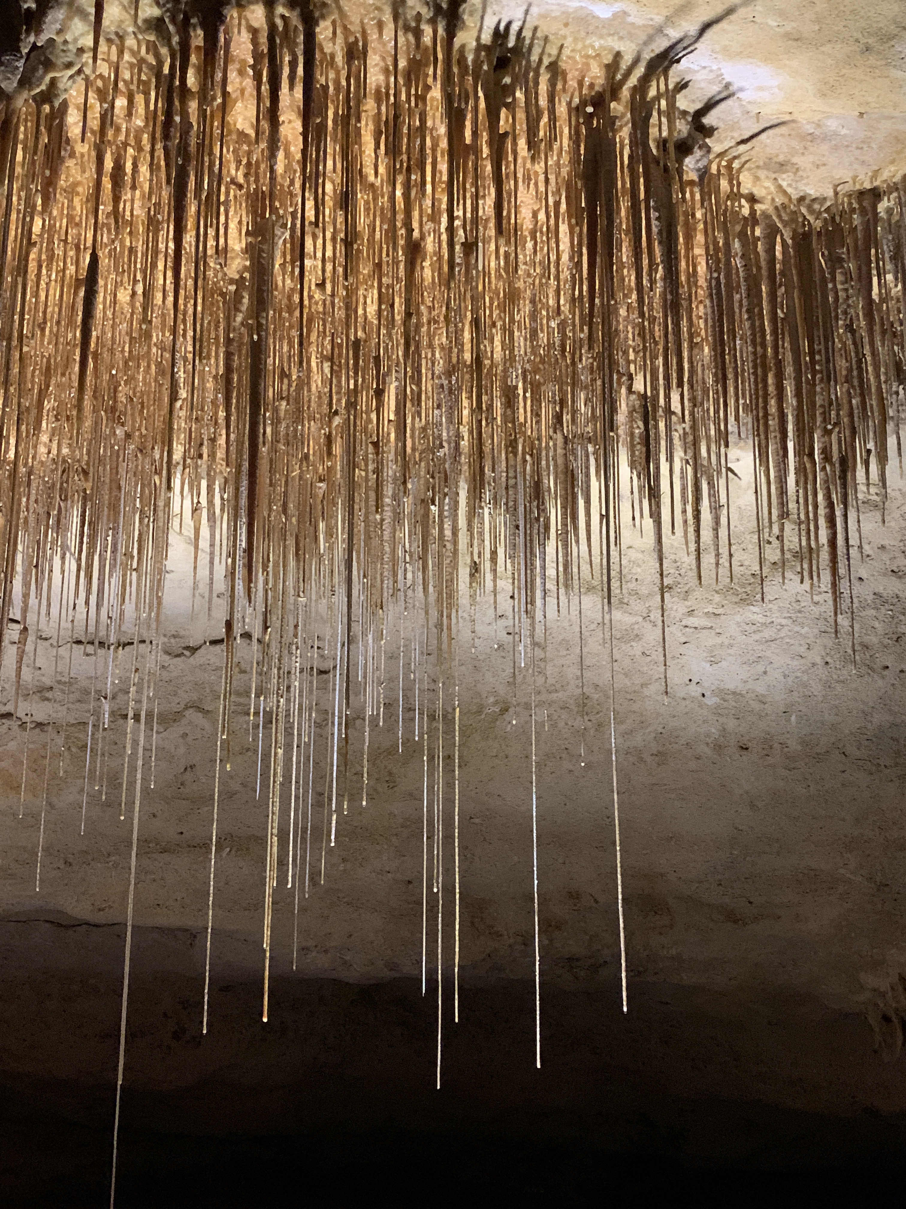
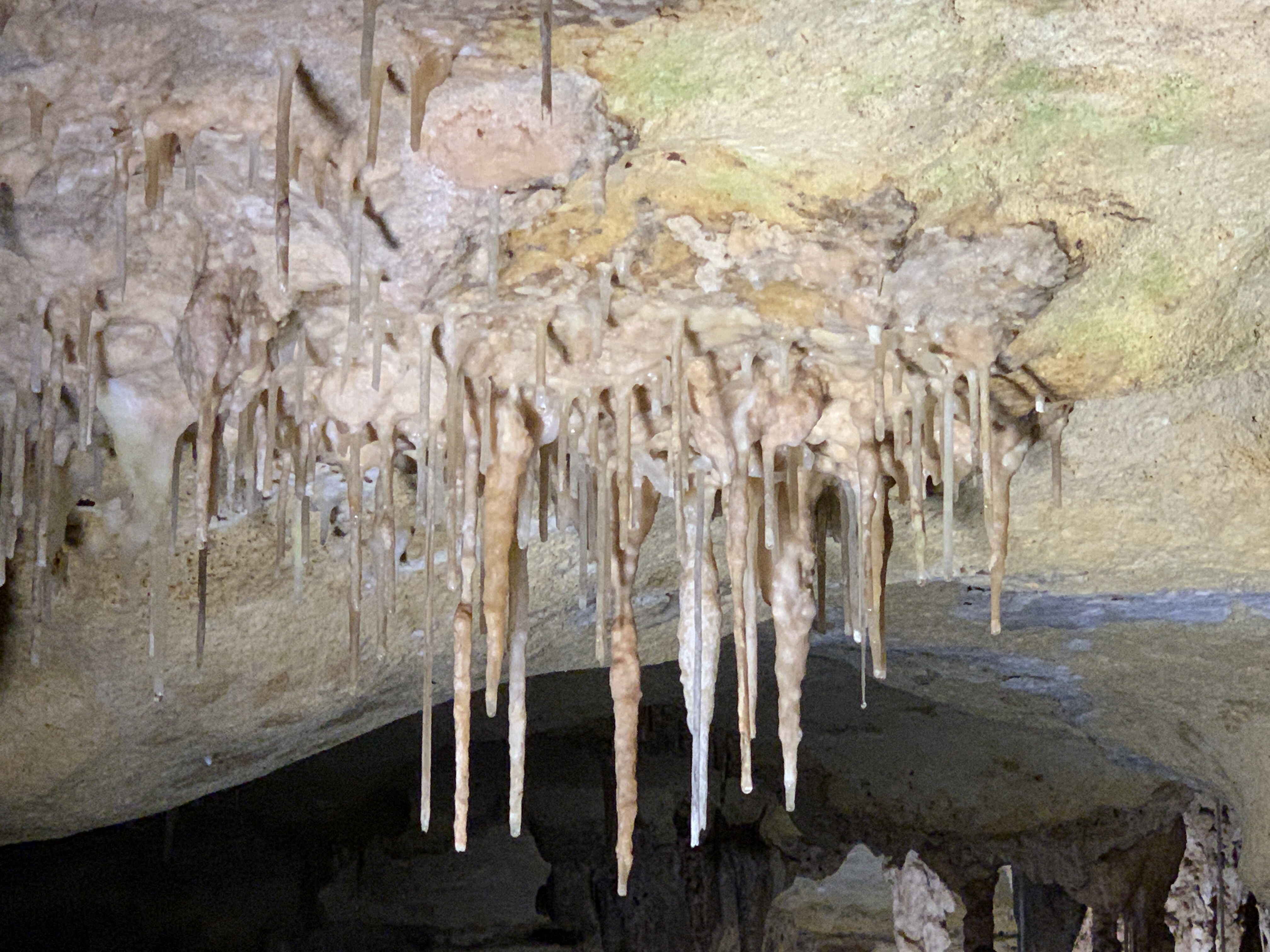
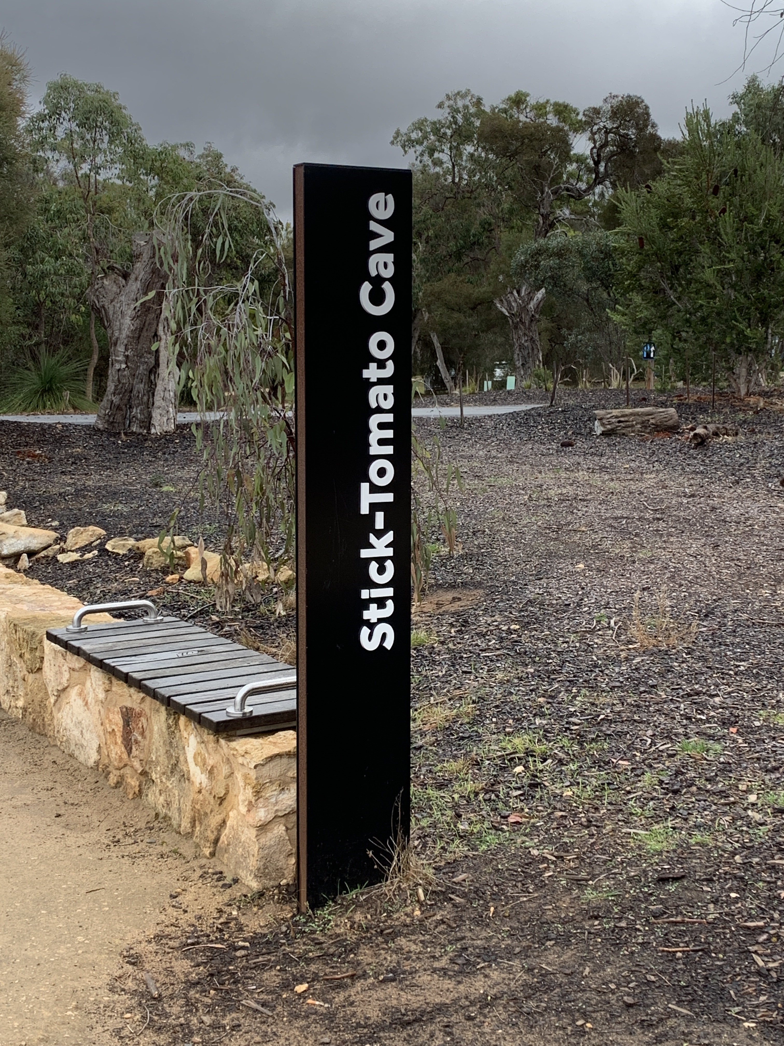
We then did the self-guided tour of Stick-Tomato Cave. This cave is very different from Alexandra Cave as it is much drier. The formations in this cave are covered in a white chalky substance. The ones close to the large entrance are covered in green algae, a result of being in too much light. There was one really interesting formation on the ceiling of this cave called Avens. This is where the roof is formed into lots of hollows by the water dripping into the cave absorbing carbon dioxide and becoming acidic and it dissolves the limestone into these amazing shapes.
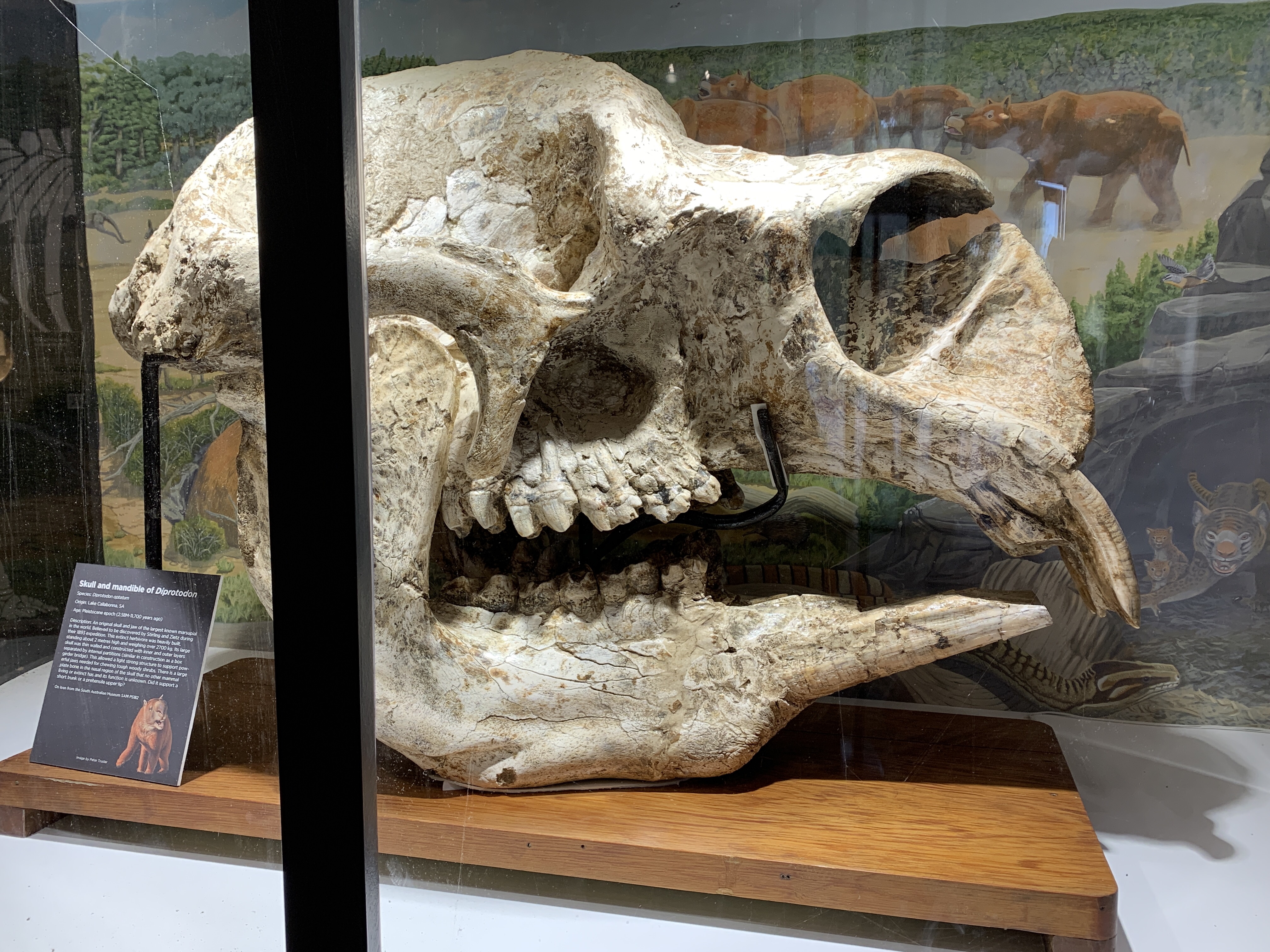
Next we went back to the Wonambi Centre to visit the megafauna display. In the entry to the centre is a great display of fossils that have been found including the massive skull of a Diprotodon, the largest creature to have ever lived in Australia. This massive creature could grow to 2500 kgs and was a giant herbivore.
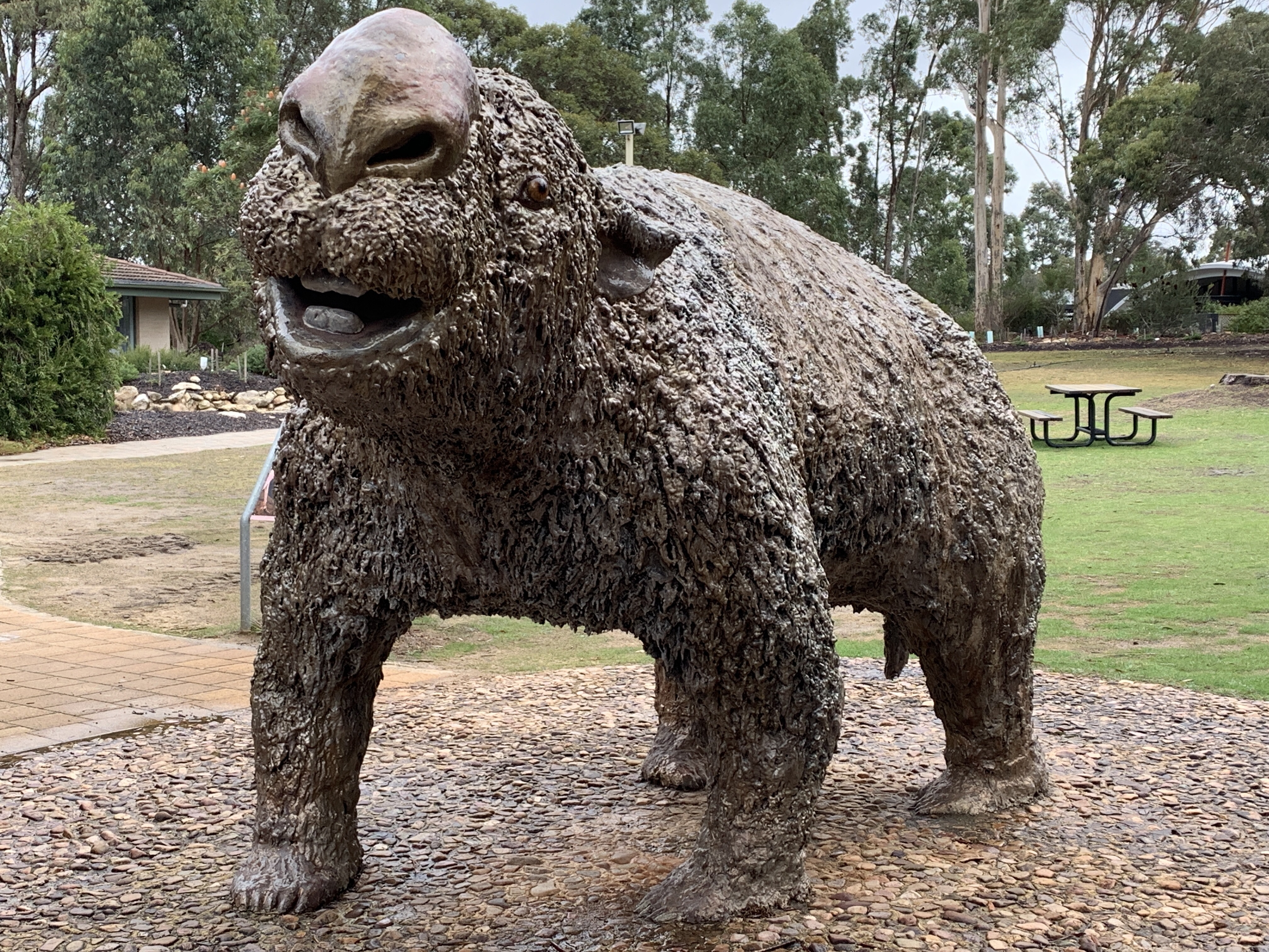
Inside is a re-creation of what the Naracoorte area may have looked like 200,000 years ago based on years of research by palaeontologists. They have been able to reconstruct skeletons of these extinct animals and work out what they looked like and what they ate. The life-sized animated models have been built as scientifically accurate as possible. This group of very large extinct creatures are know collectively as ‘megafauna’ and they roamed Australia alongside many of the animals we still have today. It is still not know why the megafauna disappeared but it was around 50,000 years ago and could be linked to the arrival of Aborigines. Aborigines may have hunted the slow moving megafauna or altered their habitats by burning. Or maybe it was climate change. Australia has experienced several ice ages over the last million years so maybe climate change wiped out the megafauna. Who knows?
Next to the Wonambi Centre is a fantastic children’s playground. It includes tunnels, rope climb, swings and is all made with natural materials such as timber logs and stone. Our grandchildren would just love this place.
Leaving the caves we decided to go and check out their campground and found a lovely little campground with about 12 flat powered sites and a large grass area for tent camping. There was a large group of children camped in tents. Looked like a school group. There is an amenities block and a tennis court. We thought it looked like a great place to bring our grandchildren one day.
We had a great day out at Naracoorte Caves in spite of the weather being miserable, raining and very cold.
Penola sits at the bottom of the Coonawarra Wine Region. Coonawarra is world famous for its Terra Rossa (Red Soil) soil that is perfect for grape growing. It has taken millions of years to form this layer of red soil rich in iron, silica and nutrients that sits upon ancient limestone bedrock. Combining this unique soil with the availability of underground water, cool nights and a long mild growing season makes this area known throughout the world as a premier wine area famous for its Cabernet Sauvignon.
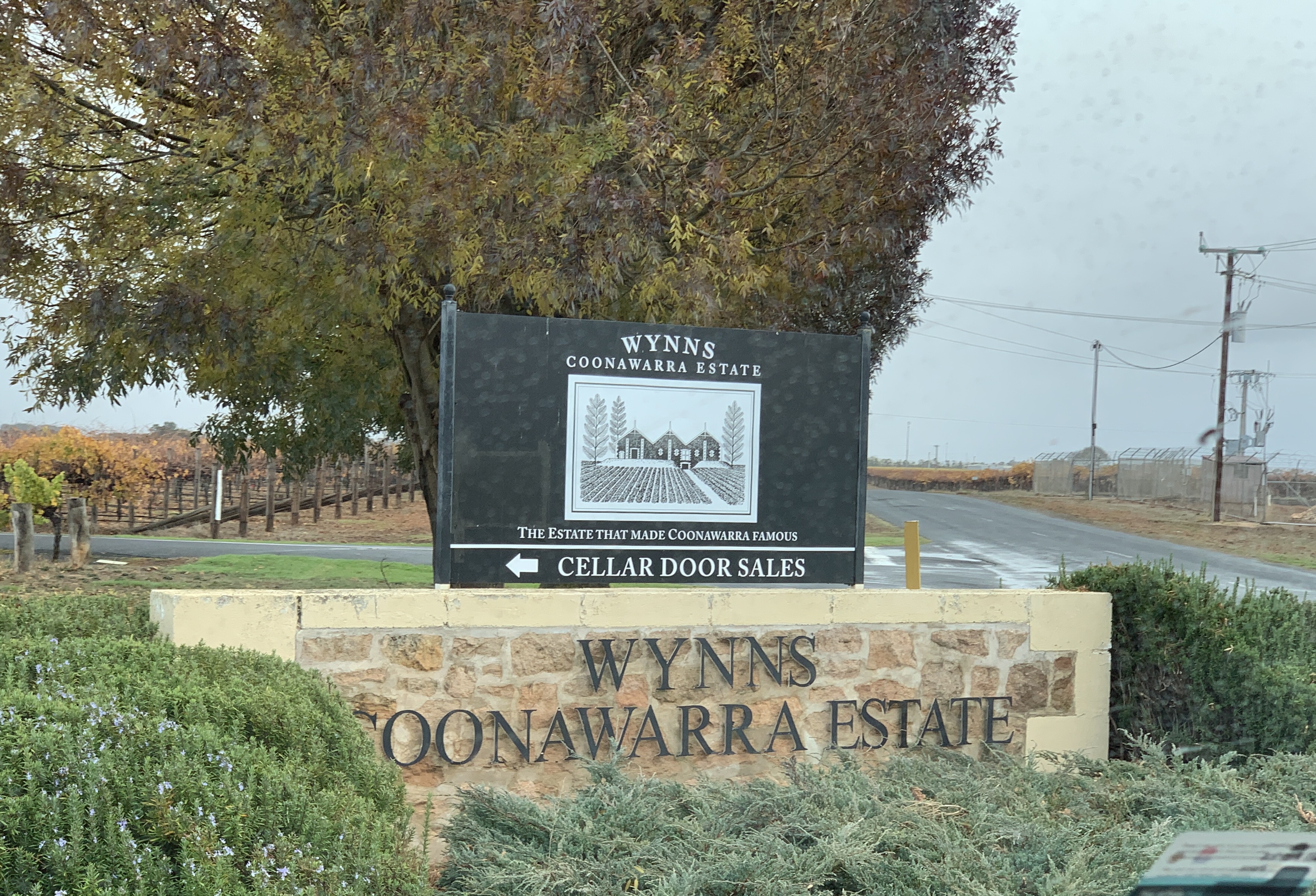
Pioneer John Riddoch first plated vines in 1890 and his legacy continues at Wynns Coonawarra Estate. John Riddoch had the famous three gabled winery built in 1896. Melbourne wine merchants Samuel and David Wynn bought the Riddoch vineyards and winery in 1951 and created the famous label including the three gabled winery and today they are one of the Coonewarra’s pre-eminent winemakers.
We pulled up in the carpark in front of the famous winery and quickly dashed inside as it was raining. The cellar door is fabulous and you can feel the history of the building with its exposed beams. They have a great history of the winery display around the walls. We enjoyed our visit to Wynns.
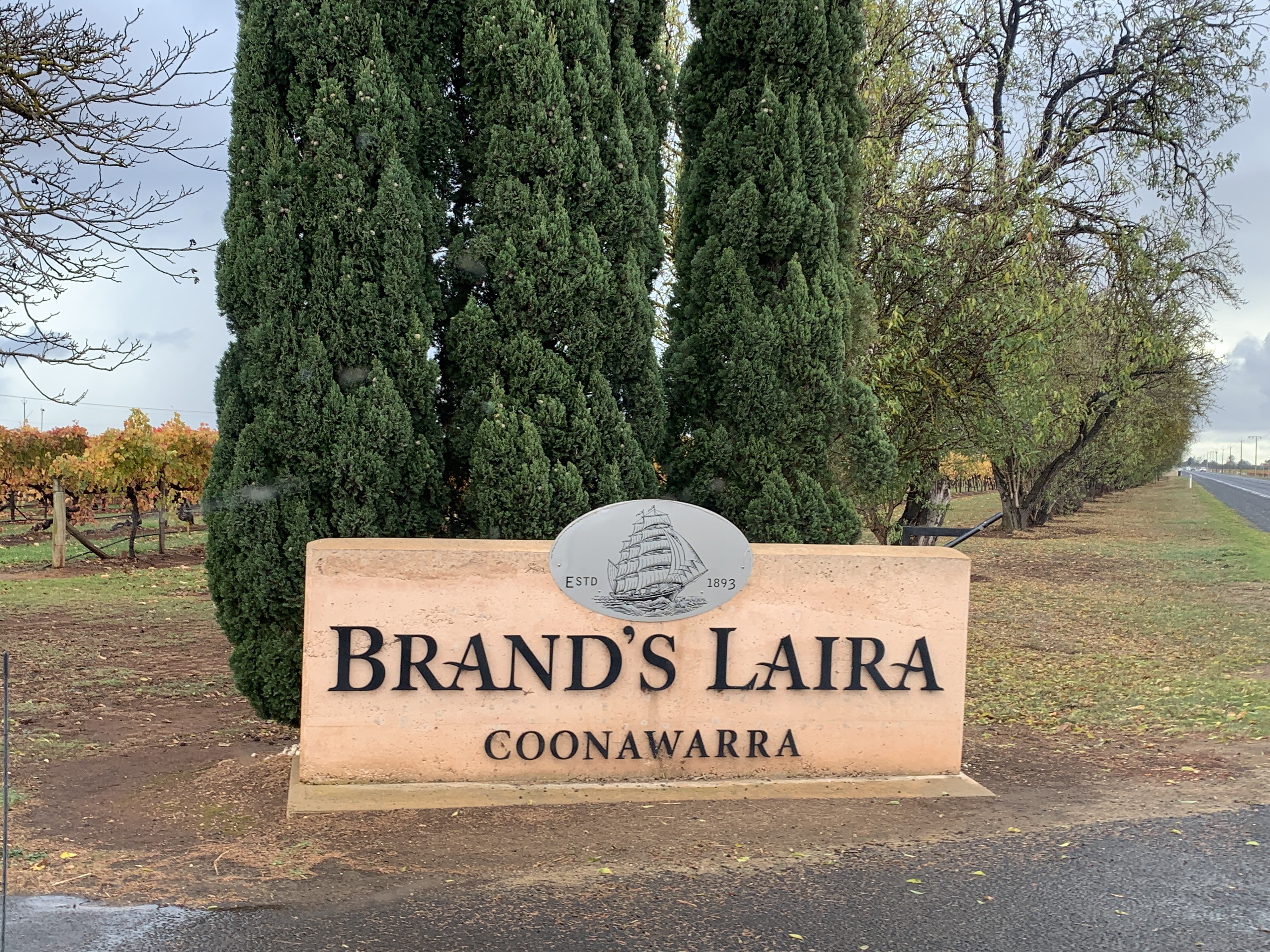
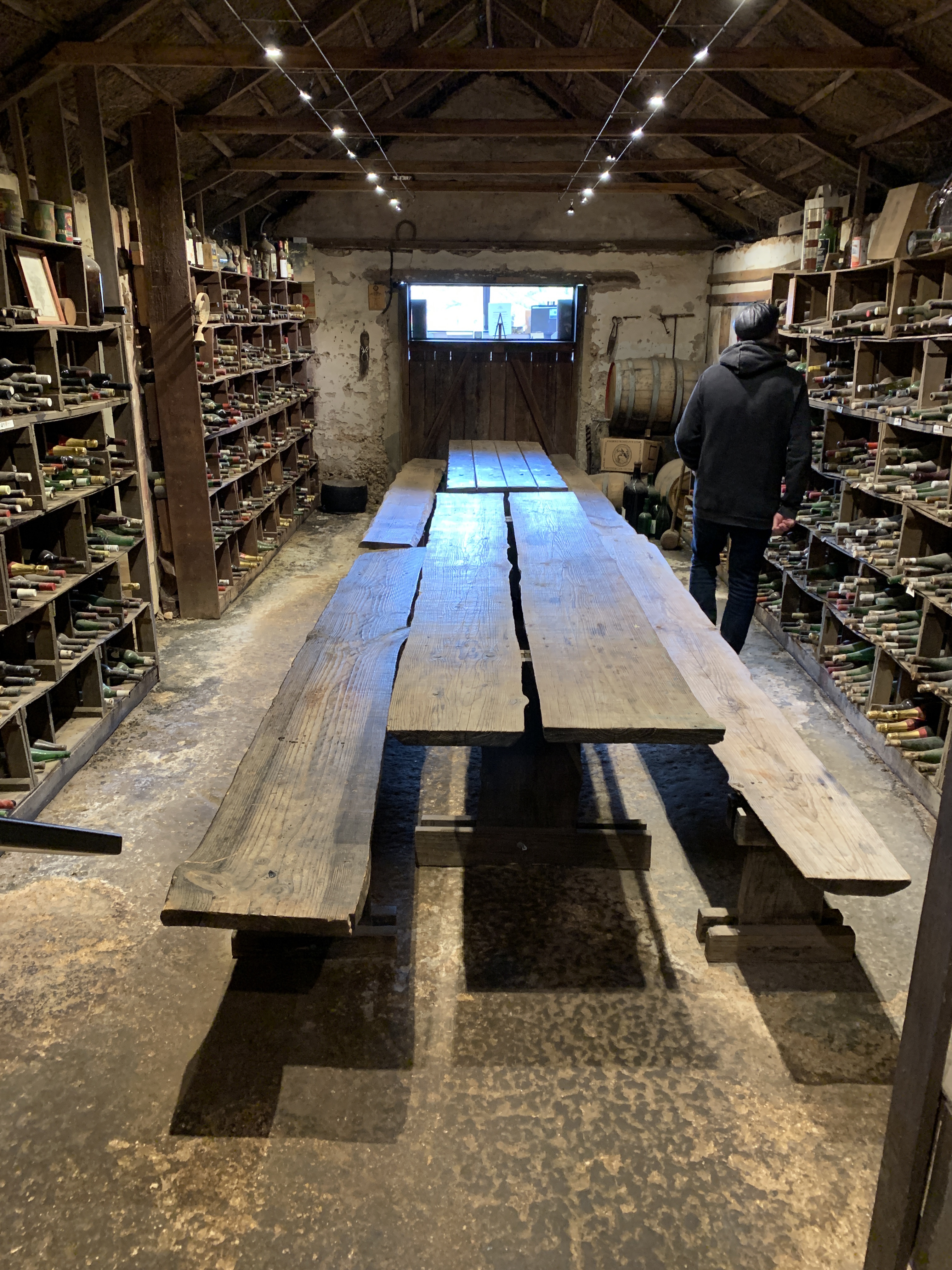
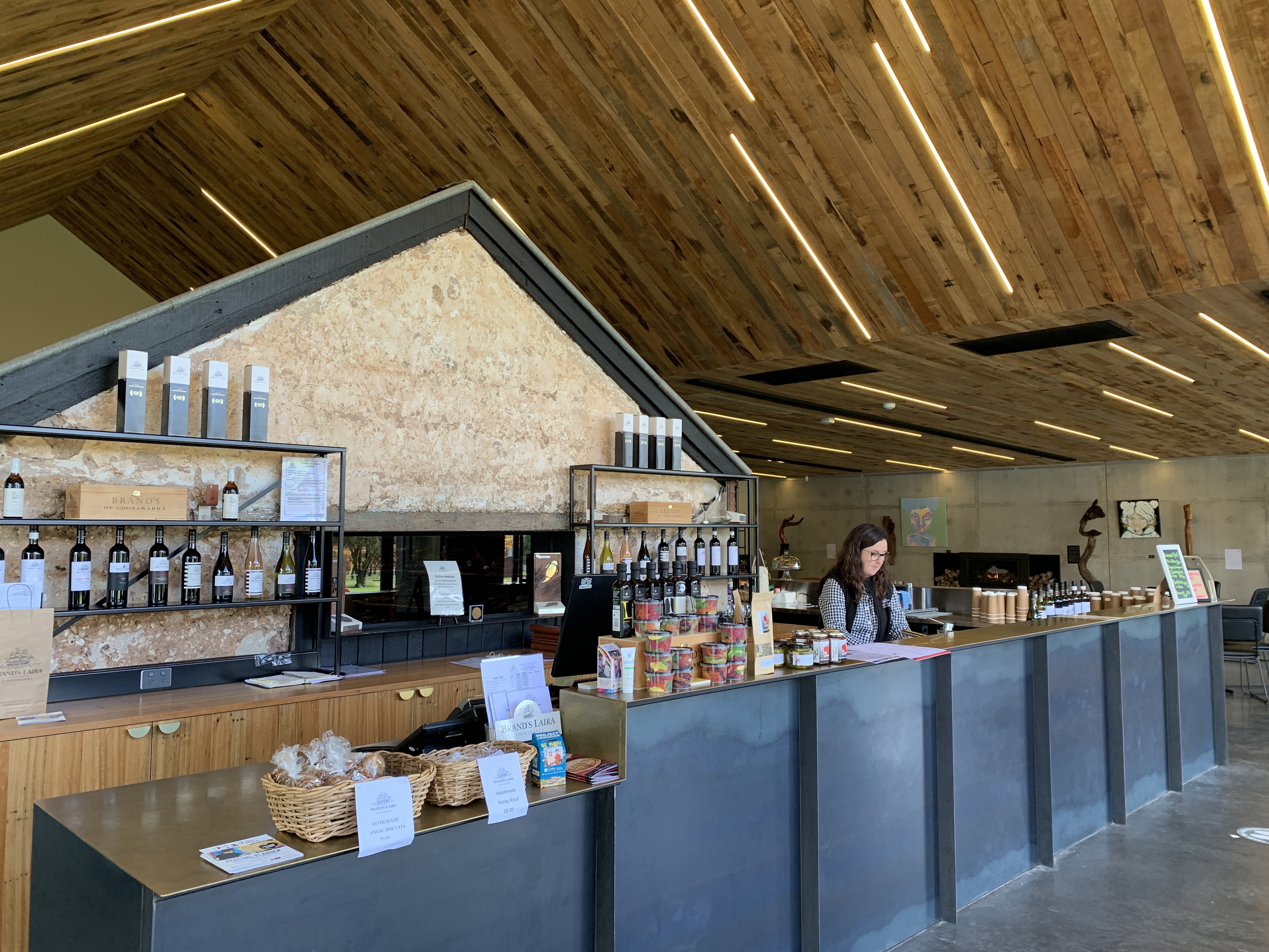
Our next stop along the Riddoch Highway was to one of Richard’s favourite wine labels Brands Laira. Brands Laira is an iconic winery in the Coonawarra and is now owned by the Casella Family Brands company from Griffith. The vineyards here date back to 1893. The recently constructed cellar door is fabulous with its polished concrete floors, rammed earth and concrete walls, Mountain Ash lined ceiling and fabulous bar made from steel with a brass sheet bench top. Inside the cellar door is the original Eric Brand’s cellar. This old building has been preserved inside the new one and its great to see this classic bit of history saved. The new cellar door has a lovely deck area that leads onto a lovely lawn with gorgeous roses that were still blooming. This would be a great spot for wine tasting and a Ploughmans Platter that you can preorder for $25 pp on a sunny day. Alas it was raining.
We continued on past many famous name wineries. Anyone who drinks wine would recognise these names such as Katnook Estate, Lindeman’s, Zema Estate, Parker Estate and Yalumba.
The vineyards were all golden and yellow still covered in leaves that have changed colour before they fall off.
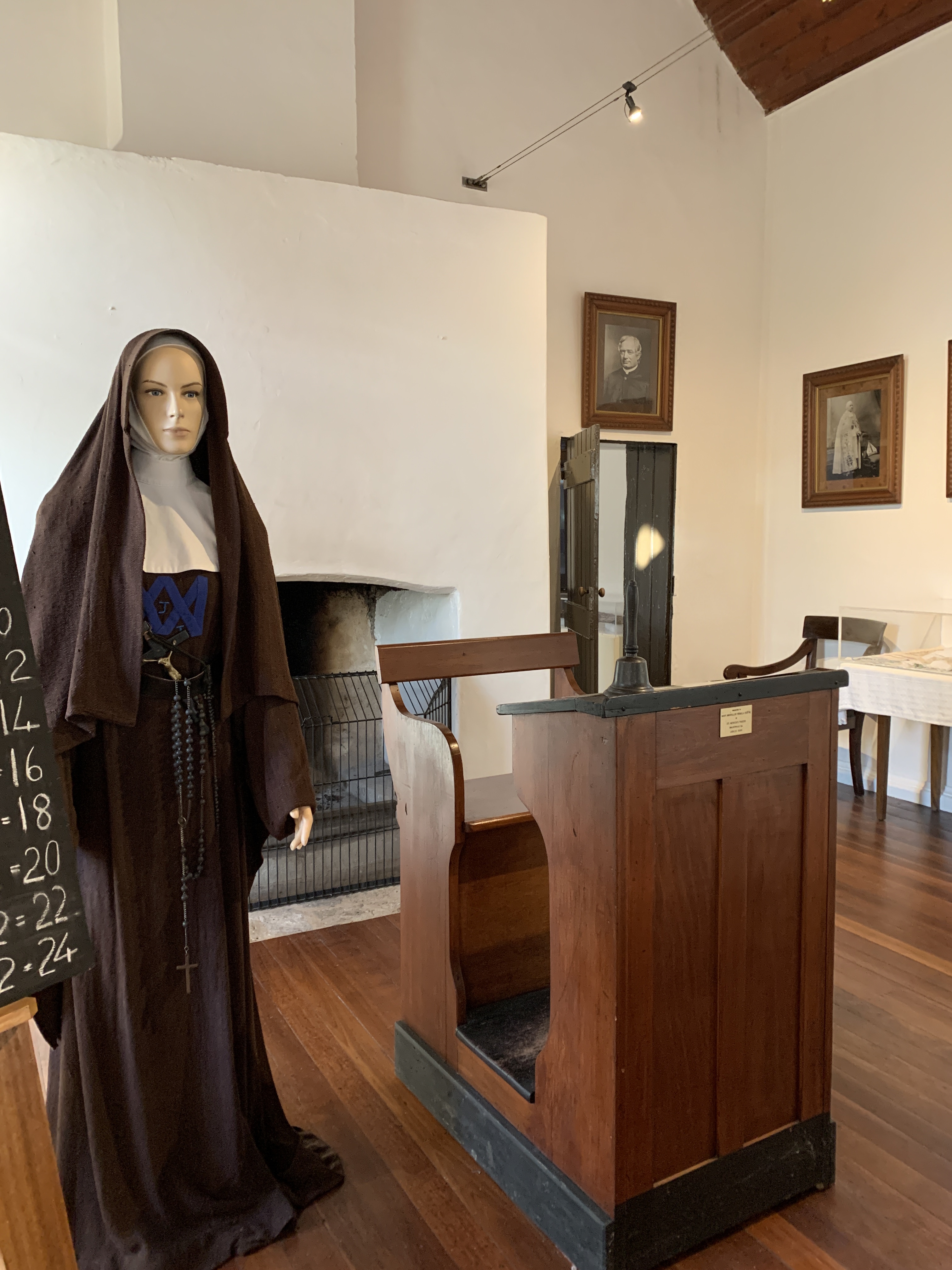
The small town of Penola at the bottom of the Coonawarra Wine Region was where it all began for Mary McKillop. It was here that her vision for providing a Catholic education to poor children was realised.
Mary was born to Scottish parents in Melbourne in 1842, the eldest of eight children. Her father was not a successful business man and the family faced many hardships and she gladly accepted a position as governess to her small cousins at her Uncle Alexander Cameron and Aunt Margaret Cameron (née McKillop), at Penola Station. Mary was only 18 when she arrived in Penola.
In Penola Mary met the charismatic priest Father Julien Tenison Woods. Father Julien was a popular parish priest whose parish included a vast area of some 56,000 square kilometres in South Australia. Father Julien rode his horse all over his parish and was well loved by his parishioners. He could be found regularly celebrating Mass beneath the River Red Gums. He was an educated man and had an interest in geology, writing, map making, music and even the Theory of Evolution.
He and Mary were like-minded in wanting to provide a Catholic education to those children whose families could not afford to pay for a governess. They both felt it was every child’s right to a good Catholic education.
Their first school was set up in an old 6 stall horse stable in 1866. Mary’s brother helped remove the horse stalls and the school began. Mary’s two sisters, Annie and Lexie, came to help. This is the time the Mary made a declaration of her dedication to God and began wearing black.
The school flourished and a new school was built out of stone in 1867. It had a large school room, a dormitory for the Sisters and a big kitchen. Mary insisted that all their furniture be as poor peoples so everything was plain and functional. By the end of 1867 10 other women had joined with Mary and they all adopted the plain brown religious habit and became known as the Sisters of St Joseph of the Sacred Heart. They were known locally as ‘the brown Joeys’. This was the first religious order founded by an Australian.
Mary’s school system was eventually taken up by the church and was the beginning of the Catholic Education system in Australia. By the end of 1869 more than 70 members of the Sisters of St Joseph were educating children at 21 schools in Adelaide and in the country.
Mary traveled widely and helped establish schools in Queensland and NSW. Mary’s untiring work in education was finally recognised by the church hierarchy and after her death in 1909 she was canonised and became Australia’s first Saint in 2010.
Penola is home to the Mary McKillop Penola Centre which includes the original 1867 Schoolhouse. The lives of Mary and Father Woods are celebrated in the excellent displays inside the centre. It is well worth a visit when you are in Penola.
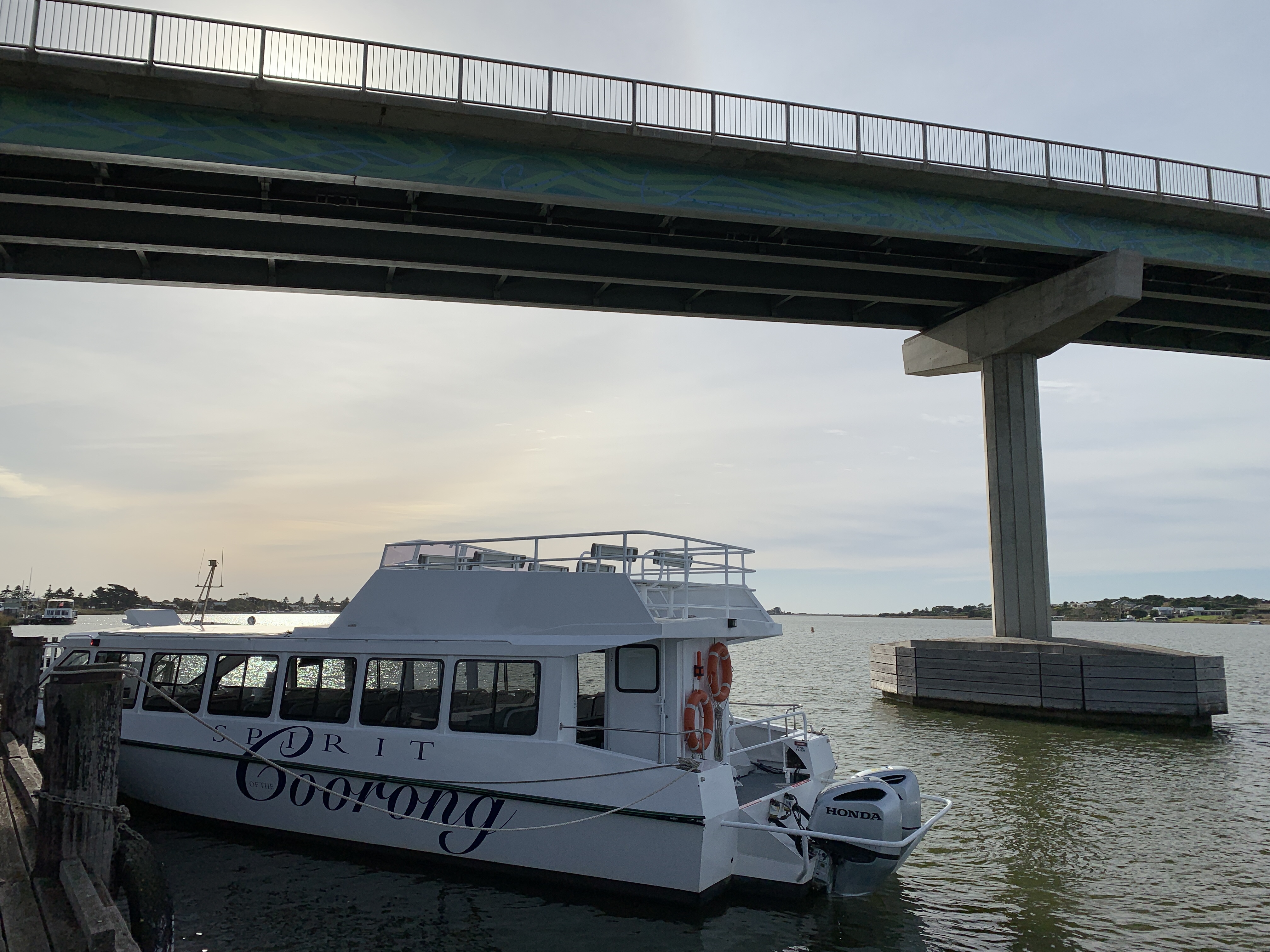
Big tick of our bucket list today. We cruised past the mouth of the Murray. We left home 19 days ago with the objective of following the Murray River from Albury in NSW to the mouth of the Murray in South Australia. Today we achieved that objective on a cruise with Spirit of the Coorong. We had booked the cruise online and it departed from the historic Wharf at Goolwa at 10.00am.
We stayed on grassy flat powered site at the Hindmarsh Island Caravan Park ($25 pn for Seniors) and were up bright and early to drive across the Hindmarsh Island Bridge to the wharf precinct. There is parking there for long vehicles so we parked the MH, left the fridge running on gas so nothing would thaw out, and went to check in.
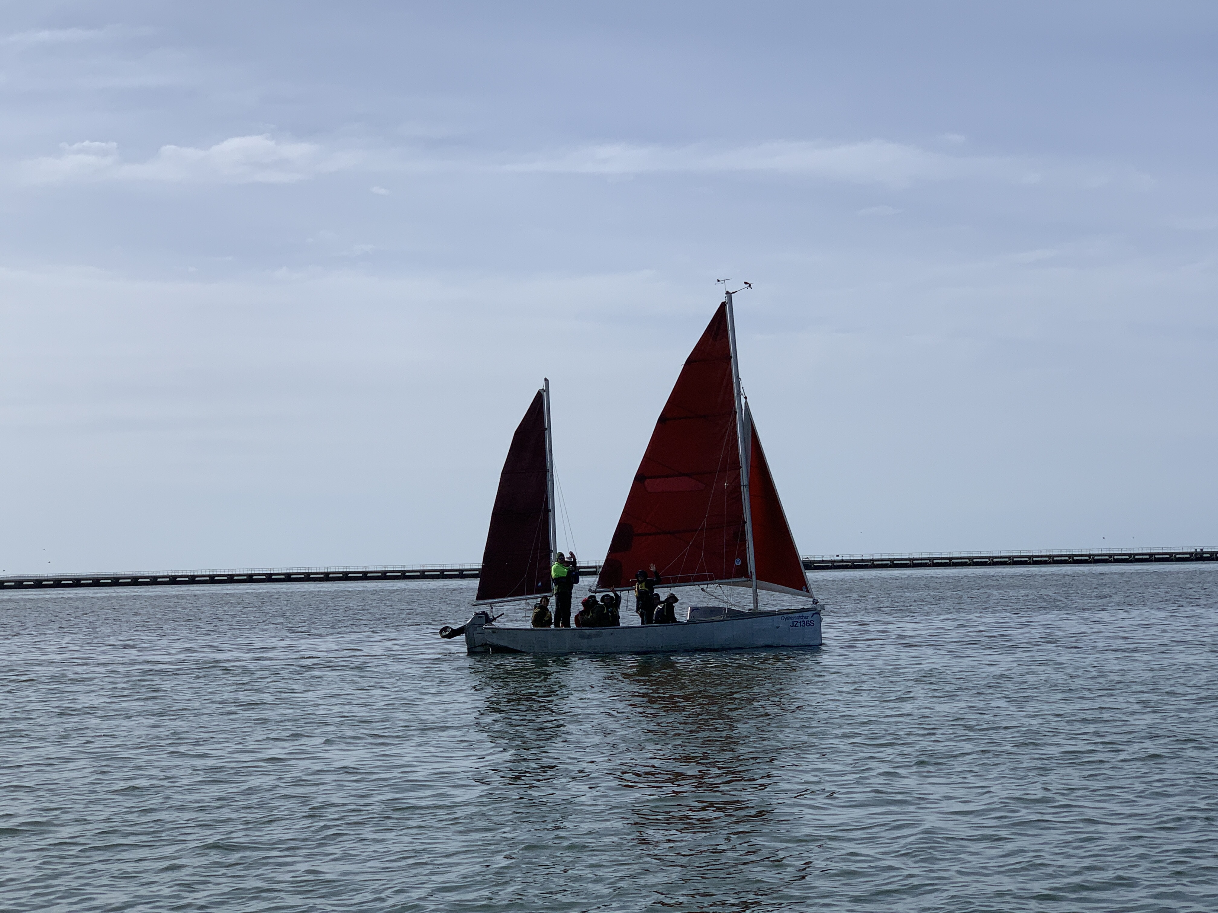
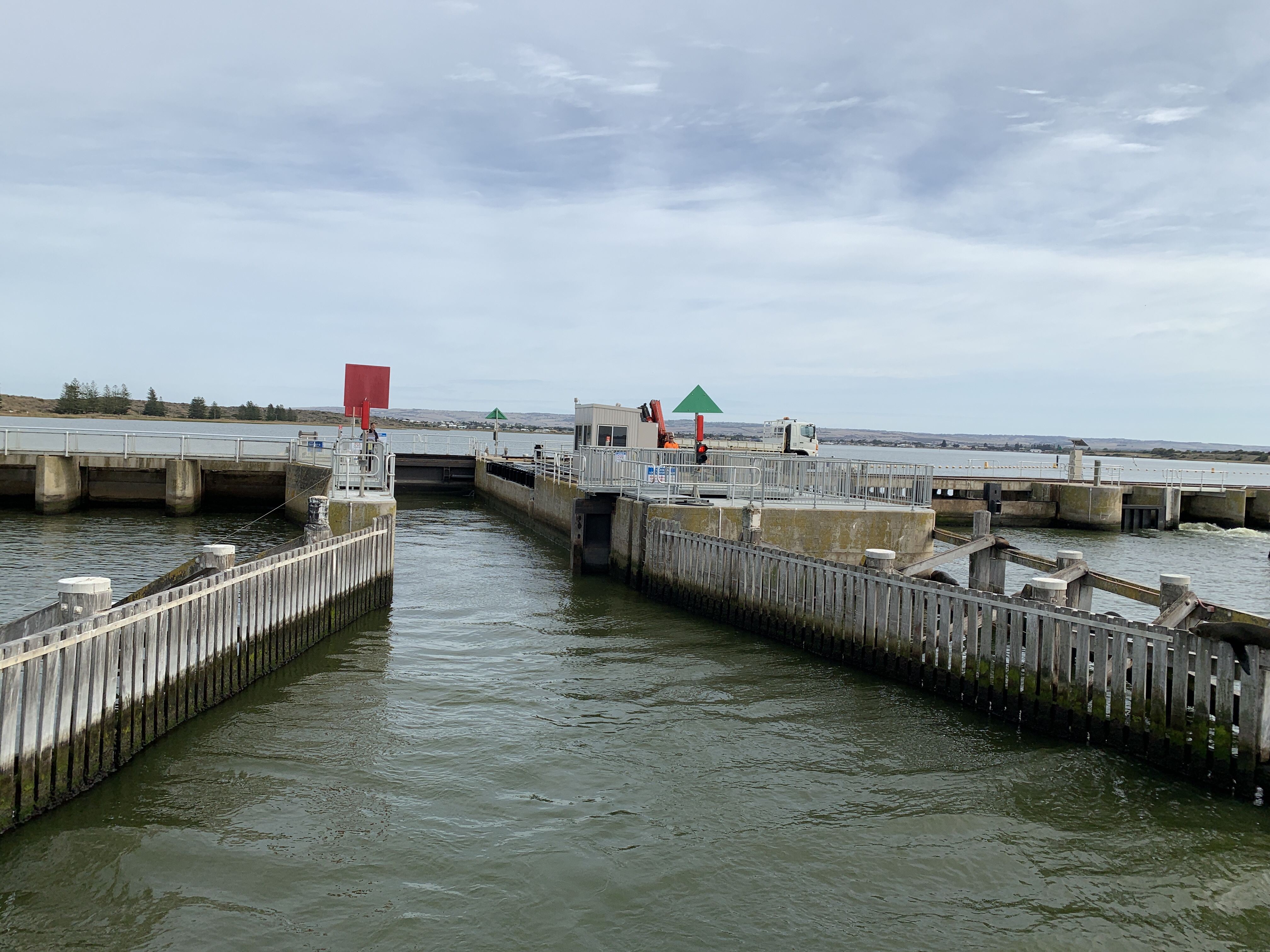
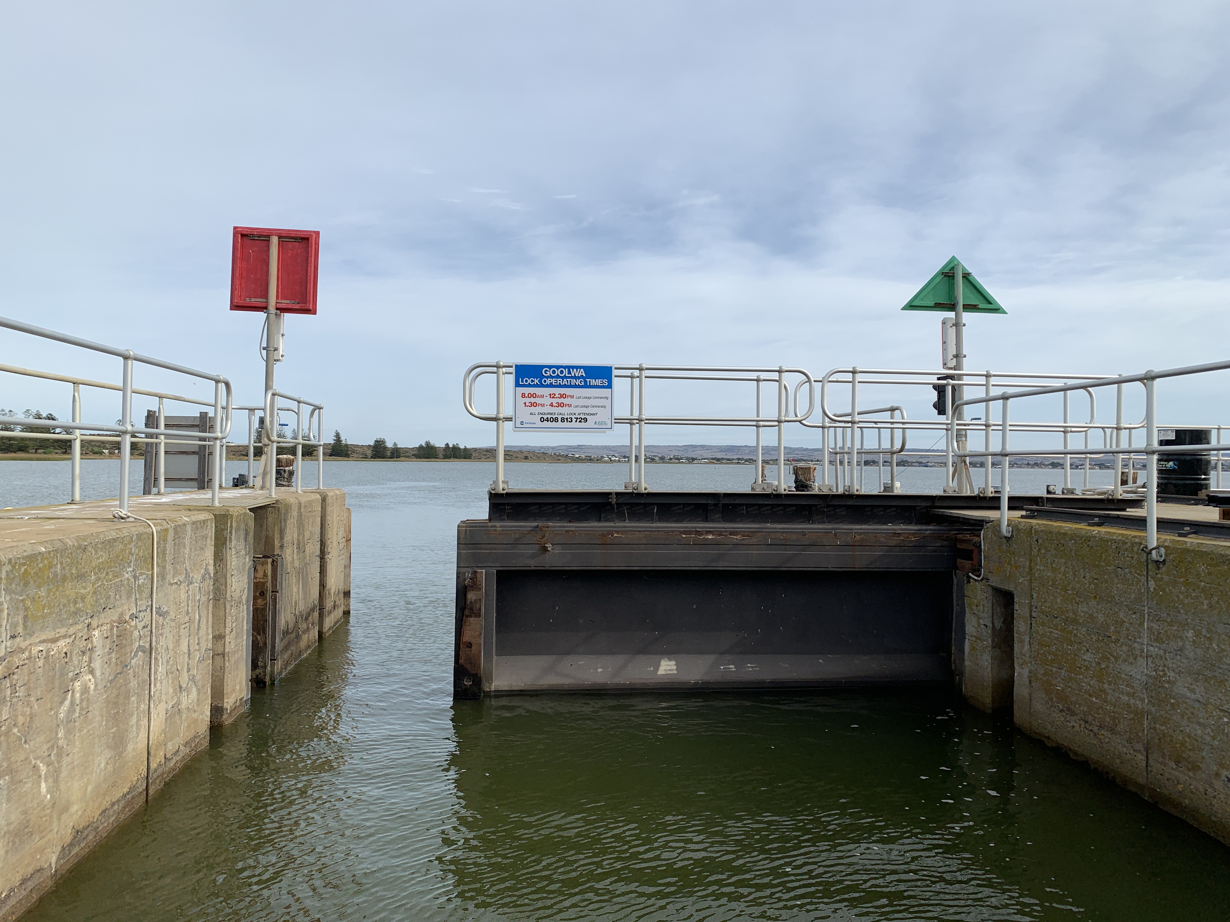
Spirit of the Coorong was moored up and a group of people were gathering ready to board. Promptly at 9.45am boarding was announced and we were introduced to our skipper, Rupert, and crew, Jack. It was a quick boarding process and once everyone was on board we headed off down river towards the Goolwa Barrage and Lock.
We were blessed with a gorgeous sunny day for our cruise especially after the last few cold and windy days.
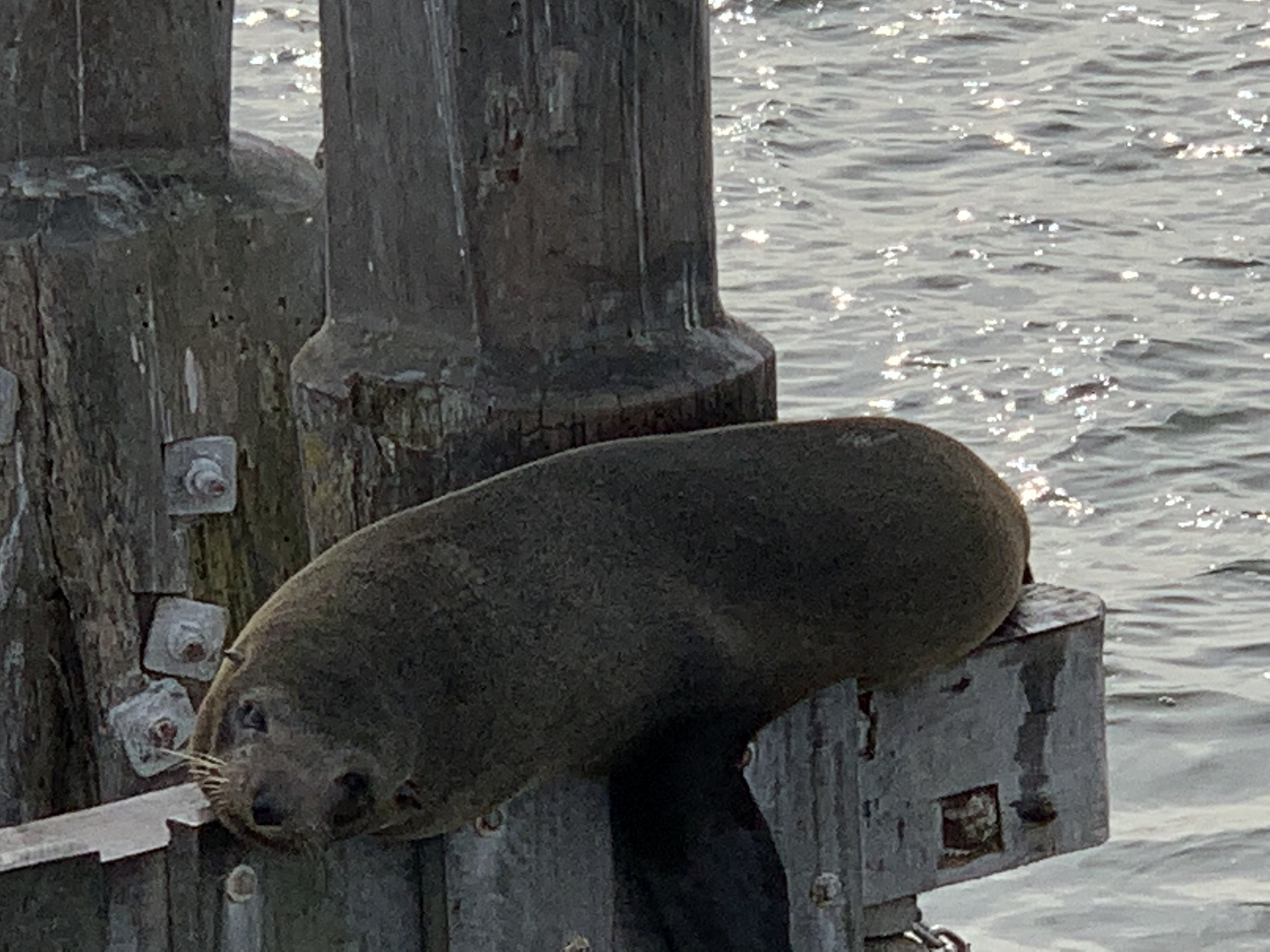
I love going through locks and this one was no exception. We had to be lowered from the fresh water river level to the sea water Coorong level. There was water flowing through one of the gates in the barrage and this is letting fresh water out into the Coorong. There was a group of sea lions at the lock hanging out on the wooden structure or playing in the water. They are funny to watch.
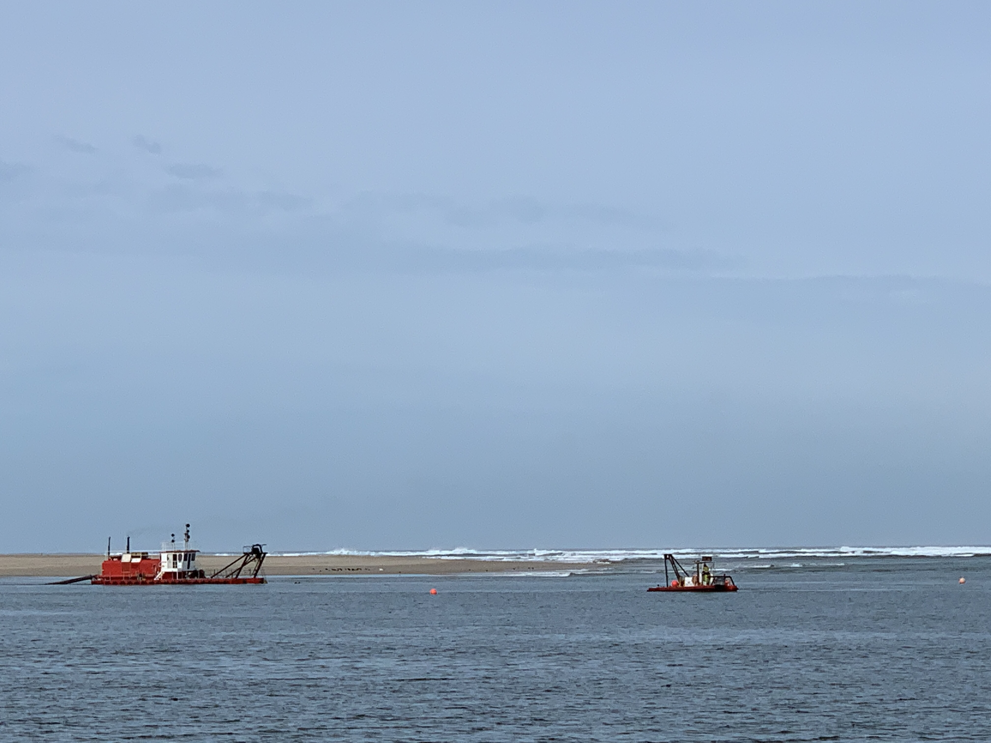
Once through the lock we cruised southwards alongside Hindmarsh Island on one side and the long thin peninsula separating us from the Southern Ocean until we reach the mouth of the Murray. The dredges were working dredging sand to keep the mouth of the Murray open to the sea.
Our first stop was at Barker’s Knoll where we went for a walk in the Coorong National Park and our guide Jack showed us the abundance of bush tucker that the Ngarrindjeri people made good use of. No wonder they lived there for thousands of years. Everything they needed was right there.
Our walk took us across the sand dunes and onto Ninety Mile Beach with the bright blue waters of the Southern Ocean crashing onto the beach. Ninety Mile Beach is the longest beach in Australia and seems to go on forever. Jake gave a demonstration of the ‘Goolwa Shuffle’ and showed us how to catch Pipis or Cockles by putting your feet firmly on the sand and twisting from side to side as the waves come in and out. The pipis rise and you can catch them as the waves retreat. To keep them they must be of commercial size. This area of the beach is for commercial pipi fishermen only so Jack threw back the ones he’d caught to show us.
Back on board and we had a treat waiting for us. Skipper Rupert had cooked up a big pan of Pipis in a delicious coconut milk, onion and garlic sauce. Everyone got to try them and they were scrumptious.
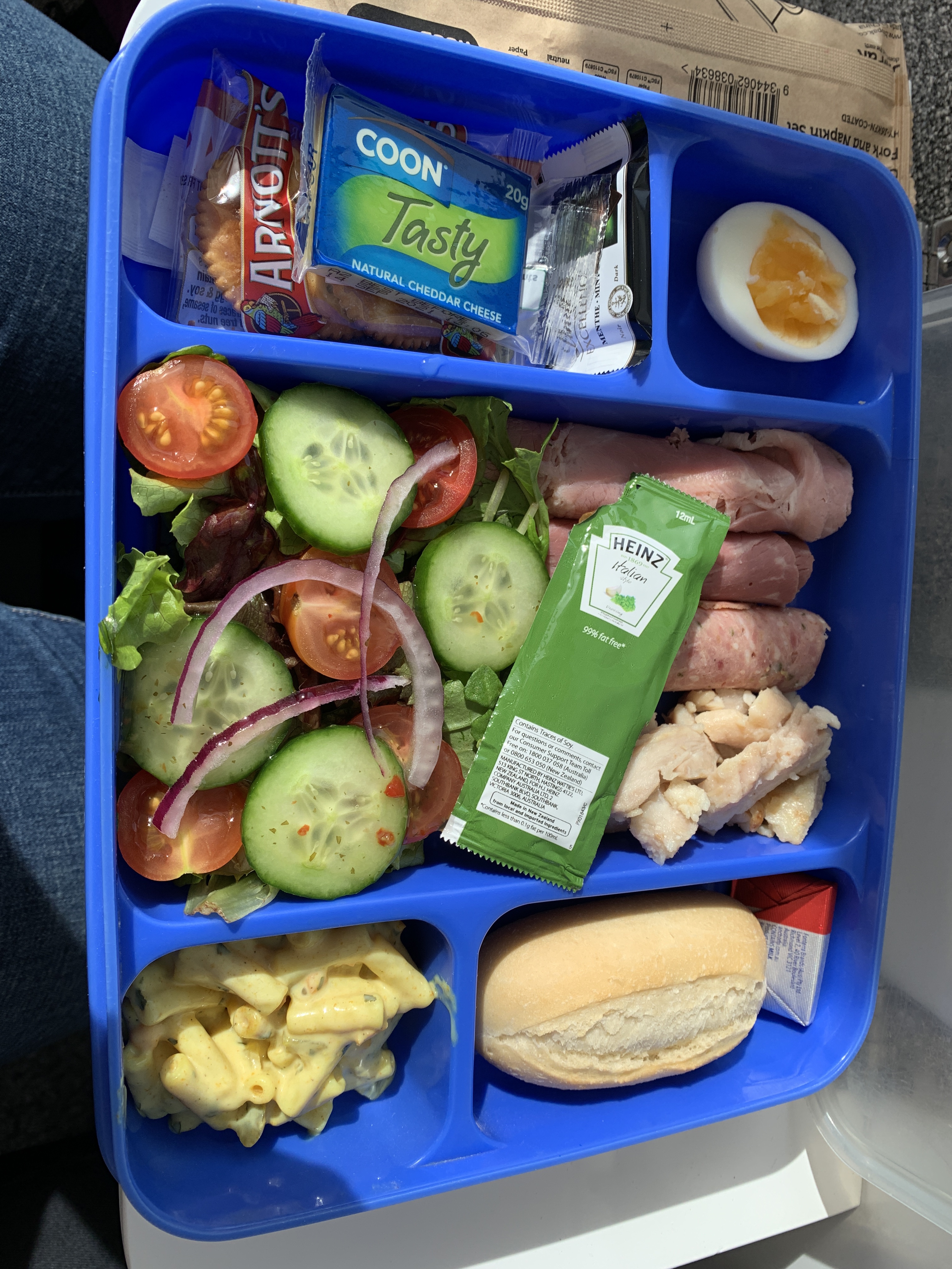
We continued our cruise down the Coorong and Jack served our lunch. Lunch was a delicious Bento Box lunch with a lovely variety of cold meats and salads. You could purchase drinks so we enjoyed a tiny bottle of wine with our yummy lunch.
Our cruise took us past the ‘shacks’ built on a point opposite Bird Island. Some of these shacks have been there for a very long time. Most from before the Coorong was made a National Park. They have now been put on leases and will eventually be removed from the park.
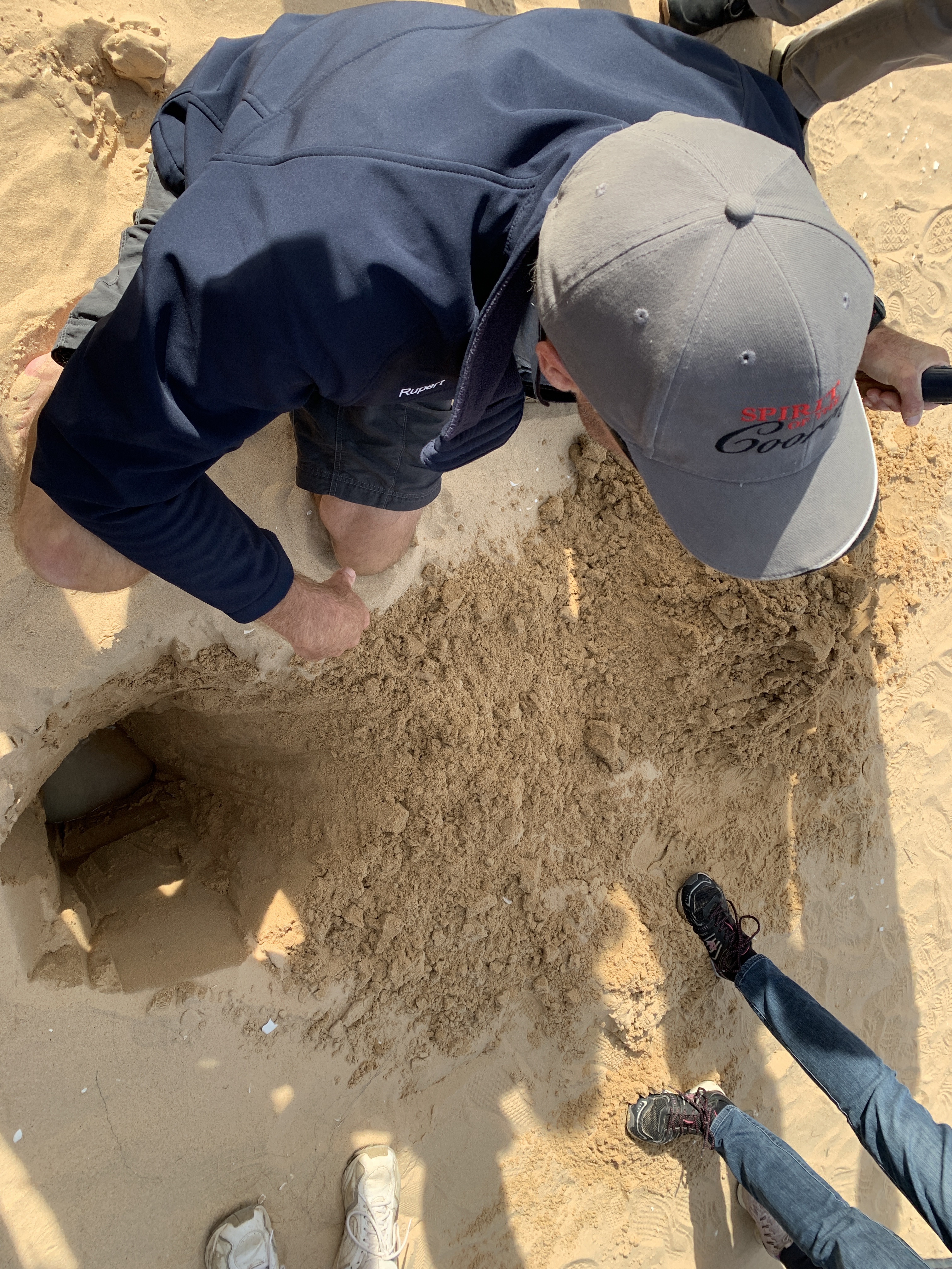
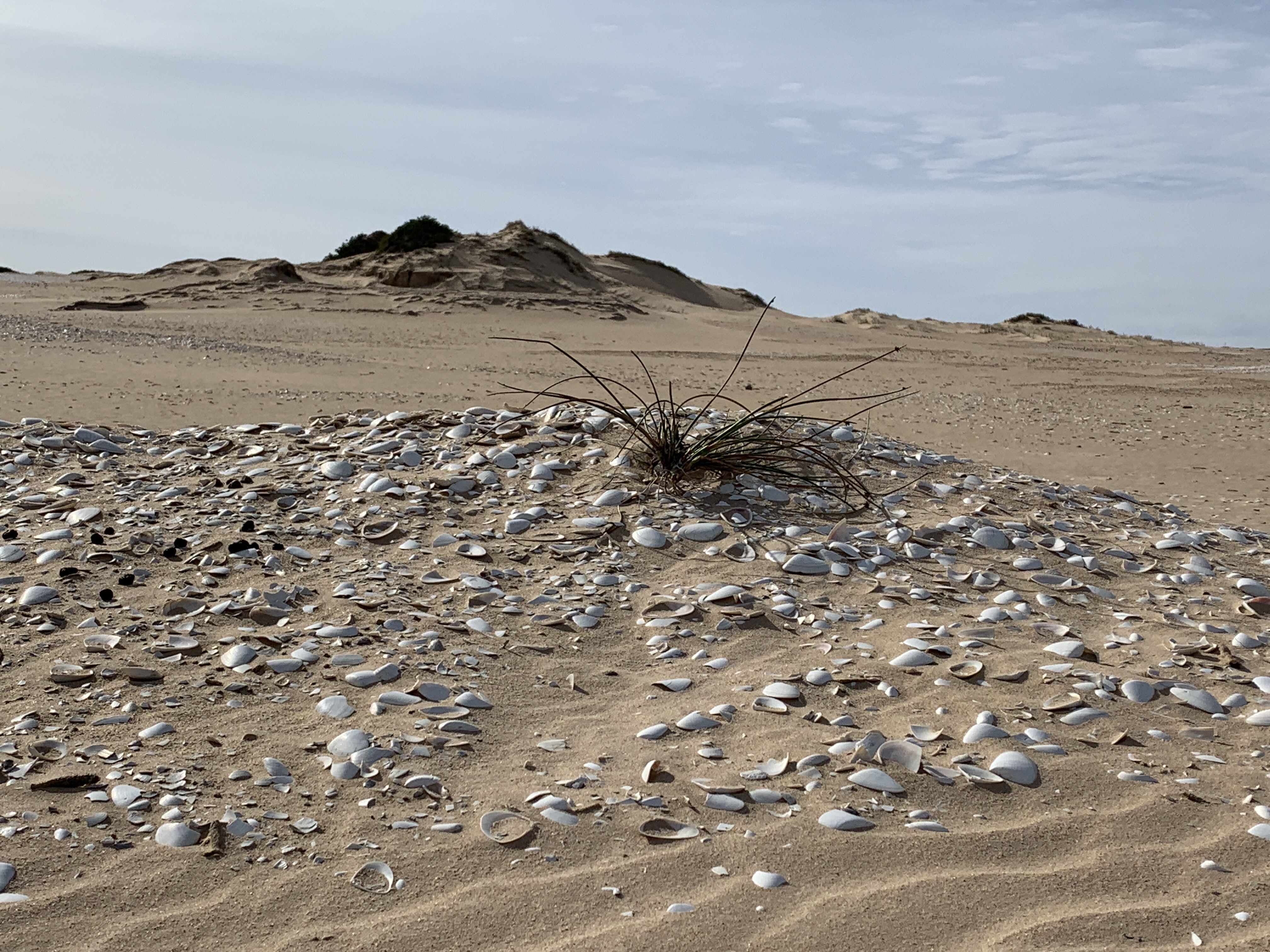
Our next stop was at Cattle Point where our guide this time was Skipper Rupert. We crossed the very high sand dunes and came to a huge wide area covered in broken shells. It is an Ngarrindjeri midden site and has obviously been used by them for thousands of years. We found blackened rocks that are not local to the area and these would have been traded for by the Ngarrindjeri to use for their fires. They were particularly good at basket weaving and would probably have traded baskets for these rocks. The local rocks are no good for fires as they just disintegrate.
Rupert pulled a spade from out of the bushes that he’d left here previously and began to dig a hole in the sand. He only dug down about 600mm when the bottom began to fill up with water. Surprise surprise, the water is fresh. Here we were on sand dunes between the Southern Ocean on one side and the salty waters of the Coorong on the other and here was fresh water. Under the sand dunes is what’s called a lens. This is a water storage area for rainfall and it’s fresh water. So the Ngarrindjeri people really did have all they needed right there. Plenty of food in abundance and fresh water too.
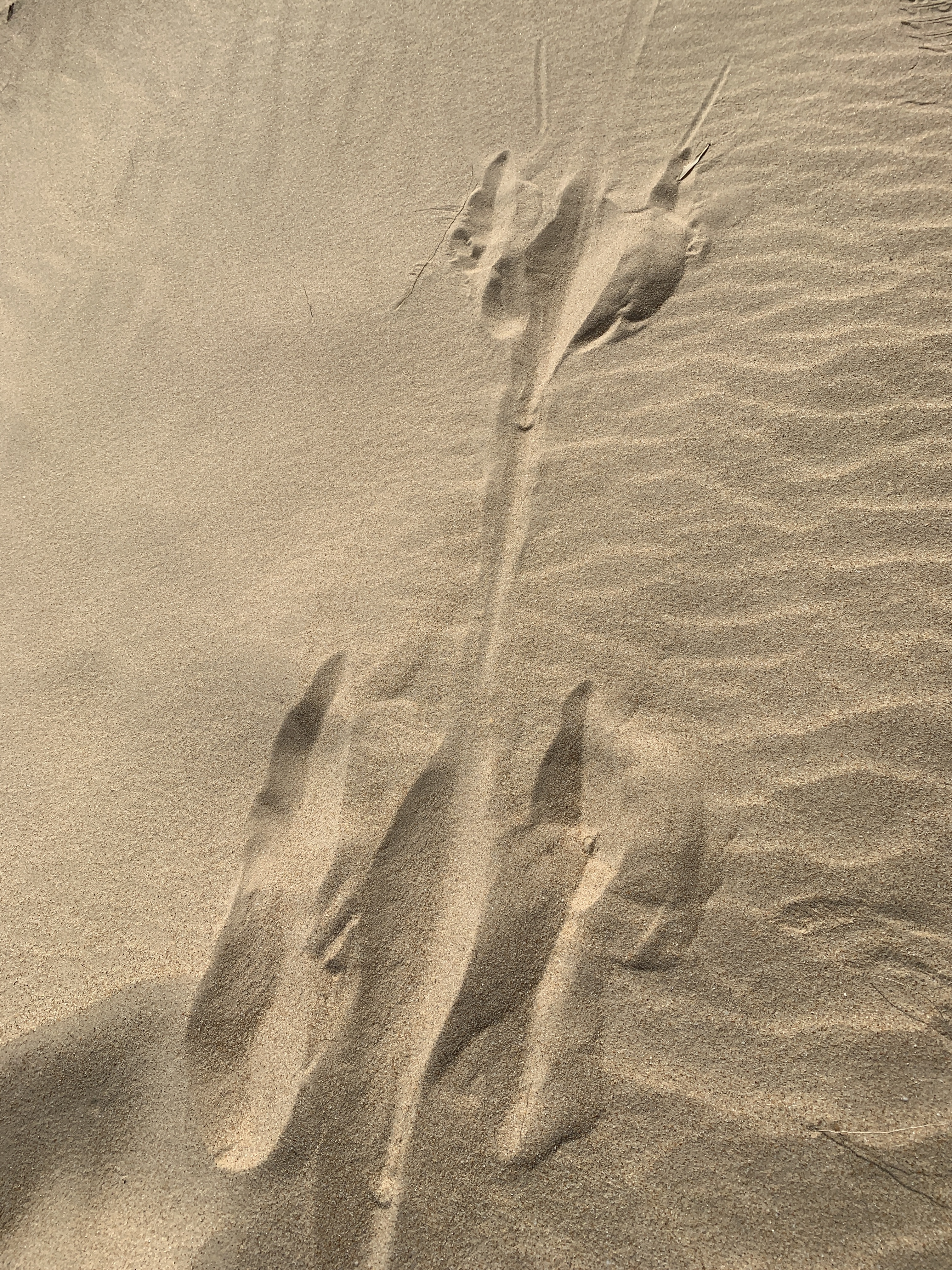
We found lots of animal tracks across the sand but the most disturbing ones were deer tracks. Wild deer have invaded the park and their numbers are increasing as they have no natural predators. They are becoming such a feral pest all across our country.
On our walk across the sand dunes at one point all you could see was sand and I thought I’d been transported to Egypt!
Back on board and we’d earn our afternoon tea all prepared for us by Jack while we were on our walk. A delicious slice and a cuppa was much appreciated by all.
It was a quieter trip on the way back to Goolwa with less chatter from the passengers. The walk had tired out quite a few. Back past the mouth of the Murray, back through the lock at Goolwa Barrage and eventually back to the wharf in Goolwa.
What a fabulous day out. We thoroughly recommend this tour if anyone is down this way. We felt it was great value for money at $118 per person for Seniors. The Skipper, Rupert and Crew, Jack, were friendly, knowledgeable and aimed to please. The Spirit of the Coorong is a comfortable boat with lots of seating inside and some seating upstairs outside. The only thing to be wary of is there are steps and stairs so for anyone with limited mobility it might be a challenge. You also need to be able to walk in sand up and down sand dunes. Good walking shoes are essential.
We camped at the Big4 Breeze Holiday Park in Port Elliot on a powered site. The cost for this was $40 per night. The park is a very large spacious one with lots of flat grassy and sandy sites. It has direct beach access to two beaches with the small Crockery Bay on one end and the larger Horseshoe Bay on the other side. This park has all the usual Big4 amenities such as a large children’s playground including a jumping pillow. There is an excellent Camp Kitchen with very clean stainless steel BBQ’s and a vegetable garden with lots of herbs for guests to pick and use. The park has some cabins and lots of shady trees. We don’t usually stay in caravan parks however we would recommend this one, although it would probably be packed in the school holidays.
Port Elliot is situated on Horseshoe Bay. A port was established here to provide a safe seaport for the Murray River trade which terminated at Goolwa. The mouth of the Murray was considered too treacherous and unpredictable for safe passage so goods and passengers were transported between Goolwa and Port Elliot on the first public railway built in Australia in 1854.
The railway was extended to Victor Harbor in 1864 after a number of disastrous shipwrecks in Horseshoe Bay and Victor Harbor provided a safer port.
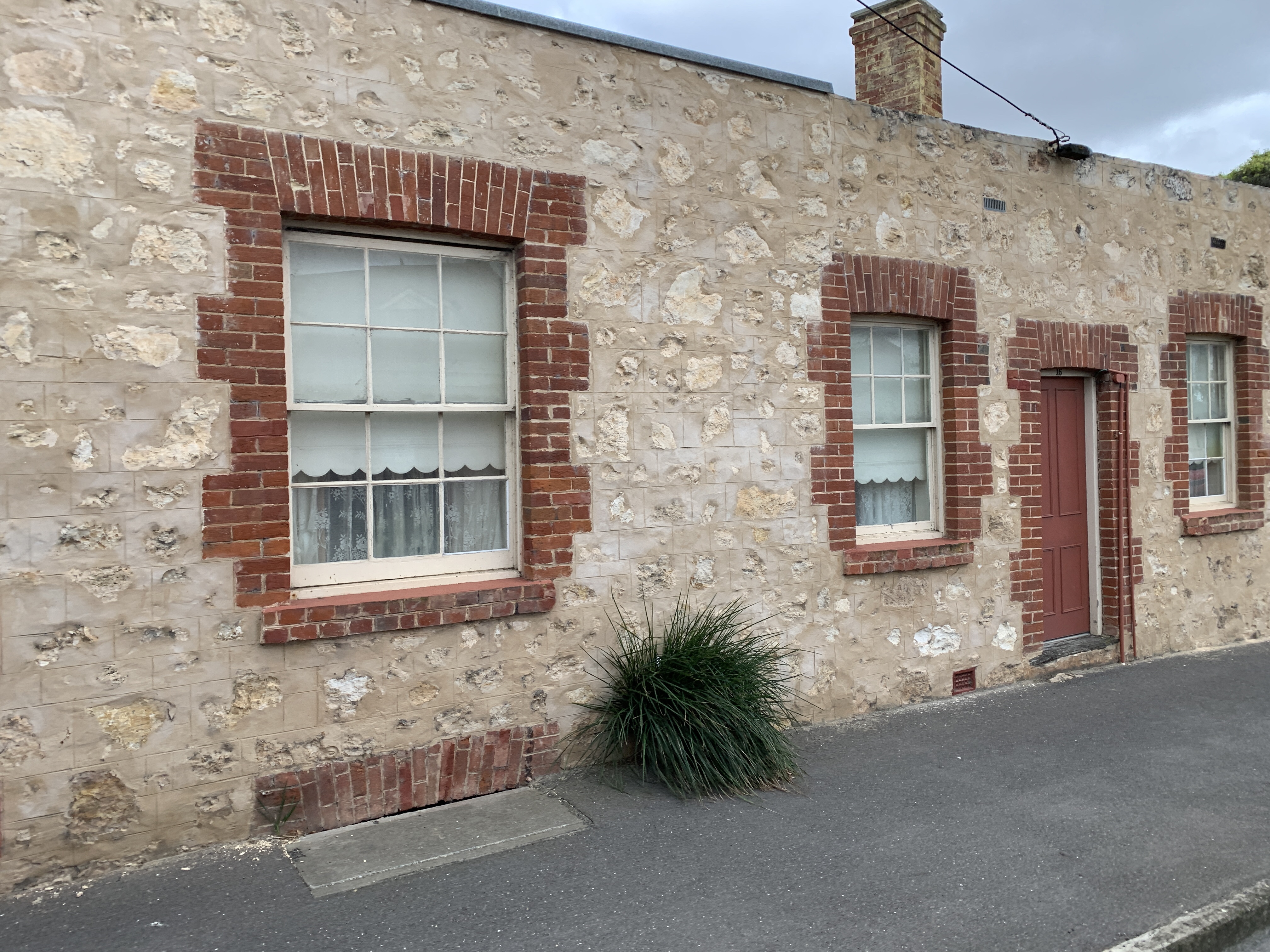
Today Port Elliot is a quiet town, home to many ‘sea-change retirees’ and is a popular holiday destination for Adelaide dwellers with the main attraction being that beautiful big beach. I love these little old historic towns with their mix of historic stone buildings amongst the modern ones.
Port Elliot
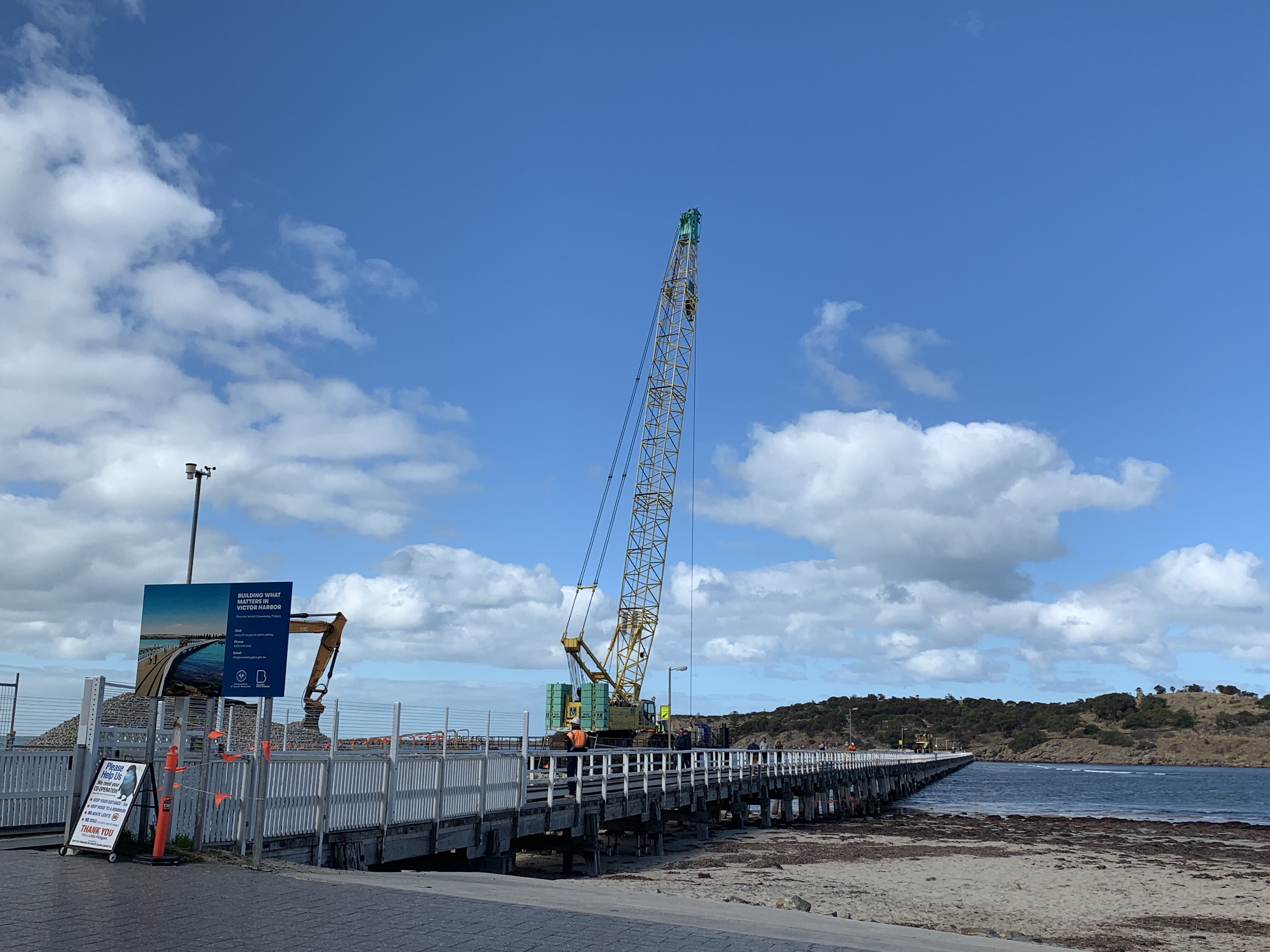
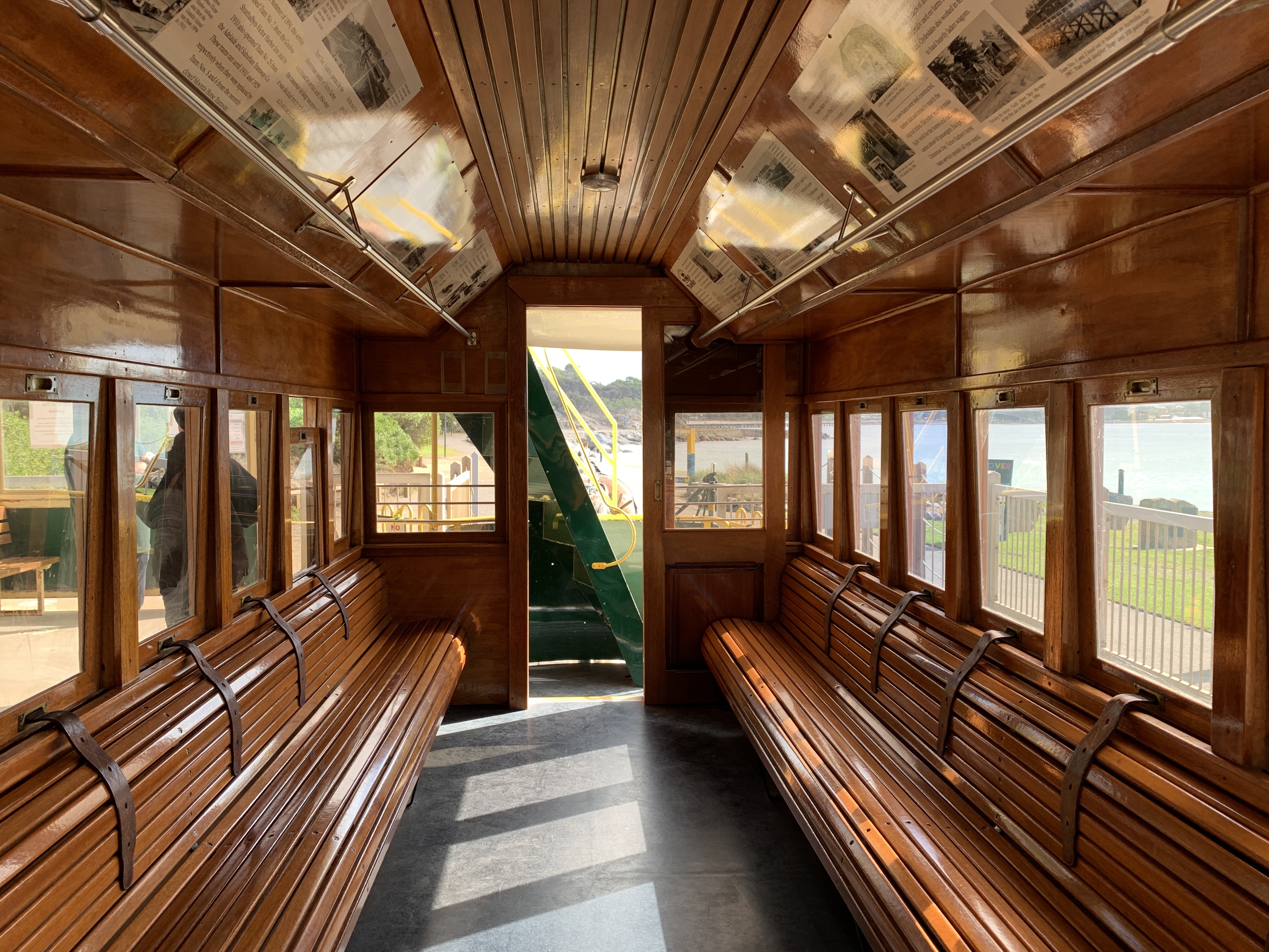
Only a few kilometres further along the coast is the historic Victor Harbor. Another beachside town with spectacular beaches. A highlight of a visit to ‘Victor’ is a ride on the Granite Island Tram. This is a horse drawn tram that takes passengers across the timber causeway to Granite Island. A Clydesdale horse pulls the historic tram and we thoroughly enjoyed our ride. We sat up the top in the sunshine and listened to those huge feet clopping along.
The timber causeway was built in 1875 and the tram went backwards and forwards transporting goods from the railway from Goolwa out to the waiting ships at Granite Island. By the1880’s 25,000 bales of wool were being transported down the Darling, Murrumbidgee and Murray Rivers by paddle steamers then by train from Goolwa to Port Victor and from there by ship around the world. As the river trade ended the Victor Harbor tram became a passenger tram and has been ferrying holiday makers to and from Granite Island since1894.
A huge redevelopment of the causeway is currently underway with a new causeway being built alongside the old timber one which will eventually be removed. I’m glad we got to ride across the old timber one while it was still there.
Granite Island is home to a colony of Little Penguins although a very bad storm a couple of years ago decimated the colony. Numbers are slowly growing again and you can do an evening tour to view these charming little creatures. Granite Island is 62 acres of huge granite boulders, many tinged with orange lichen. There are walking trails and a Sculpture Walk includes 10 sculptures. We saw one of those of a sea lion from the tram as we clopped along. It looked like a real sea lion lying on top of a boulder. Between May and October Granite Island is a popular spot for whale watching. Southern Right Whales are a common sighting. Camping is not permitted on the island nor are dogs allowed due to the Little Penguin colony.
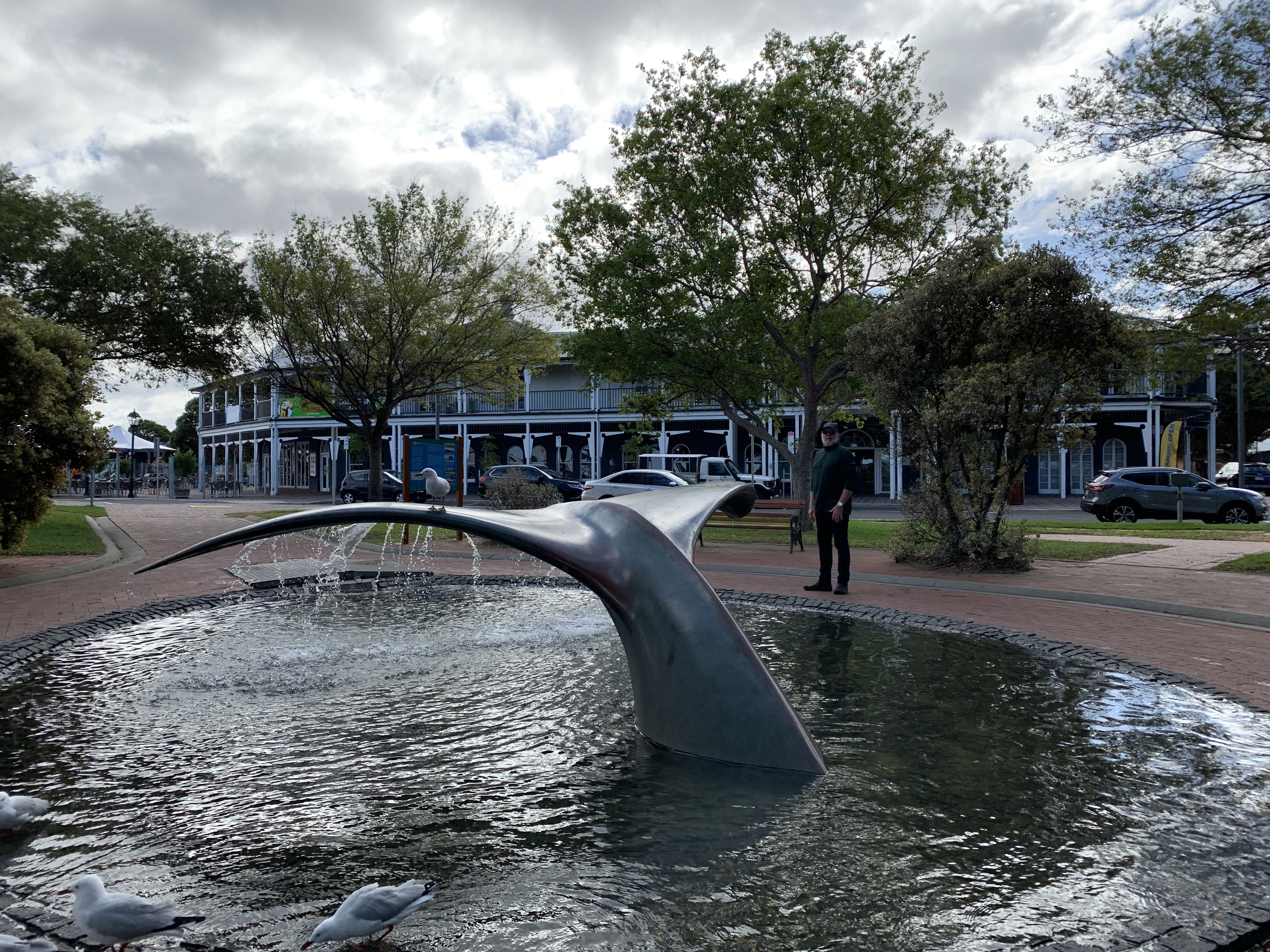
The centre of Victor Harbor also houses other historic buildings such as the Railway Goods Shed built in 1864 and Customs House which is now a National Trust Museum, built in1866. In the park nearby is a large water feature that includes a sculpture of a whale tail. The busy Main Street has been pedestrianised and houses the usual stores. We stopped for lunch at a popular Victor Harbor icon Nino’s Cafe and we were not disappointed with our lovely lunch. Nino’s Cafe has been dishing up delicious meals since 1974.
We ended our day by traveling back to Hindmarsh Island where we found a camp at the Hindmarsh Island Caravan Park for $25 for a flat, grassy powered site. We only have a short distance to go across the bridge to the Goolwa Wharf in the morning to catch our cruise of the Coorong.
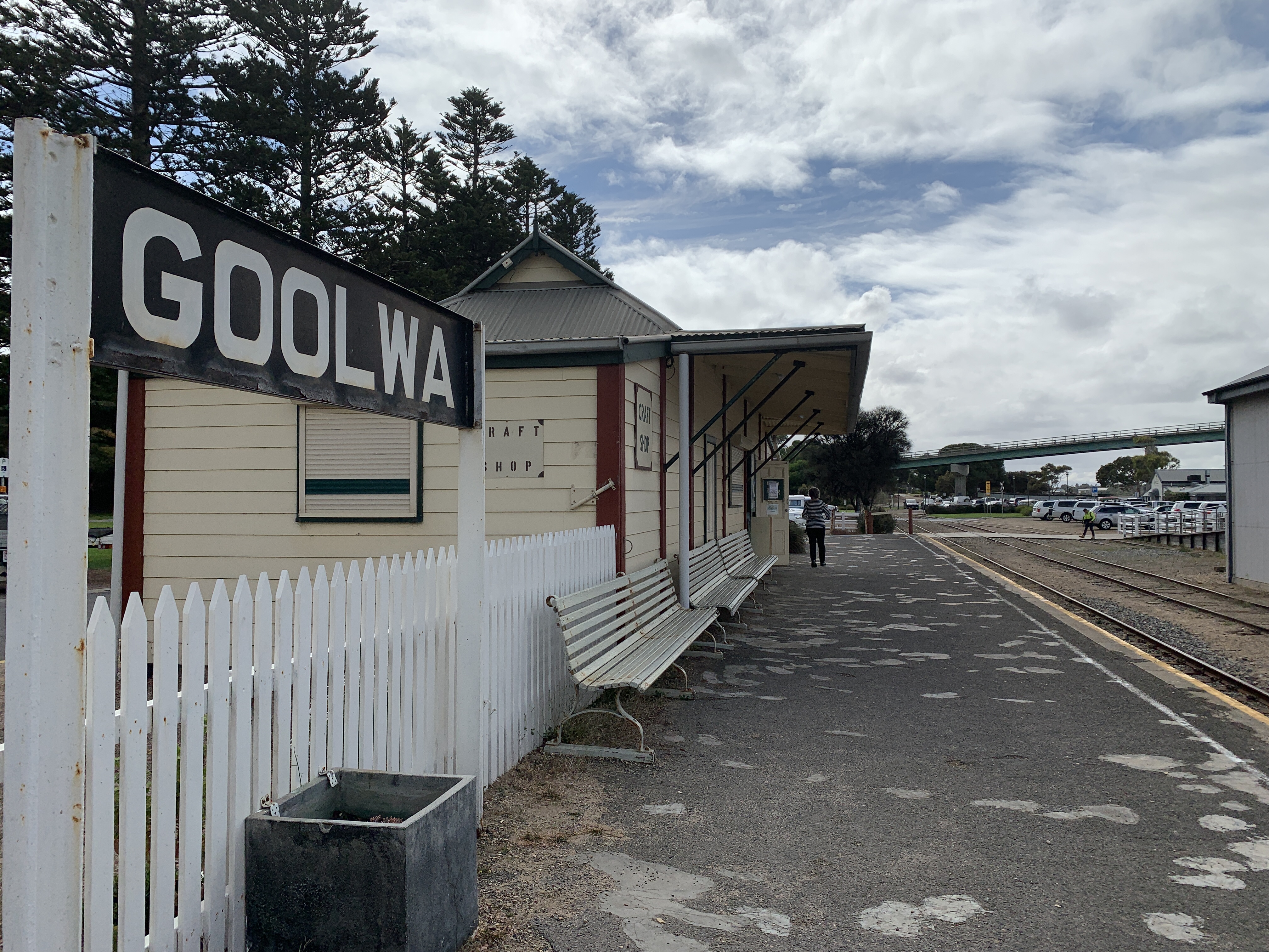
The historic river port of Goolwa began life as Goolawa, an Aboriginal word meaning elbow or bend. Goolwa was first settled by white men in 1841 and proclaimed a River Port in 1857. Goolwa was the centre for transport and trade between South Australia and the eastern colonies. The town is situated on both fresh and salt water as it is the last town on the river before it meets to sea.
Goolwa was the very first port on the Murray River and the first to engage in shipbuilding and repairs. Goolwa has another couple of firsts including the first public railway in Australia built between Goolwa and Port Elliot in 1854 and the first yacht club in Australia was established in Goolwa in 1854.
Goolwa was once an option to be the capital of South Australia and was the first Australian town to be granted Cittaslow status in 2007. Cittaslow is an organisation founded in Italy and inspired by the slow food movement. Its goals include improving the quality of life in towns by slowing down its overall pace especially in the use of spaces and the flow of life and traffic through them.
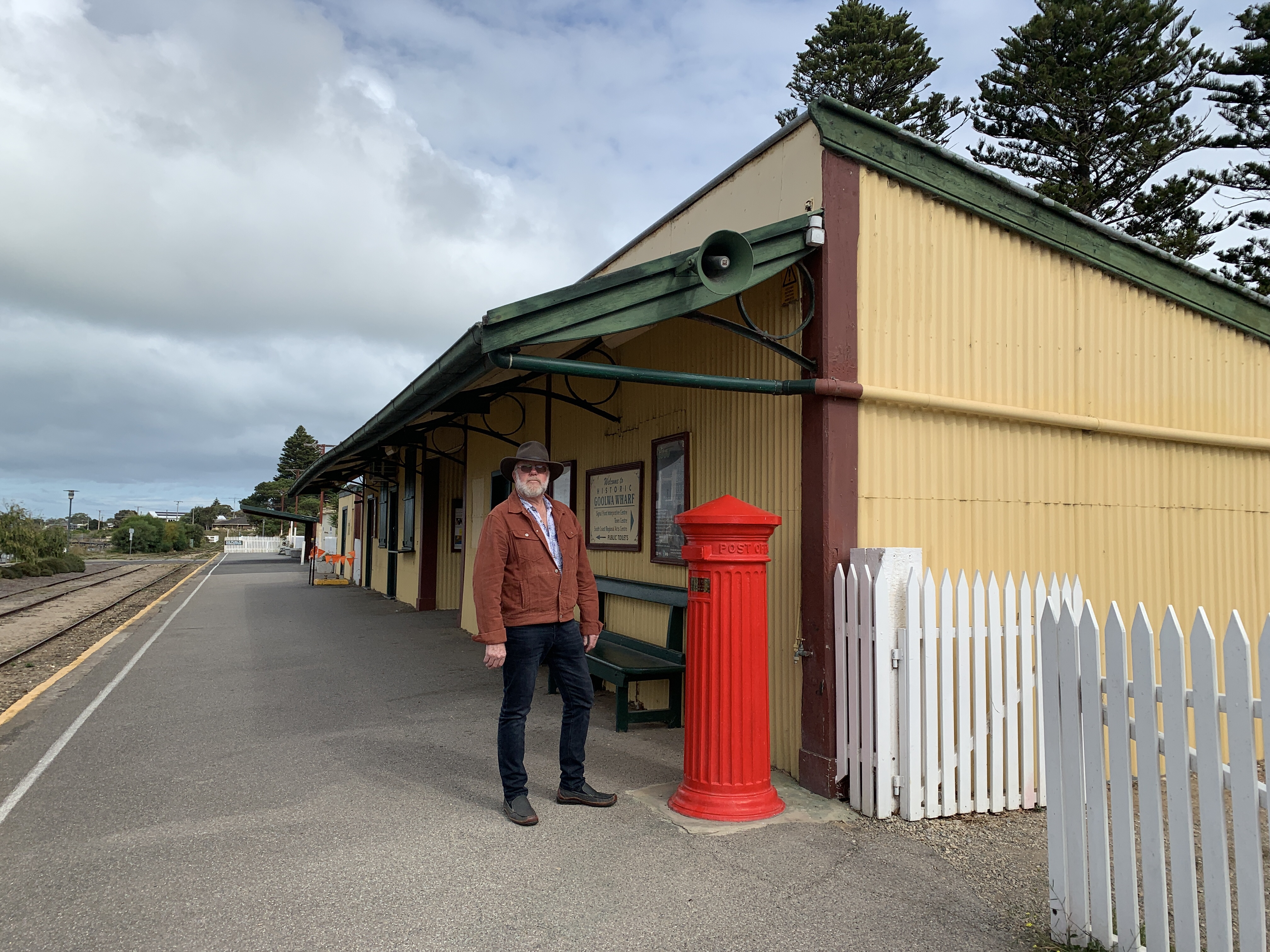
The historic Goolwa Wharf precinct provides great views of the Murray River and the Hindmarsh Island Bridge towers above. From the wharf you can ride a paddle steamer, take a cruise through the Coorong and learn more about the river trade at the Goolwa River Boat Centre. You can watch heritage trains go by or sample a drop at the brewery or wine at the cellar door. There is also a great looking cafe however it is closed on Mondays and Tuesdays.
The wharf is the home mooring for the historic paddle steamer the PS Oscar W built in Echuca in 1908 and it regularly takes visitors on 1 hour cruises up and down the river as it chugs along.
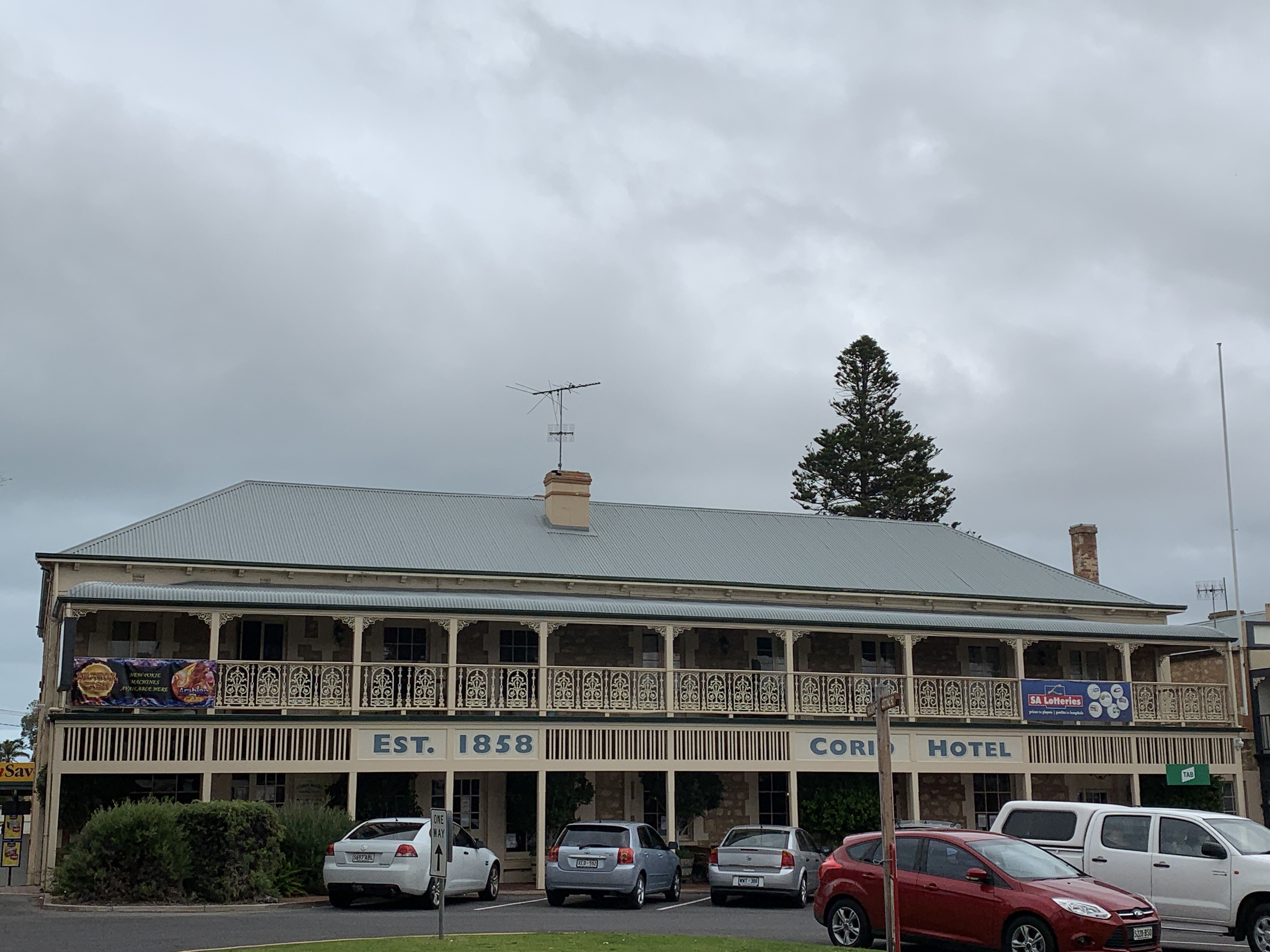
Not far from the historic Wharf Precint is the Goolwa Visitors Centre and right next door is the RSL Club which is housed in the historic Goolwa Railway Horse Stables building. It was built to house the railway horses in 1862 by local builder William Ray who had also constructed the Corio Hotel across the road in 1857. Horses were only used up until 1885 when steam locomotives had taken over and all the horses, tack and harnesses were sold. The building was purchased by the RSL in 1946 and renovated to become the current RSL Club.
On the other side of the road is another piece of history in the Goolwa Customs House built in 1859. William Ray was again the builder. It is a lovely stone building complete with offices and a residence. The Customs House was the chief collector of revenue for the government right up until 1894. The buildings were later used as the residence for the Railway Stationmaster and since 1983 has been owned by the local community.
We spent a couple of hours exploring this lovely part of Goolwa and have booked a 6 hour cruise, including lunch, on the Spirit of the Coorong to learn more about this amazing part of the world.