Uluru cycling and spectacular sunset

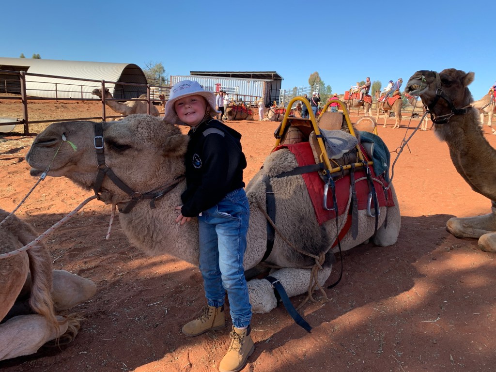
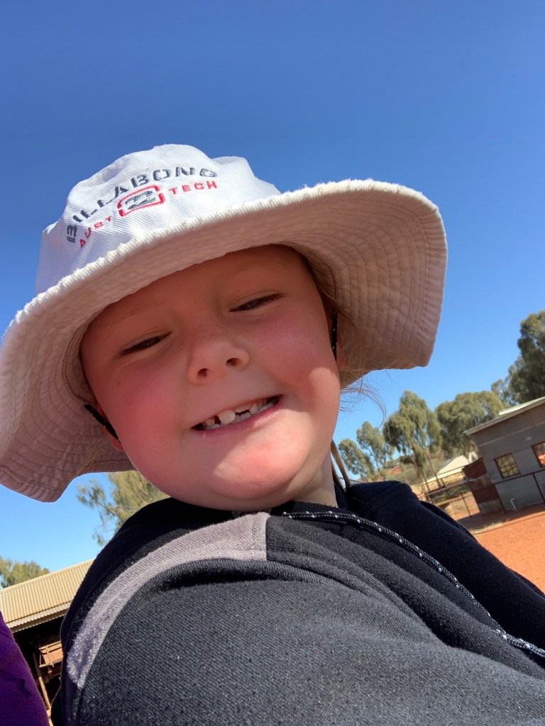
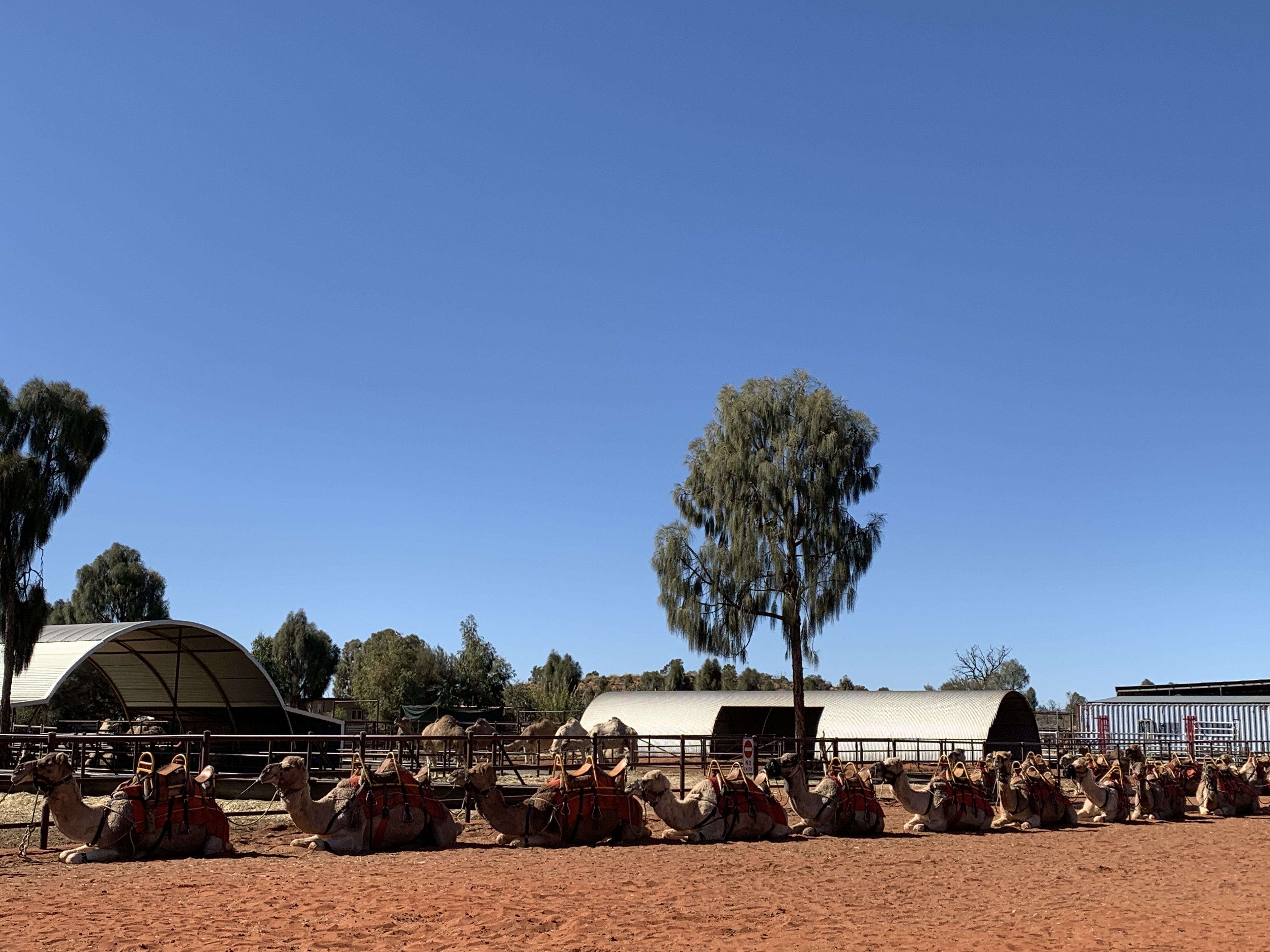
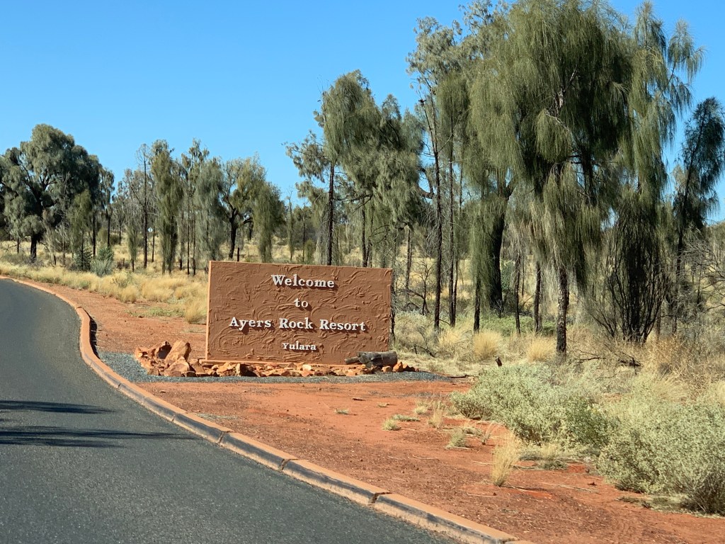
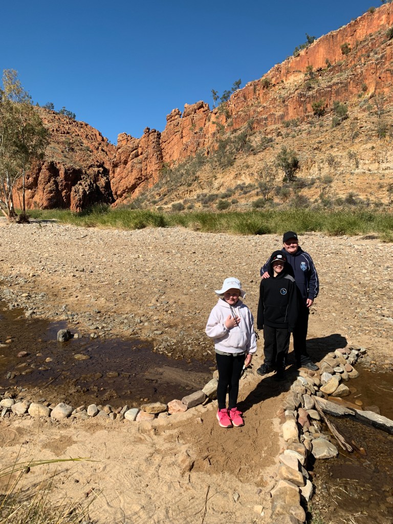
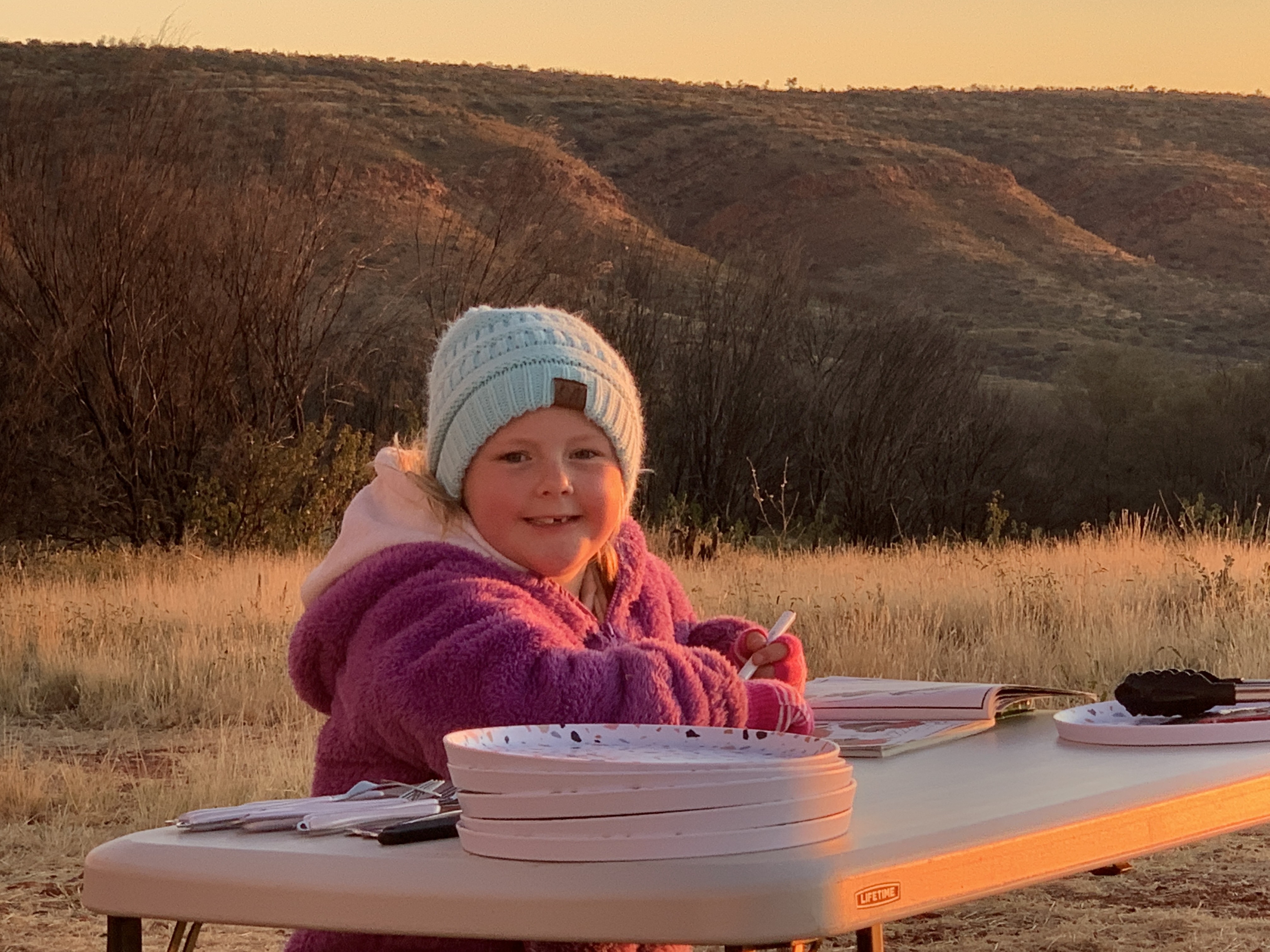
Are we having fun at Yulara? You bet we are!

An early start was needed for our cycling around the rock adventure. We had to be out at the Cultural Centre at Uluru before our booking at 9am. We set off from the campground about 8.15am with our backpacks full of water and snacks. Sadly, we were without Katie though. She had a tummy bug and didn’t feel it would be a good idea to do the ride. We thought we’d ask when we got there if we could change the day for our booking.

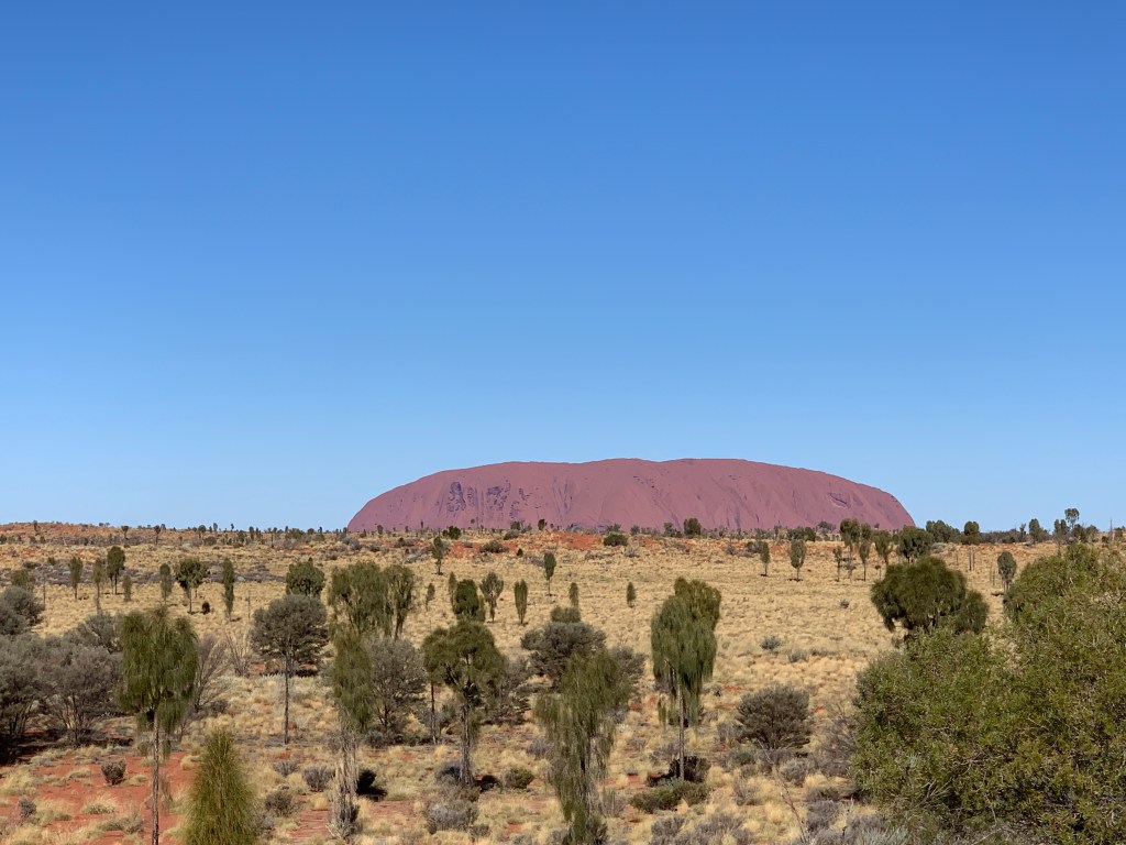
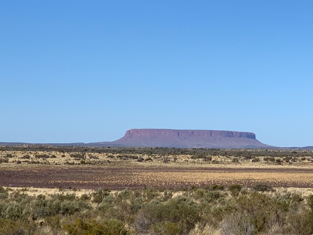
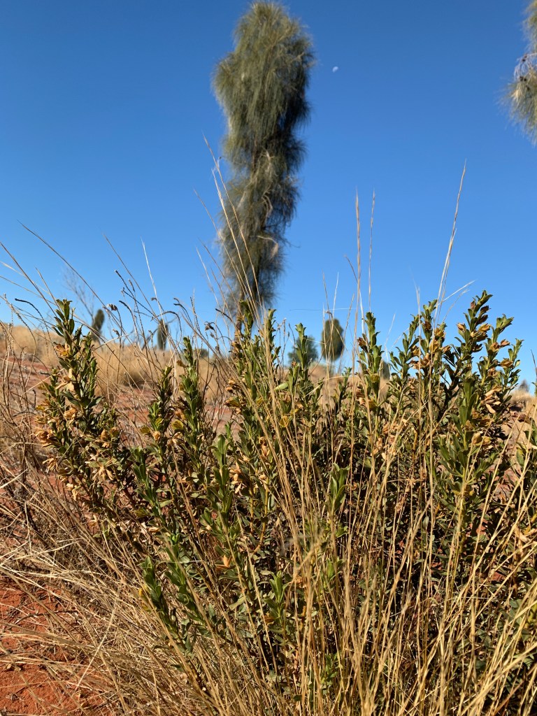
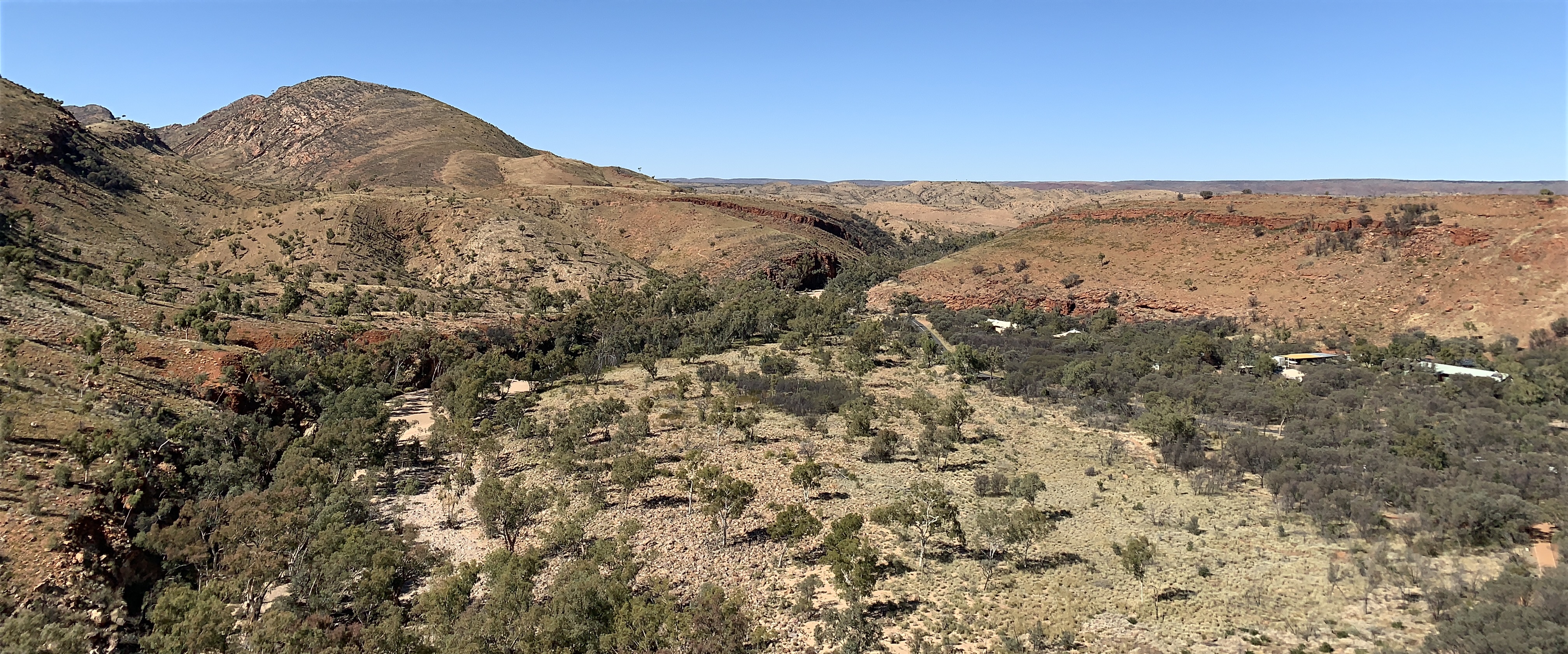
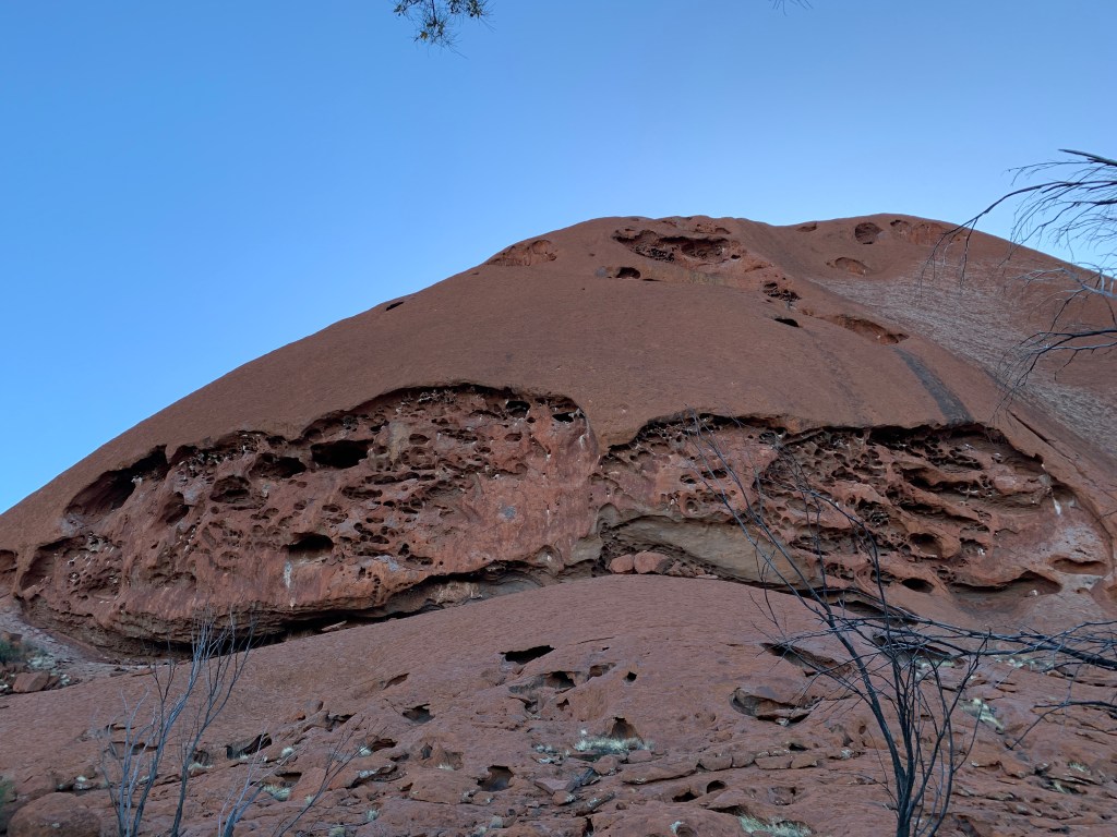
Heading out towards the rock early in the morning and the colour of the rock is very different. It looked really brown in the morning light.

Uluru early in the morning

We arrived in plenty of time and checked in at Cycle Uluru. We did ask if we could change our booking however they had no kids bikes available for any other day so we had to do our ride without Katie. Oh well, c’est la vie!

After choosing bike helmets and being allocated our bikes, a guide gave us a quick safety briefing and sent us on our way. Basically the safety briefing was there are two toilet blocks, one at The Cultural Centre and one at the Mala Car Park. Cyclists are to ride to the Mala Car Park then follow the cycling signs so you are going in an anti-clockwise fashion around the rock. All cyclists are to give way to pedestrians. That was about it!

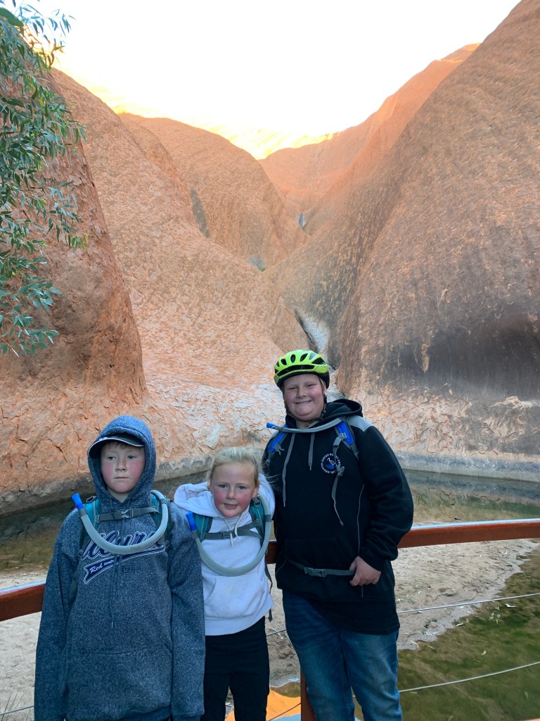
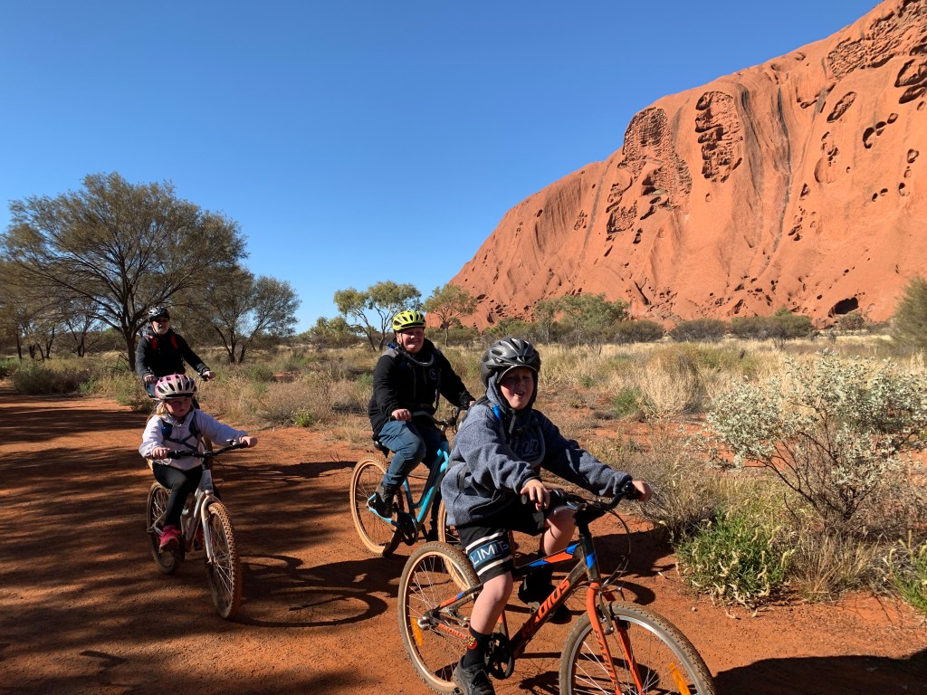
We set off with three young people all very excited to be finally cycling around the rock. We’d talked about doing this for such a long time now we were actually doing it.

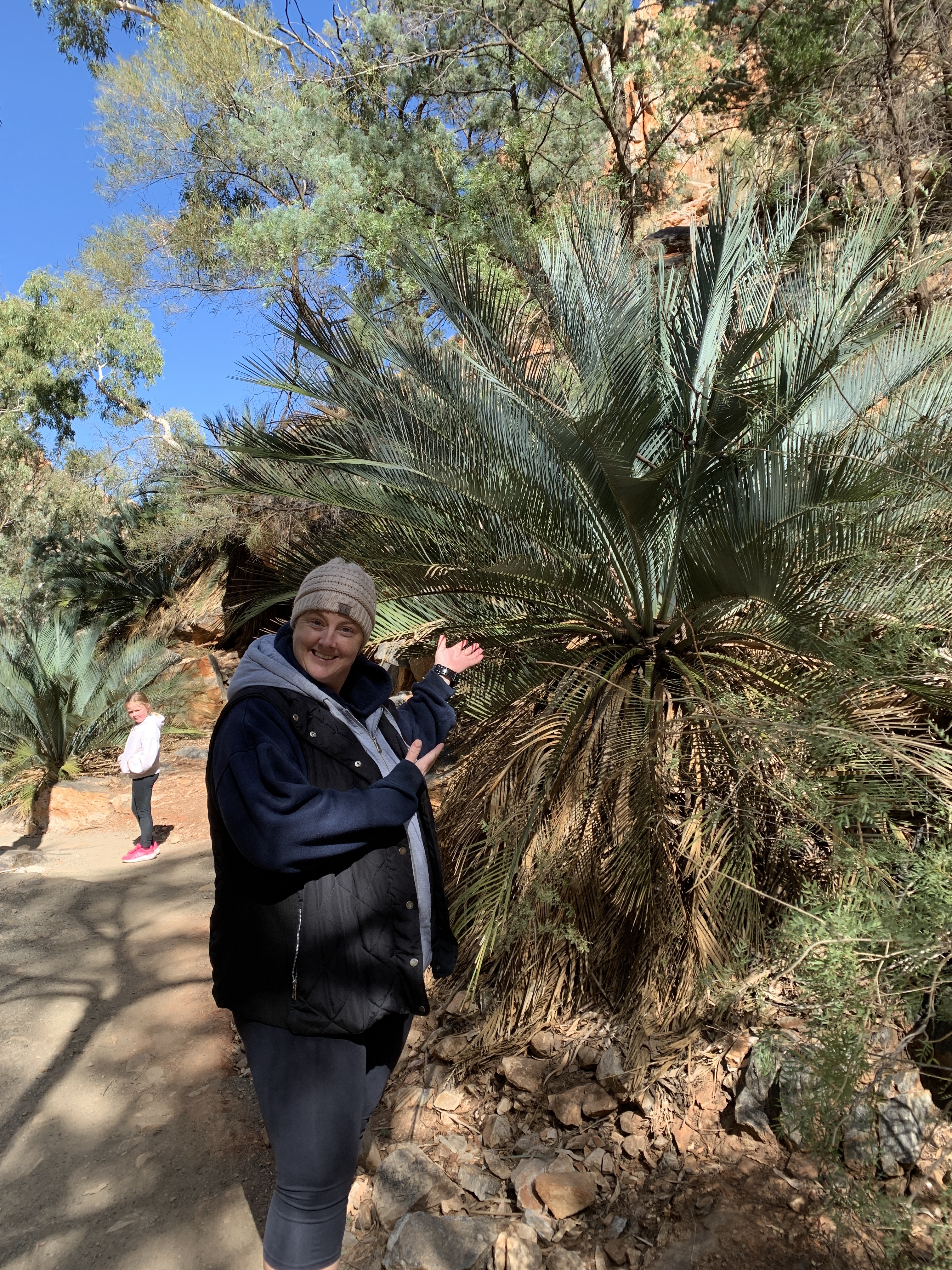
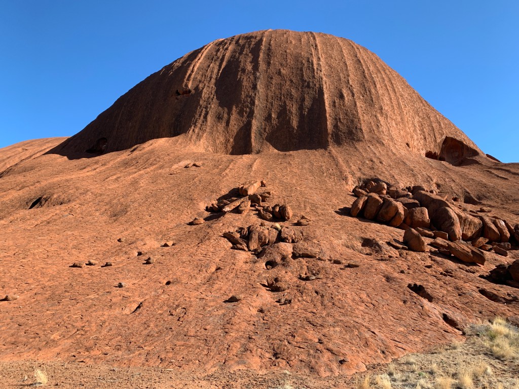
It was a chilly morning and the first part of our ride around was in the shade so it was quite cool. The kids were very excited when we arrived at a part where you could touch the rock. Actually touch it!

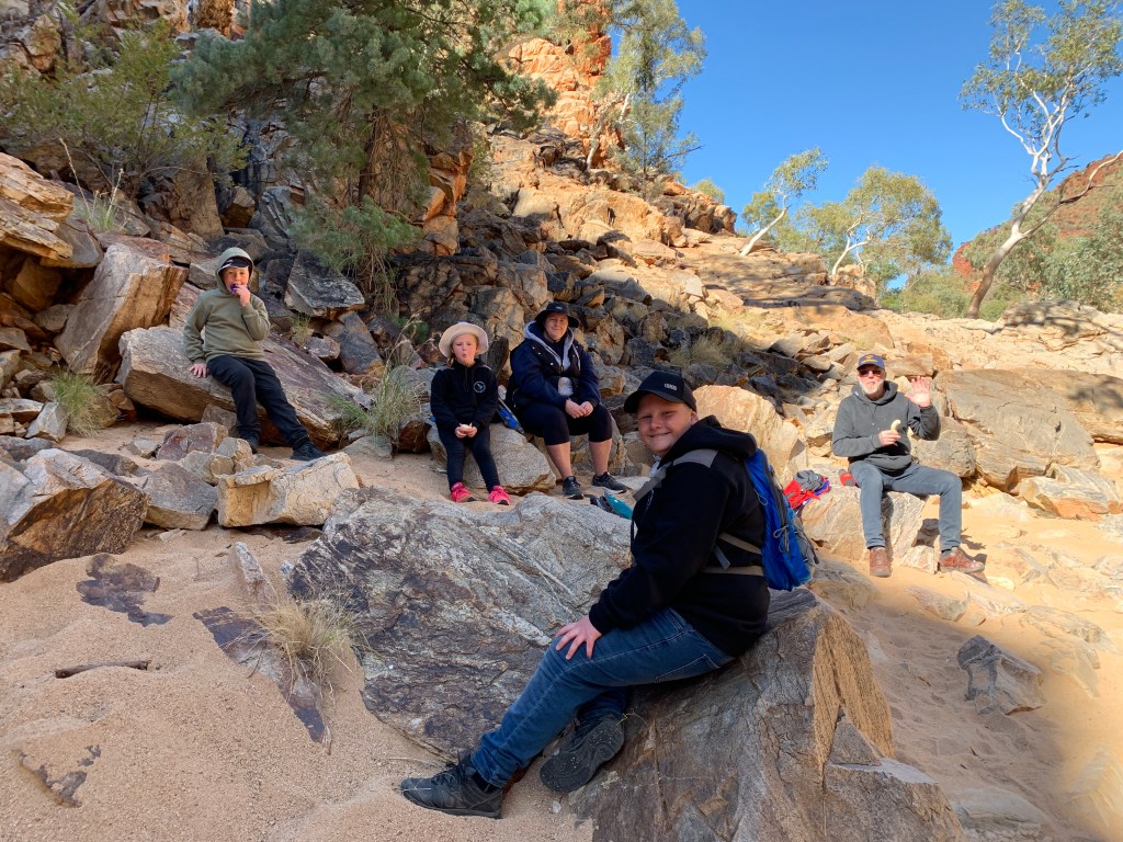
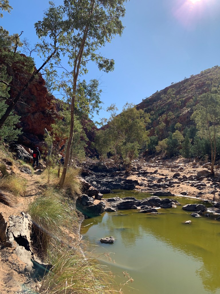
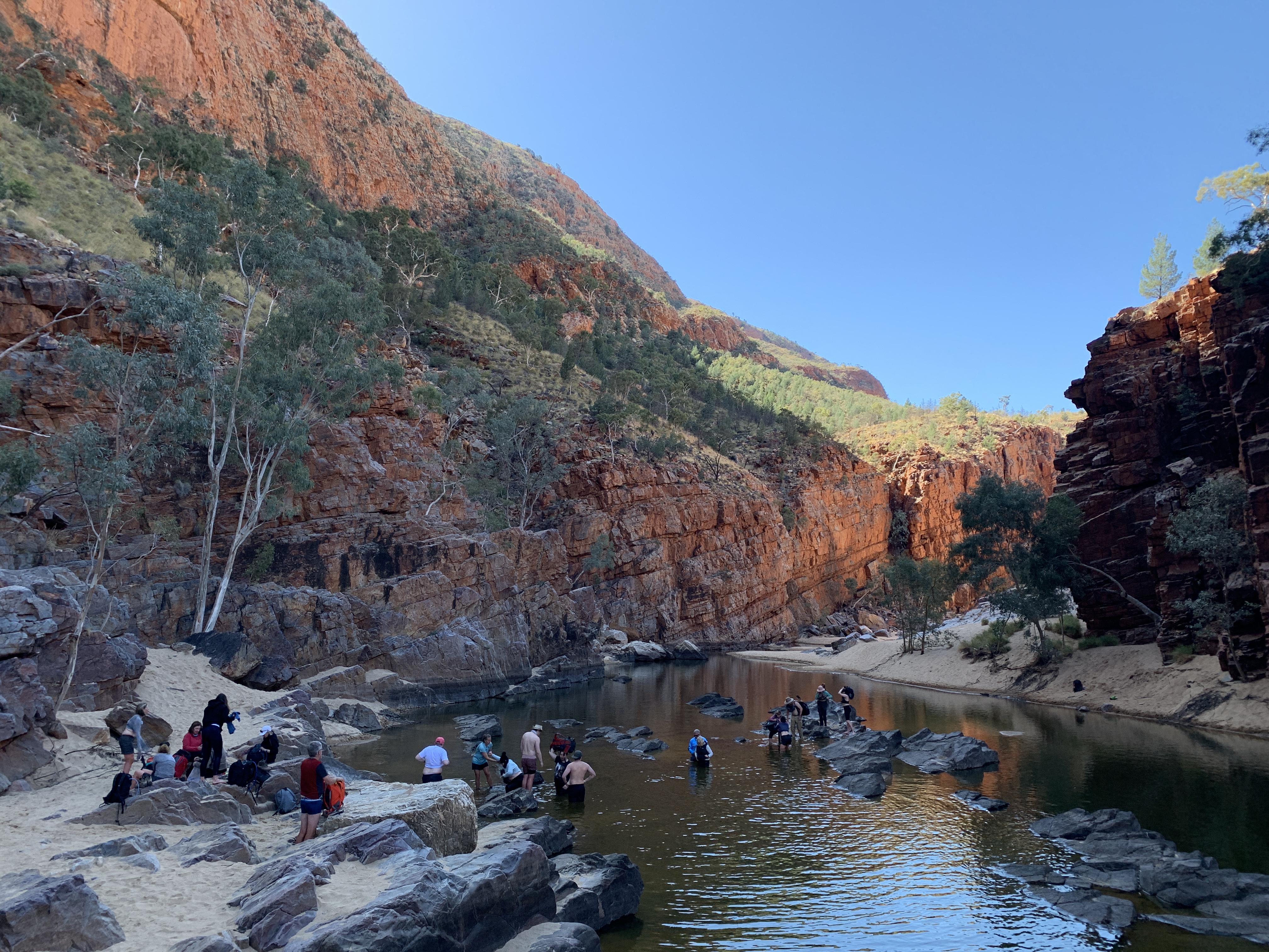
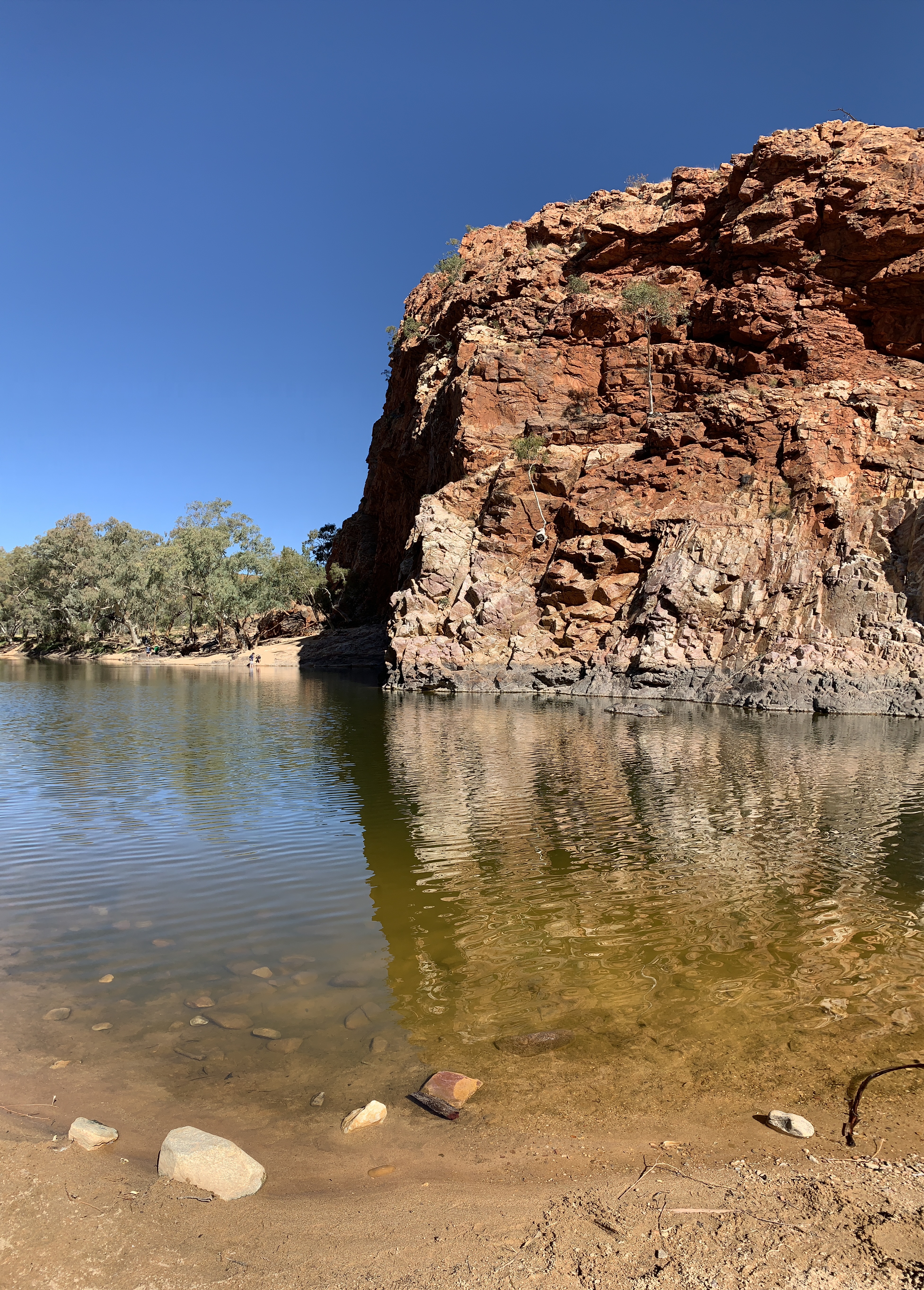
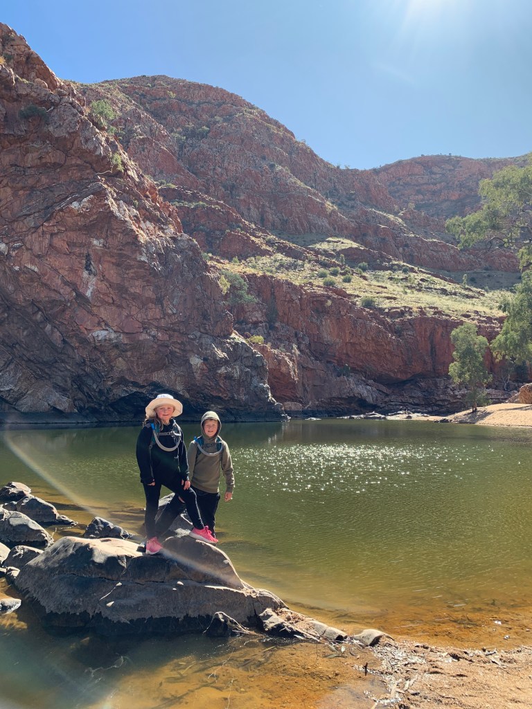
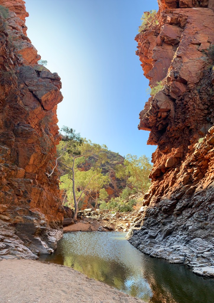
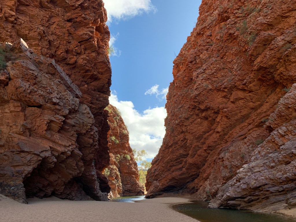
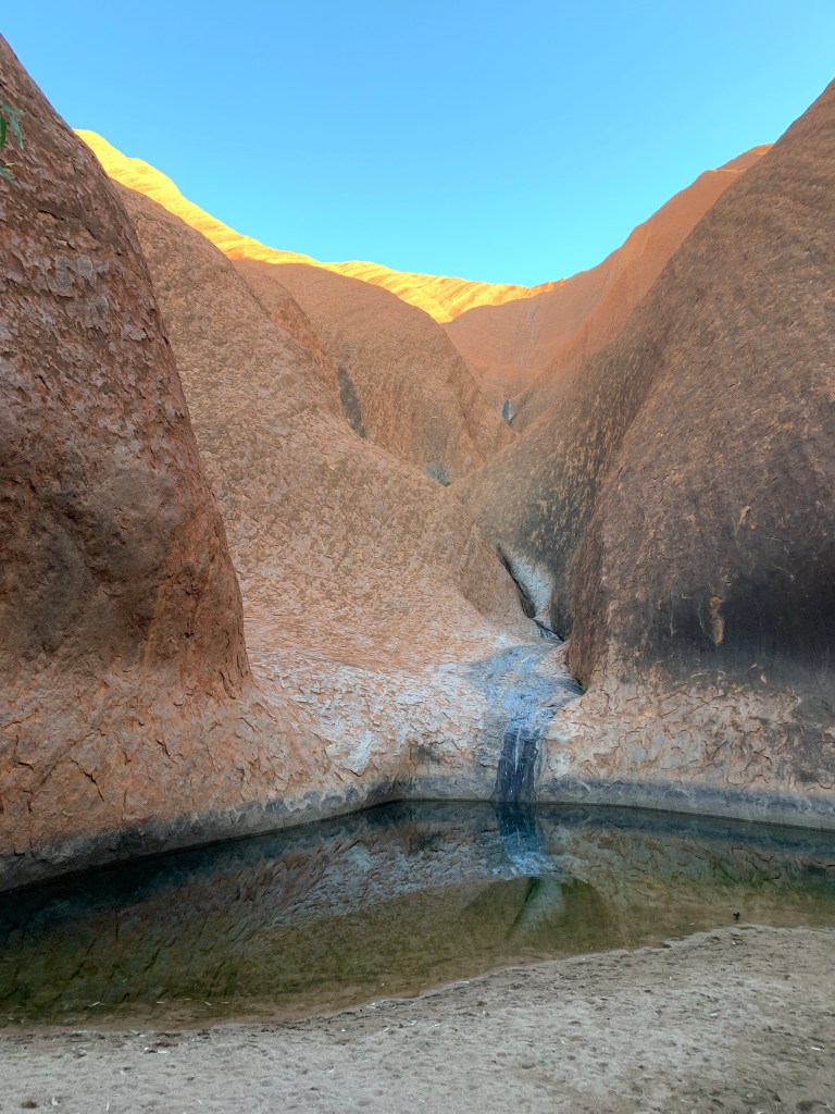
We stopped along the way to check out Muṯitjulu Waterhole, one of the most reliable waterholes around the rock. There are small caves there where Aboriginal men would have hidden while they kept their eye out for game that came to the waterhole to drink.

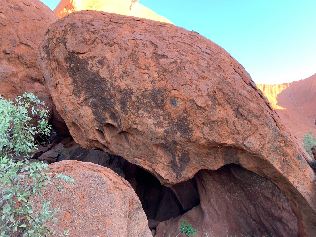
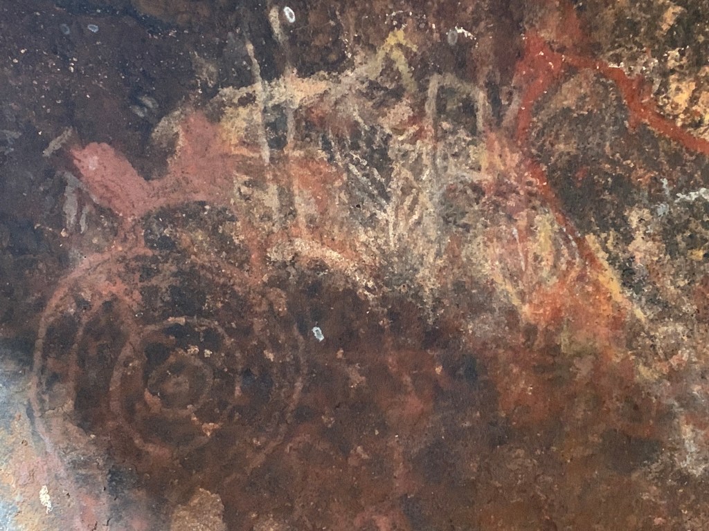
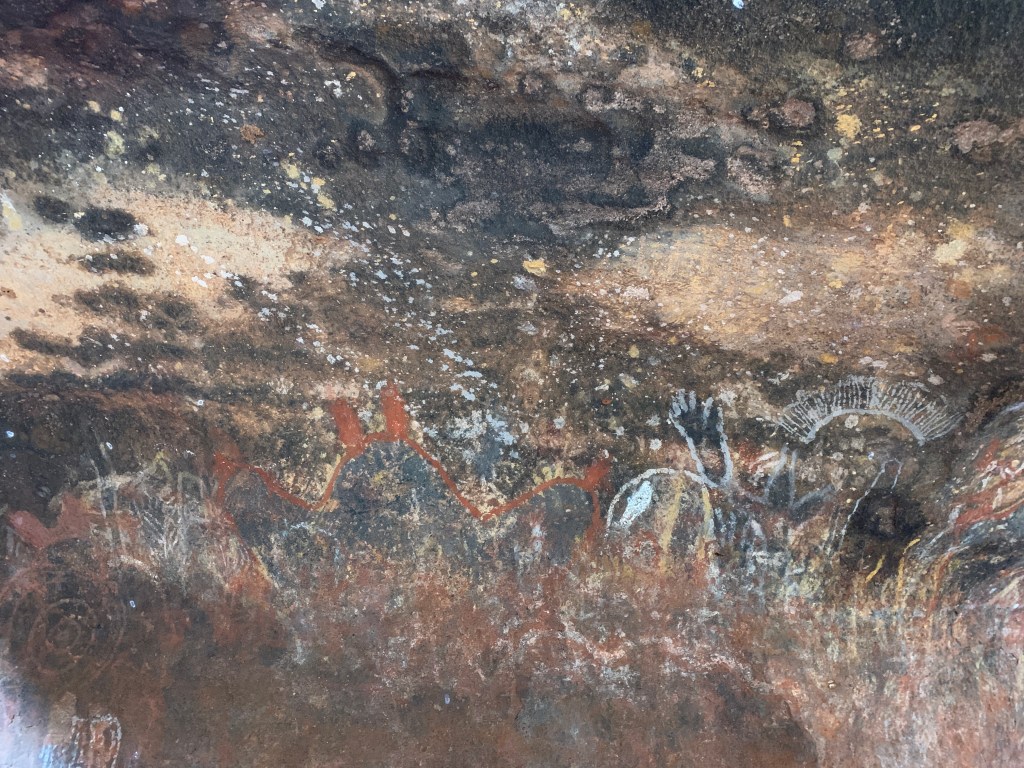
Further on we came to Mutitjulu Cave and checked out the old rock paintings. This would have been a place where people camped and used the rock paintings to tell stories. These stories are still being taught to young people to this day.

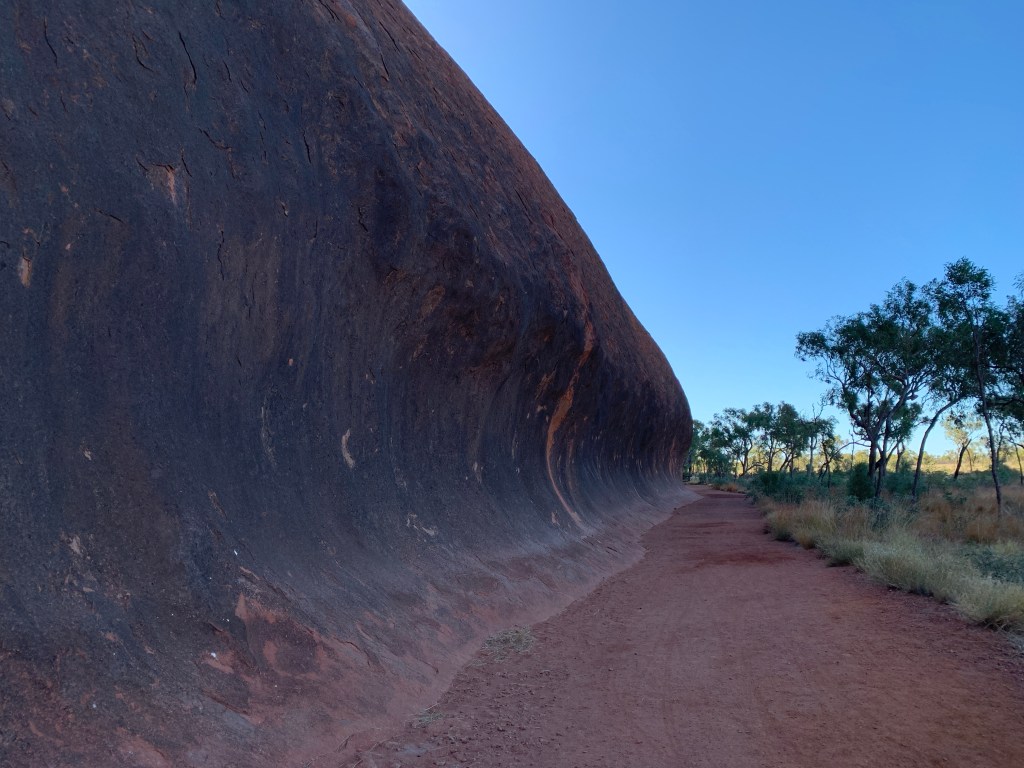
We stopped again at ‘wave rock’ and it’s a bit hard to tell from the photos just how big the ‘wave’ is.

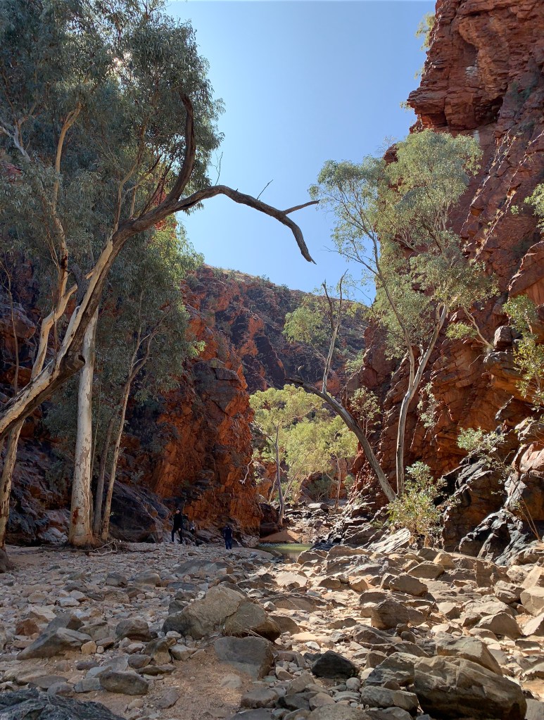
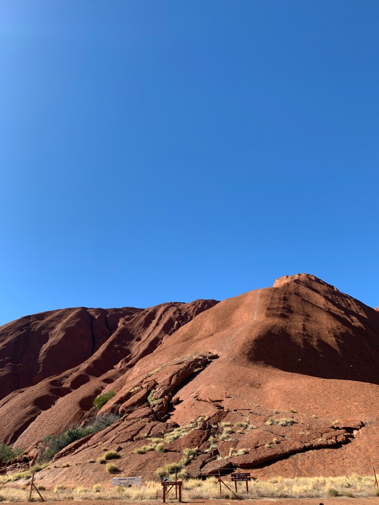
The winding red gravel path is mostly wide enough for two people to walk side by side and follows around the edge of the rock for most of the way. By about half way around we finally came out into the sun and this helped to warm us up a bit.

It’s very hard to describe how huge the rock is. At one point I stopped to take photos and the whole rock wouldn’t fit in. I tried doing a panorma but I’m not very good at those!

The Base Walk is 10.6km all the way around and we had three tired little people by the time we made it back to the Mala Car park. We’d done it! We’d cycled around the rock. It had taken us 2 hours. Not speedy I know, but we did stop a lot. You just have to stop to look at the rock and take it all in.

We made it!

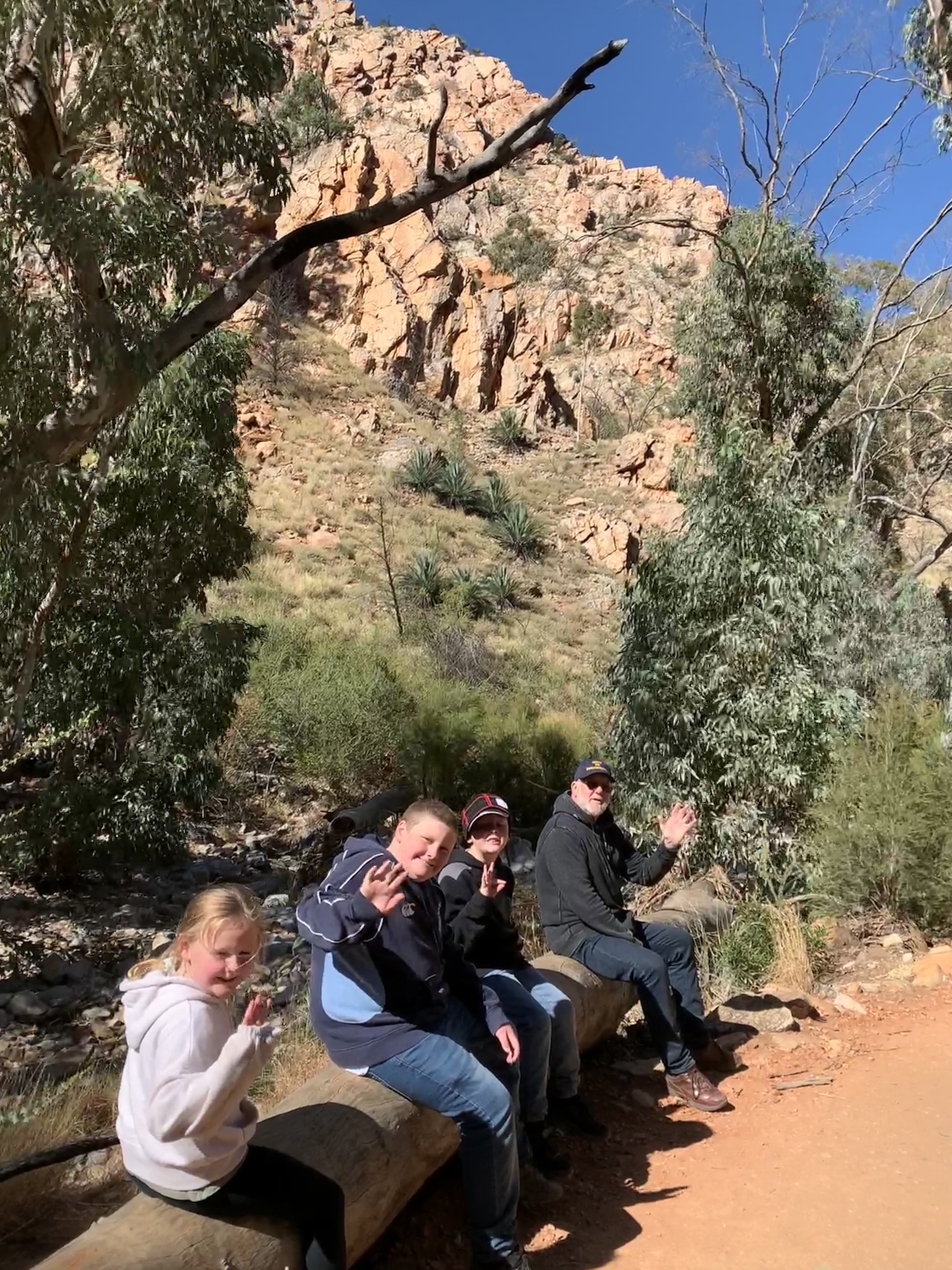
We enjoyed a well-earned 15 minute break at Mala Car park where there are lots of benches to sit on. Mala Car Park is the spot where people used to start their climb of the rock when it was allowed. Looking up at the track up the rock I really don’t see the attraction of climbing. It is very steep and looks so dangerous.

You can make out the faint trail where people used to climb the rock

We set off back to the Cultural Centre to deliver our bikes back to Cycling Uluru as our booking finished at 12noon. We made it with half and hour to spare. Our whole ride had taken us 2 1/2 hours and we’d done 15km in total.

It was a quick process to deliver our bikes and helmets back and then we headed in to check out the Cultural Centre. The Cultural Centre houses a souvenir shop, a cafe, an Indigenous Art store and an Art Gallery. Rich bought the kids all an ice cream and while they sat and ate those I checked out the art. The Indigenous Art Store has lots of paintings and wooden artefacts for sale, all made by local artists.

The Art Gallery is well worth a look as it houses superb examples of the famous dot paintings. Four lady artists were working on paintings and they are amazing to watch. The attention to detail is incredible. Those large dot paintings are so time consuming to paint dot by dot. No wonder the prices in the gallery ranged from $3,000 to $23,000. I didn’t buy one!

The kids were all keen to have a look at the artists at work so we carefully walked into the gallery so they could watch. They were all very impressed by the workmanship involved.

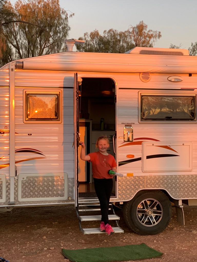
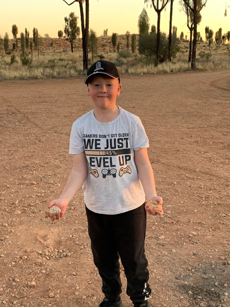
Our tired little group piled back into the car and I think a couple of them nodded off on the way back to camp. We arrived back to a spotless camp. Katie had been cleaning! Fortunately she was feeling a bit better.

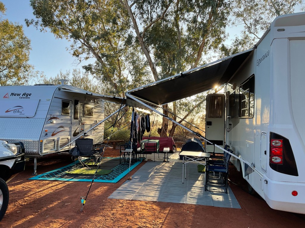
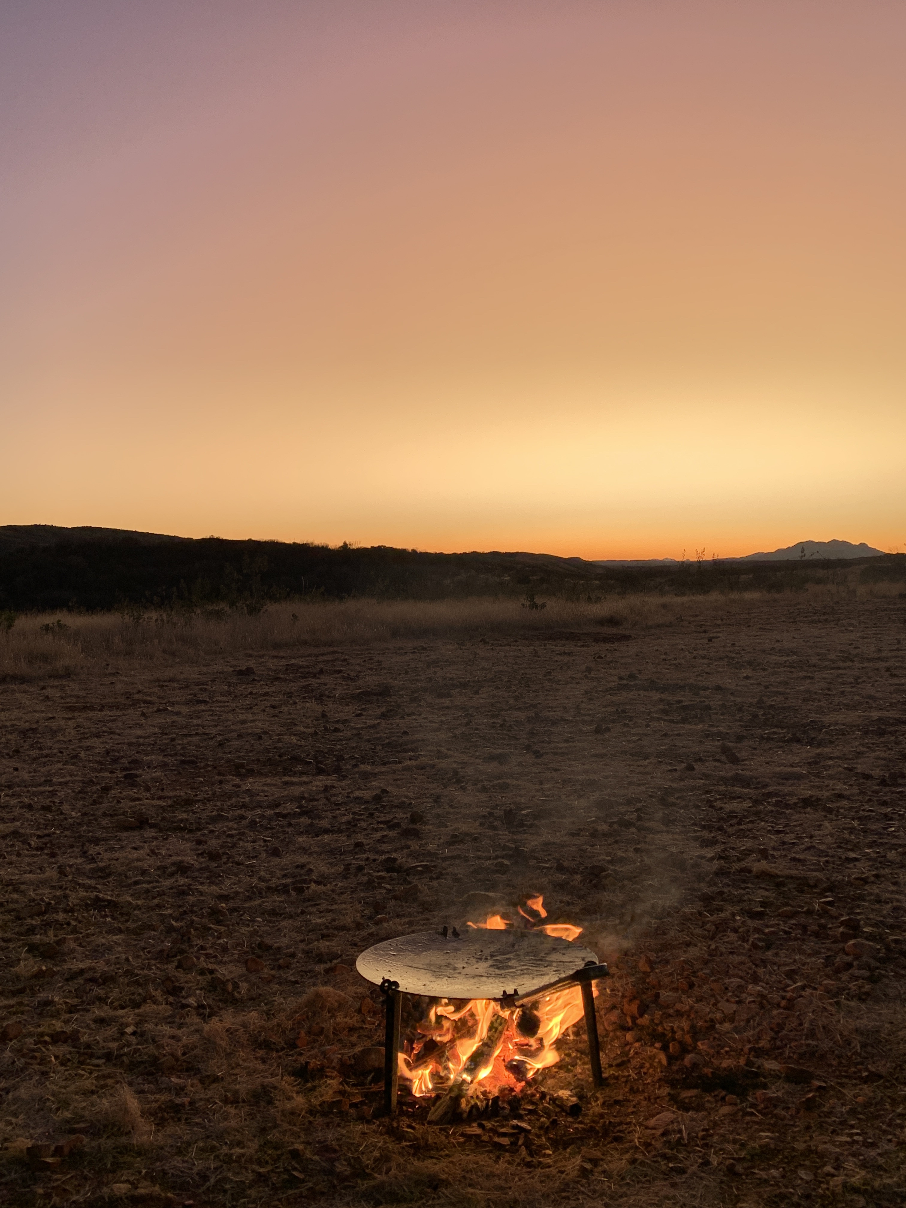
We spent the afternoon napping, watching movies, people watching (we’ve got new neighbours) and blogging. Not sure about one of our new neighbours. You should see how they’ve parked their van. It’s on such an angle I don’t know how they’ll be able to sleep in it.

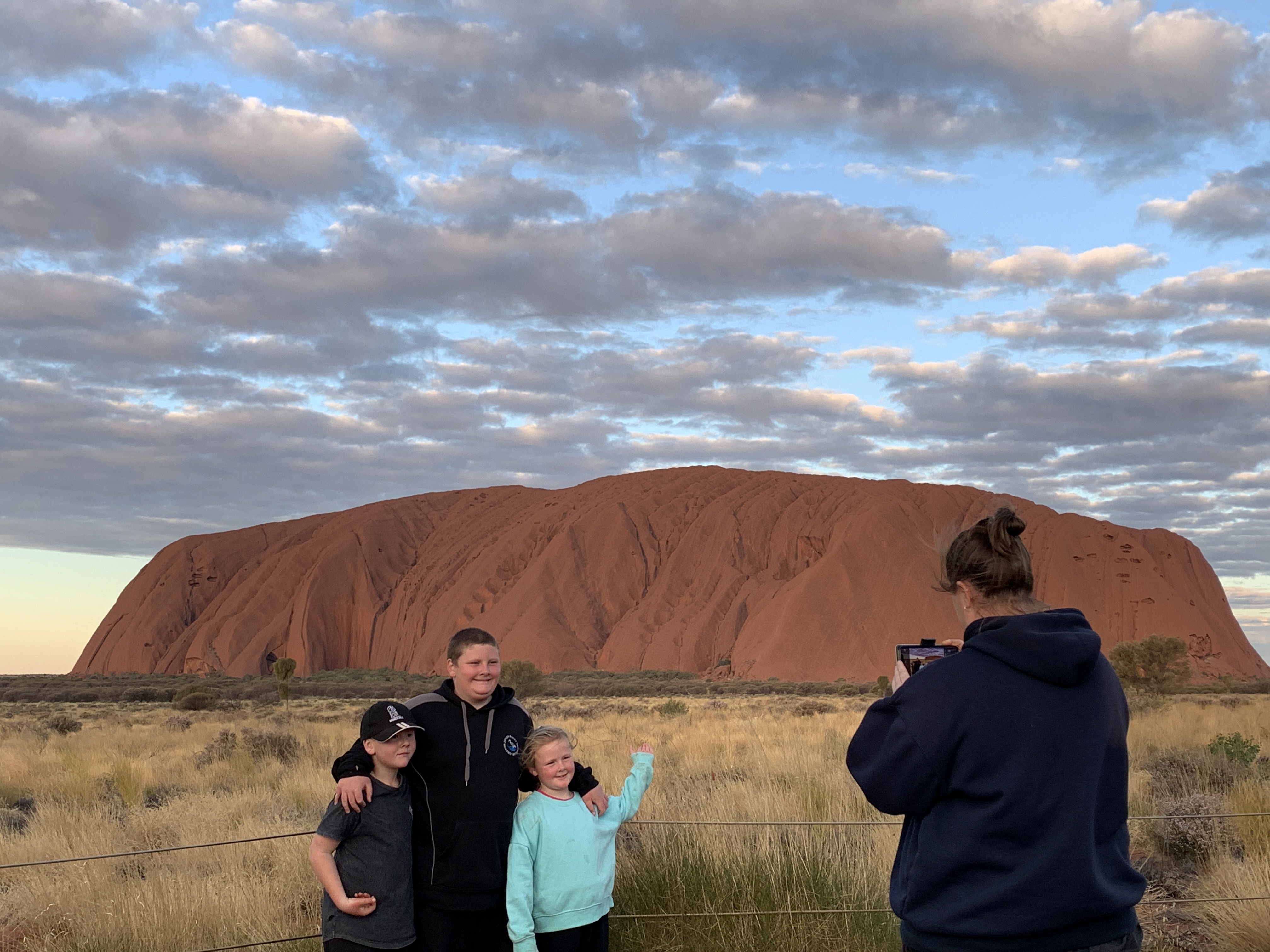
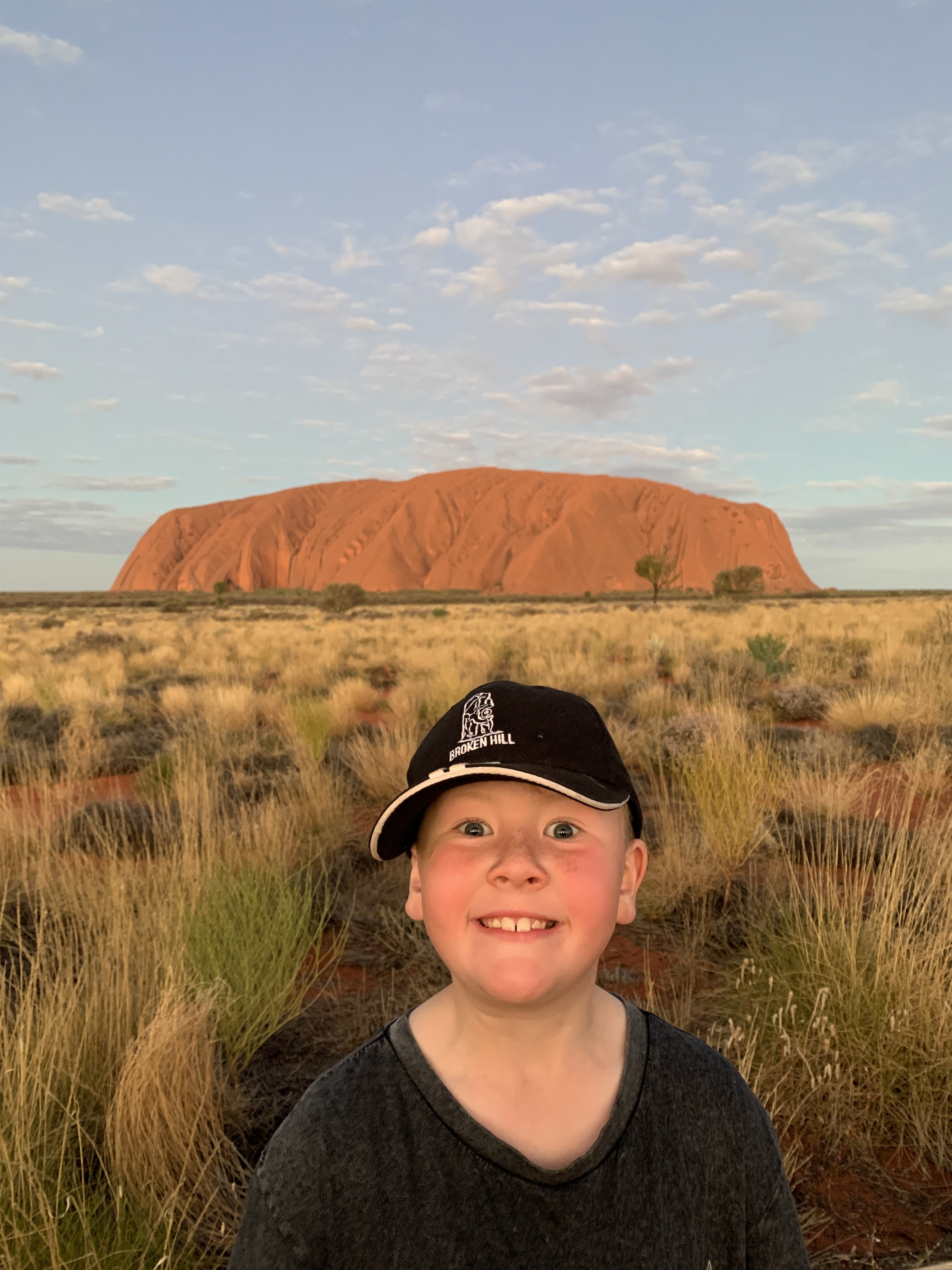
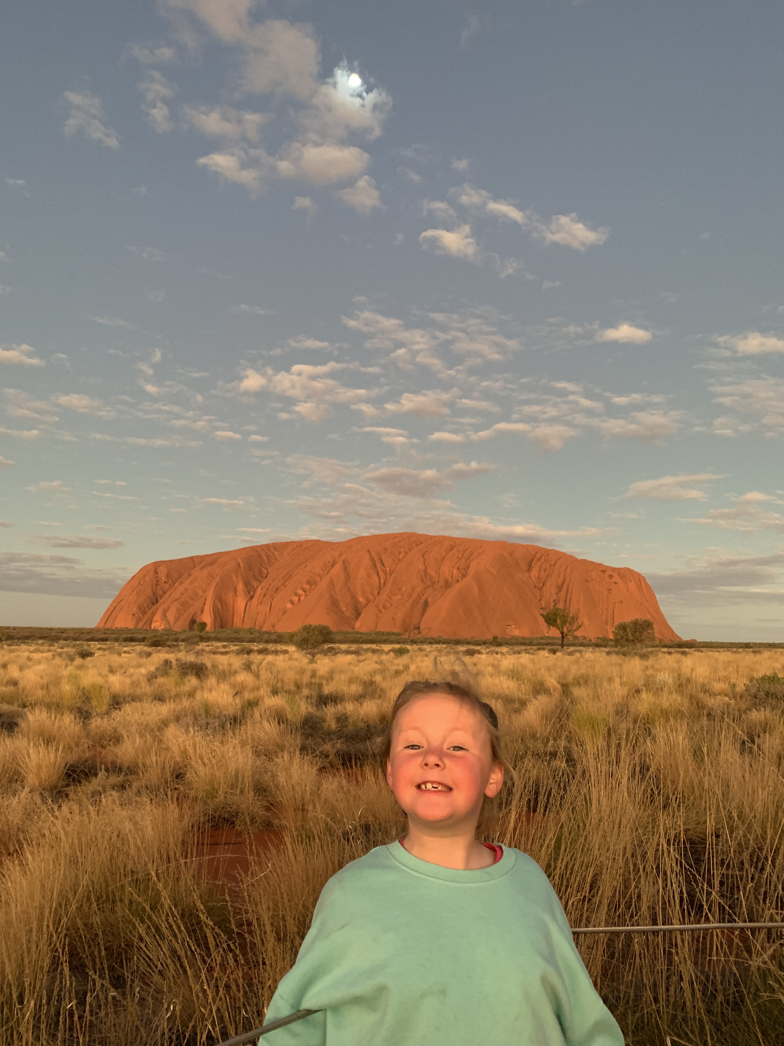
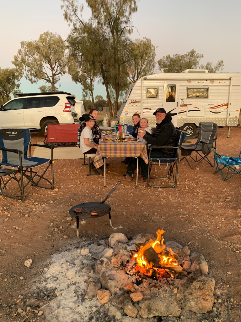
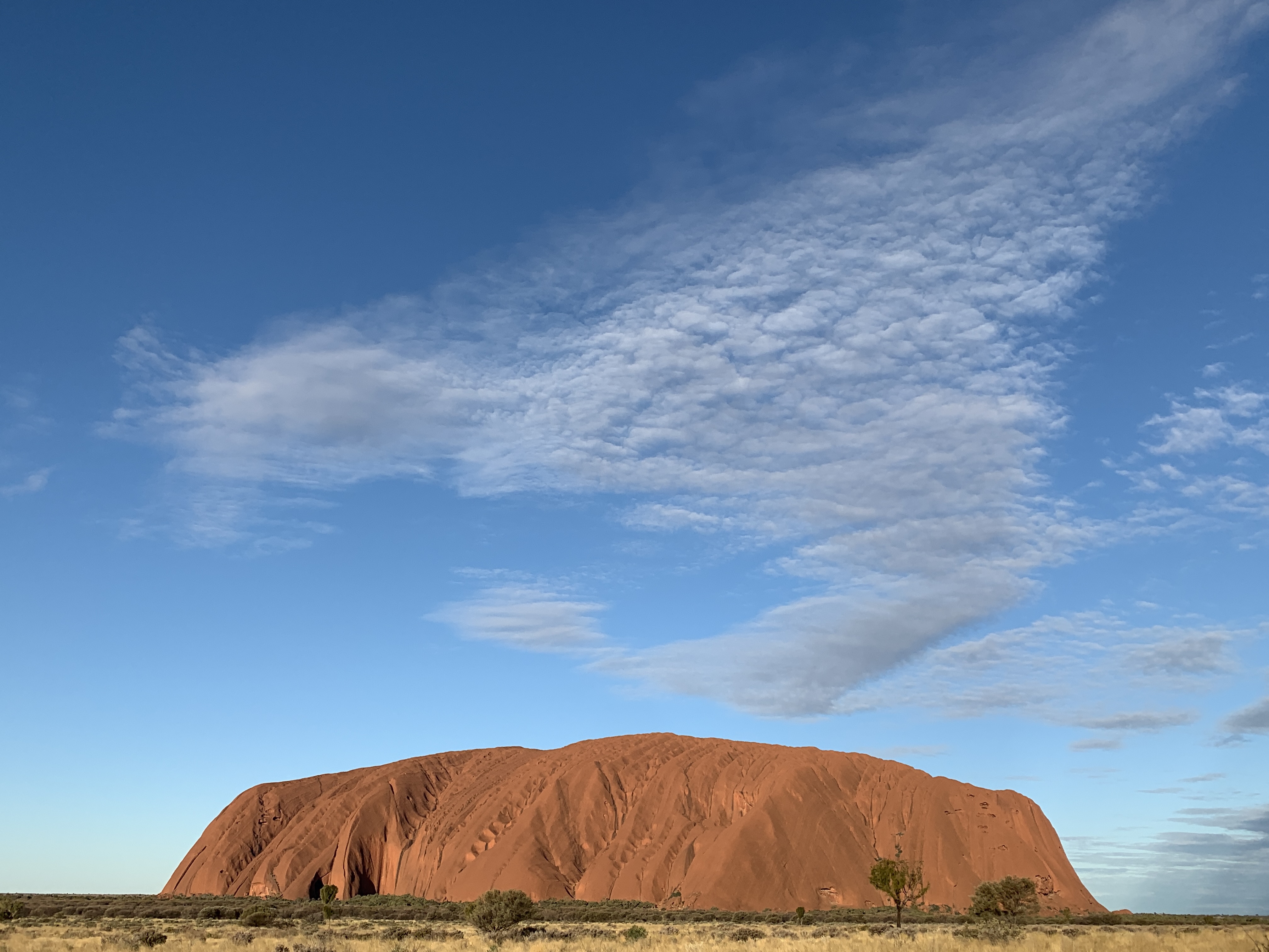
Around 4.30pm we loaded our chairs, table and picnic rug into the car along with some drinks and nibbles and set off back out to the National Park to watch sunset on the rock. To enter the National Park all adults must buy a ticket. You can purchase them online. It costs $38 for a three day pass or you can purchase an Annual Pass for $50. Children are free. As we were going in and out for 6 days we purchased Annual Passes for Rich, Katie and myself. When you reach the park boundary there is a ranger station. If you have a pre-purchased pass you can enter via the left lane and here you scan your pass and the boom gate opens. Those without passes have to enter the queue in the other lane and purchase tickets from the ranger before they can enter.

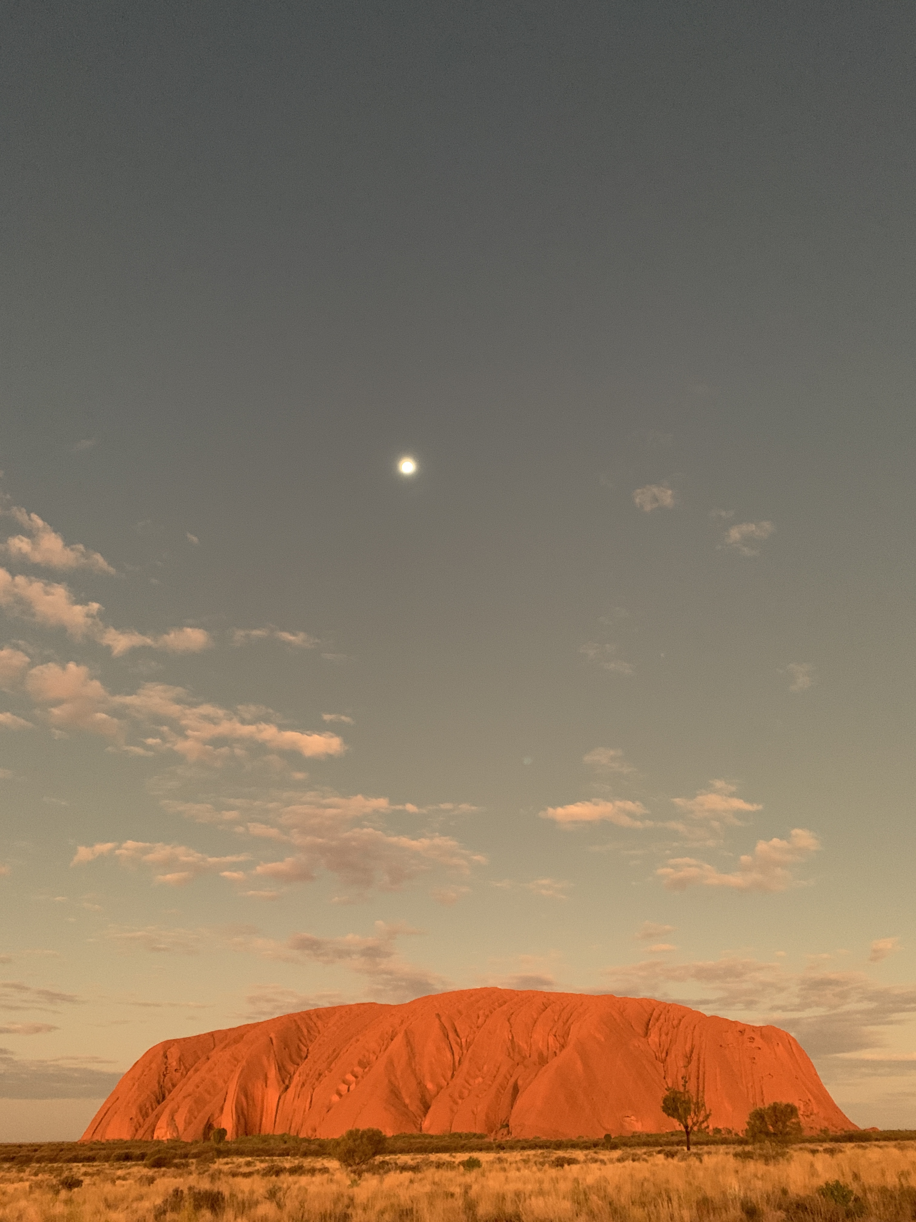
The Sunset Viewing car park is in the perfect spot to get the best views of the rock as the sun sets and it pays to get there early as the spots fill up quickly. We found a great spot with room in front of the car for our chairs and table. We had a lovely man and his two girls from Sydney on one side and another lovely man and his two girls also from Sydney on the other side.

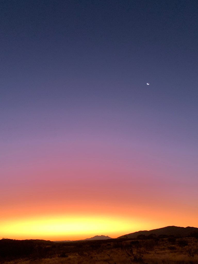
Watching the sun set on the rock is incredible, amazing and very moving. I took so many photos. Here’s a few.

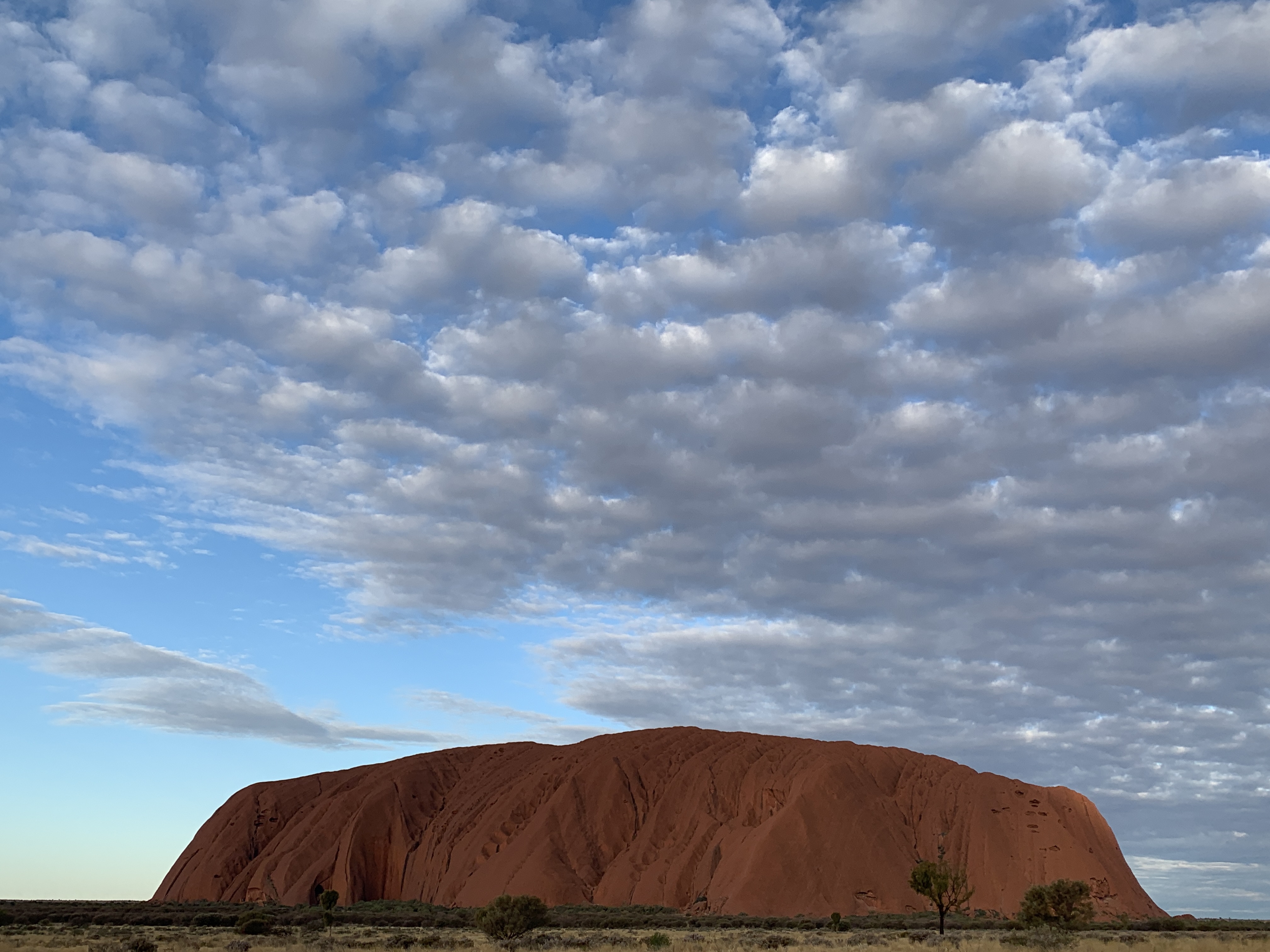
We all had such a great time and stayed out there until we were almost the last car to leave. What a fabulous evening and one I’m sure we will all remember for a very long time.

Exploring Yulara and we ride camels

Yulara is an interesting place. It is basically a big resort with multiple hotels and apartments as well as the Campground. The resort caters to all budgets from the top end at Sails in the Desert to basic tent camping for bus groups. Visitors can fly directly to Yulara as there is an airport or you can fly to Alice, pick up a hire car, camper or motorhome and drive to Yulara. This seems to be a very popular option as we’ve seen many rental campers and motorhomes since we left Alice.

The resort has a Town Square and it is here that you find the shops, Post Office and IGA Supermarket. I was surprised at the supermarket. It holds quite an extensive stock of supplies including meat, fresh vegetables and bread. We would be able to stock up again before we left to go to Kings Canyon.

We spent an hour or so wandering around the shops and then settled in the square to listen to the Didgeridoo Workshop. Ben was chosen to be a didge player along with a few other men and boys. Maddie put her hand up to have a go but was told politely that, culturally, only men and boys play the didgeridoo.

We spent the next hour watching the men and boys learning to play and listening to the didgeridoo. It is a fabulous sounding instrument and we learnt that didge players are really singers and use their body in the same way that singers do to produce the sounds. A really good didge player has to practice often and keep their vocal chords in good shape just as singers do.

We also learnt that didgeridoos can be in a certain key and they are basically an amplifier for the voice of the player.

Ben and his didge

We bought a couple of hot chooks and salad from the supermarket and headed back to camp to have lunch and prepare for our afternoon camel ride.

We had to be at the Campground Bus Stop by 1.44pm to be collected by the Uluru Camel Tours bus. We were ready and waiting when the bus pulled up.

Waiting at the bus stop

It was a short drive out to the camel farm and here we were given a safety briefing and told a little bit about what to expect on our ride. Then we were led out to where our saddled camels were waiting. They were all sitting on the ground and didn’t look so big. The saddles are all for two people so Maddie rode with me, Ben rode with Katie and Riley rode with Pa.

We had another family of three with our little group and they all managed to get on and their camels stood up with no problems.

Riley and Pa were next and were helped onto their camel, Archer, with Pa on the back and Riley at the front. The look on Riley’s face as the camel stood up was priceless. He looked absolutely terrified but once Archer was standing he relaxed.

Maddie and I were next and we managed to get on with no trouble but then our camel, Curly, started to stand up and Maddie lost it. She was scared, sobbing and shaking. I managed to calm her down and held on to her until she got used to be up so high. And it is up very high off the ground! It didn’t take long before she relaxed and enjoyed the ride.

Katie and Ben were next and they managed to get on and their camel, Jed, very calmly rose up to standing with both Katie and Ben hanging on tight.

Our guide, Tracey, rode the lead camel, Jonny, and once she was sure we were all ready we set off. It is NOT like riding a horse. The gait of a camel is completely different to any horse I’ve ever been on however, if you’ve ridden a horse, you soon get used to the movement of the camel.

Tracey led us out into the desert towards Uluru telling us lots of information along the way about camels and how they came to be in Australia, how they’ve been used as transport and cargo carriers, and fun facts about the camel.

The camels we were riding were one humped (Dromedaries) camels. The ones with two humps are called Bactrian camels. The hump is actually a big lump of fatty tissue that the camel uses to regulate its body temperature. It stores heat in it during the day and releases it at night when it’s cold. They also have very large veins running down their powerful back legs and, to keep cool, they urinate on their legs. As it dries this helps to keep them cool.

Camels have three stomachs and they can digest almost all the plant life we could see around us in the desert as we walked along. They chew their cud just like cows do. A camel burp is the most unpleasant smell because it comes from food being digested for days. Ewwww!

As our little group went over a sand dune we had a great view of the big red rock. Tracy stopped us all there so we could get great photos of us all on our camels with the rock in the background.

All our kids asked lots of great questions of Tracy and she was more than happy to answer them. We learned that camels can drink 150-200 litres of water in one go. Full grown male camels weigh between 800kg to over 1 tonne and they can carry up to 50% of their body weight. So a one tonne camel like Archer can carry up to 500kg. That’s incredible. Not wonder they were used in the outback for so long as beasts of burden.

All the camels used by Uluru Camel Tours are castrated males that have been caught in the wild and trained to take tourists for rides. These camels can do this all day without getting tired. The owner and his crew recently did a camel roundup on a nearby property and caught 270 camels. Wild camel numbers in Australia are an estimate only and it is reckoned there are over 1 million of them roaming the deserts of the inland.

Our 45 minute camel ride was over in no time and we’d all thoroughly enjoyed the experience. Maddie declared it was great fun and the camel getting down was much better than when it got up. Our camels all obediently got down so we could all dismount easily. The camels were happy for us to give them all a pat and even seemed to enjoy a scratch on the ears. They are truly amazing animals.

What a fabulous experience and one I’m sure we’ll all remember for a very long time. We definitely recommend this one to families. Such a fun thing to do.

The camel farm has a petting zoo with farm animals and the kids were keen to have a look. Our bus driver was happy to take the other guests back and come back for us to give us extra time.

Eventually we had to say farewell to the camel farm and our happy bus driver, Dan, took us back to the Campgound on the little bus.

It was my turn to cook and I did a lamb roast in the Weber and my little oven. It was delicious.

Everyone was off to bed early as we had to be up early the next morning to do our cycle around Uluru.

Happy campers after a lamb roast

We arrive at Yulara

A lovely sleep-in was had at our overnight free camp at Petermann Rest Area. I cooked up scrambled eggs and bacon for everyone and, judging by the way no one talked during breakfast, they were enjoyed by all.

After packing up we set off on our final leg to Uluru 120km away. We passed Curtin Springs, a one million acre cattle property that has really embraced tourism. They have a roadhouse, camp ground, do tours to Mt Connor and even have a paper making factory where paper is made from the local grasses. The camping area looked very busy and the vans were parked quite close together. I think we chose our overnight camp really well. We were the only ones there to start with however a couple of motorhomes came in and then three vans and a couple of campers. There was plenty of room for everyone to spread out.

We all chuckled in the morning as they had all left before we all got up!

Not long after passing Curtin Springs you get your first glimpse of Uluru in the distance. OMG it is HUGE. There was lots of excited chatter over our UHF’s with everyone thrilled we were finally nearing the famous Aussie icon.

As we approached Yulara I checked the map of the area and discovered there is only one dump point in Yulara and it is out of town near the water treatment plant so we decided we’d better head there first before going to the campground. Here we came across our first queue. Luckily there were only two in front of us.

After that necessary business was complete we headed into Yulara. Yulara is the name of the town/resort that is the closest to Uluru (Ayers Rock) and Kata Tjuta (The Olgas).

We made it to Yulara

We pulled into the Service Station to fuel up prior to camping and Katie drove into the Campground to get in the queue. After fuelling up we were able to pull in behind Katie in the queue. I think I counted 5 vans plus us in the queue so not too bad.

Entering reception we found a long queue of people most of whom were checking in like us. We felt sorry for one guy as he was waiting only to get some $1 coins for the dryers.

It wasn’t a very long wait. The three staff seemed to be doing their best. We were allocated our powered sites and given a map of the park. We were also given a Campground Pass that you have to carry with you if you wish to enter a licensed premises at Yulara. Only genuine guests at the resort may be served alcohol.

How disappointed we were when we arrived at our allocated sites. They were right out the back on red sand and there were bollards on both sides of both sites which meant we wouldn’t be able to put our slide out and awnings out. There was also no water tap. There was power however this would not do for 6 days. We’d booked sites so long ago with power and water.

It’s hard to express how disappointed we all felt. We’d been planning the trip for so long and we were so looking forward to getting to Uluru. What to do?

We set off to walk back through the campground passing by other sites and I made note of which ones were free and would suit us. Back at Reception and the queue was just as long as before. I noticed that the lady that served us before was free and I quickly walked over to her and explained that the sites were too small for us AND they had no water. That would be OK for a couple of nights but not for 6. Katie said I did get some glares from people waiting in the queue. The assistant was very helpful and tried her best to find another site for us. Eventually her senior came over to see what the problem was and when we explained she was also helpful and said it might take a while to juggle around other bookings but she would try her best.

Yay! she was able to give us the vacant sites we’d seen on our walk to reception. We were very happy with that! What a great outcome. It pays to be nice and friendly. I explained to the kids on the way back ‘You catch more flies with honey’. By being nice and friendly we achieved the outcome we wanted. The original small sites would be more suitable to a camper trailer.

We quickly walked back and moved onto our new sites. We were able to back the van in and drive the motorhome in forwards so our doors and awnings face each other. The kids were so helpful setting up camp. They are old hands at it now.

It took a while to set up camp as we were staying for 6 nights in the one place. I even put up our solar party lights. They would light up when it got dark.

We were all extremely happy with our camp sites.

It was an excited group that set off in the car in the late afternoon to drive out to see the rock. Uluru is about 20km from the campground. Wow. As we got closer we were all amazed. It is so huge that it’s a bit hard to take it all in. We stopped at the sunset viewing point and cars were already staring to park up for the sunset view. We checked out that carpark and decided we’d come back one evening with drinks and nibbles and our camp chairs so we too could sit and wait for the sunset.

We continued on and drove all the way around Uluru with another short stop at the Mala Walk. This is the place that people used to start their journey when you were allowed to climb the rock. Climbing the rock was very dangerous and also offensive to the local Aboriginal people who consider the rock a sacred place. Not a place for tourists to troop all over. I looked at the spot where people used to climb and I’m glad its closed. I’m looking forward to our cycle around it instead.

Back at camp it was Katie’s turn to do dinner and tonight’s was nachos. Delicious and filling. At the dinner table we all talked about what we were grateful for and it was a universal thing. We were all grateful to be on this trip and be finally at Uluru. We all felt very fortunate.

Tomorrow we will explore the village/resort and in the afternoon we will be going on a camel ride. How exciting! I’ve never been on a camel!

Off to The Rock

As Katie had some school and uni work to do Rich and I took her car and set off with Maddie in search of some wood for our campfires. We left the boys behind to get their swags packed up. Katie was able to use our RV wifi and logon to do her work.

There’s a Mitre10 in Alice so we headed there first. They usually have wood. We were able to get a bag of firewood and a bag of kindling. All set for our free camp that night.

Next stop was the chemist and we found one just near the Coles Supermarket. The shopping centre in the Alice CBD is quite good with all the usual shops you would expect in a town of that size. There’s a Woolworths and Coles Supermarkets and a large Kmart as well as most of the chain stores.

We arrived back at the park to find Katie had finished her school and uni work and was ready to pack up and hit the road. We set off just before 10am. We like the Discovery Park at Alice Springs and recommend it, especially to families as they cater very well for children with lots to do. There’s a couple of playgrounds, two jumping pillows, the swimming pools with water slide, free shows in the evening and you can even hire pedal go-karts. The amenities blocks are large and cater well for the large park. The camp kitchen near us was quite large with lots of room for many families.

There was quite a bit of excitement in the vehicles as we set off south. We were finally on our way to Uluru. Our original plan was to visit Uluru first, then Kings Canyon then Alice and the West MacDonnells however that had to be changed simply because the campground at Ayers Rock was completely booked out for two weeks. So our plan became Alice Springs and the West MacDonnells, then Uluru, then Kings Canyon then home again. So this day we were finally on our way to the big red rock.

It’s 475km from Alice to Yulara (the township nearest Uluru) so we thought we’d free camp somewhere along the way and arrive at Yulara the next day.

We had an uneventful trip to Erldunda, which claims to be the Centre of the Centre, where we pulled over to have a lunch break. We did pull into the road house however they had renovations going on at the pumps and it was a bit chaotic. The queue for the one working petrol pump was some 12 caravans long and as we didn’t really need fuel we continued on around the corner and pulled off the road where two vans were already pulled in. We’d turned the corner so we’d left the Stuart Highway and were now on the Lassiter Highway heading west.

The Lassiter Highway forms part of the Outback Way, otherwise known as Australia’s Longest Shortcut. This route goes from Winton in outback Queensland to Alice then to Yulara and across the desert to Laverton in WA. It is 2,700km long and has a current project happening to eventually tar the entire length. That will be amazing. We met a couple at Glen Helen who had driven across from WA. They said it took them 2 days to get to Yulara from Laverton and was much quicker for them than going all the way around across the Nullarbor. And that was with most of the way still being dirt.

We drove through Mt Ebenezer and it was a bit sad. The roadhouse and other buildings were all boarded up and derelict. It obviously was a thriving roadhouse once.

The countryside on the way to Yulara is vast woodland plains with low scrubby trees and shrubs. We hadn’t seen any sign of life though apart from the occasional bird of prey and the humans in vehicles. Hadn’t even seen a lizard on the road.

As we approached our camp spot for the night at Petermann Rest Stop (Curtin Springs East) we got our first glimpse of Mt Connor.

Wow wow wow. If Uluru is bigger then I’m going to be gobsmacked!

Mt Connor is a flat topped mesa that rises out of the desert to a height of 859m. It was glowing pink in the afternoon sun. People traveling to Uluru often mistake Mt Connor for Uluru so it is also known as Foolaru.

We chose our camp spot well. We pulled into the Petermann Rest Area and we were the only ones there. We were able to get well back from the road and set up around a little fire pit with our vehicles blocking the prevailing wind. We are surrounded by fabulous Desert Oak trees. We love these strange looking trees. The kids think they look like The Lorax from Dr Seuss.

While Richard got the wood ready for our fire the rest of us went for a walk over the sand dunes to get a good look at Mt Connor. Wow, just wow. I love all the different plants you find in the desert. Lots of red sand and there are these fabulous plants.

Riley and Pa cooked our steaks on the Biji-BBQ. Riley is becoming quite the BBQ cook. Our steaks were accompanied by baked potato and pumpkin and a rocket, beetroot, feta & walnut salad. Scrumptious!

After dinner we sat around our lovely little camp fire and played a silly word game. This game involves each person saying only two words then the next person says two words and adds to the story. Our story ended up being about an ugly princess who had warts and hairy armpits. She had a sister who had a boyfriend who fought unicorns. It was hilarious. There was lots of giggles to see who could say the next silliest thing. What a funny evening.

As we only had 120km to go to arrive at Yulara the next day we decided to have a sleep-in morning and aim to set off by 10. The night wasn’t as cold as the recent ones in the West MacDonnells.

Back to Alice Springs via Hermannsburg

We packed up and left Glen Helen before 9am and headed further west. The plan was to follow the road around in a big loop to Hermannsburg then back to Alice.

Looking towards Mt Sondor

We had a few laughs the last few days at the Winding Road signs. We came across them on the way to Redbank Gorge and further on. What passes for a winding road in the NT is really just a few bends. They didn’t seem like winding roads to us at all.

Now going to the Snowy Mountains there are winding roads!

We pulled in to check out Tylors Pass Lookout. From there you get a fantastic view across to Gosse Bluff. About 140 million years ago a space object, thought to be a comet about 600m across, crashed to earth on that spot. The shock waves shattered the rocks and stood them on them on end. Over time the rocks have eroded away and the formation is now about 5km in diameter. You can visit Gosse Bluff and camp there however the road in is 4WD only so not for us. It’s still pretty impressive even from the lookout.

We passed the Mereenie Loop Road intersection. This is the way to Kings Canyon if you don’t mind going on the dirt. You also need a permit to travel on that road.

We noticed signs for horses in the area and there was plenty of evidence left by them on the road. Katie and the kids saw a horse on the side of the road. It appeared to be struggling to get up. Maybe it was hit by a car or maybe it was having a foal or maybe it was just sick. We kept our eyes peeled but didn’t see any more horses.

We did see a mob of about 20 donkeys. That was a bit of a surprise!

One of the most famous Aboriginal painters, Albert Namatjira lived at Hermannsburg. He was a Western Arrernte man and became the first commercially and internationally acclaimed Aboriginal artist with his works being displayed and sold all around the world.

The Historic Precinct of Hermannsburg is 130kms west of Alice Springs and 107km from Glen Helen. It is a sealed road all the way. Hermannsburg was established in 1877 by Lutheran missionaries from Hermannsburg, Germany. The missionaries at Hermannsburg saw from the beginning the importance of learning and recording the written form of the local Aranda language. The mission children were educated in both English and Aranda. The Christian message was still at the heart of the mission philosophy. The missionaries forged a strong relationship with the Aranda people that continues to this day.

The land was returned to the Aranda people in 1982 and the buildings at Hermannsburg fell into disrepair. Local Aranda leader, Kasper Gus Ntjalka Williams, helped have the site declared a National Heritage Place in 2006. This has enabled funding to assist with improvements and signage for the many visitors to the area.

We arrived back in Alice around lunchtime and first stop was for fuel and gas bottles. We checked in to the Discovery Parks – Alice Springs where we were just a few days ago. While Richard and the boys stayed behind, Katie, Maddie and I set off to get the groceries.

OMG what on earth was going on in Alice? The supermarket was packed with people. There was hardly any bread left, all the long life milk was gone, there was hardly any toilet paper, the checkout queues were 4-5 deep. It was like Christmas shopping!! No one batted an eyelid though and the checkout lady said this was normal.

Back at camp it was time to get washing done. The inside of the motorhome looks like a laundry with clothes hanging everywhere to dry.

We head off towards Uluru in the morning and I think everyone is a bit excited about that.

Last day in the West MacDonnells

It was a very cold night and we woke to find ice on the top of our roof vent. However we were snug and warm and so were the boys in their swags.

We packed our backpacks and set off westwards to explore Redbank Gorge. There’s a 5km unsealed, rocky and corrugated road to the carpark and two camping areas. From Redbank Gorge carpark you can do the walk to the summit of Mt Sondor, the highest point in the West McDonells.

We followed the path to the gorge and it quickly became a scramble over rocks instead of a path. We reached the gorge at the end after negotiating the rocky waterway and were rewarded with the sight of another beautiful waterhole surrounded by towering red sandstone cliffs. Stunning! You can swim through the gorge however as the water is extremely cold a floatation device is recommended. None of us had any desire to get into that cold water. It would be great to do in warmer weather though.

We stopped at the gorge for lunch before making out way back across the rocks until we finally reached the path. It had taken us 2 hours to walk in and back out. We all felt this was the hardest walk we’d been on so far due to having to pick your way carefully over the rocky river bed without falling or twisting an ankle.

Back at camp the afternoon was spent reading, playing games, blogging and watching a couple of movies in the motorhome. Pa had a couple of little visitors for a movie session.

Pa and Riley were in charge of cooking our steaks on the camp kitchen BBQ and quite some time was spent discussing the difference between cooking a rare steak and a well-done one. Riley cooked the onions and steaks under Pa’s instructions and did a fabulous job of ensuring there was steak to meet each persons tastes. My steak was a perfect medium.

We had boiled potato with sour cream and corn on the cob to go with our steaks. There was lots of happy chatter around the dinner table.

Everyone had enjoyed our stay at Glen Helen but was now ready to move on. Everyone pitched in and packed up the outside chairs, tables, mat etc so we didn’t have to do that in the cold morning.

We had another stunning sunset for our last night at Glen Helen

Day 4 in the West MacDonnells

We had a relaxing day at Glen Helen. Reading, playing cards and games and lazing about.

We did do the short walk to Glen Helen Gorge and it is another spectacular place. The gorge was formed by the Finke River and due to the recent rains the river was running and the huge waterhole at the base of the gorge was very full.

It would have been a perfect spot for a kayak if I’d brought it on this trip. However it was left at home to make way for more wood and we’ve needed that more. It’s been freezing cold at night. A little camp fire has been lovely to sit around.

There are a couple of natural features of Glen Helen Gorge called the Organ Pipes and the Stone Window however to get there involves a swim through the icy waters of the waterhole and a further walk along the river. None of us were too keen to swim!

The traditional owners of the land will not swim in the permanent waterhole at Glen Helen as they believe it is home of an ancient and powerful Rainbow Serpent.

The Finke River starts in the West MacDonnells and travels some 700km across plains and through rugged ranges before it disappears altogether in the desert sands towards Lake Eyre. The permanent waterholes were lifelines for the Arrernte people especially during times of drought. The Finke River was a major trade route for Aboriginal people for thousands of years.

John McDouall Stuart and his party were the first non-Aboriginal people to visit Central Australia and they saw the river in 1860. By the 1870’s the river had become a major trade route for early settlers.

The Finke River is often described as the world’s oldest river. It has been following the same general course for approximately 100 million years and is home to nine species of fish.

We decided to stay one more night at Glen Helen and there was plenty of room in the unpowered section. We had another gorgeous sunset. There wasn’t a cloud in the sky and the whole of the western skyline glowed red, orange and pink as the sun dipped below the horizon. It was really beautiful.

Day 3 in the West MacDonnells

In the morning we said a sad farewell to our new friends as they left in their van to go eastwards to Alice Springs. We continued heading further west to Ormiston Gorge.

It’s a sealed road to Ormiston Gorge. There was plenty of parking as well as a kiosk, information centre, picnic tables, toilets and an amenities block including showers for the Larapinta Trail walkers. Ormiston Gorge is the Trail Head for Sections 9 & 10 of the Trail.

We packed our backpacks for this walk as it was going to take an hour and a half return. We set off on the Ghost Gum Loop and it started out going up the steep hillside. There were many steps. However the view at the lookout when you arrive at the top was worth it.

Wow, wow, wow!!

From the lookout you have a fantastic view up into the Gorge and down to the riverbed below. If you look back you can see all the way to the carpark and we could make out where the motorhome was parked. What a view!

The trail continues on and is a narrow, very rocky pathway. You really have to watch where you are going. It would be very easy to turn an ankle.

At the end of the trail you come to a stop as the waterhole was so full of water that we couldn’t cross over to be able to come back along the waterholes. We watched some Larapinta Trail walkers having to wade across the freezing cold water to get to the other side. Their legs were very red when they came out of the water!

We backtracked a bit and found a rocky gully that we thought we’d be able to use to get down to the river bed and we all made it carefully down the steep gully. The kids thought this was great fun.

Once at the bottom we found a good spot to stop for a snack and a rest before continuing on following the waterholes back to where we started our walk. It had taken us 2 hours to do the round trip.

It is so hard to stop taking photos as you walk along. Each corner you go around shows more stunning scenery. I’m sure you’ll all get sick of photos of beautiful gorges and waterholes!

We continued further west to the Discovery Parks – Glen Helen. The park is 132 km from Alice Springs. Here we had a couple of unpowered sites booked. We checked in for two nights, used their dump point, then drove up onto the newly gravelled unpowered section of the park. There was a brand new amenities block including a laundry and next to that was a brand new camp kitchen. A water tap is available at the back of the camp kitchen so we both filled up with water prior to parking up and setting up our camp with our doors facing each other.

We are all impressed with the new amenities block at Glen Helen. The Laundry is impressive too with a bank of 5 stacked washer dyers. It’s 4 x $1 a load for a wash and $4 a load to dry. The camp kitchen is also great and has a fridge, microwave, kettle & toaster, stainless steel benches, sinks, and gas BBQs.

The park was purchased by Discovery Parks and is slowly being upgraded to their standard. A brand new fuel facility is under construction and there’s evidence that lots of earthworks had been done recently to terrace the camping area.

The view from our camp is a red cliff that looked amazing as the sun sets. The red sandstone just seems to glow in the sun.

Discovery Parks – Glen Helen

Day 2 in the West MacDonnells

After a great nights sleep at our free camp at Point Howard Lookout we continued heading west and our first stop was Ellery Creek Big Hole. There is 2km of unsealed road to get to the carpark and from there it’s only a short walk to Ellery Creek Big Hole and a big hole is exactly what is there. A huge waterhole in between towering cliffs. It is a popular swimming spot when the weather is warmer.

The kids had fun crossing over the creek on a fallen log testing their balancing skills. We just hoped none of them would fall off into the very cold water. Luckily no one fell.

Our second stop was Serpentine Gorge. I had thought surely the gorges couldn’t get better each time but I was wrong. Serpentine Gorge is beautiful. There is an unsealed road that leads to the carpark. Serpentine Gorge is the Trail Head for sections 7 & 8 of the Larapinta Trail. There are toilets and picnic benches but no camping is allowed.

The rocks on either side of the gorge just lent themselves for climbing and the children really tested their skills. I couldn’t watch! They had a great time climbing up and down like goats. That is until Ben fell. Oh no! Not another broken arm I thought. Thankfully he was Ok just had a bit of a bruised knee. Luckily he only fell about a metre but his knee collected a rock on the way down. After a few minutes he was able to get up and walked back to the vehicles. No more rock climbing!

We continued westwards and found a camp spot at Neil Hargrave Lookout. There was one van set up there already and we found a spot to set up our RV’s not far away. This spot was a bit more exposed than our previous camp and the cold wind was blowing. We set up the motorhome and van so they blocked most of the wind.

We’d only just parked up and the fellow from the other van came over for a chat. They are a family with two boys, Hugo and Archie.

Hugo and Archie have a set of Battle Blocks and invited our kids to play a game. Lots of fun was had by all the kids playing that.

One of the things I enjoy most about this RV lifestyle is meeting people. We’ve met the most amazing people since we started meandering around our beautiful country. Archie & Hugo and their parents Luke & Liz have been added to our list. What a lovely family.

We invited them over to share our fire after we’d had our dinner and they came. Best thing is, they brought some wood so our campfire was even bigger!

We had a lovely evening watching the sun set and getting to know each other. The kids had a lot of fun toasting marshmallows (yuk) and playing hide and seek in the dark.

We also had some tiny mice visit camp. They were similar to the Spinifex Hopping Mouse that we’d seen earlier on our trip.

Maddie had a turn sleeping in the motorhome and she happily snuggled up in the Luton bed (the bed above the cab) with the safety net up.

Exploring the West MacDonnell Ranges

You might be wondering what’s happened to us. Where did we go?
No posts for a while and I usually post so regularly whilst on a trip. Simple truth is, there is little to no mobile service in the West MacDonnell Ranges and, if you manage to get a signal, there is no internet. However, I have been writing every day so here’s a few posts in rapid succession. Enjoy the read!

We left our comfortable camps at the Discovery Park – Alice Springs and, after a quick fuel stop, headed west into the Tjoritja/ West MacDonnell National Park.

Aboriginal people have lived in the ranges for thousands of years and call the place Tjoritja (pronounced Choor-it-ja). The ranges as they are now are just a shadow of their former selves. They were once as high as the Himalayas. Can you believe that?

Approximately 850 million years ago most of the southern half of the Northern Territory and much of Central Australia was covered by a shallow sea. During this time sediment layers built up on the sea floor. The sea receded approximately 460 million years ago leaving behind layers and layers of built up sediment.

Between 340 and 310 million years ago massive movements in the earth’s crust pushed the mountains up over 10,000 metres high. Those movements pushed and folded the rock layers and caused great slabs to slide up and over each other.

Over the last 300 million years water and wind have eroded and shaped the ranges to produce the spectacular landscape we have now.

Our first stop for the day was Simpsons Gap. No one knows why it is called Simpsons Gap. It was originally called Simsons Gap and the name was changed to Simpsons Gap but there is no one left who knows the reason why. Who was Simpson or Simson? It’s a mystery!

We called in at the Information Centre however they’d run out of maps. We took photos of the maps of each place on the wall and we would have to use those as our guides.

The road into Simpsons Gap is a short one and the carpark was large enough for many vehicles and we had no problem finding a park. It was a short 20 minute return walk from the carpark to the gap along a well made gravel pathway alongside a dry riverbed. The gap did not disappoint. At the end of the walk you are between towering red cliffs with sandy waterholes at the bottom. Just stunning.

The gap is home to over 40 rare and relict plants and is also home to the Black-Footed Rock Wallaby. We didn’t see any though.

Back in the vehicles we continued westwards and took the turn off into Standley Chasm. Standley Chasm is a bit different to the other places along our route as it is privately owned and run by the Arunda people. They receive no government funding so an entry fee is charged and they have a great little cafe serving hot food and drinks as well as a gift shop. You can also camp in their carpark after the gates close at 5pm and they have powered sites for about 6 vans. There is an amenities block and a grassy area for tents. Standley Chasm is a popular spot for walkers on the Larapinta Trail as they can rest up, have showers and recharge before continuing their walk.

The Larapinta Trail is a world renowned walking trail though the West McDonnell ranges. It is 230km long and is broken into 12 stages. You can do one, many or all of the stages. I got chatting to one of the walkers and their group was walking the entire trail and it was going to take them 15 days including a couple of rest days.

The carpark at Standley Chasm is very small and tight and, while we were able to park the motorhome, Katie had to do a five point turn to go back out and park further down the road as there was no room for a van. We did feel that this could be better signposted as we later saw quite a few large vans pull in and have to do the same thing.

Standley Chasm is a very popular tourist destination and bus loads of tourists arrive daily. Once you’ve purchased your entry ticket you enter through a gate and follow the well worn path into the chasm. The path is wheelchair friendly. The chasm is a marvellous sight. The sandstone cliffs tower some 80m above you and there is a small waterhole at the bottom. The best time of the day to view the chasm is an hour either side of noon when the sun is directly overhead. The sun shines down on both walls of the chasm making them glow. We’d timed our walk perfectly. Unfortunately, so had the hoard of other tourists. It is impossible to get that perfect photo as there are always other people in the way. Oh well. It was still a stunning sight.

When we returned to the entry we decided to give the cafe a go and all ordered our lunch. It was good lunch food and served pretty quickly considering how busy they were.

We continued our journey westwards and pulled into Point Howard Lookout free camp. This was a great spot on top of a hill with a large flat area surround by low scrubby trees. You can free camp for 24 hours. We were able to park our RV‘s in close to the trees to block off the cold wind and we had a little camp fire in the centre.

Before we left Alice in the morning I’d put Apricot Chicken on in my little crockpot and it had been cooking all day. Once we were camped up I just had to cook up some rice and mixed veggies and dinner was ready. Delicious.

Ben had a turn sleeping in the motorhome and he was snug as a bug up in the Luton. We all appreciated our microfibre blankets as it was a very cold night. Do you have those? They are the best. They are so light but keep you very warm. We also love our diesel heater.